Georges Véron
Haute Randonnée Pyrénéenne –
Pyrenean Haute Route
(Hendaye – Bagnères de Luchon – Banyuls sur Mer).

Countries: Sometimes literally on the border between France and Spain
Region: Pyrénées-Atlantiques, Hautes-Pyrénées, Basque Country, Aragon, Ariège, Catalonia, Pyrénées-Orientales
Route: Hendaye – Bagnères-de-Luchon & Bagnères-de-Luchon – Banyuls-sur-Mer
Dates: June 26, 2014 – July 18, 2014 & September 4, 2015 – September 28, 2015 (Updated 2026)
Travel companions (west): Traveled solo for the first two weeks. Later arranged to meet up with a family member, who joined me in Gavarnie. In Gavarnie, you’re immediately at high altitude, so it’s reasonable to assume there will be a difference in fitness compared to someone who’s already been on the road for two weeks. And so, I gave up the rest days planned in my schedule in favor of a slower start from Gavarnie.
During the first two days after my departure, I regularly ran into two Scots and one Australian. The latter quickly realized that I had less trouble navigating with my GPS than he did with his stack of maps. And so he decided it was easier to follow me for the full three weeks ;-).
Travel companion (eastbound): Together with the Australian, with whom I completed most of the western half. In addition to good company, this also provided me with a more reliable supply of provisions than was the case with the Post Restante service, which I used during the western half.
Public transportation:
Western section (outbound):
Western section (return):
- Bagnères-de-Luchon – Toulouse
- Toulouse – Lyon (at least a 30-minute delay without an accident)
- Lyon – Brussels South (over 2 hours total delay due to an accident, rerouted via Lille and stayed there overnight at the SNCF’s expense) (later received “compensation” of €63.80 for the delay, in the form of discount vouchers valid for one year on a future trip).
- Brussels-South – Any station
Eastern section:
- Any Belgian station – Brussels-South
- Brussels-South – Paris & Paris – Bagnères-de-Luchon
- Paris Metro Line 5 to Gare d’Austerlitz
Eastern route (return)
- Banyuls-sur-Mer – Paris – Paris – Brussels South (received €63.80 for last year’s delay, in the form of discount vouchers valid for one year on a future trip)
Brussels South – Connection to any Belgian station included in the booking - Paris Metro Line 5 to Gare du Nord
Accommodations:
- Mountain huts owned by the CAF (Club Alpine Français) (Cheaper for members of a mountaineering club).
- Gîtes d’étapes or hotels elsewhere.
- The unstaffed huts Refugio d’Azpegi, Enric Pujol, and possibly the free hut if Ull de Ter is not open, only have spring water, which you must boil, filter, or treat with Micropur before use.
- Overview list from hrp-topo.org
Payment methods:
- Cash
- Electronic payments accepted at hotels.
- Bancontact (note: only available in Gavarnie, Candanchu, Luchon, Salardu, Arinsal, Hospitalet pres d’Andorra, Super Bolquère, Arles sur Tech, and Banyuls sur Mer; not in Lescun!)
- Visa (more widely accepted in France than elsewhere, but don’t count on it)
Travel literature:
When I first started planning this trip, the only guide available in Belgium was the Cicerone guide Pyrenean Haute Route by Ton Joosten www.cicerone.co.uk (2009, reprinted in 2012 with updates, in English of course). Currently, this is the third edition from April 2024, with the author now listed as Tom Martens. This guide also comes with a GPX file. You simply need to create an account on the www.cicerone.co.uk website and use the “Add Book” feature to indicate that you purchased their HRP book on Amazon, after which you can download the file. It is a ZIP file containing many subfolders, one for each day. The quality is fine for beginners, but it only provides the main route without waypoints.
Using Freizeitkarten in combination with Garmin BaseCamp, you can now create more detailed track logs, which you can also adjust yourself to suit your chosen route.
In France, I noticed that the latest edition of the original *Haut Randonée Pyrénéenne* by George Veron (d. 2005) and Jérôme Bonneux (ISBN 978.2.84182.315.4) (2007) was still available there. This guide contains better maps and a slightly more detailed description than Ton Joosten’s, but absolutely no GPS waypoints. For purists, this guide is now only available secondhand at astronomical prices. The cheapest copies can be found at Fnac, the most expensive at Amazon.
Jerome Bonneux created his own guide describing the HRP from the Mediterranean Sea to the Atlantic Ocean, titled Trans PYR. This guide is still available at more specialized stores. My main objection to this option is that you’re constantly hiking into the wind, and the approach to the high mountains is shorter.
Meanwhile, in 2025, another alternative emerged in the form of a new guidebook:
HRP Haute Randonnée Pyrénéenne: La traversée mythique de l’Atlantique à la Méditerranée Paperback – Illustrated, Feb. 5, 2025, written by Marie Millet and published by Rando Editions, which at least has the advantage of being recent! You can download the GPX from Cicerone, but unless you edit it yourself, you’re limited to the route choices in the Cicerone guide.
I’ve since bought a copy myself and found that it contains some good ideas regarding the division of daily stages and the choice of places to stay overnight. I’ll be incorporating these into the updated version of my travelogue! I’ll also discuss the choices I don’t agree with, along with their alternatives!
The guide is slightly smaller than A5 size, weighs 300 grams, and has just under 200 pages. The descriptions are brief. You do get the essentials, but for many huts you’ll find a phone number and sometimes an email address, but not the website where you can book the hut. That’s something to look into.
Also, in the “difficulty” section, it often simply says: None! That may be true for very experienced hikers, but through my participation in travel fairs, I’ve noticed that the HRP often attracts young people with limited mountain experience! At best, there are warnings about old snow on high passes when setting out early in the season, the possibility of thunderstorms on long ascents, or orientation problems in fog!
There are also references to the condition of the paint markings, but that is a snapshot of the moment the author was walking this route. Markings in National Parks are often better than outside them. GR trails are also often better marked than non-GR trails!
As noted below, the guide uses maps from Rando Edition, which saves you the weight of carrying individual topographic maps. These are likely 1:50,000-scale maps, which can cause orientation problems in the field. Personally, I still prefer to use GPS, which offers significant advantages, especially in foggy conditions, which are certainly common in the Basque Country.
As mentioned earlier, the maps and route descriptions in the Basque Country use Basque place names, whereas digital maps usually opt for Spanish or French names, which can cause problems. The on-site signposts also mostly use Basque names!
Another option for travel guides on the HRP is that from Sua Editions, a Basque publishing house—though it is in French! Written by Gorka Lopez, a woman who is no stranger to writing mountain hiking guides with a focus on the Pyrenees. The approach of seeking out the most feasible routes for hikers who may be doing this for the first time is particularly interesting and aligns with the focus of this report! Available through Fnac Belgium, but no store currently has it in stock.
Do your own research! It’s an important part of your preparation!
Map:
Back then, only the hand-drawn maps in the guidebook and the digital topographic maps; now supplemented with free maps from Freizeitkarte-osm.de, on the Garmin GPSMAP device. This device can store 10,000 tracklog points. It weighs 200g with batteries and uses 2 AA batteries every three days if you’re not logging. 8 AA batteries weigh 200g and will last you about 12 days if you’re not logging.
For the entire Pyrenees, there are maps from Rando Editions (1:50,000), of which you’ll definitely need 8 to 10 (100g each), or the French IGN (1:25,000). The 1:50,000 maps aren’t detailed enough for trails without good markings
Internet:
www.hrp-topo.org (for HRP purists!)
www.ffcam.fr (Club Alpine Français)
www.agrepy.org (Association de Gardiens de Refuges des Pyrenees)
www.alberguesyrefugiosdearagon.com (reservaties in Aragon, Spanje)
www.wiki.openstreetmap.org/wiki/hrp (tracklogs)
Personal information:
Haute Randonée Pyrénéenne –
Pyrenean Haute Route
(Hendaye – Bagnères de Luchon & Bagnères de Luchon – Banyuls sur Mer).
Introduction:
Whereas the Munich–Venice route involves 3 weeks of alpine terrain and 1 week of “flat” terrain, with a total elevation gain of approximately 25,000 meters, and the E5 Oberstdorf–Verona route clocks in at about 21,000 meters, the full HRP (Hendaye – Bagnères-de-Luchon – Banyuls-sur-Mer), you must cover 50,000 meters of elevation gain in 42 days. In short, this means more than 1,000 meters of elevation gain and loss per day.
That’s a lot. That’s a tremendous amount. And so it comes down to knowing your body’s limits and, above all, not exceeding them.
It is therefore important not only to keep your own body weight low, but also to limit the weight of your backpack as much as possible. Know your gear: good shoes and, above all, a pair of trekking poles are indispensable. And for those setting out early in the season: an ice axe and crampons.
Physical Preparation:
The better your physical condition at the start, the greater the chance that you’ll be able to enjoy your trip. Maybe it’s because I’m getting older, but I’m becoming increasingly convinced of the need for proper physical preparation. Hiking in the Ardennes is great, but the feeling of a 2,500-meter climb combined with a 1,000-meter descent is simply unmatched. A challenging route recognized by the Climbing & Mountaineering Federation is the GR trail from Bouillon to Vresse, where the elevation gain and loss come close to that of a typical day hike.
In 2007, I lost 10 kg, for the simple reason that you have to carry not only every kilo of gear you bring along, but also every kilo of excess weight. And so I brought my BMI down below 25.
Equipment and Food:
Clothing:
- Shoes: Type B to C hiking boots (La Sportiva Trango Alp Evo GTX – Cadin II GTX Mid), preferably from a well-known brand and ideally paired with a Gore-Tex liner. Alternatively, a pair of type A/B mountaineering boots (Lowa Renegade Mid) with a standard Vibram sole may be used, though extra caution is required in wet weather and especially on wet rocks. This is only recommended if you are setting out late in the season and therefore no longer need crampons or an ice axe.
- A pair of type A approach shoes (The North Face Hedgehog)
- A set of socks: at least 2 pairs of good quality (loop weave on the inside and made of materials ranging from wool to Coolmax). Consider a pair of “Bugsox Adventure” (€16.95) socks from Tropicare (www.careplus.eu) that are treated against mosquitoes and ticks (no personal experience with these yet).
- Summer climbing pants (Mammut with Schoeller Dryskin or, again, Decathlon).
- Bermuda shorts (my personal preference, but people will look at you strangely. Downside: you’ll be more bothered by the sometimes lush vegetation. Watch out for stinging nettles, hogweed, and ticks. Especially with the latter, long pants can give you a false sense of security. Checking your legs after every time you walk through tall grass is no luxury, and even then you might miss some… There are especially a lot of them in the Basque Country :-(.
- Sports shirt with SPF 30
- Pair of socks: preferably two pairs of good quality (looped fabric on the inside and made from materials ranging from wool to Coolmax)
- Synthetic underwear: briefs (I prefer Nur Die’s microfiber) and a long- or short-sleeved T-shirt (available at Decathlon or traditional outdoor sports stores)
- Wide-brimmed hat.
- Mosquito repellent: Tropicare/Tropenzorg/Care Plus now makes mosquito repellent with or without DEET, since it’s not exactly healthy, but it is the most effective… A hat also keeps mosquitoes out of your hair, especially if you apply some mosquito repellent to the sweatband.
Clothing in the backpack:
- A 45+10L backpack from Lowe Alpine, which is lighter than my old Decathlon one and yet not much more expensive. Put everything in your backpack in plastic bags sealed with metal clips (a rain cover won’t help if you fall into a stream). For lightweight enthusiasts with a deep pocket, there’s also Ula Equipment: Starting at €200, available at http://www.chrispacks.com
- A down sleeping bag with a comfort temperature of 2°, -4°, -21°C (The North Face Gold Kazoo sleeping bag (1.0 kg) with included waterproof compression sack. This is recommended even for non-tent campers, especially for use in unmanned huts, such as the Refugio d’Azpegi.
- Gore-Tex jacket with hood or rain hat (Outdoor Research). (Gore-Tex is still the preferred choice, but those put off by the high purchase price can find reasonable alternatives at Decathlon)
- Care Plus/Sawyer water filter with matching hydration bladder. In 25 years, I’ve only had one malfunction, but still…
- Preferably a Camelbak Crux 3L with a hose, with a total capacity of 2 to 3 liters (especially in the summer, don’t count too much on finding water along the way). It remains to be seen whether the new models with zippers are just as reliable.
- Heavyweight fleece, preferably with a windbreaker
- Sunglasses with high UV protection. Choose a close-fitting model that can also serve as protection for your eyes against hail or snow. Sunscreen (SPF 20 or higher) and possibly lip balm with SPF
- Spare synthetic T-shirt and underwear
- A pair of spare socks
- Lightweight, dry spare clothing or thermal underwear for inside the sleeping bag.
Other equipment:
- Telescopic hiking poles (reduce strain on the knees when descending). Preferably buy poles from the Leki or Decathlon brands as a more affordable alternative. You can find even cheaper options at Naturehike via AliExpress. Pay attention to the material of the grips (avoid hard plastic) and, above all, avoid poles with a buckle in the wrist strap. With prolonged use, that buckle will become irritating.
- Only for those setting out early in the season: crampons (Grivel New-matic Air Tech light) and ice axe (Camp Corsa Nanotec). A lighter and more versatile alternative can be found in the Grivel Condor Evo Alpine 3 and Grivel Explorer (Grödel)
- 1 towel measuring 50 x 30 cm, preferably microfiber (dries faster and retains less odor if it can’t be dried properly.)
- 1 washcloth with a small tube of shower gel and shampoo, a travel toothbrush with a small tube of toothpaste (saving an almost-empty tube for the trip is also an option), a stick of shaving soap, and disposable razors or a battery-powered travel razor.
- A few packs of paper tissues, which can double as toilet paper
- Opinel or Swiss Army knife
- Micro flashlight or headlamp to find the toilet in the dark
- Personal first-aid kit: elastic bandage, sterile wipes, antiseptic, band-aids, small scissors, athletic tape, Compeed, Ibuprofen, Dafalgan, Rinomar (for a runny nose), Imodium (generic: Loperadomine for diarrhea)
- Spare plastic bags
- Needle and thread
- Tube of hand soap (1 for 2 people)
- Cell phone (coverage not guaranteed everywhere) or satellite communication for those who can or are willing to pay for it.
- Navigation tools: topographic maps (see above), compass, and/or GPS.
Other equipment specifically for users of unstaffed huts:
- Be sure to bring a lightweight plastic sheet the size of a sleeping pad, as the unstaffed huts aren’t always very clean!
- Only for the unmanned huts (Refugio d’Azpegi) might you also consider bringing a lightweight mattress. The Enric Pujol hut does have mattresses! Unless you’re really on a tight budget and prefer camping, the extra weight of a lightweight mattress seems like a lot of weight for little use. You can, however, ship them back home from Lescun, meaning you’ll only be burdened with them for one week. Spending the night in Roncesvalles results in a 38.5 km marathon with 2,000 meters of ascent and 1,600 meters of descent the next day, and that’s only feasible under the most ideal conditions.
- For those who need a cooking stove for the two nights in unmanned huts, consider the Esbit PT750-TI cooking pot combined with the foldable Esbit titanium stove, the foldable Spork, and Esbit solid fuel tablets. Not low-budget, but low-weight! Of course, this setup is only suitable for wind-free environments, such as unmanned huts! Currently best available through the French Alpinstore.
- See further below:
Other gear specifically for tent campers:
- A 3- to 4-season tent from a well-known brand, capable of withstanding winds up to 100 km/h and light snow loads. (I currently use a Hilleberg Akto with a footprint (1.85 kg) (approx. €800 and thus has become much more expensive in recent years)
Groundsheet or footprint with a cleaning cloth - NeoAir UberLite Sleeping Pad (250 g – R-value: 2.3 – (51 x 183 x 6.4 cm – €220) NeoAir XLite NXT Sleeping Pad (370 g – R-value: 4.5 – 51 x 183 x 7.6 cm – €204) Or alternatively Decathlon (510 g – R-value: 1.5. (60 x 195 x 5.0 cm – €50) Ideal for temperatures above 8°C. (ASTM F3340-18 standard). Thermarest Neoair Venture WV Advantage R-value: 2.2 (51 x 183 x 5 cm) (540 g) (Decathlon €60) (Received for free under Decathlon’s warranty policy. Very customer-friendly. Only downside: 140 g heavier than my previous one.)
Those who prioritize insulation and weight but aren’t constrained by a limited budget should therefore choose one of the Therm-a-Rest NeoAir Lite mats. - The brand with the widest selection of freeze-dried meals is currently Trek’n Eat, a sub-brand of the Katadyn group, best known for its water filters, but the Optimus stoves are also part of their group. A more limited selection can be found at
Adventure Food, distributed through AS Adventure stores. There are 2 x 600-calorie packs available for under €10. Mountain House also offers individual 1,000-calorie packs. - As a tent hiker, my preference for fuel is still alcohol, but I’ve now switched from a 25-year-old Trangia to a more modern Esbit CS985HA (430g) (esbit.de) (Alpinstore), currently available without a flame distributor, pocket rocket style. It’s faster and lighter than the Trangia. For outdoor use, it’s best to make two small windbreaks from the side panels of 330ml beverage cans. They weigh next to nothing and fit perfectly into the burner base. You always buy a gas canister full and have to carry it full from the start. Alcohol is easy to measure out and can be poured into a small plastic bottle. Alcohol stoves are almost impossible to find in regular outdoor stores anymore, but you can get them at the best price through the French Alpinstore (probably too good, too cheap, and not enough spare parts needed ;-)). Methanol (burns cleaner than the ethanol available in Scandinavia). You’ll also need a foldable titanium spoon. That’s all you need to eat a freeze-dried meal. The argument that alcohol has a low caloric value is theoretically correct, but in practice it’s nonsense, since you really don’t need much to heat up a freeze-dried meal: 35ml in the evening for a full portion, 25 ml in the morning for a half portion; use a 50 ml syringe (Rohloff oil change kit or pharmacy) with a plastic tube long enough to reach the fuel bottle.
- Pocket knife, matches in a film can with the side of the box inside, a scouring pad, a dishcloth, and some dish soap.
- Backpack of approx. 80 liters. I myself still use a 20-year-old frame backpack from Bergans, which is still being made (bergans.com). Inside, I still put everything in plastic bags sealed with metal clips. Small items and daily rations go into Aldi freezer bags. For lightweight enthusiasts with a sturdy budget, there’s also Ula Equipment: Starting at €200, available via http://www.chrispacks.com.
Nutrition:
According to nutritional guidelines, your diet should consist of 15% protein, 30% fat, and 55% carbohydrates. For some sports, the carbohydrate percentage can even go as high as 70%.
However, keep in mind that fat contains more calories per unit of weight than other macronutrients.
For this trip, I only brought some supplies from Belgium for the first 6 days. In practice, this takes us to Lescun (6 days). Restocking is a relatively big problem here. The village shops are sometimes open on Sundays, but they often have a very limited selection, so you have to make do with what little is available.
If you really want to keep your backpack light, you should order a packed lunch every day at a hut, hotel, or gîte. If you arrive early, you can eat lunch at the hut, but it’s often the same food as dinner :-(.
I myself chose to restock via Post Restante in both Lescun and Gavarnie during the western section. At the time, this cost €16.40 for 0 to 5 kg, plus another €2.50 for a postal box. There were issues with the completeness of the contents of the postal packages. In Lescun, the box had been resealed, but the contents were complete. In Gavarnie, the contents of the box were incomplete. Two day rations were missing, and an almost empty bottle of eau de toilette had been added :-(. Consider using a private courier service like DHL.
Heavier hikers will need proportionally more supplies.
A meal plan should be sufficiently varied and, of course, acceptable to you.
Keep in mind, however, that I eat something different at home than this.
Breakfast in French and Spanish huts and hotels is usually better than in Austrian ones. By this, you should understand that you eat everything that is available, including cornflakes or other popular breakfast cereals and/or cookies (Spain). If you do this, you’ll have to carry less with you and/or buy fewer supplements, and you’ll usually be able to make it until lunchtime. Expect to pay €13 for a packed lunch at a hotel or hut.
Many sports nutrition products already list their nutritional information. If you can’t find this on the packaging, you’ll need to use a general list of food nutritional values. You can find this in a book on nutrition at the library or online. If you know that 1 g of protein corresponds to 17 kJ or 4 kcal, 1 g of fat to 38 kJ or 9 kcal, and 1 g of carbohydrates to 17 kJ or 4 kcal, then you can calculate it yourself.
| Naam: | Gr.: | Prot./100gr: | K.hydr./100gr: | Vet/100gr: | Cal/100gr: | KJ/100gr: | Prot: | K.hydr: | Vet: | Tot Cal: | Tot KJ: |
| Muesli bar | 63 | 5,5 | 77 | 9 | 418 | 1765 | 3,465 | 48,51 | 5,67 | 263,34 | 1111,95 |
| Energie Bar | 80 | 5,4 | 72,3 | 9,2 | 392 | 1653 | 4,32 | 57,84 | 7,36 | 313,6 | 1322,4 |
| Chocolate with nuts | 40 | 9,2 | 49,7 | 36 | 564 | 2353 | 3,68 | 19,88 | 14,4 | 225,6 | 941,2 |
| Snickers | 50 | 10 | 50,9 | 27,9 | 500 | 2090 | 5 | 25,45 | 13,95 | 250 | 1045 |
| Gingerbread | 40 | 3,2 | 74 | 1 | 323 | 1371 | 1,28 | 29,6 | 0,4 | 129,2 | 548,4 |
| Totaal: | 273 | 17,745 | 181,28 | 41,78 | 1181,74 | 4968,95 | |||||
| %: | 6,50% | 66,40% | 15,30% |
The chocolate is usually Ritter Sport. You can also find alternatives at Lidl or Aldi.
You can sometimes find energy or protein bars at Aldi or Lidl, but you’ll definitely find Isostar bars at sports stores. Foré (a Snickers knockoff) is available at Aldi. Buy hard muesli bars, not soft ones, because not much will be left of them after a trip in your backpack. Or you’ll have to put them in a box, which adds extra weight.
Pyrenean cuisine and southern eating habits:
If you know that I follow the Food Hourglass diet at home, you’ll understand that Italy is a true culinary challenge for me. On the Food Hourglass diet, carbohydrates (bread, pasta, rice, potatoes) are preferably replaced as much as possible with higher-quality foods like vegetables, fruit, and nuts. And let’s not forget that Southern cuisine is primarily based on refined carbohydrates like bread, pasta, and rice. Good for athletes, but very bad for anyone who isn’t.
The lack of unprocessed fruits and vegetables only reinforces that sense of culinary deprivation. Pasta, rice, and canned vegetables naturally have a longer shelf life and are easier to transport than fresh produce, and that is a decisive factor in supplying mountain huts. Most hotels and gîtes, however, are located along the road, so this isn’t really an excuse. On the Spanish side, there’s a slightly greater emphasis on vegetables than on the French side. In Spain, you can often get a mixed salad as a first course. In France, it’s more often soup.
Moreover, the timing of carbohydrate intake here is also quite poor. The main meal is served in the evening between 7:00 and 8:00 PM and is high in calories. Very often, the bread is the leftover from what you received with the main meal in the evening and is therefore dry. Furthermore, the side dishes are limited to sweets. Cheese or meat are real exceptions (only in certain hotels and gîtes). You’ll often find very sugary breakfast cereals and cookies, rarely whole-grain bread. So you have to specifically ask for bread.
Reservations for cabins, hotels, and gîtes:
For the first two weeks of this trip, I didn’t book a single overnight stay from Belgium, except for the night in Roncesvalles, since this is a junction with the Camino Francés. For the third week, however, everything was booked by phone for the huts and online for the hotels and gîtes. For the last night in Luchon, I booked a hotel via http://www.booking.com.
For the eastern section, however, all reservations for huts, hotels, and gîtes were made online. For hotels, this was usually done through http://www.booking.com. Keep in mind, though, that the huts in the Pyrenees are small and tend to be overcrowded during the French or Spanish vacation periods (mid-July and August) and especially on weekends. As for the high-altitude huts, reservations by email are in some cases only possible before the start of the season, i.e., while the operators are still in the valley. Certain groups of huts can be booked through a special website such as http://www.redusonline.com (huts owned by the Spanish FEEC) and http://www.ffcam.fr (Club Alpine Français). Canceling reservations for huts can be more difficult, as reservation fees must be paid (€10 to €15 per person per night). Hotels sometimes charge a fee for this (see booking details).
Navigation – GPS:
A GPS device alone isn’t much use. You have to feed it data.
The old Cicerone guide Pyrenean Haute Route by Ton Joosten contained about 500 waypoints in UTM format. I had to enter those myself back then. Thanks to the Freizeitkarten, this has effectively become unnecessary, because the maps have been improved to the point where you can simply find the points on the map using the search function.
You can find a tracklog for the HRP online. I haven’t checked how detailed this tracklog is, but you can improve it by downloading the OSM maps of the Pyrenees from the internet. These maps show a lot of trails, and by overlaying the tracklog onto the trails, you can create a good tracklog yourself.
As mentioned above, a GPX file is available with the Cicerone guide Pyrenean Haute Route http://www.cicerone.co.uk (2009, reprinted in 2012 with updates, in English of course). Currently, this is the third edition from April 2024, with Tom Martens listed as the author. All you need to do is create an account and use the “Add Book” feature to indicate that you purchased their HRP book on Amazon, after which you can download the file. It is a ZIP file containing many subfolders, one for each day. The quality is adequate for beginners, but it only provides the main route without waypoints. Using Freizeitkarten in combination with Garmin BaseCamp, you can now create more detailed track logs, which you can also adjust yourself based on your chosen route.
You can also find a tracklog for the GR11 online, which is detailed, allowing you to copy the overlapping sections. Cicerone also offers a guide for this route, and you can download the GPX file in the same way as for the HRP, as described above.
Can you obtain this tracklog via this site? No. Hiking the GR20 with a printed report from this site in hand is still reasonable. Hiking the HRP in the same way is not advisable.
So, anyone who has done their homework will encounter few problems on the ground in terms of orientation.
Those who go early in the year will find that the trail at high altitudes is sometimes covered in snow. And then it comes down to experience and judgment on the ground. How can you safely descend without a clear trail until you reach an uncovered section of the path again? Where is the best place to cross a snowfield, where a stream likely runs underneath, which could erode the snowfield from below? (Not if you don’t really have to 😦 ).
So first, gain experience in the Alps, where there’s usually a solid trail and where the trail markings are better than in the Pyrenees. Also, make sure you know how to handle trekking poles, an ice axe, and crampons before you come here.
A hybrid solution for the real ice axe is currently available from Grivel in the form of the Grivel Condor Evo Alpine 3: a telescopic hiking pole with a built-in ice spike!
Elevation data listed:
The elevation data listed in the Cicerone guide did not correspond to reality in any way. Only the nominal elevation differences between the various reference points were added up, without taking into account intermediate climbs on the terrain. This was due to the partially outdated format of the guide at the time, which included 500 GPS points but no track logs. Even based on the theoretical track logs I had created at the time as an orientation aid in the field, it was easy to see that the listed elevation differences were a significant underestimation of the actual conditions on the ground.
For example, Ton Joosten listed an ascent of 1,300 m for the first day, whereas in reality it is 1,470 m. The descent of 1,070 m is actually 1,251 m. For other stages, this difference is even greater.
The elevation differences listed in Marie Millet’s French guidebook are, however, correct in that regard!
Outbound journey:
While you can easily book a flight a year in advance, this is still not possible with a TGV. Three months in advance is usually the maximum. How they still fail to realize that this is a handicap remains a mystery to me. Moreover, eco-friendly travel by train is often more expensive than by plane (depending on the destination). And while a TGV may be called a TGV, in practice it often isn’t—either because there are too many stops, or because the tracks aren’t adapted.
On top of that, there’s still the problem of Paris, a city without a north-south rail connection. And even when they do run a train around Paris, they make it stop in Lille (Rijsel) on the way to Brussels South—even though that train was already announced as two separate trains (Lille Europe – Brussels South) when it departed from Nice. Splitting the train at Charles de Gaulle is probably too logical, or else that Belgian conductor would have to work too long on French territory…
The outbound trip took place on Thursday, so I chose Flixbus (Brussels – Irun).
Since there is a station in Luchon, I chose the train for the return trip. Luchon – Brussels (usually twice as expensive as Flixbus).
In Paris, based on my final stop in Irun, I had to transfer to a bus coming from London that was packed, since there were only two passengers on that bus heading to Irun and not all bus drivers are keen on making a detour through the center of Irun. During the stop for dinner, all buses heading to Spain converge at the same parking lot along the highway. You arrive in Irun around 4:30 a.m. Many bus drivers don’t drop you off at the station itself, but at the beginning of the street, since it’s very difficult for a bus to turn around at the station itself.
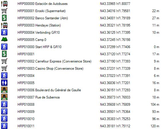
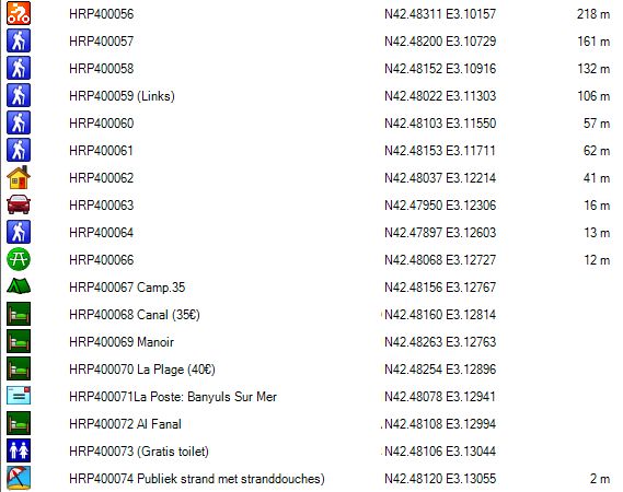
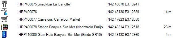
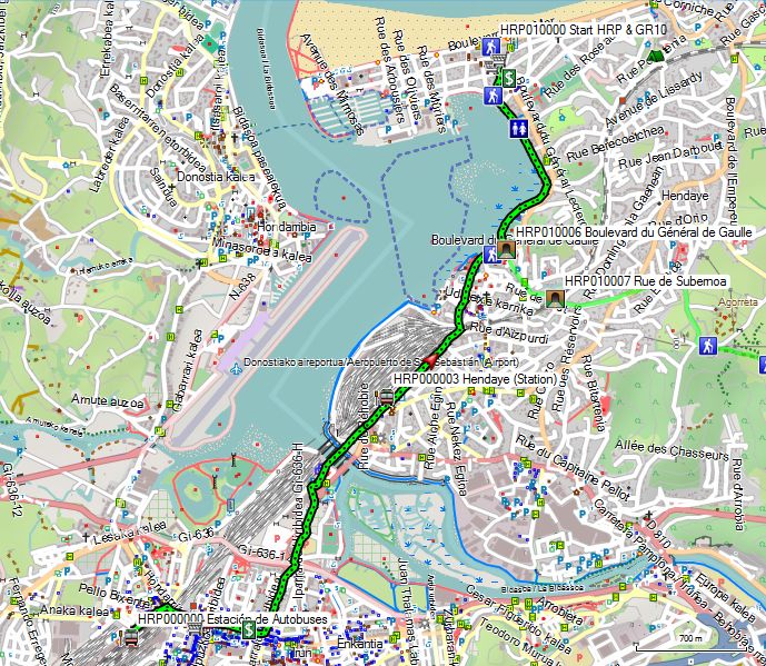
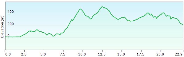
Day 00: Irun – Hendaye |
5.4km | +45 | -45 |
Without rest: 1:00
At the back of the station (HRP000000), you’ll find a restroom that’s open to the public, but as a result, it’s not exactly a model of cleanliness. The station itself opens around 6:00 a.m. on weekdays.
From the station, walk toward the church at the beginning of the street. You are in a nightlife district here, so don’t be surprised if you encounter drunk and noisy people. At the end of the street, turn right and cross the tracks via a bridge. Continue along the shopping street for 600 meters. On a parallel street, you’ll find an Eroski supermarket (HRP000001), but since it’s still early, it isn’t open yet. The ATM (HRP000002) at Banco Santander is open 24/7! 😉 On Avenida Iparralde, turn left and continue north. Go around a roundabout and pass under the N1. Go around a second roundabout counterclockwise. Go clockwise around the third roundabout and walk past the facades of several shops and hotels. Avoid the busy road, which goes uphill, and take the historic pedestrian bridge, to the left of the bridge for car traffic.
The river forms the border. Stay as close as possible to the railroad tracks, and after 350 meters, you’ll pass the French border station at Hendaye (HRP000003). When the tracks go underground, turn left and cross the tracks. At a roundabout, go straight ahead.
If you don’t want to walk all the way to the official starting point, after 180 m you can turn right onto a path at the northeast corner of the cemetery. You descend to Rue Pellot, where the GR10—and thus the HRP—begins. Here you can turn left to the official starting point or right toward the Mediterranean Sea! 😉
To reach the official starting point, follow the boardwalk along the Baie de Chingoudy. From here, you’ll find GR markers. When the boardwalk curves to the left, turn right onto Rue Des Citronniers (HRP010004), and yes, there really are lemon trees there. At the roundabout, take the second right onto Boulevard Du Général Leclerc. You’ll find a Casino department store here (HRP010003).
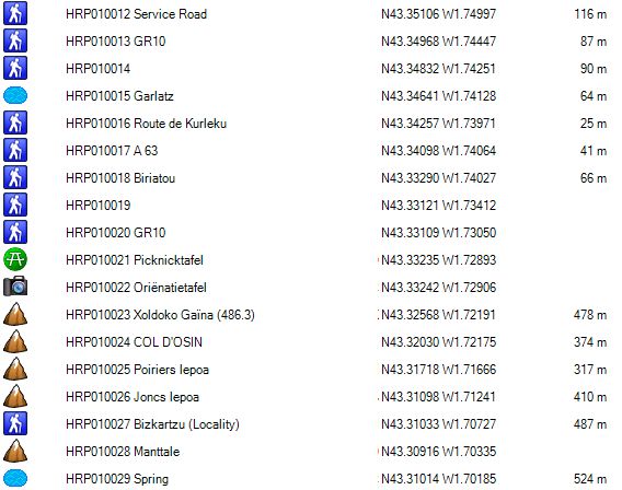
Dag 01: Hendaye – Col Lizuniaga |
25.1km | +1500 | -1300 |
 Without rest: 8:15’, with rest: 9:00’
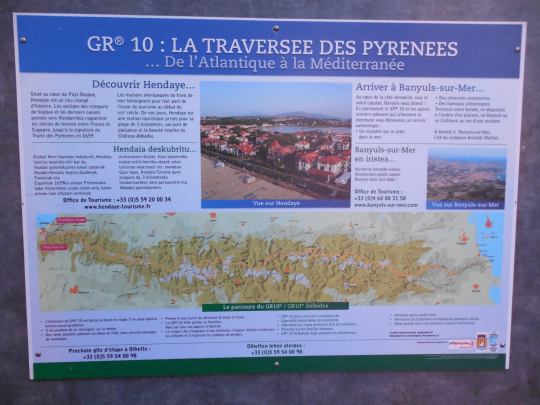
At the end of Boulevard Du Général Leclerc, you’ll find the information sign for the GR10. Here you are at the Atlantic Ocean and thus at the true starting point of the HRP, which follows the GR10 for the first few hours.
After taking the obligatory photo, retrace your steps and set off on your great adventure.
Head back to the roundabout at Baie de Chingoudy. Don’t follow the road; instead, take the bike and walking path along the water until you reach a passageway under the roadway.
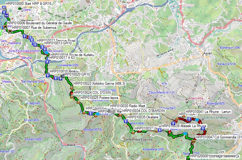
You go under the roadway and emerge via Rue Pellot at a roundabout. Here, you go between the buildings. At a T-junction, turn left onto Rue de Subernoa, a dead-end street that ends in a small pedestrian tunnel (HRP010007) under the tracks. At the other end, continue in the same direction until you reach the D358. Follow it to the left and exit it after 100 m at a roundabout by turning right. At a T-junction, turn right, and then after 400 m, take the second street on the left. After 75 m, leave the paved road for a gravel path (HRP010008). At a fork (HRP010009), turn right. Follow the gravel road, which rejoins the paved road (HRP010012), and continue along it until you reach the busy D810. Cross the roadway and continue down a narrow path (HRP010013) through the trees. At the next intersection, turn right (HRP010014). You make a slight bend around a hilltop and then continue in the same direction. You turn right and walk toward the A63. Just before the embankment, turn left, and then you’ll find a small path to the right that leads to a small tunnel under the A63 (HRP010017). Go through the small tunnel and continue south toward HRP010018 Biriatou. From here, head southeast to the underpass beneath the A63 (HRP010017).
Then head east via the Chemin du Chateau and then take a gravel road to the right to (HRP010020) GR10. Here you’ll find a faint path on the right along the mountainside, which also leads to (HRP010024) COL D’OSIN. The GR10, however, follows the ridge. You then pass by the (HRP010021) orientation table and the (HRP010022) picnic table. You’ll walk along the mountainside for a while, after which the GR signs will lead you up the ridge to (HRP010023) Xoldoko Gaïna. The trail continues over the ridge to (HRP010024) COL D’OSIN.
You descend to a saddle (HRP010025) and then climb steeply up the other side. At Joncs Lepoa (HRP010026), continue along the ridge. At a fork, turn left. Just before a stream bed (HRP010029), do not cross it, but turn left to go around the Manttale ridge (HRP010028). Continue at the same elevation before descending toward the paved road and the tourist hub of the COL D’IBARDIN (HRP010034).
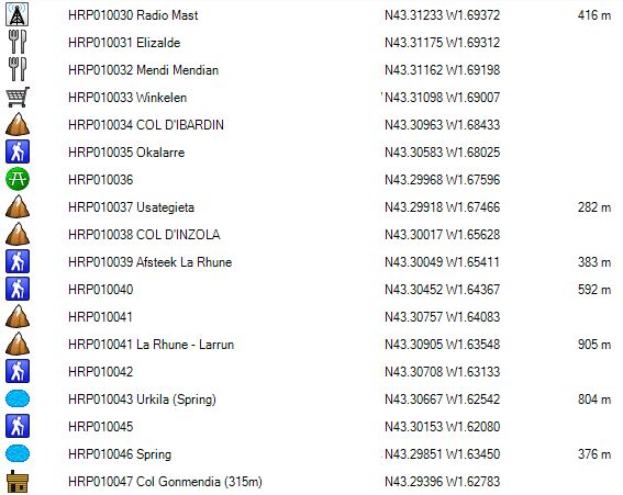
You’ll pass several restaurants and souvenir shops, and even two gas stations. At the roundabout just before the Total gas station, you’ll reach the main road. The GR10 turns left here and stays in France. The HRP heads into Spain. Follow the main road down to the right until you can turn left onto a side road (paved). Follow this road to the Okalarre Restaurant (formerly a banquet hall). Leave the paved road and, just before the fence, turn left (HRP010035). Follow this path until it leads to a dirt road (HRP010036), which you could also have taken just before the Okalarre Restaurant by turning right.
On the dirt road, turn left and pass a picnic area with a spring. Immediately past this, turn left and climb up a gravel road to a crossroads (picnic area) with a signpost to La Rhune (Larrun) on the left. You will then reach the COL D’INZOLA (HRP010038).
Here, take the jeep trail marked with a no-vehicles sign, with a fine of €300 for violations. Standing here in the midday sun, your desire to climb is briefly dampened when you realize where you need to be: almost right at the top of the transmission tower and the buildings on the summit of La Rhune (Larrun) :-(.
As on all jeep trails, the climb is unpleasant due to the condition of the road and the lack of shade. At GPS HRP 0008A, you can continue following the road to the left or take a path straight ahead. This leads to the ruins of a farmhouse, where you have to climb a short distance back up to the road. You continue along the flank below the summit to a ridge of the mountain, where you make a counterclockwise turn to the ruins of a building (HRP 0010 P48 1). From here, you can head to the cirque at the summit of La Rhune (Larrun) (only if you need to replenish your water supply).
The HRP turns right here and follows a faint path on a spur of La Rhune (Larrun) to a faint fork (HRP010043 Bron), where you turn right and descend in a zigzag and then in a straight line to HRP010045. At first you followed faint white-yellow markings, which then change to yellow markings.
You make a right turn. The horizontal section toward the boundary stone is very faint and overgrown. A very steep path runs along the boundary
You turn right. The flat section leading to the boundary marker is very faint and overgrown. Along the boundary, a very steep path descends (faint blue markings) to a large hunting cabin (HRP010047) on Col Gonmendia, at the edge of the forest. Those who turned right 200 m past the COL D’INZOLA (HRP010038) and continued along a path on the flank of La Rhune saved themselves a lot of effort and trouble in reaching Col Gonmendia as well!
Here, follow the path on the flank of the ridge (slightly uphill) at the edge of the forest (orange markings). On the descent, you pass several small hunting huts. The road curves to the right, and at a junction, turn left to continue descending along the same line until just before the road. Here you will find:
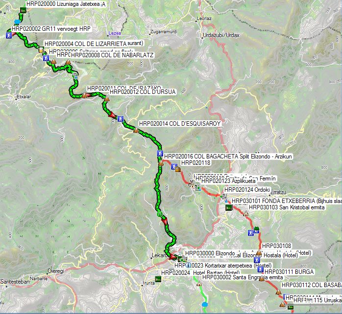
Hostal-Restaurante Lizuniaga Jatetxea (HRP020000):
Language: Spanish
Tel: +34/948631031
Auzoa, 26, Garaitarreta, Navarre, Spain
Open: All year round, may be closed in early summer. (Seemed closed, but is open). Check in at the kitchen door.
Room rate: (No recent prices online!) (room with 2 beds, private bathroom, and TV)
1/2L red wine and bread: included
Dinner (7:30 PM):
1st course: large mixed salad with cheese and ham
2nd course: Pasta with 3 slices of roast pork
3rd course: dessert: cheese platter.
Breakfast: starting at 7:30 a.m. (Saturday)
4 slices of toast, jam, butter, fruit bowl (generous), coffee or tea
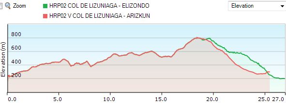
Day 02: Col Lizuniaga -Elizondo |
27.1km | +1100 | -1100 |
Without breaks: 7h30’, with breaks: 8h00’ (though, in this case, “break” was a relative term 😦 )
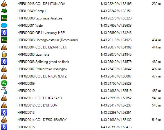
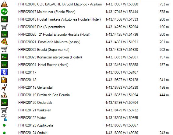
You leave the hostel and cross the road, which is the actual COL DE LIZUNIAGA pass (HRP020000). Continue straight ahead. The concrete road soon turns into a dirt road. You pass a spring (HRP020001), and at the second road coming from the right, the GR11 joins the HRP (HRP020002). Continue following the GR11 to the COL BAGACHETA (HRP020016).
You cross the asphalt for the first time at the COL DE LIZARRIETA (HRP020002). There you will also find a restaurant. 600 meters further on, you can choose between the ridge or the flank to the COL DE NABARLATZ. After crossing the road a second time at COL D’URSUA (HRP020012), you climb slowly through the forest, followed by open terrain covered with ferns. When the descent begins and the road curves to the left, you’ll find a GR-marked trail on the right, which descends only gradually toward COL D’ESQUISAROY (HRP020014). After this pass on the asphalt, a climb follows along a rough path that levels out and continues to rise gently. At HRP 0022 P53 4, the path meets a fairly level road coming from the left. You head toward a small pass, where you’ll find small bunkers along the road. The road descends slowly. It splits. The main road curves clockwise, and to the right there is a turnoff from this curve. There is a wooden post with a name in Basque, of which you can only make out the elevation of 795m. This is the COL BAGACHETA (HRP020016).
Given the difficulties with lodging and supplies in Arzikun, Marie Millet’s French Guide recommends continuing to follow the GR11 to Elizondo, where there are more lodging options and shops.
At the COL BAGACHETA (HRP020016), continue southward along the road on the flank of the Larrondo (853m). At a three-way junction, take the road straight ahead and follow the right bank of the Arlako Erreka stream. At the next fork, turn left, then a little further on leave the gravel road for a path along the forest edge, which follows the stream bed at a distance and also descends the flank of the Unboto (802m).
Below the summit of Unboto (802m), the trail emerges onto a gravel road that you follow further downhill to a picnic area. (HRP020017)(Maistruzar). From here, follow the better road downhill. There are shortcuts via trails, but whether to use them is a personal choice, partly determined by weather conditions.
After the first series of hairpin turns, the GR11 leaves the asphalt to the right and takes a detour through the forest to reach the center of Elizondo (HRP030000).
Hostal Elizondo (HRP020020):
Calle María Azpilkueta, 10
31700 Elizondo, Navarre.
info@hostalelizondo.com
Prices 2026:
Single room + breakfast: 52€
Double room + breakfast: 77€
Albergue Kortarixar (HRP020023):
Polígono Datualde 7
31700 Elizondo
(Navarre)
Tel: +34/626 53 24 52
info@kortarixar.es
Prices 2026:
Single room with private bathroom: 40€
Double room with private bathroom: 60€
Single room with private bathroom: 30€
Double room with private bathroom: 50€
1 bed in dormitory: 20€
Store:
Dia CL. SANTIAGO, 82. 31700 Baztan
Variant to Arzikun:
Here you leave the GR11.
Take the curve clockwise, and at the highest point, leave the road and follow a barely discernible path to the left. Descend toward the ridge of a hill. You’ll find a path to the right of this ridge. At the second “bump,” switch sides.
In a grove of oak trees, look for a path among the ferns leading toward a dilapidated farmhouse with the remains of a red-tiled roof. Here a road begins, which descends gradually and changes sides at a break in the ridge, continuing down past a goat pen (HRP020118) and the Azplikueta cemetery (HRP020119). However, along the way I encountered a billy goat that apparently did not appreciate my presence.
Confrontation with a billy goat
At first, the animal was grazing peacefully in a bush along the side of the road. But when it noticed me, it stepped into the middle of the road and blocked my path. Usually, you’d expect animals like that to take off running, but this one clearly had other ideas. The animal had curled horns measuring up to 50 cm in length and spanning about 80 cm. It displayed just about every form of threat: from standing on its hind legs, to circling, to lowering its head with its horns pointed forward. When you consider that the animal, standing on its hind legs, was taller than this lone hiker, you can imagine that it didn’t come across as very reassuring. Fortunately, there were two walking sticks between me and the animal.
My first attempt to lose it was near the goat pens, but the wall there was too low, as the animal easily jumped onto it. A second attempt was near the cemetery and the Ermita de San Fermin. The wall there is significantly higher. However, just before this wall, there is a staircase leading to a chapel. After the goat jumped over a low fence, it climbed up the chapel steps and leaped from the highest point of the stairs onto the wall. But a donkey doesn’t stumble over the same stone twice, so I waited for him to jump down from the wall, then quickly made my way out through the cemetery gate. After picking up one of the lower sections of my telescopic walking poles, which I’d lost during the struggle, I made a quick getaway—and, above all, got out of sight.
In Azplikueta (HRP020123) itself, you’ll only find annoying dogs, but they’re usually called to order by their owners. I couldn’t figure out who the goat’s owner was. My Spanish isn’t good enough to figure that out.
From Azplikueta (HRP020123), you descend to the N121-B, after which you climb toward your final destination, Arzikun. You reach this via a backstreet from Ordoki (HRP020124), which starts at the grain silos and returns to the main street at a roundabout. On foot, at the roundabout, you can continue across a historic bridge, where you’ll find a water tap (HRP020127). The bridge leads to a historic road, which you’ll leave after a bend to take a path that climbs toward your final destination, Arizkun.
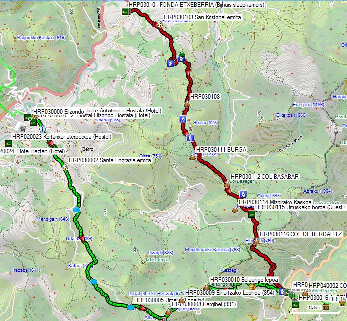
On the main street, turn right, and across from the covered pelota court you’ll find FONDA ETXEBERRIA (HRP030100). This is the actual center of the village, serving as a café, restaurant, village store, and hotel for HRP and other wayfarers.
You’ll spend the night in the annex located within walking distance: FONDA ETXEBERRIA (Annex bedrooms) (HRP030101).
FONDA ETXEBERRIA (HRP030100) (closed according to Google Maps):
Language: Spanish
Tel: +34/948453013
pension@baztanetxeberria.com
http://www.baztanetxeberria.com (Website no longer functional)
Alternative:
Casa Rural Zilbetinea
C. Larrain, 14, 31713 Arizcun, Navarra, Spain
+34948453489
€65 (2024) for single occupancy with breakfast.
This likely refers to the annex that was used by the former FONDA ETXEBERRIA for overnight stays.
Meals:
Asador Ordoki
Poligono Ordoki S/N Valle de Baztan
31713 Arizcun Spain
+34 948 45 31 65
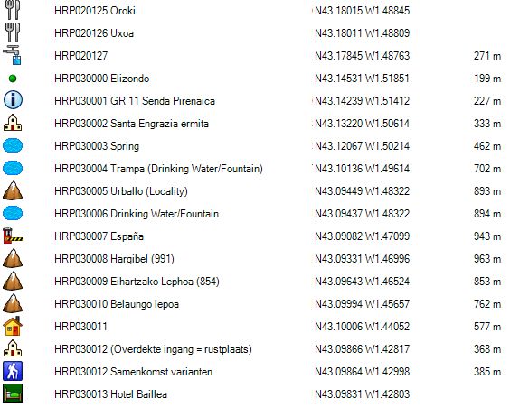
Day 03: Elizondo –Les Aldudes |
13.9km | +875 | -700 |
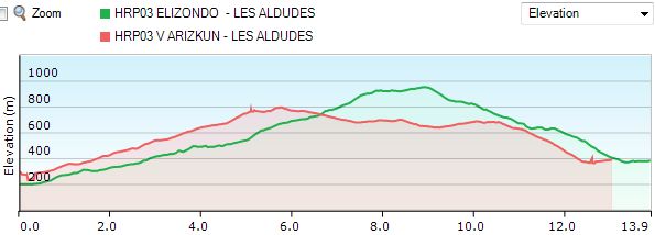 Les Aldudes: without breaks: 4h45’
Follow the GR11 all the way to the Spanish-French border.
Turn right off the main street in Elizondo and pass by the church. After the church, take the second street on the left, then turn right onto Maurizio Berekoetxea Kalea (street), which you follow to the edge of town.
Just before the edge of the forest, you’ll find an information sign (HRP030001) for the GR11. Here, take the gravel path diagonally to the right that leads into the forest, past a wall and an old farmhouse. Continue following the GR11 markings, which gradually gain elevation. You pass the Ermita anta Engrazia and, 500 meters further on, leave the road to the right to cut across the hairpin bends. You cross the road again and continue along a gravel path through the fields. You cross a cattle grid.
You enter the forest and continue southeast until you reach the Spanish-French border (HRP030007).
Here, you leave the GR11 to the left toward the Hargibel (991 m) (HRP030008). You descend along the French side, but parallel to the border, to the Ehartzako Lephoa (854m) (Col d’Heyharza) (HRP030009). Here you’ll find French markings for the GRT5 and an asphalt road that you follow downhill. At the first hairpin bend, you leave the asphalt and continue on a path parallel to the border, which then descends to an asphalt road. You leave this road after 150m to the left via a gravel path marked in yellow (Trail 4).
Near a few buildings, the path turns into asphalt. At the next cluster of houses (HRP030011), you leave the road again and take a gravel path to the left. At the edge of the forest, near a few houses, it turns back into asphalt. Upon leaving the forest, the route via Arizkun joins the one coming from Elizondo. You continue descending to Les Aldudes (HRP040000).
Centre Auberge Erreka Gorri
460 Xerrenda Karrika (350m past the turnoff for tomorrow)
64430 Aldudes
Tel.: +33/(0)6 72 93 84 57
Email: centre-aldudes@pep64.org
Beds: 77 (renovated in 2022)
No prices listed online!
Hôtel restaurant Saint Sylvestre: (2.2 km) (HRP030017)
Room: €87 (2026)
1775 Iruñeka Errepidea
Esnazu District 64430 Aldudes
stsylvestre.hotel@gmail.com
+33(0)5 59 37 58 13
Alternative route from Arizkun:
Les Aldudes: without breaks: 3h 15’
You leave your lodging via a street that runs behind the FONDA ETXEBERRIA (HRP030100). Turn right onto a street where you’ll find yellow-and-white markings. Where the road curves to the left, continue straight ahead on a path through the forest. This path gets very muddy after rain, so you can avoid this by staying on the paved road. At the end of the forest, the HRP rejoins the road. Follow the road to the right. Where it ends, do not turn diagonally right toward a farm, but continue straight ahead on a country road. At HRP030104, turn left. At HRP030105, the HRP curves to the right. Continue climbing to (HRP030108).
Here, take the steepest path until it ends at two consecutive barriers (HRP030109). The first is locked with a chain. So climb over the first gate and open the second, or climb over the fence on the left to reach the meadow. Follow the fence to your right along a faint path. At the trees, turn left toward the ruins of a stable. From here, you must go through the tall grass, diagonally across the meadow toward the hill and the forest at its end (HRP030110). In the corner of the meadow, you’ll find a small step over the fence under the trees. This brings you to a forest road. The Cicerone guide directs you to head uphill through the forest again toward the Burga ridge (HRP030111), but you can also simply follow the forest road to the left. It turns right and then continues toward COL BASABAR (HRP030112) (much easier ;-)).
Here, the same scenario repeats. The guide directs you over the ridge (HRP030113) (white-green), which is a brutal climb. If you’re only going as far as Les Aldudes, you can safely follow the guide here. If you’re continuing on to Roncesvalles, turn right here and follow the white-yellow markings, which stay along the side of the slope. You’ll pass a farm (HRP030115), where they sell cheese, and continue following the signs to COL DE BERDALITZ (HRP030116).
Here you cross the pass. Do not take the road on the ridge, but a path that runs diagonally to the right along the slope and then descends gently into the forest. At the edge of the forest, you can already see Les Aldudes. Turn left. The forest road turns into asphalt. Continue along it to the end, where you turn left toward the center of Les Aldudes (HRP040000). Cross the bridge and turn right.
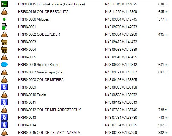
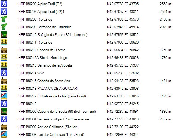
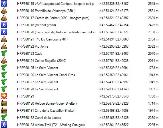
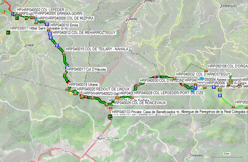
Day 04:Les Aldudes – Ref d’Azpegi |
27.7km | +1600 | -1000 |
Without breaks: 8h45’
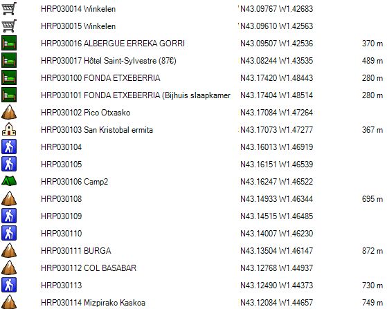
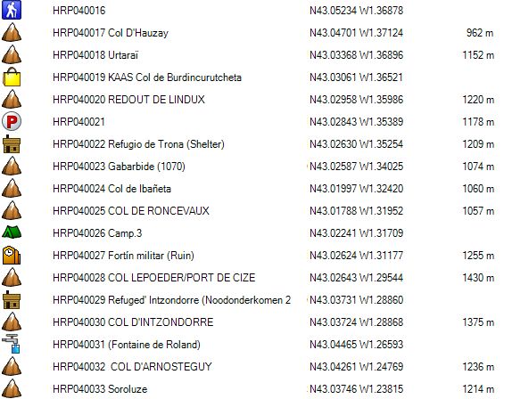
Across from the gas station (HRP040001) and its attached store, you’ll find a rough concrete staircase that ends at a small gate. Open the gate and continue up a steep, somewhat technical path that zigzags upward. A little further on, the path climbs in a straight line to a saddle, COL LEPEDER (HRP040002), with a hunting cabin. Here, you climb to the right along the ridge. At the top, you’ll find a path across the ridge to the left. The path climbs gently at first to another hunting cabin (HRP040003) before descending toward a pass. You’ll end up on a crossroad (HRP040004), where you’ll follow a path straight ahead that is largely overgrown with ferns. This path climbs gently to the left toward the paved road (power lines along the road). On the paved road, turn left. At a fork, turn right. You climb to a saddle with a barn (HRP040007) to your right, under a tree. Here, leave the road and follow the ridge via a less distinct path. In a sort of basin, leave the path that continues climbing along the ridge for a trail that turns right and stays on the flank. A little further on, the trail makes a sharp left turn. Here you can see the rest of the climb toward COL DE MIZPIRA (HRP040008).
From COL DE MIZPIRA, you mainly follow the ridge, sometimes on a trail, sometimes off-trail. At HRP040009, you can either cross the Col de Errola (HRP040010) or take a road that goes around the col to the left and descends 50m to the saddle beyond the Errola (HRP040011).
You continue descending to the COL DE MEHARROZTEGUY (HRP040012).
From the COL DE MEHARROZTEGUY (HRP040012), you can either take the trail across the ridge or take the (detour) route to the ridge. At HRP040014, the trail rejoins the road, and the HRP follows the road via the COL DE TEILARY (HRP040015) to a fork (HRP040016). Here, take the gently ascending road to the right to the Col D’Hauzay (HRP040017).
At the col, turn left and continue following the road to the Col de Burdincurutcheta (HRP040019) (CHEESE available). From here, the Cicerone guide directs you over the REDOUT DE LINDUX (HRP040020). It is easier to simply continue following the road to a pass beyond the REDOUT DE LINDUX (HRP040021). Here you will find GR markers. Continue following the paved road to the Col de Ibañeta (HRP040024).
At the Col de Ibañeta, follow the paved road to the COL LEPOEDER/PORT DE CIZE (HRP040028). The GR takes some detours here, but they are usually very rough and steep, so it’s better to stick to the road. At the Col, you’ll find the Camino, which you follow in the opposite direction until just before the Fontaine de Roland (HRP040031). Along the way, you’ll pass the Refuge Izandorre (HRP040030) (emergency shelter, 2 beds without mattresses) (listed in the guide as Cabanes de Bentarte).
Just before the Fontaine de Roland (HRP040031), leave the Camino, turn right, and follow the signs for the GR 8 (not GR 11).
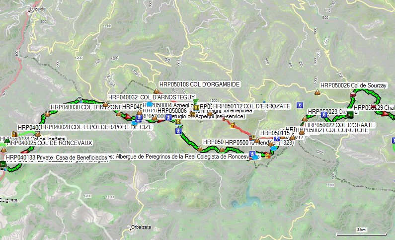
1.5 km past the Fontaine de Roland, you’ll reach the Col d’Arnosteguy (HRP040032) (1,236 m), with a parking lot just below it on the D428. 1 km further on, you’ll reach Soroluze (HRP040033) (1,214 m). Here, take the path diagonally to the right that descends toward the edge of the forest to reach the paved road after a second right turn. Here you will find the REFUGIO d’AZPEGI.
REFUGIO d’AZPEGI (HRP050000):
 Unmanned hut, maintained by the Espagnole municipal government.
This is a damp, self-service hut with no indoor toilet or running water. The bench and table are bolted down. There is a spring right outside the door. It’s best to sleep on the mezzanine, where it’s dry. No mattresses! Sleeps approximately 15 to 20 people.

Note: If you choose to descend to Roncesvalles, you’re also committing to a 38.5-km marathon with 2,000 meters of ascent and 1,600 meters of descent the following day. The Refugio d’Azpegi is located 11.2 km past the Col de Ibañeta.
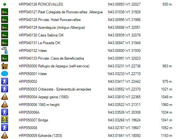
From the Col de Ibañeta (HRP040024), you can descend via the Camino to Roncesvalles (signs are impossible to miss :-)).
Just before the inn, turn right and then take a left through a passageway to reach a courtyard and continue into the garden at the front of the complex. Here, you can turn right toward Casa Sabina or go straight toward La Posada.
CASA SABINA (HRP040130):
Languages: Spanish, French
Tel: +34/948760012
Open: All year round
Overnight stay in a room: (room with 2 beds, private bathroom in the room)
Menu: (pilgrim’s menu)
Dinner (7:00 p.m. or 8:00 p.m.):
1st course: soup
2nd course: trout with potatoes or stewed meat with fries
3rd course: dessert: yogurt.
¼ bottle of red or white wine, ¼ bottle of sparkling water, and one piece of bread: included.
(Portions could be a bit larger)
Breakfast: starting at 6:15 a.m.
2 croissants, 2 toasted rolls, jam, butter, coffee or tea (no charge from the owner).
LA POSADA (HRP040130):
Price: (all-inclusive rate for 1 person in a room, not booked in advance)
(It seems more expensive online, but apparently they offer a discount due to pressure from Casa Sabina.)
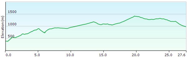
Day 05-06: Roncesvalles -Chalets d’Iraty |
38.5km | +2000 | -1600 |
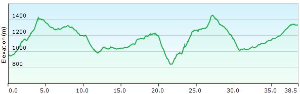
Total: without breaks: approx. 11:30, with breaks: 12:30 (from Chalet Pedro via the road, not via the GR)
From Roncesvalles, you can follow the Camino in the opposite direction to the COL LEPOEDER/PORT DE CIZE (HRP040028).
You can also take the Camino variant along the road (same road as yesterday) back to Col de Ibañeta (HRP040024).
From here, you can once again follow the HRP and the GR. In the Cicerone guide, this is incorrectly labeled as the GR11, but according to the signage on the ground, these are the GR 8 and GR 12. The GR 12 is a specifically Basque GR, where all maps and signposts are in Basque. Not tourist-friendly. Identity is clearly more important here than commerce and tourist-friendliness.
The further description of this stage coincides with that of Days 04 & 05.
Day 05:Ref d’Azpegi –Chalets d’Iraty |
26.8km | +1400 | -1050 |
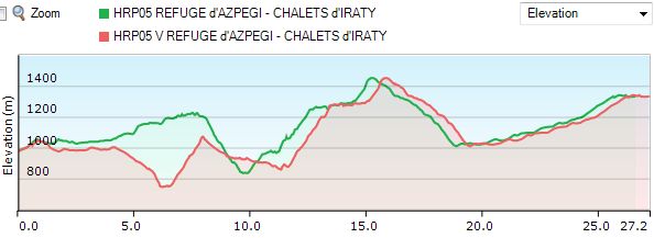
 Total: without breaks: approx. 8h30.
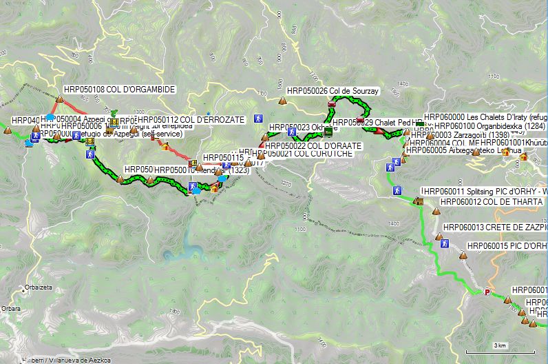
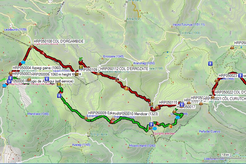
From Refugio d’Azpegi (HRP050000), retrace your steps back to Azpegi Gaina (HRP050004) (1,060 m). Officially, you leave the paved road at the third bend, following a signpost toward Errozate. Here you’ll find GR12 markers and follow a trail along the edge of the forest. According to the digital map, you can also take a shortcut at HRP050003. You then enter the forest (HRP050006). Once back on the grassy plain, take the right fork at the junction (HRP050006A).
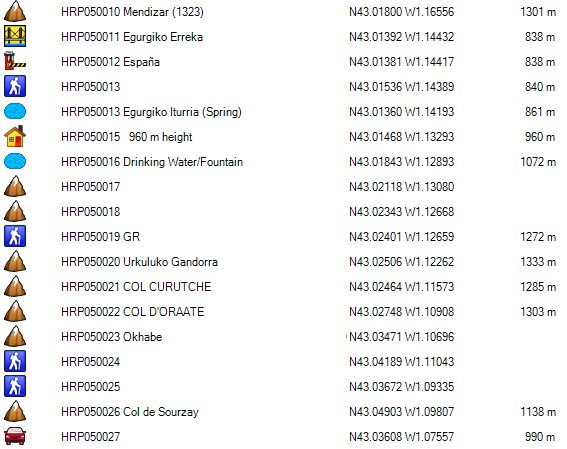
Follow this road for 1 km and cross a bridge (HRP050007). Then take a path to the left (HRP050008). At an elevation of 1100 m, you’ll pass a stone water reservoir. Continue uphill and pass below Ezkanda (1203). Due to tall vegetation, the marked posts are difficult to see. You pass below Mendizar (1323), after which you begin the descent toward the border. You cross the bridge (HRP050011) over the Egurgiko Erreka.
On the other side, follow the road north toward the Egurgi huts. There, you can take a path (HRP050013) to cut across the hairpin bends. At the end of the road, at the tallest building (HRP050015), continue along a path that zigzags toward a pass between two peaks (HRP050017), after which you climb behind the rocky ridge to a trail junction marked HRP050019. You walk along the back of the rocky ridge on the slope of Urkuluko Gandorra. Here you are back on the route indicated in the Cicerone guide. At COL CURUTCHE (HRP050021) you reach the border again.
Het oude traject verliep dichter tegen de grens via de COL D’ORGAMBIDE (HRP050108). tot aan de COL CURUTCHE (HRP050021).
From there, the road runs partly through the forest, where there are some very marshy areas. The road ends at the COL D’ORAATE (HRP050022), which is accessible to vehicles.
Historical route:
The historical path before the turnoff to the Refugio d’Azpegi has been slightly rerouted there, so the GPS point in question is no longer exactly in the correct position.
On the paved road, turn left and then make an S-turn. You can optionally cut across the open terrain at the second turn. The path then continues in a straight line toward COL D’ORGAMBIDE (HRP050108).
 To the left of the pass, you’ll find a cromlech (stone circle). Here, turn right and follow the road until you reach its lowest point. There, you’ll find a faint dirt road that leads to a farm. Along the way, you’ll come to a fenced-off area; stay to the left of it and find a way down toward the PONT DE CHUBIGNA/XUBIGNA (HRP050110). Further down the slope, you’ll find a better path that descends to the bridge in question. Cross the stream via the bridge, and on the other side, head downstream until just before the bed of a small tributary (HRP050111). Here you’ll find a path that is initially narrow and heavily overgrown with grass, marked with faint white-and-red markings, which climbs gently up the slope and then ascends vertically through a river channel to the COL D’ERROZATE (HRP050112). Just below the pass, there is a fence to keep livestock out. From this fence, there is no trail until you reach the pass.
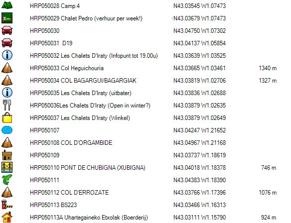
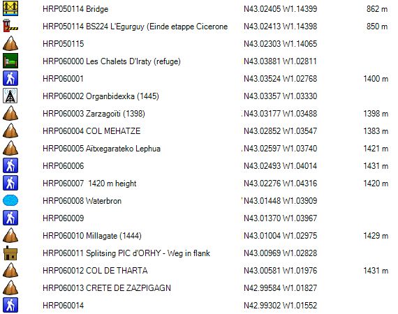
From the col, take a dirt road under a hut, cutting across the bend in the paved road, and then descend along the paved road until it makes a sharp left turn. Here, descend into the riverbed where you will find Boundary Stone BS223 (HRP050113). From here, follow the left bank of the main stream and descend to a farm (HRP050113A), where you return to the main road via the access road. Follow this road to Boundary Stone BS224 (HRP050114) L’Egurguy (official end of the fifth stage in the Cicerone guide) (No facilities!).
If you have a tent, you can camp here. If you don’t, you’ll have no choice but to keep walking until you reach Col Bagargui/Chalets d’Iraty.
The start of this second part of the stage is quite something!
Turn right and cross the bridge. The directions here are very unclear and leave a lot to the imagination. Keep following the road until you reach a gully between two hills. Here, find a faint cattle trail leading uphill. Follow this until you come across a well-defined cross-country trail, and follow it to the sloping ridge of the mountain (HRP050115). Continue climbing along this ridge and then along the mountain’s flank toward the GR (HRP050019). During the climb, you’ll cross many cattle trails, all of which lead downhill. You’ll need to cross all of them until you reach a trail where you’ll find GR markers. Follow this path to the left to the COL CURUTCHE (HRP050021), where you turn left. The road runs partly through the forest, and there are very marshy areas here. The road ends at the COL D’ORAATE (HRP050022), which is accessible to vehicles.
Common route:
Do not follow the paved road; instead, turn left. The path climbs gently up the slope of Okhabe (HRP050023) and ends on an open grassy plateau. Well before the wooden signpost at (HRP050024), you can cross over to the GR 10-marked trail that “returns” toward Okhabe (HRP050023) and then makes a left turn. Continue eastward; at HRP050025, leave the wider road for a path that is initially narrower and less distinct, heading toward the forest edge. From the forest edge, the path widens and becomes heavily eroded. Descend toward the asphalt of the D18. Here, turn left.
On the right-hand side, you’ll pass Chalet Pedro.
Chalet Pedro (HRP050029):
Chalets here are rented out on a weekly basis only.
The restaurant’s prices are “on the high side.”
When we passed through here, neither the terrace nor the restaurant was open.
You will find a water tap here between the terrace tent and the front of the main building.
Continue along the paved D18 to a fork in the road. Here, turn right toward Col de Iraty/Bagargui. About 100 meters past the fork, you’ll find a signpost (HRP050030) on the right with GR10 markings. If you’re doing stages 5 & 6 in one day, it’s better to stay on the road. The climb is gentler, and you won’t have to descend. The same applies to the second section starting at GPS HRP050031 D19.
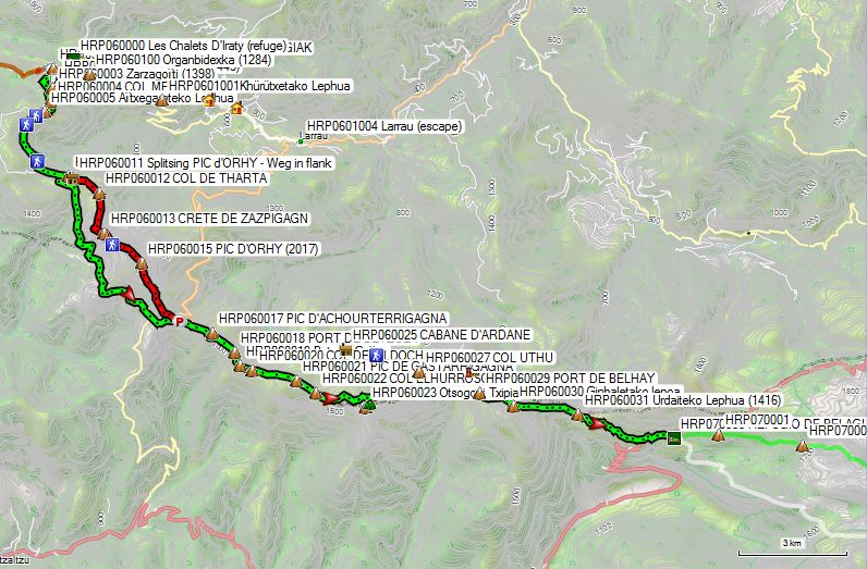
Les Chalets D’Iraty (refuge – HRP060000):
Language: French
The information desk at Les Chalets D’Iraty (HRP050032) is only open until 7:00 PM. Anyone arriving later should go to the manager’s residence (HRP050035 Les Chalets D’Iraty (manager)). There you will find the shop, the restaurant (closed), and the gîte (refuge).
Accommodation: €18/person in a “room” for two. (2025) (sleeping bag!)
Room = bunk bed with a chair in a small cubicle.
Shared bathroom and kitchen.
Coin-operated shower (included, 5’): Don’t turn off the water, or the time will run out. Bad for the environment….
Shop: some canned goods and other non-perishable items. Bread in the morning, after 8:00 a.m.
Dinner: reheat purchased canned goods :-(.
What you are hopefully saved from!
Day 06: Col Bagargui – Larreau |
9.0km | +173 | -843 |
Total: without breaks: 2h30, with breaks: 3h00.
Larreau is not on the HRP, but in the valley. There, we were picked up by the wife of my Australian travel companion for a ride to Lescun. Lescun itself is not accessible by bus; the bus only goes as far as the Pont de Lescun in the valley. After that, the only options are to walk (a 5 km uphill road) or hitchhike to Lescun. Strangely enough, the school bus does go all the way to Lescun, but it is not available to the general public.
Those who don’t have the luxury of a private taxi will have to come up with another solution.
It’s possible via the GR10, but that takes at least 3 days.
Since my itinerary was set in stone from Gavarnie onward, there was no leeway left to accommodate such unexpected events. So be sure to build in some flexibility into your itinerary (this was normally planned for).
Stages 07, 08, and 09 have only one unstaffed overnight stop in the Cicerone guide, with no supplies or any other amenities. Furthermore, you must cross the Zazpigagn Pass and the Pic d’Orhy on Day 7. The combined duration of Days 8 and 9 is also long: 11 hours and 15 minutes.
Those aren’t ideal conditions when the weather is really bad.
The thunderstorm had been forecast for the afternoon, but didn’t arrive until the evening. In Lescun, it wasn’t too bad overall, but the photos in the local newspaper the next morning told a different story. Hailstones as big as golf balls caused significant damage in some areas (mainly lower down in the valley).
A variant of the GR10 descends to Larreau, but this one is not marked. The section we took here was “freestyle” :-), with all the drawbacks that entails.
Part one is mainly a trail, but makes a large hairpin turn to return to the road. Part two starts off well, but the trail fades away and eventually we descended freestyle back to the road. Part three starts off well again, but the end is used by local residents as a sort of green waste dump. Part four is partly heavily overgrown. The signs have not been removed, but there is a notice from the municipal government suggesting an alternative route along the road. Along the way, you’ll encounter comical “No Motorized Traffic” signs (C3), which are meant to prohibit motorized traffic, but the trail is so overgrown that this is effectively impossible. There is an alternative route via the paved road from the hamlet (Inchauspe–Bordalépoa) to Larreau, and that is also recommended if conditions there do not improve.
And so there was little choice but to spend nearly two days forced to rest in Lescun :-(.
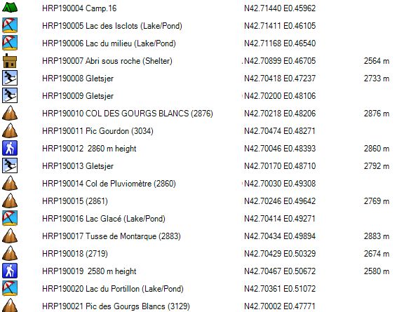
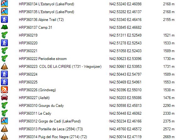
Day 06:Chalets d’Iraty – Ref de Belagua |
28.7km | +1550 | -1500 |
Restoration of the Refugio de Belagua began in August 2018. Previously, hikers had to rely on the Cabane d’Ardanne, a self-service hut in reasonable condition equipped with mattresses. But now that the comfort of a staffed hut is available, the Cabane d’Ardanne is reserved for the die-hards… For those who find the HRP not challenging enough…
From the Col de Iraty/Bagargui (HRP050034), head back 30 meters westward, then take the asphalt road to the left and the gravel road heading south that cuts across the first hairpin bend. You return to the asphalt and continue climbing until the asphalt finally turns into gravel. Those who want to hike along the ridge take the path to the left. The rest follow the gravel road. Both routes converge again at the Mehadze Pass (1383) (HRP060004).
The shortest route here is to follow the asphalt for 450 m, then turn left off it onto a gravel road and return to a gravel road junction (HRP060006), where you continue in a southwesterly direction. The gravel road turns into a trail (HRP060007) and circles around the base of a wooded slope. You reach the Millagate Pass (HRP060010) (1444) and, a little further on, a shelter (HRP060011).
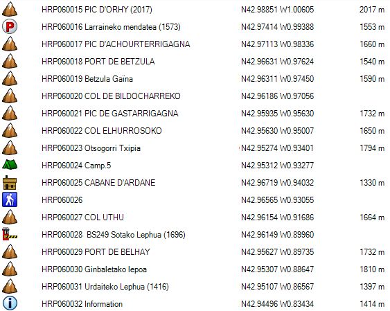
A little further on, you’ll come to the fork between the route over the Pic d’Orhy and the trail that runs along the lower slope. Taking the Pic d’Orhy route saves you 2.5 km, but involves an additional 100 meters of ascent and descent. There is also a short section secured by cables. In favorable weather conditions, taking the route over the Pic d’Orhy is certainly not a disadvantage. In rainy weather or strong winds, follow the path along the flank. At point HRP060014, just past the Crete de Zazpigagn, you can descend back to the lower path. Both routes rejoin at the border along the D26 (HRP060016).
You follow the border ridge or skirt the peaks from below, alternating between the Spanish and French sides. Between Col Elhurrosoko (HRP060022) and Col Uthu (HRP060027), choose the French side. After that, stay on the Spanish side until you descend at Urdateko Lephua (HRP060031) (1416) toward the main pass road between France and Spain, where you’ll find the Refugio de Belagua (HRP070000) at a parking lot there.
Refugio Belagua (HRP070000):
Beds: 56
Carretera Na-137 Puerto de Belagua
31417 Isaba
+34 623 10 73 17
1-person bed + breakfast: €49 (2026) See the Spanish version; the French version has not been updated!
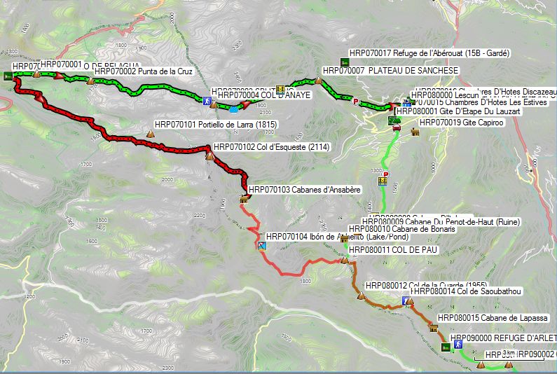
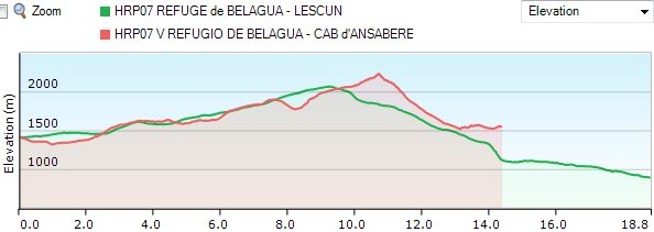
Day 07:Ref de Belagua – Lescun |
18.8km | +825 | -1350 |
 Note:
Note:
- Red: Marie Millet’s French guide directs you to the Cabanes d’Ansabère (Cabanes d’Ansabe on digital maps!), a hut with two bunk beds. There are a total of 3 huts, of which, depending on the source, 1 or 2 are occupied by shepherds in the summer. The shepherds’ huts are equipped with solar panels. Marie Millet describes the huts as unattractive and recommends camping at Lac d’Ansaère (Ibon de Acherito on the digital map!). Of course, you’ll need to bring a tent for that!
- Green: My advice remains to simply descend to Lescun and use your stay there to restock or take a rest day! Compared to the Cabanes d’Ansabère, you only save 4 km in horizontal distance, but you have to climb nearly 500 m more! The next day, you save 1.5 km but have to climb the same amount and descend 700 m more! The choice is yours….
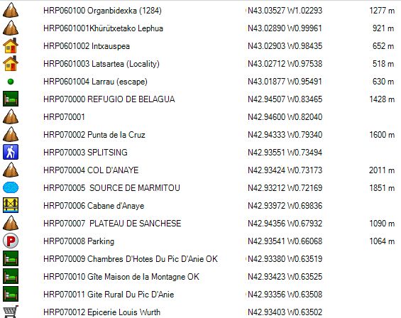
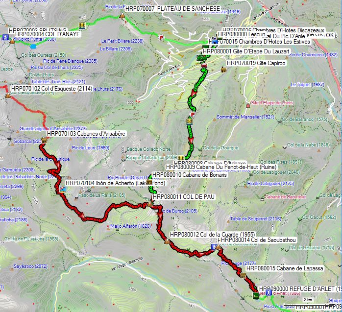
You leave the Refugio de Belagua via the back exit (the road from the parking lot). There you will find an information sign (HRP060032). At the fork there, turn left and head uphill. You will cross a stream and follow a path between a rock face and the forest. Once past the rock face, you enter the forest. After 1.5 km, you’ll emerge into open terrain again and reach Punta de la Cruz (HRP070002). Continue climbing eastward. Just before the border, you’ll come to a fork; continue in the same direction until you reach Col d’Anaye (HRP070004).
Below the Col d’Anaye, descend toward the fountain or take the leftmost path that cuts a corner. In any case, take the descending Sentier du Marmitou (HRP070005), which heads down toward the forest. At an elevation of approximately 1,630 m, you’ll find a fork between a path that passes by the Cabane d’Anaye and the accompanying bridge (HRP070006) and a path that curves to the right (without a bridge?). Cross the bridge and follow the stream bed downhill until both paths converge again and you enter the forest.
At the edge of the forest, you reach a gravel road on the Plateau de Sanchese (HRP070007). As you leave the forest, follow the gravel road straight ahead downhill. You’ll pass a cattle grid and a turnoff to a cabin. Continue downhill toward the edge of the forest. At the end of the forest, continue descending toward the parking lot (HRP070008) and the paved road at a hamlet called Borde de Labarrère.
Pass the first left turn and continue downhill to a fork in the road, where you turn left. At a fork near Lescun, turn right and then left onto Rue Matachot.
Gîte du Pic d’Anie (HRP070011):

Language: French
Phone: +33/559347154
Open: All year round
Room rate: €58–63 (2024)
Gîte: €17 (per person per night. (2024)
Breakfast: €9 (expensive; buying bread and jam at the store is cheaper)
Half-board: €25 + €17
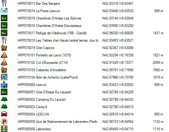
Bar des Berger (HRP070013):
Menu: €15
Dinner (7:30 p.m.):
1st course: soup
2nd course: duck or turkey
3rd course: dessert
Wine: €3
Les Tables d’en Haute (HRP070018):
Dish of the day: €10.50 (Terrace only, so only when the weather is nice)
Head up the hill between the village store and the town hall, then turn left.
Store (HRP070012):
Quite a wide selection. Also includes French topographic maps.
Camping gas and Optimus (gas).
La Poste Lescun (HRP070014):
Tuesday, Thursday, Friday, and Saturday: 9 a.m. – 12 p.m.
Wednesday: 2 p.m. – 4 p.m.
Note: The postmistress is the cook at Bar des Berger.
Day 08: Lescun – Ref d’Arlet |
18.3km | +1557 | -384 |
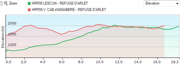
Total: without breaks: 6h00, with breaks: 6h15.
Green: From the Hotel du Pic d’Anie (HRP070009), descend toward the Bar du Berger (HRP070013) and then toward the Pont du Moulin over the Gave de Lescun (river). Those who wish to follow the GR on the other side face a very steep climb. You can also take the road, which makes the climb a bit gentler. At the campground (HRP080001), continue up the paved road. At GPS HRP080004 LESCUN, you cross the Route d’Ansabère, which leads to the hut of the same name, a stopover chosen by Marie Millet. At the intersection, go straight toward Col de Pau. Further on, you’ll take a few turns off the road. After the second turn-off, leave the GR and continue on the road. Further on, the road makes a hairpin turn. The road ends at a “parking lot” (HRP080005) and turns into a dirt road. 300 meters further on, you cross the Labrenère River via a bridge (HRP080006). If you continue straight ahead on this road, you will have to cross the river without a bridge. On the other side of the bridge, follow a path to the point where the road crosses the river.
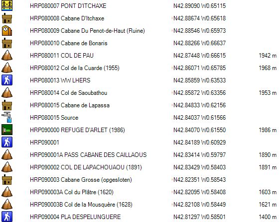
From here on, you enter cow country, and you can tell by the condition of the road. Here you can see what too many cows can do to a road…. You’ll be wading through the mud with your shoes and searching for a patch of ground that’s still somewhat firm. You cross the PONT D’ITCHAXE (HRP080007), but that doesn’t improve things much. The road remains in poor condition all the way to the Cabane D’Itchaxe (HRP080008), which you pass by on the lower side. The road fades into a trail. From the ruins of the Cabanes Du Penot-de-Haut (HRP080009), the trail is clear, and you can follow it without difficulty all the way to the COL DE PAU (HRP080011). At an altitude of 1,700 m, you pass by the Cabane de Bonaris (HRP080010) and leave the river valley.
From the COL DE PAU (HRP080011), the Marie Millet variant (Red) joins the historic trail, which winds up and down along the ridge. You’ll pass the turnoff (signpost) to the Cabane de LHERS (HRP080013). 150m further on, at the Col de Saoubathou (HRP080014), you’ll find another fork, where you turn right. 200m past the Cabane de Lapassa (HRP080015), you’ll find a descending path to Borce. The turnoff is not marked here. The trail is difficult to follow until the REFUGE D’ARLET (HRP 0111 P96 2) comes into view. The trail, which is marked on the OSM map, corresponds to the logged trail on the ground.
REFUGE D’ARLET (HRP090000):

The cabin has since been better insulated and has three levels:
Ground floor: winter room and restrooms (sink, no shower)
First floor: entrance, dining hall, kitchen, and storage area for backpacks and shoes
Second floor: sleeping area (accessible via a miller’s staircase)
The hut takes great care to prevent potential infestation by unwanted bedbugs. Upon entering the hut, you must shake out your sleeping bag, and you must repeat this when leaving. Backpacks must remain downstairs. I am unaware of the effectiveness of these measures.
Only 5 guests in the hut itself and 6 in tents.
Language: French
refugearlet@yahoo.fr
0033/559360099
0033/648993822
Price: €49.50 (2026)
Dinner (7:30 p.m.):
1st course: soup, bread
2nd course: cutlet, risotto, vegetables
3rd course: dessert: pancake and fruit cocktail
Breakfast (7:00 – 8:30 a.m.):
Muesli and cornflakes, very little bread, 2 slices of gingerbread, coffee, tea, or hot chocolate.
Thanks to the muesli, it was OK.
Day 9: Ref d’Arlet – Col du Somport |
16.3km | +900 | -1300 |
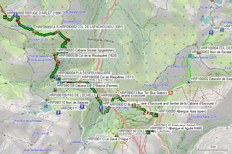
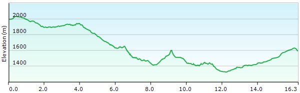
Total: without breaks: 6h 45’, with breaks: 7h 15’
You cross the small “dam” below the hut and walk along the shore of Lac d’Arlet. At the end of the lake, the trail curves to the left, and you then head up the slope toward a pass (HRP090001). You circle around the Pic d’Arlet and descend mostly southeast toward the PASS CABANE DES CAILLAOUS (HRP090001A), near the hut of the same name. Do not turn left toward Cabane de Gourgue Sec, but head east to the COL DE LAPACHOUAOU (HRP090002) (1,891 m), then turn south toward Cabane Grosse (HRP090003 (locked)).
You’ll arrive at a locked hut, where the trail begins. When this trail splits after 150 meters and starts to climb, there are two options:
1) Continue following the trail toward PLA D’ESPELUNGUERE (HRP 0114 P100). Here, turn left.
2) Follow the marked trail to the right. You descend to the Col de la Mousquère and then pass the turnoff to the Col du Plâtre. The trail becomes a zigzag path and descends to the edge of the forest. At an elevation of 1,500 meters, the trail turns into a road. This road zigzags and loses little elevation, so you can easily cut across the curves. You’ll come to a signpost pointing toward Cabane D’ESPELUNGUERE (where you can buy cheese during the season). Here, turn left toward PLA DESPELUNGUERE (HRP090004).
At PLA DESPELUNGUERE (HRP090004), cross the road. At a fork, turn right and walk to the river; here, turn right along the river to the bridge (HRP090005 Passerelle D’Espélunguère). Cross the river and continue straight for 100 meters. Then turn right. After 250 meters, you’ll come to a signpost where only the path leading up to the left is marked and visible.
Follow this trail to the Col de Maspêtres (HRP090008) (1,511 m). 200 m further on, you’ll come to a fork, where you turn right. You’ll join another trail and continue south until you pass the Cabane d’Escouret (HRP090009). Here, you descend via the gravel road. At an elevation of 1,350 m, you leave the gravel road via a trail (HRP090010) that branches off at a bend in the gravel road. You return to the gravel road, which you follow to the left until you reach the Passerelle du Sansanet (HRP090011). You descend to the parking lot, from where you reach the N134 (HRP090012). Follow this road to the right and uphill for 1.2 km to the next bus stop (HRP090013). There, you can leave the N134 for a smaller road, which then turns into a gravel road and a path that takes you between the N134 and a tributary of the Gave d’Aspe. You cross the N134 again, then cross a large parking lot (HRP090016) and continue to the border, passing by the old border post. From there, walk to Albergue Aysa (HRP100000).
Albergue Aysa (HRP100000):
Visited in 2018 during the Camino Tolosana 2.
Carretera de Francia s/n, Somport, 22889 Candanchú
aysa.somport@gmail.com
0034/974 373 023 (47 beds)
Overnight stay with breakfast: €30 (2026)
Overnight stay with half board: €49 (2026)
Packed lunch: €12
Shower: €4
No set menu, which makes it more expensive:
- Chicken, fries, salad: €11, 1.5L water: €2.50
- Entrecôte, bell pepper, fried potatoes: €14, glass of wine: €1.50
Breakfast at 8:15 a.m.:
Chocopops with milk, fruit juice, 1 yogurt, 1 madeleine, 1 slice of cheese, 1 slice of ham, 2 jars of jam, butter, 2 pieces of toast (which is a bit sparse, given the amount of side dishes; ask for more bread).
Connection between the GR11 and Candanchu:
Given the limited availability of lodging in Candanchu during the summer, this old route is no longer highly recommended!!!
At the bridge ((HRP090005) Passerelle D’Espélunguère), cross the river and continue straight ahead for 100 meters. Then turn right. 250m further on, you’ll come to a signpost where only the path leading up to the left is marked and visible. However, you must head diagonally right here along a very faint path through the grass. At the edge of the forest, the path becomes clearer.
Even in the forest, the path remains fairly faint, so you need to pay close attention. There are caines. The actual course of the path differs quite a bit from the marked path on the OSM map. At the top, you’ll come to a small stone building (HRP090108) belonging to EDF (Electricité de France).
Here, a road begins that turns into a path. Here you will find the ladder (approx. 3 m, made of metal and attached to the wall), after which the pass is named.
A little further up, you’ll find the PAS DE L’ECHELLE pass (HRP090109) and the nearby Ibon de Estanes lake (HRP090110). Descend to the lake and walk around it clockwise. On the other side of the lake, the trail is unclear, as there are multiple tracks that sometimes fade and are very distinct near the streams you’ll cross. Head toward a pass, where you’ll find a large cairn (HRP090111). From here, the trail descends slightly to GPS HRP090112. From here, you’ll find GR11 markers. Here, you leave the path that continues descending toward the valley and climb slightly to the right to continue up and down, along the border.
You can see the COLLADO DE CAUSIAT (HRP090114) from a distance, but it takes quite a while to get there. To stay at roughly the same elevation, you’ll need to take a long detour, and the Le Gave D’Aspe (HRP090113) in particular is an obstacle on your way to Candanchu.

You descend through the forest to the bed of the Le Gave D’Aspe. You cross the first branch and then descend into the riverbed, before crossing the second branch. The current is strong enough to warrant caution. Normally, the GR11 presents few problems, but this is clearly an exception to that rule.
On the opposite side of the Le Gave D’Aspe, you will see two trails on the slope. The upper one has eroded, so you must use the lower one. The next section in the gorge is heavily overgrown. At the end of the gorge, climb out of the gorge and up the slope toward COLLADO DE CAUSIAT (HRP 0118 P100 4).
During the descent, the trail becomes faint. Descend toward the ski lifts, then take the road to the left and descend around the military complex to the paved road. On the paved road, descend to the right until a side road branches off the main road via a hairpin turn.
Here you will find the following side by side:
REFUGIO EL AGUILA (HRP090117):
Only open in the winter?
Language: Spanish
0034/974373291
There was a group of children at El Aguila, which made it quite crowded there. That’s why we opted for the adjacent Refugio Valle del Aragon.
REFUGIO VALLE DEL ARAGON (HRP090116):
Language: Spanish
Carlos Maza Ballonga
albergue_valledelaragon@hotmail.com
reservas@candanchu.com
0034/974373222
Accommodation: No recent rates available online!
7-bed room for 2 people, 4 showers and toilets in the hallway
Dinner (7:30 p.m.):
1st course: pasta, bread
2nd course: meatballs
3rd course: dessert: fruit platter
Wine and water included
Breakfast (7:00 a.m.):
Bread and plenty of cookies, coffee or tea
HOTEL EDELWEISS (HRP090115):
Only open in the winter?
Accommodation: No recent rates available online!
Day 10:Col du Somport– Ref Pombie |
15.0km | +1375 | -850 |
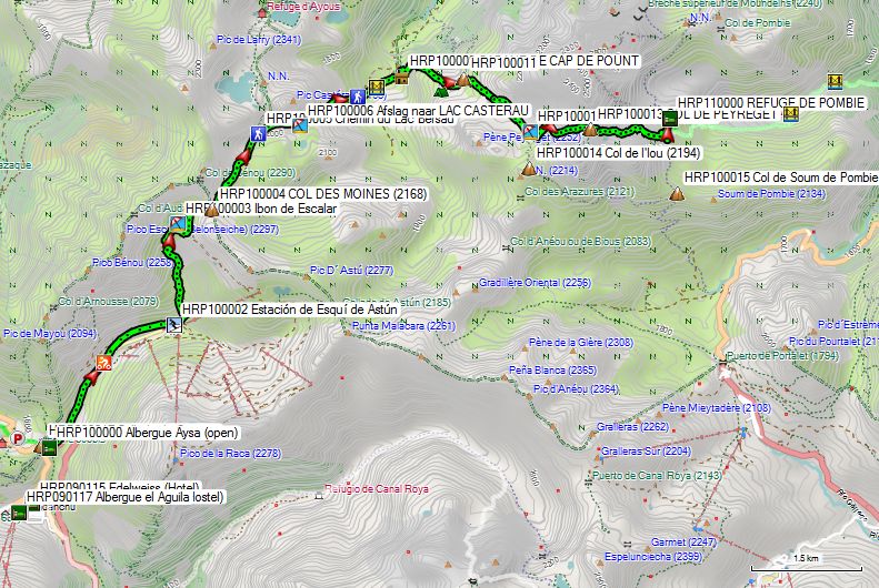
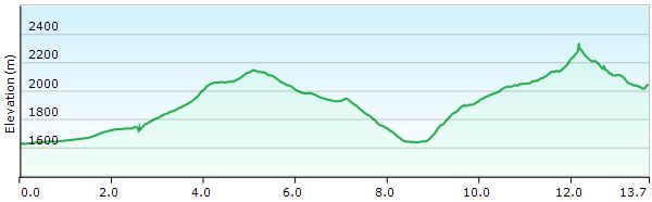

Total: without breaks: 6h30, with breaks: 6h45.
Pretty much everything in Candanchu is closed. Only Albergue Aysa (HRP100000) on the pass itself is open from 8:00 a.m. This is probably thanks to the pilgrims, since tourists arriving by car come later! 😉
At the pass itself, turn right and then immediately left toward Astún. With Astún in sight, it’s best to head diagonally left toward Hotel Europa (HRP100001) to pass behind the hotels. Here, at the Estación de Esquí de Astún (HRP100002), a very faint and steep trail starts to the right of the mountain stream. This trail ends at a gravel road. Turn left until the road ends and turns back into a trail. This trail climbs up the slope to the right of the river. Circle the Ibon de Escalar (lake HRP100003) counterclockwise, then continue climbing to the COL DES MOINES (2168) (HRP100004).
On the other side, you descend easily to the turnoff (HRP100005) toward LAC CASTERAU (HRP100006). Here you’ll find GR markers, which you follow downhill. You pass the lake and continue descending in a zigzag pattern until you reach a gravel road (HRP 0123 P103 2).
You cross the gravel road (HRP100007) to find the continuation of the trail a little further on, along which you continue descending toward the bridge (HRP100008) over Le Gave de Bious. You cross the river and follow it upstream to a cabin, CABANE DE CAP DE POUNT (HRP100009), with a corral for animals.
As indicated in the HRP guide, finding the trail here is not straightforward. First and foremost, you need to understand where you’re going, and that’s a bit surprising.
Do not follow the main valley. Nor should you follow the valley that runs parallel to the CABANE DE CAP DE POUNT. The easiest route is to follow the trail in the main valley that passes below the CABANE DE CAP DE POUNT, then look for a faint zigzag pattern on the slope to your right, leading toward a small pass between two ridges at an elevation of 1,000 meters. Head toward this zigzag pattern on the slope to find a trail there, which will take you easily to the pass (HRP100011). Beyond this pass, you’ll find a valley that continues to climb toward LAC DE PEYREGET (HRP100012).
You’ll circle the lake, and once above it, you’ll enter an area of boulders and snow (if you’re there early in the season). You must be very careful during the climb toward COL DE PEYREGET (HRP100013). The descent is also not easy. Due to the snow, the trail (in July 2014) was difficult to find on the descent toward REFUGE DE POMBIE, so the descent was made via a distinct track in the snow, followed by a secondary trail on the flank, toward REFUGE DE POMBIE (HRP110000).
You can avoid the difficulties around the COL DE PEYREGET by going around the col to the right instead of over it. To do this, from the lake, take the clearly visible trail to the right toward the Col de l’Ou (HRP100014) (2194 instead of 2320), then descend from there to the Col de Soum de Pombie (HRP100015) and on to the REFUGE DE POMBIE (HRP110000). The route is longer, but easier, and at the start of the season certainly faster!
REFUGE DE POMBIE (CAF) (HRP110000):
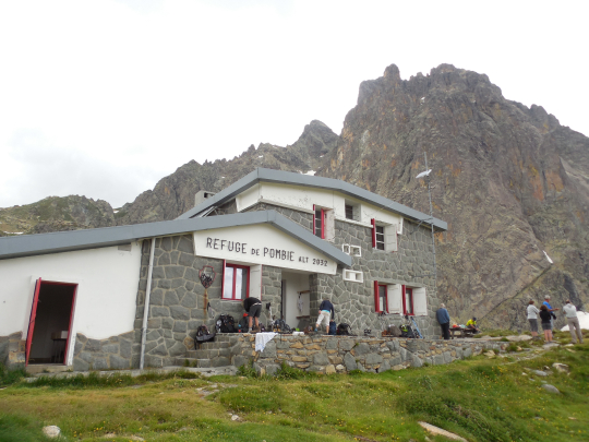
Open: June 1 to September 30
0033/559053178 (very busy hut in good weather and on weekends; popular with rock climbers; reservations recommended!!!!)
Language: French
Half-board: €36.50 (2024 – members of mountaineering club)
1/4L Red wine: €2.50
45 beds in dorms and 16 in a tent!!!, no showers, restrooms downstairs. Limited electricity (solar panels)
Dinner (7:00 PM):
1st course: soup, bread
2nd course: chili con carne with rice
3rd course: cheese and dessert
Breakfast (6:30 AM):
Muesli, 3 slices of bread, pre-packaged toast, gingerbread, jam, butter, coffee, cocoa, or tea
Day 11: Ref Pombie – Ref d’Arremoulit |
10.4km | +1050 | -825 |
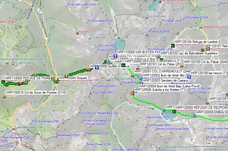
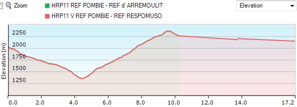
Total: without breaks: 4h 45’ (Guide), Respomuso: +3h20.
How it should have been:
From the hut, there is only one trail leading down toward the D934. You descend through open terrain, and from the first bridge (HRP110001), the trail runs mainly along the banks of the Pombie (mountain stream). At the edge of the forest, you’ll find a second bridge (HRP110002) where you cross the river. You leave the forest, and just before the bridge over the Gave de Brousset (HRP110003), you cross a trail that descends alongside the Gave de Brousset. Continue eastward to the parking lot on the D934.
Cross the road and follow it 20 meters to the left. There, to the left of a shelter (HRP110004), you’ll find the trail to the Col d’Arrious (HRP110008). First, you’ll climb through the forest. As you leave the forest, cross the Ruisseau d’Arrious via a bridge (HRP110005) and continue climbing on the right bank through alpine meadows toward a second shepherd’s hut (HRP110006 – Quèbe d’Arrious) beneath a boulder. You continue climbing, and at an elevation of 2080m, you cross the Arrious a third time. You keep climbing along the river and pass three false passes, which can be somewhat frustrating for those who are tired.
Just before the actual Col d’Arrious (HRP110008), you’ll find a signpost pointing to the right, indicating a trail that leads to the concrete dam of Lac d’Arrious (HRP110009). There, take the trail that heads left up the slope. You’ll soon reach the “Passage d’Orteig” (HRP110010), a section of trail secured by cables that shouldn’t pose any problems under normal conditions. In case of snow or strong winds, you should consider the alternative route via Lake Artouste, but that means an additional 200 meters of elevation gain and loss (HRP110009).
Once you begin the descent after the “Passage d’Orteig,” you can see the hut on the shore of the lake of the same name.
Refuge d’Arremoulit:
Closed since June 2023. Expected to reopen by summer 2026!
Alternative places to stay:
Refuge de Larribet.
Beds: 60
Tel: +33(0)9 88 66 61 22 – HS: 06 67 32 14 95
Half-board: 45,65€ (Members)
Refugio de Respomuso:
(Better suited for tomorrow’s route and shorter! 3 hours 20 minutes)
+6,7km en +450m -550m
B: 90
Tél. : +34/974 337 556
Half-board: 59,90€
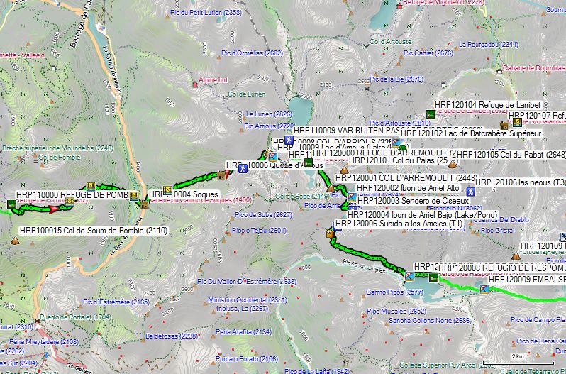
What you prefer to avoid:
It was already clear at the hut: everyone was heading down and returning to the valley, which meant there was still room available in the hut. The forecast for the coming days was downright bad, with daytime temperatures of 0°C at 2,800 meters. If you know that the easiest pass (COL DE LA FACHE) (HRP120010) is located at 2,664 m, then you get the picture.
A young French couple, who had already had orientation problems on day 10, showed signs of them again when leaving the D934, but pressed on despite the fact that they had neither crampons nor an ice axe. A small group of Belgians who did have this equipment also pressed on. None of these parties reached the Refuge Wallon within two days.
Given the poor weather forecast, my Australian travel companion contacted his wife again, and she came to pick us up on the D934 in the valley.
The descent itself is easy.

We drove down to Cauterets so we could start the climb the next day from the Pont d’Espagne to the Refuge Walon.
We took a chance and found a room at the Hotel Odalys.
Hotel Odalys –Balneo Aladin:
Only opend in winter??
Avenue du Général Leclerc 11, BP 62
65110 Cauterets
Accommodation: €65 per room.
Dinner (L’Aragon, next to City Hall):
The cheapest pizza in Cauterets, and it’s pretty good.
1/2 L Red Wine: €5.50
Alternatives:
https://www.booking.com/city/fr/cauterets.nl.html
Day 12: Ref d’Arremoulit– Ref Wallon |
15,9km | +1075 | -1475 |
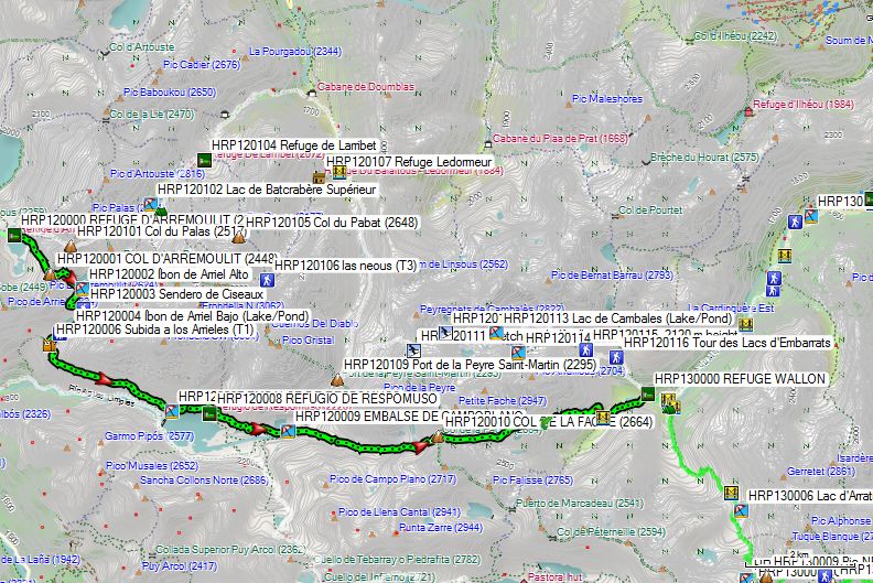
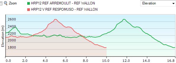
Total: without breaks: 7h40’
You leave the renovated hut heading east along the lake’s shore. At the end of the lake’s spout, you climb diagonally up the slope in a southeasterly direction to the Col d’Arremoulit (2448) (HRP120001).
On the other side, descend eastward to a spur of the Ibon de Arriel Alto (Upper Lake) (HRP120002). Follow the western shore southward and then eastward to a trail junction (HRP120003). There, turn right (south) toward the eastern shore of Ibon de Arriel Basso (Lower Lake) (HRP120004). At a fork (HRP120005), turn left and walk between two small lakes toward a ruin (HRP120006). From here, the trail turns eastward. 2.5 km further on, you’ll reach the Embalse de Respomuso lake (HRP120007) and, another 700 m further, the hut of the same name.
Refugio de Respomuso (HRP120008):
Beds: 90
Tél. : +34/974 337 556
Half-board: 59,90€
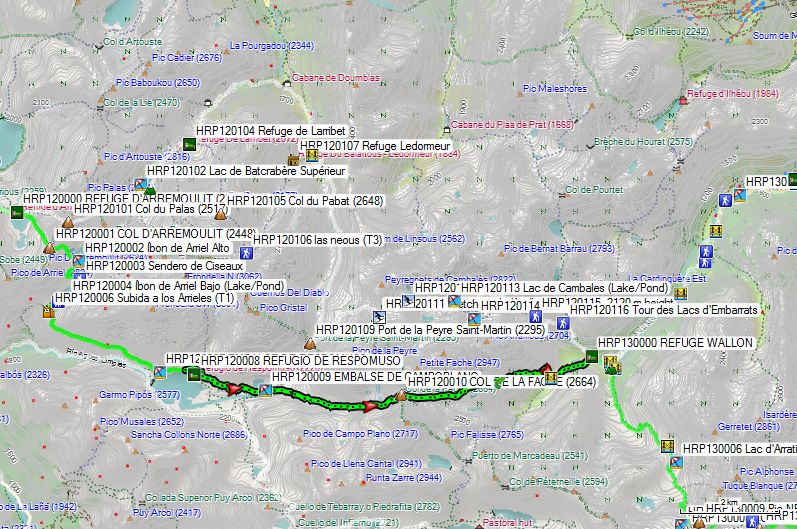
Follow the trail that runs along the slope about 40 meters above the hut. Follow this trail toward the southern shore of the Embalse de Campoplano (HRP120009). Cross the reservoir, then come to a fork in the trail; turn right and cross a stream. Continue eastward uphill. You round the southern shore of the Ibones de la Facha, then continue on to the Col de la Facha (2664m). Here you cross the border back into France.
You descend down a scree slope heading east. 250 m before Lac de la Fache, you skirt around it at a safe distance along the southern scree slope. You continue climbing to Col de la Fache (HRP120010) (2,664 m). You descend through scree fields. At the end of this, the valley splits in two, and you enter the left valley where you cross both the inflow and outflow (HRP120011) of a small lake. You then descend again in a diagonal zigzag down the southern flank. You cross a second stream and continue descending in a zigzag pattern to the bridge over the Port du Marcadau River (HRP120012). 100 meters further on, you’ll find another bridge over a tributary of the previous river. 80 meters lower down, you cross the river one last time, after which you head toward the hut.
REFUGE WALLON/MARCADAU (HRP130000):
Open: June 1 to September 30
Reservations: https://www.alberguesyrefugios.com/wallon/reservar (No longer a CAF hut)
0033/562926428 (Very busy hut during good weather periods and on weekends; popular with hikers; reservations recommended!!!!)
Language: French
Half-board: €58.00 (2026)
1L red wine: €8.00
120 beds in dorms or small rooms (2-person, 4-person), no showers, restrooms downstairs. Limited electricity (solar panels), could use a refresh.
Dinner (7:00 PM):
1st course: soup (generous portion), bread
2nd course: stew with rice
3rd course: cheese and dessert (cake)
Breakfast (6:30 AM – 8:00 AM):
Cornflakes, Chocopops, muesli, toast, gingerbread, jam, butter, coffee, cocoa, or tea (self-service, so plenty to go around :-)).
Dag 13: Ref Wallon – Ref Bayssellance |
12.9km | +1500 | -725 |
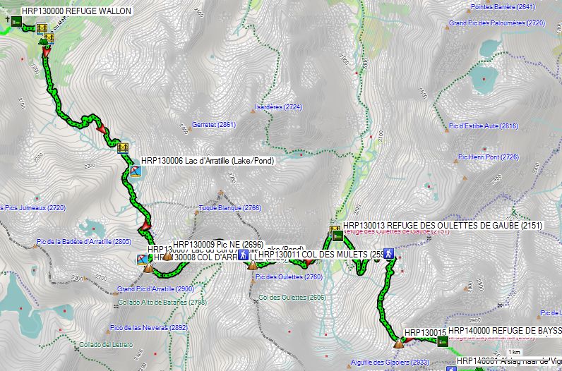
Total: with breaks: 7h20’, without breaks: 6h50’
From the Refuge Wallon (HRP130000), descend toward the Pont d’Espagne until you reach the first bridge (HRP130002) over the Gave du Marcadau. You cross the river and find a good trail there. A little further on, you cross a second bridge (HRP130003), this time over the Gave d’Arratille. About 2 km further on, you’ll cross a third bridge (HRP130005), again over the Gave d’Arratille. 250 m further on, you’ll reach Lac d’Arratille (HRP130006), which you’ll partially circle counterclockwise.
From the lake, you’ll find cairns leading to a tributary stream that flows into the lake from a narrow gully. Straight ahead, you can’t see anything, so turn right until you find old paint marks coming from the direction of the lake, though they weren’t visible from there.
Follow the marks uphill. They curve across the slope and head back toward the river gully. The markings are very faint, so you have to search for the “path.” At the snowfields, you can only look for a way up. The markings are too old and too faint to be visible from a distance. Given the bad weather of the past few days and the relatively early hour, we are the first ones on the trail and there are no clear tracks visible in the snow.
 Further up, you’ll find Lac du Col D’Arratille (HRP130007), which was still almost completely frozen over in July 2014. On the slope leading up to it, you’ll have to traverse fairly steep snowfields that end at the lake and that you must cross on your way to Col D’Arratille (HRP130007 – 2,528 m). After 2 hours and 45 minutes of searching, you reach the col.
On the Spanish side, you’ll find a clear path on the flank. Strangely enough, the trail markers here have been painted over with white paint. Ironically, this makes the markings clearer. On this flank, you must cross several steep snowfields. You can see the COL DES MULETS (HRP130011) on the other side of the basin, but the steepness is a bit daunting. After 1 hour, you reach the COL DES MULETS.
You’ll also find many steep snowfields on the descent from the COL DES MULETS (HRP130011 – 2591). Without an ice axe, it’s best to cross these as quickly as possible and descend through scree fields that are free of snow.
Once in the flat part of the basin (OULETTES DE GAUBE) near the hut of the same name, do not head directly toward the hut, as there is still a river you must cross. It is better to do this via the bridge (HRP130012), which is located to the left (downstream) of the hut (HRP130013), if you want to keep your feet dry, but here too, the trail markings on the ground are unclear.
REFUGE DES OULETTES DE GAUBE (HRP130013):
 Closed until summer 2026! Exact opening date not yet known!
Open: June 1 through September 30
Beds: 85
Tel: 0033/562926297
0033/562454136
Half-board: 45,25€ (members – 2024 – summer)
Reservations are recommended.
The hut is accessible from the Pont d’Espagne and is therefore a popular destination for day-trippers. During our stay, there were school groups of teenagers here who were more interested in checking their appearance in the makeup mirror than in the scenery around them.
No shoes allowed inside the hut!!!??? Incomprehensible. One toilet for day-trippers. With a school full of teenagers, that causes problems. Customer-friendly for real mountain hikers? In any case, they didn’t win me over!
On the descent from the COL DES MULETS, you can see the trail leading toward the HOURQUETTE D’OSSOUE (HRP130015). From the hut, you head up the slope, parallel to the river. The trail is/was very wet. At first, it zigzags vertically upward toward GPS HRP1300114. Here you will find a signpost indicating: Col: 1h, Hut 1h30. At this point, there is a fork, and the trail veers right, running more or less horizontally before gradually ascending along the slope. The final section of the climb is almost entirely on snow. The HOURQUETTE D’OSSOUE (HRP130015) (2734) itself is only visible at the very last moment.
From the pass, the REFUGE DE BAYSSELLANCE (HRP140000) is clearly visible. The official trail to the hut runs along the slope to the left of the snowfield and then descends in a zigzag, eventually ending on a snowfield. You will usually also find a track through the basin that leads directly to the hut. The official trail is safer.
REFUGE DE BAYSSELLANCE (HRP140000):
Open: June 1 through September 30
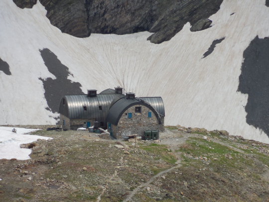
Tel: 0033/562924025
0033/974776652
Beds: 58 op lager.
Reservation recommended.
Language: French
HP: 47.40€ (2026, for members of a mountain sports club)
Backpacks and shoes remain in the entrance. Baskets are available to take the necessary items to the sleeping areas. The walls in the shelters are damp due to condensation.
The hut has 2 French toilets and lavatories with cold water.
Dinner (20:00):
1°: soup, bread
2°: stew with rice
3°: cheese and dessert: chocolate mousse
Breakfast (06:30):
3 small white slices and 3 coarse, 2 slices of gingerbread, jam, butter, coffee, cocoa or tea (plenty available for a high-altitude hut :-)). Furthermore, the climbers of the Vignemale had not yet finished their basket, which was then passed on to others with more time) :-))).
Despite the weather forecast, the summit of the Vignemale remained largely in the clouds. Whoever made the mistake of enjoying the postcard view at the REFUGE DES OULETTES DE GAUBE (HRP130013) had to pay for it the next day with a climb in the icy cold.
At the REFUGE DE BAYSSELLANCE (HRP140000), you can indeed camp. The camping sites consist of spacious flat areas surrounded by a circle of stones.
Day 14: Ref Bayssellance – Gavarnie |
14.6km | +325 | -1475 |
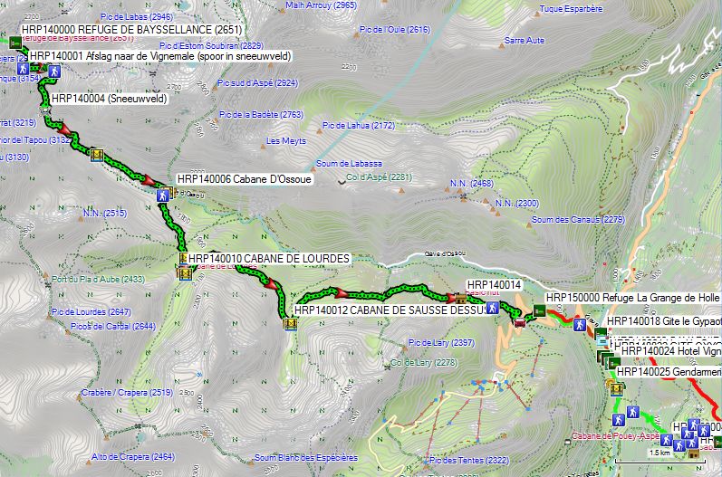
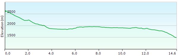
Total: without rest: 5h15’
Apparently some people are still able not to find the way to Gavarnie…
 Still, it isn’t that difficult!
You leave the cabin and walk to the cairne in front of the cabin door. Here you will find a path that descends in zigzag to the trench, where the snow field coming from the HOURQUETTE D’OSSOUE is located. You cross the lower end of this snow field/river. Lower you go in the flank to the right. At GPS HRP140001, the path to the valley makes a hairpin bend to the left. Those who follow the track up in the snowfield, will end up on the Vignemale!!! Some apparently need a lot of time to realize that Gavarnie is in the valley and not uphill… :-(((
You descend further towards Gave d’Ossou, which you follow downstream. You do have to make a number of intermediate climbs in function of natural obstacles.
At GPS HRP140004 you will have to decide according to the state of the snow field, where you will cross this. The original path is quite high in the snow field and is therefore quite steep. In the beginning of the season you will find a track that crosses the snowfield at a lower position.
The bridge over the Gave d’Ossou (HRP140005) was not present at the beginning of July 2014, because of works. At the Maison du Parc in Gavarnie there was an apology :-(((. And so the river had to be crossed via the still sufficiently thick snow field over the Gave d’Ossou.
After the bridge, you walk through a flat boulder-studded valley/bed until you reach the Lac d’Ossoue (HRP140007). At the end of the lake you will find a parking space and a shelter (HRP140006). Those who are tired can also follow the gravel road, later asphalt road towards Gavarnie.
Those who have energy left, cross the Gave d’Ossou via the bridge (HRP140007) behind the dam and climb in the flank towards the CABANE DE LOURDES (HRP140010). From the bridge you will finally find recent GR signs. 200m for the cabin you will find a relatively new bridge (HRP140009). Just below the hut you will find a second bridge (HRP140011). You’re returning to the main valley.
At the level of the CABANE DE SAUSSE DESSUS (HRP140012), the trail goes away from the main valley again. At the hut you cross another tributary via a bridge (HRP140013). After the river you take the middle path in terms of level A little further you will find white red signs. The path goes up and down until you arrive at an electric fence with meadow gate. From here, you descend. At the height of an antenna, the path makes a striking left turn.
In view of the road in the valley, the path becomes unclear again, due to cattle tracks. Walk here parallel with the electric fence down until you find a clearer path (HRP140015) with markings. Then the zigzag goes up to the roadway (HRP140016). You’re crossing the carriageway. On the other side you will find an initially narrow white-red marked path that becomes wider and clearer. This comes back to the road in sight of the Grange de Holle. Again, the indications are unclear. At sight you walk to the parking lot at the front of the Grange.
Refuge La Grange de Holle (CAF) (HRP150000):
Open: June 1 through September 30
Tel: 0033/562924877
Beds: 62 in multiple rooms
Reservation recommended.
Language: French
HP: 47,15€ (2026 for members mountaineering association)
1/2L Red wine: 5,00€
thirant.joseph@wannadoo.fr
The shoes stay in the entrance. The cabin has 2 normal toilets and showers with unlimited hot water (free after departure afternoon customers).
Dinner (19.00h):
1°: soup, bread
2°: duck (free salt) with rice
3°: cheese and dessert: cake
Breakfast (07.00 – 08.30h):
Bread (toaster available), gingerbread, cereals, jam, butter, fruit juice!!, coffee, cocoa or tea.
In 15’ you descend via the parking lot to the road. You descend via the road until you find a designation to the right past a hairpin bend. You descend via a gravel road to just before a house, after which you go to the left and descend further via a path to the tourist office of Gavarnie.
In Gavarnie you will find alternative accommodation in:
Gite d’étape Le Gypaete (HRP140018):
Open: all year
Tel: 0033/562924823
Beds: 45
Half-board: 46€ (2024)
Gite Oxygène (HRP140022):
Open: all year
Tel: 0033/562924061
Beds: 57 (10 rooms with from 4 till 9 beds
Overnight stay with breakfast: 50€ (2024)
Ontbijt: brood, (koude) pannenkoek, confituur, boter, fruitsap!!, koffie, of thee
Dinner: in the restaurant across the lodge:
Confit de Canard, salad and fries: 10€
Post Office (HRP140019):
The post office of Gavarnie can be found in the tourist office, but has more limited opening hours: 09 – 12h.
The suit I sent from Belgium Post Restante arrived, but was already heavy with adhesive tape of the Post of Toulouse. Of the 8 daily rations I sent from Belgium, 6 arrived. In the box instead of the 2 missing daily rations, put a glass bottle of perfume filled for 1/5. On the spot the cases photographed and complaint lodged with the local postmaster, who forwarded me by telephone with a responsible person in Toulouse. Result: I had to lodge a complaint in Belgium, despite the fact that the facts clearly occurred in Toulouse.
In Belgium complaint lodged with B-Post. We are still waiting for a concrete answer.
In the past I already shipped equipment from Austria and Italy to Belgium. I have never had any complaints about this. Only the French post clearly drops stitches.
ATM !!!:
Located somewhat hidden in a passage between two houses, about 80m past the Gite Oxygène on the right side, (just about at the height of the Hotel Vignemale).
Hotel Vignemale (HRP140024):
tel : +33 (0) 562 924 000
+33(0)689229665
Rooms from 160€!!!
Camping La Bergerie (HRP140026):
Camping on a very steep terrain with terraces.
Camping on the Grange de Holle is free if you eat there. So that choice was made quickly.
Shopping:
In a tourist hole like Gavarnie you will find tourist stuff at usury prices. The choice is limited, prices high. There are 2 shops with food.
So sending by post remainder was not yet a bad choice, but then the staff of the French Post must learn to bring their own food to work L.
Drink something…
Usury prices peculiar to a tourist trap!!!
Choice between the Cicerone and the Monte Perdido variants:
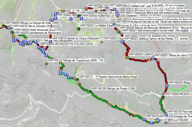
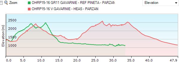
The Cicerone variant has its right to exist. But as long as the Refuge de Barroude does not become operational again (presumably September 2027!) is the distance from Heas to Parzan very long! And then the variant via the Monte Perdido suddenly becomes very interesting! l. A look at the chart should make that story clear!
The Cicerone variant has the objectively few advantages. The Monte Perdido variant is 15km shorter, which also results in a reduction of 650 meters of climbing and descending. And that’s solid.
Look at the differences in numbers:
- GAVARNIE – HEAS – PARZAN (Red): The historic route, but also the longest and the one with the highest altitude difference: with a total length of more than 48km and 2900m scaffolding and 3200 descent. Disadvantage: the length of the stage Heas – Parzan, as long as the Refuge de Barroude is not operational! A stop in the Refuge de Barroude also extends the HRP by one day.
- GAVARNIE – REF PINETA – PARZAN (Green): 15km shorter with 650m less altitude difference: with a total length of 33km and 2250m scaffold and 2625m descent. You can make it heavier by following the GR11 between the Refugio de Pineta and Parzan (for the purists!) The descent of the Port Neuf de Pinède is constantly steep! The path is indicated by T3! For those who are not yet difficult enough, you can also opt for a passage via the Refuge de Tuquerouye (2666 – unmanned!) (+200m) and T4 instead of T3!
Day 15 (1): Gavarnie –Heas |
19.9km | +1275 | -1200 |
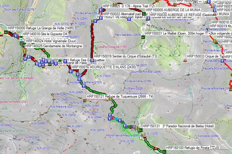
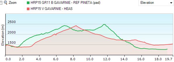
Total: without rest: 6h30’
For those who are well trained, the full stage 15: Gavarnie – Heas can be completed without any problems in one day, given the lack of technical difficulties, itself in the spring.
From the tourist office, you just follow the herd towards Cirque de Gavarnie. At the bridge near the campsite you cross the river and follow the right bank.
You can either take the path 150m past the campsite and then go to the right on the junction to get to the official path after crossing the stream.
You can also walk to the signpost (HRP150002) and start the climb there.
Initially you can still enjoy some shade, but at the height of the signpost PLATEAU DE PAILLA (HRP150004), go to the left and pass the tree line.
From here you walk over the mountain meadow, first in the direction of the Cabane de Pailla (HRP150006). You do not walk up to the hut itself, but together with the cows you look for a way up (HRP150005), to get back on the path from the mountain series (HRP150007).
The day trippers follow the path directly to the hut (HRP150008). However, know that there is also a path that climbs more slowly into the cabin in a hairpin bend to reach it along the back. If you drag up a fresh load of food, you better choose the original path. After 1h45’ you are uphill.
There are half-wild horses and donkeys here that like to join the hut. Watching where you walk is the message.
In normal circumstances, you can easily walk to Heas.
Refuge des Espuguettes (PN) (HRP150012):

Open: half of June to half of September
Tel: 0033/562924063
Beds: 60
Reservation recommended. (Sat full-booked with a class of schoolchildren, a phenomenon you get with easily accessible cabins :-().
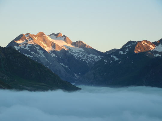 Language: French
Half-board: 51,15€ (2026)
The shoes stay in the entrance. The cabin has 2 normal toilets, 2 sinks behind a door, so you have privacy, but no showers.
Dinner (19.00h):
1°: soup, bread
2°: pasta, sausage with peas
3°: dessert
Breakfast (07.00h):
Lots of bread, no muesli, gingerbread, jam, butter, coffee, cocoa or tea.
From the hut you can see both the pass HOURQUETTE D’ALANS (HRP150016) and the last part of the road. The beginning of the path is vague, given it proceeds in an alm that has been grazed by cattle. You leave from the hut in a northeasterly direction. Further on you will find a clearer path/cattle track. The path zigzags in an easterly direction, in function of the terrain until the split (HRP150015) with the path to the Piméné (2801m). Here you turn right and follow the foot of the degree up to the HOURQUETTE D’ALANS (2430m), a climb and pass without any technical difficulty.
Just below the pass (HRP150017) you do not take the path on the right, towards the Spanish border, but the path that descends to the left in an easterly direction. Lower goes the path south towards center of the bowl. Along the way you pass a second and third junction (HRP150018) from a path towards Spanish border.
Here you go permanently to the left, downstream towards Lac Des Gloriettes.
The description in the Cicerone guide will send you along the western shore of the lake and over the dam, but that is a detour.
You can also cross the river 250m for the lake via a concrete bridge (HRP150020), the river, towards “Parking”. 150m further the path is rather vague. You should look out for upright vertical stones, which serve as cairnes. Further on, the path is clear. You pass a split (HRP150022) with an alternative path to LE MAILLET (HRP150031), for those who did not find shelter in LA MUNIA (HRP160000). This path goes to the right/right. Along this you can go via the flank to the Cirque de Troumouse.
If you have booked in La Munia, follow the path to the left to the parking lot and pass a gate in a fence along the way.
On the Parking Lac Des Gloriettes (HRP150023) you go to the left to the asphalt. You follow the asphalt zigzag downhill to the bridge (HRP150027) over the river in the valley. If necessary, you can use the path from the second hairpin bend / crossroads (HRP150025), which is shorter, but also more technically difficult
On the main road (D922) you go to the right and follow it until just past the church (HRP150028 Chapelle Notre-Dame) of Heas.
In Heas itself it was difficult to stay overnight in July 2014. Only AUBERGE DE LA MUNIA (HRP160000) was open at the time. The adjacent CAMPING LE CAIRN (HRP150029) had been closed for a year. The AUBERGE LE REFUGE (HRP150030), located at the toll gate on the road to the Cirque de Troumouse, is also closed.
In addition to the AUBERGE DE LA MUNIA, in July 2014 only the 4km further and 300m higher inn Le Maillet (HRP150031) was open. But if you have not reserved a seat in AUBERGE DE LA MUNIA, it is better to take the route in the flank to reach Le Mailtet, as described above.
AUBERGE DE LA MUNIA (HRP160000):
Open:all year
Tel: 0033/562924839
Beds: 10 in 4 rooms
Reservation recommended. (Was fully booked).
Language: French
HP: 55,00€ (2024)
Red wine: included
contact@aubergedelamunia.com
Dinner (19h30):
1°: Shepards pie with duck, bread
2 °: roast with potatoes and lettuce
3°: dessert: ice cream
Breakfast (07h30):
Croissants, fruit juice, toast, bread requested, little jam, lots of butter, coffee or tea.
Day 16 (1): Heas – Parzan |
28.3km | +1600 | -2000 |
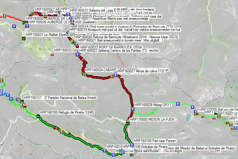
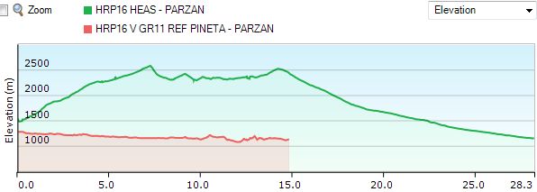
Day 16: at rest 11h30, without rest 10h30’ 28.3km +1616 -1997
According to Marie Millet’s guide, this should be possible in 8h40. You only get this if you have walked in well and pass here from mid-August… At the time I walked this piece too early and you can see that in the times. Moreover, at the time I had a person who had walked in less, because of a start in Gavarnie and was also less confident in snowy conditions. Sending Grödels or light crampons to Gavarnie is definitely to be considered if you leave early. Global warming is playing a lot in favor here!
Those who look at the figures of day 16 (Heas – Parzan) realize that the entire route can only be completed under the most ideal conditions, both in terms of snow load and other other weather phenomena. Splitting the stage in the Refuge de Barroude seems advisable. But as long as it is not finished and operational (September 2027!), it will continue to bite through or opt for the 15km shorter alternative via the Port Neuf de Pinède and the Refugio de Pineta!!!
You leave AUBERGE DE LA MUNIA (HRP160000) to the left via the asphalt. At a kind of split you will find a parking lot (HRP160001) on the left. Here the asphalt turns into a mountain road. After just 100m there is a split and you leave the main road to the Cirque de Troumouse (HRP160002) to the left for the path to the HOURQUETTE DE HEAS (HRP160007). The trail returns in the flank to the AUBERGE DE LA MUNIA. This is where it goes up along the river. You pass two bridges over the river, which you ignore. You stay on the left bank. A little further between the second bridge and the shepherd’s hut (CABANE DE L’AGUILA (HRP160004 – 6 beds, attention, is used by shepherds)) the path is calved from the slope, and you have to improvise a bit. Opposite the hut you will find a Maria shrine along the path (HRP160003 Oratoire de la Sainte Famille).
You climb into the flank above the hut. You pass by a boulder and around him in a pointer next to the river. Higher up, the path zigzags between two supply rivers of the aforementioned river. Here it is not always easy to identify the main path. Higher up, the path goes resolutely to the left in the flank towards CABANE D’AQUILLOUS (HRP160006 – Private: for shepherds only).
At the height of the hut you have to be careful that you do not continue to follow the path along the river, but that you cross the river (HRP160005) in the direction of the hut. In the immediate vicinity of the hut, the trail is also somewhat unclear. You walk here quite a bit parallel with the river, but further on the path becomes clearer again. Higher up (ca 2400m) the path makes a striking turn to the left. 500m further the path again makes a striking turn, now to the right (ca 2450m). You are in a zone of loose rock. The path is sometimes vague in the stone mass. The path in between makes a number of shorter zigzag movements to go just below the degree (ca 2575m) permanently to the left until the narrow pass HOURQUETTE DE HEAS (HRP160007 – 2608m).
In the early summer you look down on the other side on a huge steep snow bowl. If you are standing here at low clouds/fog, the case becomes even more difficult. One ill-equipped French solo puller did not see the descent, and returned to his steps.
Just below the pass, turn right over “flat” plate, to go a little further to the left until (HRP160008), where the path (in the beginning of the season) disappears under the snow. In this case, it makes sense to turn right, towards the beginning steep debris field (HRP1600009). You descend “Freestyle” through the debris field to HRP160010 (End steep debris field, back on the road).
Via the path you descend further to the mountain stream Neste de Badet (HRP160011 – 2336m), a good place to stock up on some calories, for what you still have to wait. 150m further you will find the split with the path to the valley (HRP160012).
The climb to the HOURQUETTE DE CHERMENTAS (HRP160013 – 2439m) is quite simple. The first part of the short descent is also that. At HRP160014 you will find a split and follow a climbing path to the right under a striking rock face. The path is dotted with manure from chamois, but you will not see the beasts themselves. Then it continues in the direction of a far-visible climbing path in the debris field (HRP1600015). This ends in an Unnamed Small Pass with snow field (HRP160017). The path that descends from this one initially seems quite innocent, but passes over two snowfields (HRP160018) over river channels, which are very steep. Since Gavarnie I was in possession of crampons, but not of an ice pick and so it had to happen with two sticks. Height fear can not be better in a decent case. At the end of the second snowfield (HRP160018) were 2 Austrians, waiting for our passage, who after watching our passage have returned to their steps.
The path goes smoothly in the direction of the intersection with the normal access path from the valley (HRP160019). From here you will find (in the spring) flat snowfields until the under construction of Refuge de Barroude (HRP160020)). The route is marked with metal rods in the snow.
Refuge de Barroude (PN – HRP160020 – 2373m):
Note: on the night of Saturday 11 to Sunday 12 October 2014, the cabin burned down completely.
The good news is: There will be a new cabin. Only this one will not be ready until September 2027.
https://www.snohetta.com/projects/refuge-de-barroude
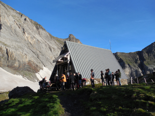
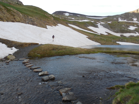 Involved a very small cabin with the living space on the ground floor and the normal sleeping space under the roof. The new cabin will be significantly larger and more comfortable.
Between the Refuge de Barroude and the PORT DE BARROUDE (HRP160022), you have to pass 3 snowfields in the spring. For those who slept in the Refuge de Barroude, this will be in the morning and especially after a clear night, the snow will still be frozen:
The first snowfield is quite steep.
The second snow field (HRP160021) is that less, but if you slip here, you end up in the lake. You can simply bypass this snowfield on top. (Our Basque friends did this effectively after a lot of alcohol the previous evening. ;-))
The third snowfield is quite flat and poses few problems.
The PORT DE BARROUDE is a fairly flat and open col. Just below the Colis there is another split (HRP160023), where you go to the left. You descend along the other side via a white-yellow marked path to the CABANE DE BARROSA (HRP160024 – closed shepherd’s cabin). Near the hut the path is a bit vague. 200m past the hut, you have to fludge the river RIO DE BARROSA (HRP160025). It is here to look for a suitable crossing, for those who want to keep their shoes dry (in the spring).
Once past the river, you first have to cross a boulder field of the bed. On the other side you have a great chance to meet Isards. They really are not shy and seem to be looking for minerals near the rocks. They also like the one in your urine! 😉
Slowly the path becomes better and becomes a forest road. Anyone who has lighter footwear can change here. Until Parzan, there are no more technical difficulties. More than that… there is 5km of asphalt on the menu until Meson Fuen in Parzan and with shoes of the type C that is really not recommended. After 3.3km you pass the exit for tomorrow. You will continue to descend until Parzan, where you will find next to a restaurant, a gas station, a relatively large food store (all days 09 – 21h) and a cash machine completely at the end of the hamlet the Meson La Fuen.
MESON LA FUEN (HRP170000):
Open: all year
Tel: 0034/974501047
0034/974501170
Beds: 32
Language: Spanish
Rooms: starting at 60€ (2026)
Red wine: included
www.alberguesyrefugiosdearagon.com
Dinner (20.00h – Spain):
Choice of 5 starters, 5 main dishes and 5 desserts (portions somewhat small for mountain hikers)
Breakfast (08.00h – Spain :-():
Croissants, fruit juice, toast, bread, raw heps!!! jam, lots of butter, coffee or tea (good, but late :-()
Day 15 (2): Gavarnie – Ref Pineta |
18.5km | +1675 | -1900 |
Total: without rest: 6h30’
For those who have walked in, the full stage 15 (2): Gavarnie – Refugio de Pineta can be easily completed in one day. In case of emergency you can move to the Refuge de Tuquerouye (2666), but then you have to climb 200m extra of which the last part via a path T4. Also the descent for the following day is T4!
From the tourist office, you just follow the herd towards Cirque de Gavarnie. At the bridge near the campsite you cross the river and follow the right bank.
You can either take the path 150m past the campsite and then go to the right on the junction to get to the official path after crossing the stream.
You can also walk to the signpost (HRP150002) and start the climb there.
Initially you can still enjoy some shade, but at the height of the signpost PLATEAU DE PAILLA (HRP150004), go to the left and pass the tree line.
From here you walk over the mountain meadow, first in the direction of the Cabane de Pailla (HRP150006). You do not walk up to the hut itself, but together with the cows you look for a way up (HRP150005), to get back on the path from the mountain series (HRP150007).
The day trippers follow the path directly to the hut (HRP150008). However, know that there is also a path that climbs more slowly into the cabin in a hairpin bend to reach it along the back. If you drag up a fresh load of food, you better choose the original path. After 1h45’ you are upstairs.
There are half-wild horses and donkeys here that like to join the hut. Watching where you walk is the message.
In normal circumstances, you can easily walk to Heas.
To make the need a virtue, you can only do a wash (in good weather of course).
From here all overnight points were reserved for 2 people, but with three it was always successful (with some improvisation).
Refuge des Espuguettes (PN) (HRP150012):
Open: half of June to half of September
Tel: 0033/562924063
Beds: 60
Reservation recommended. (Sat full-booked with a class of schoolchildren, a phenomenon you get with easily accessible cabins :-().
Language: French
Half-board: 51,15€ (2026)
The shoes stay in the entrance. The cabin has 2 normal toilets, 2 sinks behind a door, so you have privacy, but no showers.
Dinner (19.00h):
1°: soup, bread
2°: pasta, sausage with peas
3°: dessert
Breakfast (07.00h):
Lots of bread, no muesli, gingerbread, jam, butter, coffee, cocoa or tea.
From the hut you can see both the pass HOURQUETTE D’ALANS (HRP150016) and the last part of the road. The beginning of the path is vague, given it proceeds in an alm that has been grazed by cattle. You leave from the hut in a northeasterly direction. Further on you will find a clearer path/cattle track. The path zigzags in an easterly direction, in function of the terrain until the split (HRP150015) with the path to the Piméné (2801m). Here you turn right and follow the foot of the degree up to the HOURQUETTE D’ALANS (2430m), a climb and pass without any technical difficulty.
Just below the pass (HRP150017), you can take the path to the right, towards the Spanish border. However, you might be better off descending to the left in an easterly direction. Further down, the path heads south towards the center of the basin. Along the way, you pass a second fork (HRP150118) of a path towards the Spanish border. By making this choice, you walk slightly less through the scree field below the Pic Rouge de Palla!
After 600m, at GPS HRP150120, you reach the fork between the path to the Refuge de Tuquerouye (2666) Refuge de Tuquerouye (2666) with a difficulty level of T4 (right)!
Refuge de Tuquerouye (2666)(HRP150121):
Self-catering hut owned by the CAF.
Beds: 12 with mattresses and blankets.
Wood supply under the beds.
No running water! To be fetched from the lake (15′!)
Continue straight ahead in a southeasterly direction. After a good 500m, you cannot avoid the scree field, but the gradient towards the Port Neuf de Pinède (2460) (HRP150122) is much lower than towards the Refuge de Tuquerouye (2666), resulting in a difficulty level of T2.
The descent is of a completely different order! Up to the edge of the forest, the average gradient is 32%! The average lowlander would not want to descend this in early summer! The first part of the descent goes due south, then east, and then southeast along the base of the rock face, which runs parallel to the path up to an altitude of approx. 2240m. There, the path suddenly curves to the right (southwest), away from the end of the rock band.
You cross a gully, after which you seek out the other “bank”. Here, you continue to meander on the highest part between the aforementioned gully and that of the Canal del Garién (HRP150123). At an altitude of 1880m, you cross the latter, and a little further on, you reach the junction (HRP150124) with the path coming from the Refuge de Tuquerouye (2666)
Together, you descend in a zigzag direction to the south, moving away from the Canal del Garién. At GPS HRP150125, you reach the fork between the option to descend further via a jeep track through open terrain or via a forest path with more shade. Those who choose a better chance of shade turn left here in an easterly direction. You can proceed in a straight line or via a more sloping path. Eventually, you arrive at a crossroads of paths near a spring in the forest (HRP150126). Take the descending path in a southeasterly direction. At an altitude of 1550m (HRP150127), ignore a turnoff to the right that leads you to the jeep track. At an altitude of 1380m (HRP150128), cross a gravel road and continue descending via the path on the opposite side of the road. Continue descending, ignoring all side paths. You cross a bridge (HRP150130) over a tributary of the Rio Cinca to reach the Monte Perdido car park and information center (HRP150132) a little further on.
Depending on your preference and level of fatigue, continue descending to the Refugio de Pineta via the asphalt, the jeep track, or the GR11!
Refugio de Pineta/Ronatiza (HRP160100):
Open: all year
Tel: 0034/974501203
0034/649288877
Beds: 34
Language: Spanish
Half-board: 48,70€ (2026)
Reservations: https://www.alberguesyrefugios.com/pineta/
Day 16 (2): Ref Pineta – Parzan |
15.0km | +600 | -725 |
For this stage, there are 3 options: asphalt, gravel, and GR11. Those wishing to follow the GR11 start with a climb of 900 vertical meters!
Those who find it difficult enough already can descend via the asphalt. After 350m, you can take a jeep track to the right, which runs closer to the river. After 3km, you cross the river (HRP160101). You continue descending to the reservoir. Those wishing to go to the center of Bielsa take the path to the right here and continue via a path over the Mirador de Bielsa (HRP160110) to the center.
The rest go over the dam to the asphalt. Follow this to the first real hairpin bend in the main valley (HRP160109), where you leave the asphalt for a path towards Parzan.
You will encounter Meson Fuen first. Closer to the border, you will also find a restaurant, a gas station, a relatively large grocery store (every day 09:00 – 21:00), and an ATM.
MESON LA FUEN (HRP170000):
Open: all year
Tel: 0034/974501047
0034/974501170
Beds: 32
Language: Spanish
Room in half-board: starting at 60€ (2026)
Red wine: included
www.alberguesyrefugiosdearagon.com
Dinner (8:00 PM – Spain):
Choice of 5 starters, 5 main courses, and 5 desserts (portions a bit small for mountain hikers)
Breakfast (8:00 AM – Spain :-():
Croissants, fruit juice, toast, bread, raw ham!!! jam, lots of butter, coffee or tea (good, but late :-()
Day 17: Parzan – Ref Viados |
20.5km | +1600 | -1000 |
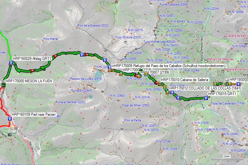
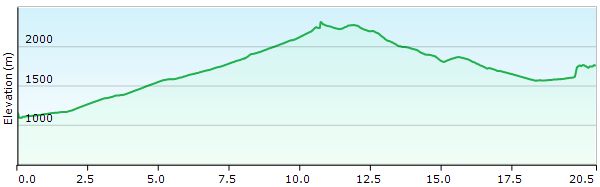
Total: with rest: 6h00, without rest: 5h30
Technically speaking, this day presents no difficulty whatsoever. You leave Parzan via the same road you entered yesterday (if you came via Heas!). After 1.7km, you leave the road to the right via a gravel road (HRP160129). There are white and red GR11 markers and a signpost: “Lago de Urdiceto 11km”. You cross the bridge and climb the side wall of the main valley, then turn left into the side valley.
You follow this road to the power plant service road (HRP170001). Here you leave the gravel road and follow this service road and the GR11 markers. Further up, you leave the service road for a mule track that runs along the top of the reservoir and rejoins the gravel road further on. You follow the gravel road to the next hairpin bend (HRP170002), where the GR11 once again leaves the gravel road for a mule track, which remains lower on the flank than the gravel road. Only just below the pass does the GR11 climb back up to the level of the gravel road. At GPS point HRP170003, you will find a fork in the path. Here, turn right. The path partially disappears under a snowfield, so you will need to improvise and find your own path through the boulder field. Eventually, you return to the gravel road and reach the PASO DE CABALLOS (HRP170004). The road continues towards Lago or Ibon de Urdiceto, but you leave it to follow the initially descending path in an easterly direction. Just beyond the pass, you will find a shelter/emergency room (HRP170005).
The path first descends into the flank of the basin before climbing back up to a spur of a mountain ridge. From the highest point (HRP170007), you descend back into the basin behind it. This area is locally very boggy and iron-rich. It sometimes requires a bit of improvisation here.
You cross a river via a bridge (HRP170009). Once across the river, you must cross another rather boggy area, and orientation is somewhat difficult here as well. You should not descend too far, but rather stay at the same level until you find path markers again. You descend to the Cabana de Sallena, an (agricultural) hut (HRP170010), where a road begins. At the first hairpin bend, you can leave this road to cut across the next bend via a steep and rough path that leads back to the road. This descends to the bridge over the Barranco de la Basa (HRP170011) and climbs uphill again on the other side to the COLLADO DE LAS COLLAS (HRP170012). You descend along the road to a signpost (HRP170013). From here, you follow the white and red markings of the GR11, which repeatedly cut across the road. At the next signpost (HRP170014), you leave the road once more, only to return quickly. You follow the road and descend further to a larger gravel road in the valley (HRP170015). Here you climb uphill again to a bridge (HRP170016). Just before the bridge, there is a site for youth groups.
Just past the bridge, you will find a small CAMPING FORCALLO (HRP170017), where you can also get a drink. After this, a brutal climb follows via a path that cuts across the bends in the road. Eventually you reach the REFUGIO VIADOS (HRP180000).
REFUGIO VIADOS(HRP180000):
Open: June 1 through September 30
Tel: 0034/974341613
Beds: 70
Language: Spanish and French
Half-board: 41,50€ (2026)
Shower: 2,00€
½ bottle of red wine: 5,00€
www.alberguesyrefugiosdearagon.com
Dinner (8:00 PM – Spain):
1st: soup, bread
2nd: salad, meat, potatoes, tomato
3rd: dessert: peach
Breakfast (6:00 AM – 8:30 AM – Spain :-)):
Toast, cake, cookies, carton of fruit juice, jam, butter, coffee or tea (low-fat and slow :-()
Route selection stages 18-21:
REF VIADOS – REF CONANGLES.
The HRP follows a technically difficult route that can only be undertaken in the best possible conditions and therefore certainly not in early summer with heavy snowfall.
Given that time is a precious commodity that is not available in unlimited quantities to someone belonging to the working class, the execution of the HRP was spread over 2 years. And that is where Bagnère de Luchon comes into the picture as a breaking point, given the good rail connection towards Paris and Belgium. The disadvantage is that you are then forced to follow the original route of the HRP. The border must be crossed somewhere, and if that is not through the Bielsa tunnel, then it is via the Port d’Aygues Tortes; for this, in the spring, you could certainly use a pair of crampons, poles or an ice axe, along with a dose of experience and common sense.
The fact is that 10 years ago, this section of the GR11 was still reserved for tent hikers or hikers who wanted to use unmanned huts. And this, too, has changed in the past 10 years. It can easily be done without a tent! Moreover, you save a hiking day compared to the classic HRP!
Therefore, an honest assessment of your own capabilities is required depending on the chosen period of execution.
Anyone who does not absolutely need to be in France is better off following the technically easier route of the GR11 in early summer. Ton Joosten may be a bit condescending about it, but he lives in the Pyrenees and can tackle the difficult sections when the weather is nice…. Make sure you don’t end up in a rescue helicopter yourself!!!
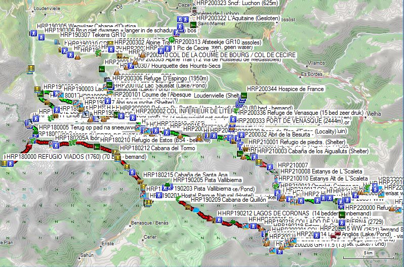
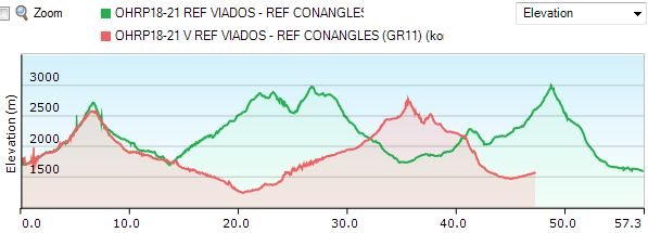
Day 18 (1): Ref Viados – Ref Soula |
13.7km | +1172 | -1218 |
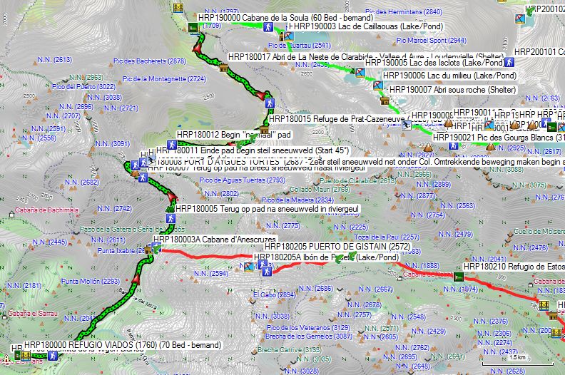
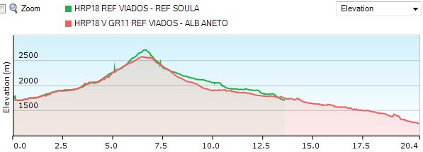
Total: with rest: 9h00, without rest: 7h30
You leave the hut and cut across the hairpin bend in the road to return to the road near the bridge. Next, you cross the river (HRP180001) and climb via a path passing underneath a number of barns to a fork in the road (HRP180002). You do not descend towards the bridge over the river, but climb via a narrow path to the left of the river.
After 1km, there appears to be a discrepancy between the GR11 tracklog and the path indicated on the OSM map. The OSM map was correct. After 2km, both merge again. The path slaloms through a gorge below the Cabane d’Anescruzes (HRP180003), a new shepherd’s hut visible from afar on a hill above the path (HRP180003A). After crossing first a tributary (west) and then the main stream (north), the GR11 and the HRP split (HRP180004). The GR11 continues in an easterly direction towards the PUERTO DE GISTAIN (HRP 0197 P190 1 – 2572m). The HRP continues on the left bank in a northerly direction towards the PORT D’AYGUES TORTES (2683m).
There is indeed a path to the PORT D’AYGUES TORTES (HRP180008), but it is faint and requires a lot of attention to follow, given that the cairns are rather small and the path itself is not very well ingrained in the landscape. The path is marked on the OSM map and is fairly accurate.
Initially, you follow the river, but near a small waterfall, you veer to the right to circle the rocky zone to the right of the waterfall. Subsequently, you return to just near but above the riverbed. Further along, in early summer, you will encounter a large snowfield in the river gully, which is best avoided via the right flank. At GPS HRP180005, you return to the path after the snowfield in the river gully.
Higher up, you will also have to cross another snowfield that covers the riverbed. Therefore, be alert to the course of the river under the snow and try to avoid crossing the river itself via a snowfield or snow bridge, unless you are absolutely certain of the snowfield’s load-bearing capacity. At GPS HRP180007, you return to a visible path in a scree field after crossing a wide snowfield next to the river gully. You can see the river itself flowing over the rocky outcrop to your left from a distance. From here, the route to the PORT D’AYGUES TORTES (HRP180008) is straightforward.
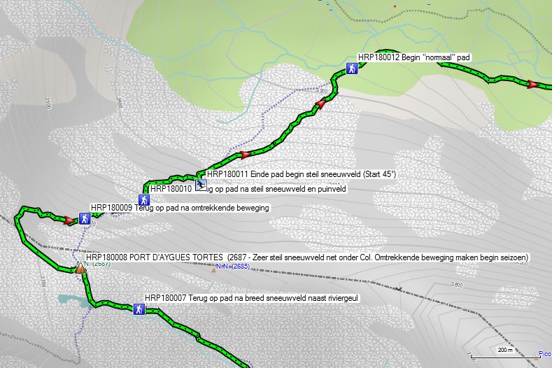
Looking down into the valley from the pass is quite a shock. What is neatly marked on the OSM map as a zigzag path is, once again, buried under a thick and, above all, steep layer of snow. Anyone with a bit of common sense left knows that it is not advisable to descend into this snowfield, so you had better look for an alternative route.
Anyone who has done their homework and taken a look at the old map in the hallway of the Refugio de Viados knows that there was once a path descending from the pass in a circular motion.
So, it is best to follow the ridge about 200 meters to the left to then descend via a number of natural “steps” into an exposed landscape, until you can return to the path at GPS HRP180009 after the circular motion.
Not much further on, you have to leave the “path” again for a steep snowfield. At GPS HRP180010, you can rejoin the path after a steep snow and scree field. At GPS HRP180011, the path disappears under the snow again. This time, it involves a very long snowfield that is steep at a 45° angle at the start but gradually levels out to almost horizontal. After the snowfield, another boulder field follows before finally reaching open terrain.
At GPS HRP180012 (wooden post and frame), something that is supposed to pass for a “normal” path finally begins.
At the Refuge de Prat-Cazeneuve (HRP180015 – 8B unmanned), you had better take a rest, because the descent to the Refuge de la Soula can certainly be described as difficult. Of 2 men with daypacks who thought they could get this over with quickly, one disappeared into the rescue helicopter at the Refuge de la Soula (HRP190000).
It is not advisable to switch to lighter footwear here. It is better to wait until you reach the Refuge itself.
REFUGE DE LA SOULA (HRP190000):
Website is not functioning!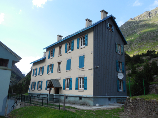
Open: June 1 through September 30
Tel: 0033/562402341
Beds: 60
Language: French
Half-board: 47,00€ (2024)
Bottle of rosé wine: 11,50€
refugedelasoula@gmail.com (winter)
Dinner (7:00 PM):
1st: soup, bread
2nd: salad, sausage, rice, tomato
3rd: dessert: applesauce
Breakfast (7:00 AM – 8:30 AM):
Bread, gingerbread, jam, butter, coffee or (green) tea (ask for extra bread !!!!)
Day 19 (1): Ref Soula – Ref du Portillon |
11.3km | +1650 | -800 |
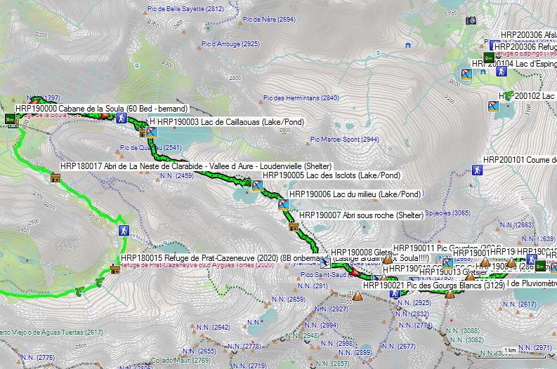
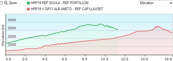
Total: excluding rest: 6h30.
You leave Refuge du Soula (HRP190000) in a northeasterly direction and begin the climb on the right bank of the Ruisseau du Caullauas, which you follow at varying distances until you reach the lake of the same name. After many hairpin bends in the path, at an altitude of 2,160m, you reach the junction (HRP190001) with the path coming directly from the Cabane du Prat Cazeneuve. From there, you continue climbing to the northern side of the retaining wall of Lac de Caullauas (HRP190003), which you cross.
You circle the lake via its southern shore and continue along the lake’s tributary (Ruisseau du Caullauas). At an altitude of 2350m, you cross the stream and then circle the Lac des Isclots (HRP190005) along the north side. Just before the Lac du Millieu (HRP190006), you cross the lake’s outlet and circle the lake along its southern shore. From here, the terrain becomes heavier, with scree and large boulders. You encounter a small intermediate plateau before climbing further again through the glacial debris. You pass a rocky spur and follow the cairns upwards to the Col des Gourgs-Blancs (HRP190010) (2877).
You can still find snow here even late in the season!
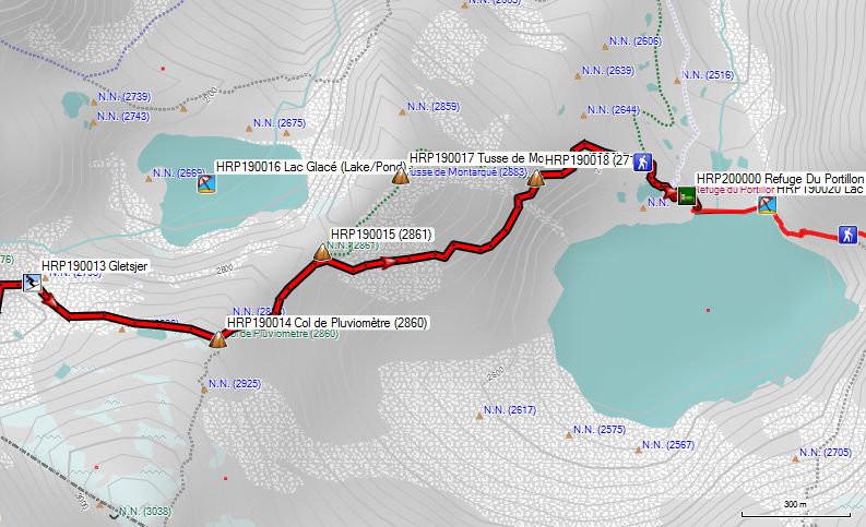
First, you descend a little along the left side, then turn right in a southeasterly direction. You encounter a scree slope of glacial debris, which you must climb to ascend via the left side of the basin (HRP190013) to the Col de Pluviomètre (HRP190014) (2860).
You leave the Col in a northeasterly direction to an unnamed pass (HRP190015) at an altitude of 2861m, at the foot of the Tusse de Montarque (HRP190017) (2883). In bad weather conditions, you walk to the Tusse itself, and from there descend to the Refuge de Portillon (HRP200000). Under favorable conditions, you can circle the Tusse de Montarque from the unnamed pass in an easterly direction until both paths rejoin at another unnamed pass (HRP190018)(2719).
Stay at the same altitude for another 200m (HRP190019) until you start the descent towards the Refuge de Portillon. You circle the largest of 3 smaller lakes on the northern shore of Lac de Portillon along the northern side, to descend from there in an easterly direction to the Refuge de Portillon (HRP200000).
Refuge de Portillon (HRP200000):
Open: half of May to half of October
Tel: +33 (0)9 88 66 99 67
Beds: 80
Half-board: 42,50€ (2026 -Leden)
Language: French
Reservations: click here!
Day 20 (1) Ref du Portillon –Ref de la Renclusa: |
16km | +1175 | -1500 |
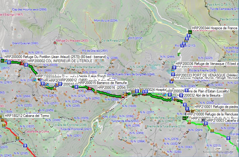
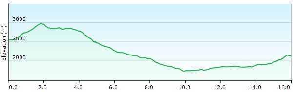
Without rest: 7 hours
You leave the Refuge de Portillon (HRP200000) via the dam of the Lac du Portillon (HRP190020). At the end of it, you follow the shore for another 120m in a southerly direction, to then begin the real climb in an easterly direction. At an altitude of 2620m, you already reach the first fork (HRP200001). You continue in an easterly direction. 200m higher, you reach the actual scree field, which you do not really leave again until you are 1000m below the Col Inferieur de Literole (HRP200002) (2981). Just below the Col, given the altitude, you will find a number of snowfields until late in the season.
From the Col, you make a clockwise arc to the border and the fork in the paths (HRP200003). Which path you choose depends on the snow conditions and must be assessed on site. At the Ibon Blanco de Literola, both paths rejoin. 50m further on, you reach an Unnamed Col (HRP200005) (2844). 120m further on, just past the Ibons des les Arenals, you find another fork (HRP200008).
From here, the real descent begins towards a small lake and an Unnamed Col (HRP200010) (2587). From here, the path turns north and descends further towards another Unnamed Col (HRP200012) (2466), to the right of a small lake. You pass south of this point and reach the junction with the path to the north of it at GPS HRP200013. You descend further towards the bank of the Barranco de Remuñe, whose course you follow in an easterly direction. 900m further on, in a section with another scree field, you will find a crossroads of paths, where you continue along the river in an easterly direction. You walk between the river and the rock face further east through a number of scree fields to another Nameless Col (HRP200016) (2054).
After another scree field, you enter the forest and descend further towards the road to the Hospital de Benasque. At the ruins, you leave the road and walk behind them. You walk towards the river and then take the path upstream, to the first bridge (HRP200020). Beyond this bridge, you must choose whether to take the path or the gravel road towards the Cabane de la Besurta (HRP200033). The gravel road is a bit of a detour, but it is a lot faster to walk on, and after the descent you might opt for some walking comfort. The path is neither really flat nor bone dry! Those who choose the path turn right after the first bridge and follow the river further upstream to the Abri de Besurta (HRP200032), where you eventually reach the gravel road and follow it to the Cabane de la Besurta (HRP200033).
Those who choose the gravel road cross the next two bridges to find the gravel road to the Cabane de la Besurta (HRP200033) at the Hotel Hospital de Benasque.
From the Cabane de la Besurta (HRP200033), ignore all turnoffs to the left and cross the Rio Esera. 200m further on, ignore another turnoff to the left (HRP200035) and continue climbing along the Barranco de la Renclusa to the Refugio de la Renclusa (HRP210000).
Refugio de la Renclusa (HRP210000):
Tel: (+34)974 344 646
Beds: 92
Prices 2026:
Overnight stay: €28.40 (2026) (Note: hostels in Catalonia do not accept membership cards from other mountaineering associations.)
Breakfast: €11.50
Dinner: €23.60
Pic-nic: €16.20
Day 21 (1-3):REFUGIO de la RENCLUSA:– REFUGI DE CONANGLES |
16,4km | +1225 | -1775 |
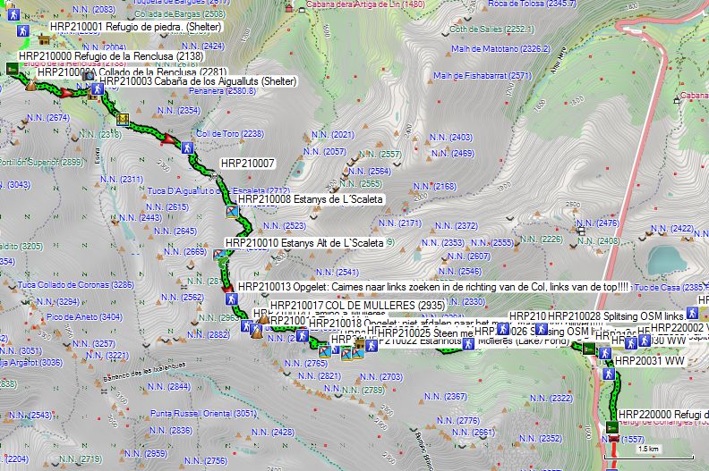
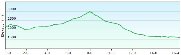
Without rest: 9:30 with rest: 11:45 (expect a lot of search time)
 You leave the Refugio de la Renclusa (HRP210000) heading south, then turn left at the next 3 junctions. You climb to the Col de la Renclusa at an altitude of approximately 2300m, after which you descend. At an altitude of approx. 2240m, ignore the path to the right and continue descending to the Rio Esera. To the left, you will find the waterfall and the Forau D’Aigualluts (HRP210002). This is a river sinkhole where the river goes underground. In Belgium, this also happens with the Lesse, which led to the formation of the Caves of Han. At GPS HRP210004, you must follow the direction to Coll de Toro.
From here, the path becomes faint and the cairns rather small. This remains the case for the rest of the day. At GPS HRP210005, you will find a bridge across which you cross the river. From here, a difficult section begins on the flank of the stream. Here, you follow the left arm of the OSM tracklogs three times. You have to search for the path and the cairnes. Further on, you enter the valley of La Escaleta. It is flatter here. The path fades, and the cairnes are once again too small and indistinct, especially in foggy weather.
At GPS HRP210006, you will find the fork between the Col de Toro and the Col de Mulleres, marked by two signs screwed onto a rock. At GPS HRP210007, there is a section where the course of the path is unclear and you also need to use your hands. You cross the outflow of the Estanys de L´Scaleta (HRP210008). 500m further on, just before a small lake, you cross the river again.
At GPS HRP210009, you follow the right arm of the tracklog. Here, at Lake Estanys Alt de L’Scaleta, you will find a final camping opportunity before the Col de Mulleres. Further along, you will find a small stream.
You enter a zone of large stone slabs. Here, the cairnes stand out well because you do not have to search for them among other loose rock. At GPS HRP210013, you need to pay very close attention. Here, cairnes run in the direction of a wide col to the right of the Pic de Mulleres.
Here, you must look for cairnes to the left in the scree field in the direction of the Pic de Mulleres. Only 200m from the Pic de Mulleres do you head towards a “saddle” to the left of the Pic. From the ridge, you can see the path clearly, but from below, this is much more difficult!!! Next, you need to find your way along the ridge to the Col de Mulleres, marked by a somewhat larger cairne.
 If you look over the ridge, you will see a path a few meters below the ridge that descends steeply through a fine gravel field, with a few climbing sections along the way. You must descend the first few meters below the ridge.
It cannot be emphasized enough that the entire section of the HRP between Viados and Vielha should only be undertaken when the winter snow has largely disappeared, and even then only in optimal weather conditions. At the slightest doubt, divert to GR10 or GR11. Stage 26 between Salardu and Refugi Gracia Airoto should also only be started in the most optimal weather conditions.
Between the Col de Mulleres & GPS HRP210018, there is a significant difference between the path observed on the ground and the tracklog on the OSM map. It is possible that this was created in snowy conditions. Please note: at GPS HRP210018, you must not descend to the lake but stay at a high altitude. Up to the next split in the tracklog, it is fairly accurate. At GPS HRP210019, being the split towards Refugi de Molières (not observed on the ground), there is also a large discrepancy between the OSM and the reality on the ground.
From GPS HRP210019 (Stone with faint painted marking of the split towards Refugi de Molières), the OSM tracklog once again coincides with the observable situation on the ground.
At a large red stone field, descend past this field and pass underneath it. At GPS HRP210026, follow the left arm of the OSM tracklog. This is surprisingly difficult and more technical than you would expect at this altitude. The river plain appears flat, but no path was visible in this direction. At GPS HRP HRP210028 (Stone OSM split), follow the road to the left until you reach the Hospital de Vielha (HRP210029).
Follow the gravel road to GPS HRP210029 Hospital de Vielha. This is currently closed and will likely remain so, as it is too large to be operated profitably. Walk behind the building and pick up the path there to the signpost at GPS HRP210030 WW. Those not camping turn right here and descend towards the signpost at GPS HRP210031 WW. Here you cross the river and continue your way through the forest to the Refugi de Conangles (HRP220000).
Refugi de Conangles (HRP220000):
(36 beds – manned – FEEC).
Reservations on www.refusonline.com 15€/ppn
Half-board in a bunkbed: 52€ (2023)
Showers: to be paid
1 bottle of red wine: 8€
Possible discount for members of the mountaineering federation.
Many families and regular hikers. Reservation required.
Dinner (8 pm):
Pasta
Mixed salad with 2 sausages and bread
Yogurt
Breakfast (7 am):
Bread, butter, jam, 1 slice of cheese and 1 slice of ham, fruit juice, biscuits and 2 cakes (good).
Day 18 (2): Ref Viados –Alb Aneto |
20.5km | +1200 | -1675 |
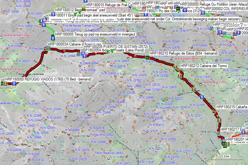
The entire route is marked GR11. You save a day compared to the classic HRP!
You leave the hut and cut across the hairpin bend in the road to return to the road near the bridge. Next, you cross the river (HRP180001) and climb via a path passing underneath a number of barns to a fork in the road (HRP180002). You do not descend towards the bridge over the river, but climb via a narrow path to the left of the river.
After 1 km, there appears to be a discrepancy between the GR11 tracklog and the path indicated on the OSM map. The OSM map was correct. After 2 km, both merge again. The path slaloms through a gorge below the Cabane d’Anescruzes (HRP180003), a new shepherd’s hut (HRP180003A), which is visible from afar on a hill above the path. After first crossing a tributary (west) and then the main stream (Barranco de Añes), the GR11 and the HRP split (HRP180004). Immediately after this split, there is also a very faint path (HRP180204) (T6) that runs along the right bank of the Barranco de Chistau (HRP180204A) towards the lake and summit of the Royo.
After first returning about 100 meters into the scree field, the GR11 continues in an easterly direction towards the PUERTO DE GISTAIN (HRP180205 – 2572m). At an altitude of 2300, you reach a more vegetated zone again and a tributary of the Barranco de Chistau, which runs south of the rock face. At an altitude of 2520m, you cross this tributary and continue climbing, parallel to the rock face, to the PUERTO DE GISTAIN (HRP180205 – 2572m).
You leave the pass in a southeasterly direction, ignoring the path to the Ibon de Posets. 200m past the pass, you find another fork (HRP180206), where you cut short a climb to an unnamed pass by passing below at the same level until you reach the path (HRP180207) returning from this unnamed pass. The path now turns east, and you descend through a not-too-steep slope in the scree field towards the source area of the Rio Estos. Next, you approach the bed of the Rio Estos itself to enter a zone with low vegetation. At an altitude of 2130m, you cross the Rio Estos (HRP180108) and continue on the left bank. At an altitude of 2080m, you cross a tributary called Barranco de Clarabide (HRP180209). The path moves away from the riverbed and descends further towards the Refugio de Estos (HRP180210).
Refugio de Estos (HRP180210 – 1890):
(54 beds – manned).
Tel: +34 974 34 45 15
Mail: info@refugiodeestos.com
Reservations on: https://alberguesyrefugios.com/estos/reservar
Half-board in a bunkbed: 60€ (2026)
Pic-nic: 16,20€
Good spot for a meal break!
From here, follow the jeep track downhill for 9 km to find Camping Aneto (HRP190200) 900 vertical meters lower. Along the way, you pass 4 bridges, the first and the last of which cross the Rio Estos itself, and the other two cross tributaries.
Hostal Parque Natural(HRP190201):
Only for those who want to take a rest day and are traveling as a couple! Rooms are only rented for a minimum of 2 nights during peak season. They clearly don’t want hikers passing through! 😦
Camping Aneto(HRP190200):
Not just camping! There are also room rentals (€86/2p) for two and bungalows starting from 2 people (€125/2p). For the solo traveler without a tent, the most economical option turns out to be the lodge: €27/p.
There is a restaurant and a camping shop featuring a refrigerated counter alongside many pre-packaged and unhealthy items. Both are open from June to September.
Day 19 (2): Alb Aneto – Ref Cap Llauset |
17.0km | +1950 | -800 |
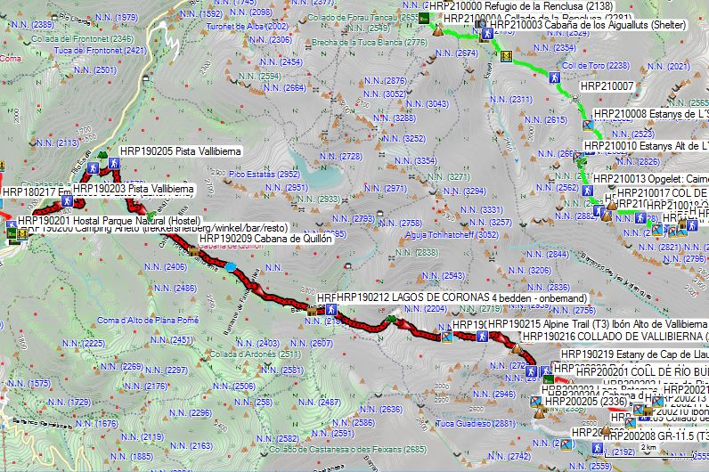
Note: Between June 20 and September 14, private vehicles are not permitted on the A-139 road between Benasque and the Cabane de Besurta, but public transport is available on a very regular basis. You can also go from Camping Aneto to the stop at the start of the Piste Vallibierna.
The entire route is marked GR11.
Leave Camping Aneto (HRP190200) and walk to the A-139 road at the bridge (HRP190202) (Puente de San Jaime). Do not cross this road, but take the gravel path on the left bank of the Rio Esera. Cross a tributary and return to the bank of the main river. Follow this to the base of the dam (HRP190203). There, you must make a counter-clockwise turn to overcome the elevation difference of the dam. Continue along the eastern bank of the reservoir and cross the Rio de Vallibierna. 175m further on you reach a crossroads (HRP190204), where you turn right and start the climb towards the Collado de Vallibierna (HRP190216) (2729).
600m past the turn-off you leave the road (HRP190205) and cut across a hairpin bend in the road to return to it just below 1600m. At an altitude of 1740m you cross the Canal Chordana (HRP190208). You descend a bit only to have to regain it again and cross the Canal de la Mina at 1800m. You leave the forest and cross the Canal del Quillon near the hut of the same name (HRP190209). 900m further on, to the left of the path, you will find the Fuente de la Esmoladera (HRP190210) (spring). 2.2 km further along the bank of the Barranco de Coronas, you will find the Refugio de Coronas (1965) (HRP190211) with 12 beds without mattresses!
450 m past the hut, you will find a turnoff (HRP190212) to the Lagos de Coronas. Follow the road that leads back to the Rio de Vallibierna. The road turns into a path, and at the Barranco de Llosas, follow it upstream to the Pleta de Llosas (HRP190213), a flatter area where you might be able to camp.
Here, cross the river to head east to find and cross the Barranco de Vallibierna. Follow it uphill to the Ibon Bajo de Vallibierna (HRP190214) (2460). Round this along the north side. Next, you pass the Ibon Alto de Vallibierna (HRP190215) (2480), passing along its southern side. Ignore the turn-off and continue in an easterly and later southeasterly direction towards the Collado de Vallibierna (HRP190216) (2729), which is about 200m lower than the Col de Mulleres (2935) on the “normal HRP”.
From the Col, you can see your final destination for this stage. However, there is still a descent with an average gradient of 27%, which has been rated T3 as a trail! At an altitude of 2500m, just below a small lake, do not cross the streambed but descend further to 2400m, where you will find another fork in the path. To reach the hut, continue further east to find another fork 50m further on. Here you cross the tributary and continue south to the Refugio de Cap de Llauset (200200) (2425).
Refugio de Cap de Llauset (200200) (2425):
Opened in 2016 with 32 beds. Already expanded in 2018 to the current 86 beds!
Tel: +34/974 120 400
Mail: refugiocapdellauset@gmail.com
Half-board: 60€ (2026)
Reservations on: https://www.alberguesyrefugios.com/capdellauset/
Day 20 (2): Ref Cap Llauset –Refugi de Conangles |
10.0km | +325 | -1150 |
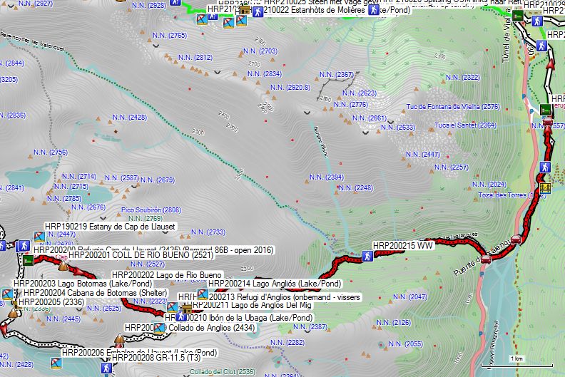
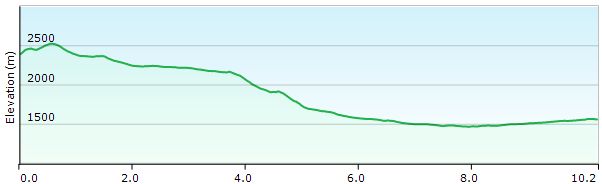
Note: Unless you have plenty of time and energy to spare, a descent to the Embalse de Llauset seems like a rather unnecessary effort. The route over the Coll de Rio Bueno seems more appropriate!
The route is marked GR11 from the Lago de Anglos del Mig.
You leave the Refugio de Cap de Llauset (200200) heading east and climb to the southern end of the Estany de Cap de Llauset (190219). From there, you continue climbing to the Coll de Rio Bueno (200201) (2521). After the Coll, you descend into the scree-filled pit of the Lago de Rio Bueno (200202). You follow the southern shore of the lake, and at the end of it, the worst of the scree is over. You continue your descent, first passing to the east of a small lake before continuing eastward to pass the Ibon de la Ubaga and the Lago de Anglos del Mig halfway. You pass both the inlet and the outlet of the latter lake.
Between the two lakes, you rejoin the GR11. North of the outlet, you will find the Refugi d’Anglios (200213), an unmanned wooden hut with six beds without mattresses.
You cross the inlet of the Lago Anglios (200214) and continue along the eastern shore of the lake. At the end of it, you follow the Barranco Rueño downstream. Just before entering the edge of the forest, you cross another tributary. You continue descending on the right bank of the Barranco Rueño. At an altitude of approx. 1620m, you will find a signpost (200215). You can cross the river here and descend along the left bank; this path is T2, whereas the right bank is T3. Both end at the N-230 (200216), which you follow in a northeasterly direction.
At the end of the lake, take the first turn to the right (200217) and cross the Noguera Ribagorçana river. At a tributary, cross it to then return to the main river. Once in the forest, a path coming from the right (200219) joins your path and you continue in a northerly direction. In an opening in the forest, join the gravel road (200220) coming from the parking lot of the Refugi de Conangles (220000), which leads north to the hut itself.
Refugi de Conangles (HRP220000):
(36 beds – manned – FEEC).
Reservations on www.refusonline.com 15€/ppn
Half-board in a bunkbed: 52€ (2023)
Showers: to be paid
1 bottle of red wine: 8€
Possible discount for members of the mountaineering federation.
Many families and regular hikers. Reservation required.
Dinner (8 pm):
Pasta
Mixed salad with 2 sausages and bread
Yogurt
Breakfast (7 am):
Bread, butter, jam, 1 slice of cheese and 1 slice of ham, fruit juice, biscuits and 2 cakes (good).
Day 19 (3): Ref Soula – Gr d’Astau |
19.0km | +1048 | -1580 |
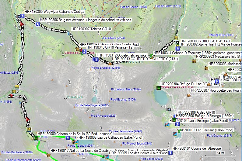
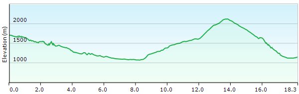
Total: with rest: 8h00, without rest: 6h45
Route choice:
The HRP follows the REF SOULA – REF PORTILLON section (9.3km +1365m -448m). However, this section is listed as level E (Exceptional) in Ton Joosten’s guide. Given that I noticed during the descent from the PORT D’AYGUES TORTES (level 1) that a fellow hiker was having trouble descending steep snowfields, I felt it irresponsible to increase the difficulty level any further and decided to continue along the GR10 to Bagnère de Luchon, despite the fact that the weather conditions were good.
In the hut, there was a family with 3 children aged between 10 and 16, who did leave for Refuge de Portillon. Although the children had crampons, they had only one walking stick. Afterwards, we heard reports from a rope team, during which one person fell and another went to the hut to get help. Apparently, there is no mobile phone coverage there. The incident was noticed by an alpinist sitting higher up the slope who was able to make contact with the hut via a transmitter, which in turn was responsible for notifying the emergency services.
The advantage of already having an impressive track record is that it is easier to let common sense prevail over ego. (And so it became the GR10, albeit with regret).
Route:
You leave the hut along the small railway track of the hydroelectric power plant and descend via the right bank. At GPS HRP190301, you cross the river via a bridge and then continue along an artfully constructed path on the flank above the river. In the forest, you can choose between a very direct descent or a zigzag descent. At GPS HRP190302, you cross another bridge and then emerge onto asphalt. You must cross this, to then descend to the left of the hydroelectric power plant grounds. You cross the Pont de Prat (HRP190303) and end up at the public car park at the foot of the power plant, at the start of the D725. The cable car from La Soula also terminates on the grounds of the power plant. This cable car is reserved exclusively for hydroelectric power plant staff.
The car park fills up early in good weather. You follow the D725 downstream for a distance of 3.5 km, until it makes a prominent S-bend (HRP190304). Here you will find a signpost to the Cabane d’Ourtiga (HRP190305). You must climb along a brutally steep jeep track until it levels out into a more open area. At GPS HRP190306 you will find a bridge. If you do not cross it, you walk along a path and continue in the shade of the forest. If you do cross the bridge, you walk along a jeep track through open terrain. Both variants rejoin at a small dam with a bridge at its foot (HRP190307). Here, the jeep track crosses the river towards Cabane Ourtiga (HRP190308 – shepherd’s hut), and you can switch banks again. On the right bank, you will also find signs for the GR10 here, which descends from the flank onto the jeep track. The GR continues to follow this briefly upstream until it dead ends just past the dam. There, it turns into a narrow path that goes up and down frequently to reach a basin opposite Cabane Ourtiga (HRP 0202F – shepherd’s hut). You will find a signpost “Cabane Ourtiga 5min”, which you ignore to turn left. You climb somewhat inconspicuously up a grassy slope to a poorly marked fork (HRP190310), where you turn left and return towards the bed of the Ruisseau de Nere, continuing to climb towards COURET D’ESQUIERRY (HRP190313).
From the pass, the GR10 descends in an almost easterly direction until just before the Cabane d’Esquierry 1650m (closed shepherd’s hut – no water), where the path briefly leaves the vicinity of the riverbed. Subsequently, the path returns to the riverbed and you descend further to the tree line. Here, the zigzag path is followed downhill through the forest. You leave the forest at a rock face, and from here the path becomes quite obscured due to animal grazing and shortcuts to the original zigzag movement by day-trippers. Fortunately, you can see the bridge over the Rivière la Neste D’Oo (HRP190316) from afar, so you know where to go. You cross the bridge and then continue to the right until you reach the AUBERGE D’ASTAU (HRP200300).
AUBERGE D’ASTAU (HRP200300):
Open: April 1 through October 30
+33 5 61 89 30 86
+33 6 23 22 65 95
Beds: 60
Half-board in a room: 72,00€ (2024)
Half-board in the gïte:46,00€ (2024)
Dinner (7:30 PM):
1st: soup, bread
2nd: salad, stew, potatoes, tomato
3rd: dessert: yogurt
(just enough for a mountain hiker)
Breakfast (6:15 AM – 8:30 AM):
Croissants, bread, jam, butter, coffee or (green) tea (ask for extra bread !!!!)
Day 20 (3): Gr d’Astau – Luchon |
21.8km | +1422 | -1898 |
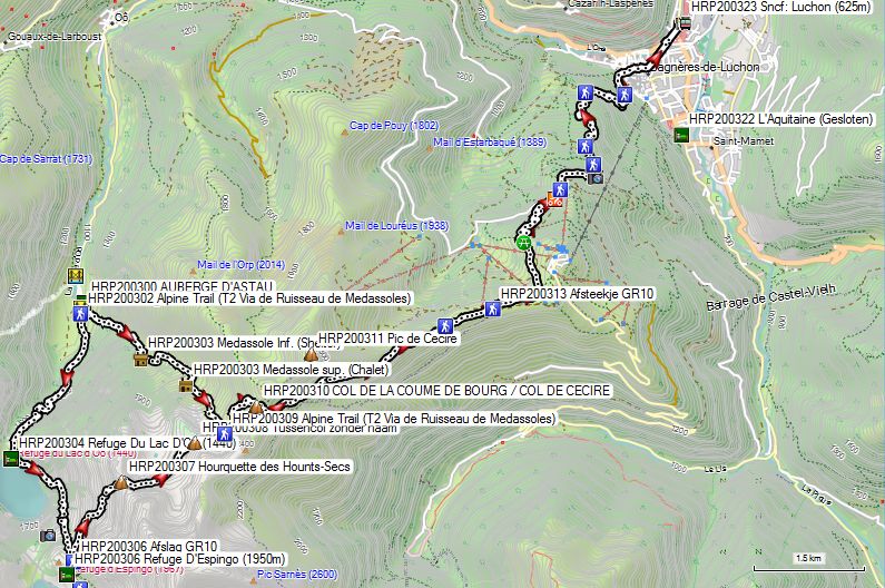
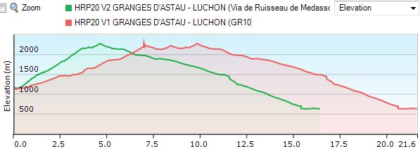
Total: with rest: 8h15, without rest: 7h30
Note 1: In July and August, a bus runs to Luchon, dropping off tourists in the morning and picking them up again in the evening.
Note 2: In good weather, an early start is advisable, as you can then climb mostly in the shade of the mountain flank up to the first pass (HRP200310 COL DE CECIRE). You will not find trees again until the Halte d’Artigues Ardoune (HRP200314). In Bagnère de Luchon, the thermometer read 38°C (yes, really).
Route:
Leave the inn to the left and follow the gravel road uphill. 80m past the bridge over the Médassoles river, you will find a path that climbs up along the river via the lower and upper Médassoles huts to the COL DE LA COUME DE BOURG / COL DE CECIRE (HRP200310 – 2272m). This path saves you approximately 5km and 225 vertical meters.
The gravel road of the GR10 gradually becomes impassable for four-wheelers, mainly due to a lack of “maintenance”. The path seems to end abruptly at the river gorge. Here, you are directed onto the flank via an unsightly narrow and steep path. At the dam, the GR10 turns left. You reach the Refuge Du Lac D’Oo (HRP200304) by turning right below the dam and crossing the river.
You continue climbing on the flank to the left of the lake, passing several smaller waterfalls before climbing further towards the main waterfall. Higher up in a sort of gorge, this transitions into a path paved with stones, the rocks of which are very smooth due to heavy use. Once you have conquered the steepest part, you will find a fork, where the GR goes left towards Hourquette des Hounts-Secs (HRP200307 – 2275m).
Continue straight ahead towards Refuge D’Espingo (HRP200306 – 1950m) and the Refuge Du Portillon (Jean Arlaud) (HRP200000 – 80 beds – staffed), stop at the HRP.
At the Hourquette des Hounts-Secs (HRP200307 – 2275m), you leave the shadow of the mountain flank and enter the full sun. You descend towards a first basin. Soon you climb back towards an unnamed Intermediate Pass (HRP200308 – approx. 2200m).
Next, you descend a short distance again and reach the junction with the path along the Médassoles (HRP200309) to then climb to the COL DE LA COUME DE BOURG / COL DE CECIRE (HRP200310 – 2272m). At the Col, you will find a small snowfield in early summer, which is easiest to bypass by going left.
The path to the Pic de Céciré (HRP 0204G – 2403m) is clearly visible on the flank and is a favorite destination for day-trippers.
You descend into the basin and pass a spring that seems only suitable for animals. Next, you turn left on the flank. At GPS HRP200312, you rejoin the ridge under a high-voltage power line, which you follow via a gravel road towards Superbagnère.
The GR10 follows the ridge a little further until just near Superbagnère. However, you can also start descending a bit earlier, namely at GPS HRP200313 (GR10 shortcut). Here, a grassy path descends slowly into the basin up to a ski lift. From here, the path continues as a mountain bike (VTT) route up to the tower of the Halte d’Artigues Ardoune (HRP200314), visible from afar. From here, you will find GR signs again.
You descend effortlessly through the forest until you pass the pipes of a hydroelectric power plant for the first time. A little further down, you leave the wide road for a path on the flank, but this is not sufficiently clearly marked in the initial phase. A little lower down, you will find a clearer path again. The path comes right up to the pipes a number of times, without however crossing them. Next, you descend definitively in a large zigzag movement towards Bagnère de Luchon. You can continue following the GR10 to the church. Here you leave the GR and walk along the Allee D’Etigny, the main shopping street, towards the spa town. Here you cross the park and circle the pond on the left to reach the Hotel L’Aquitaine (HRP200322).
Hotel L’Aquitaine (HRP200322) (Closed since Januari 2023):
Alternatives:
Day 20 (3) HOSPICE DE FRANCE –REFUGIO de la RENCLUSA: |
11,6km | +1450 | -700 |
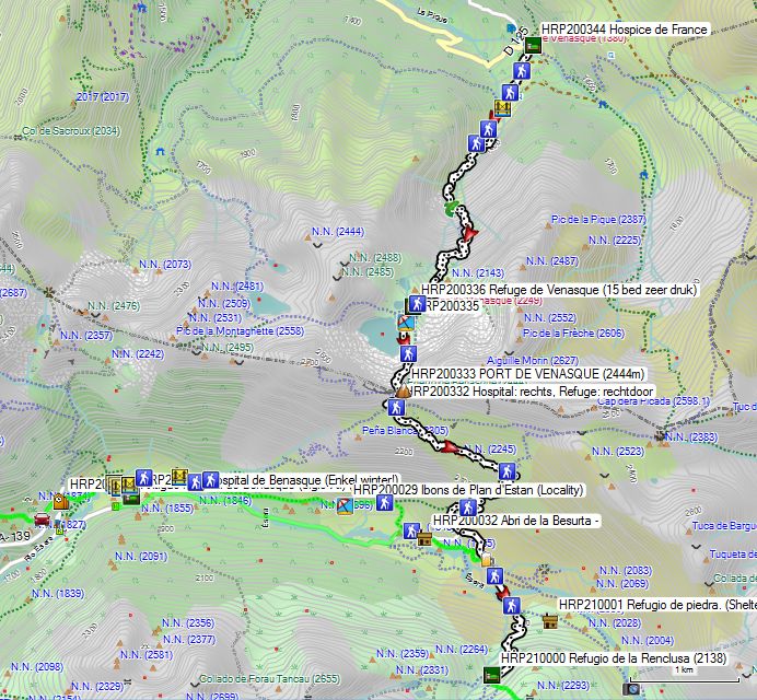
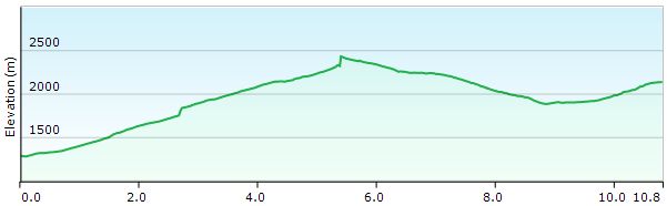
Without rest: 4h30, with rest: 5h30
By bus, you arrive at the Luchon station (HRP200323 Sncf: Luchon (625m)). In July and August, a minibus departs from in front of the tourist office at 09:30 towards Hospice de France. Those wishing to depart earlier or outside of July and August will need to take a taxi. You may be able to try sharing it with other arrivals.
The distance by road is more than 10km, and an elevation difference of more than 600m must be overcome. You will not find many alternatives off the road.
You can have breakfast at the Hospice de France from 07:00. Do not expect much else besides bread, butter, jam, fruit juice, and coffee or tea.
Hospice de France (HRP200344):
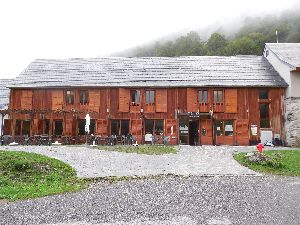
(+33)688324064
Overnight stay in a bunkbed: 34€ (2024)
Overnight stay in a room: 77€ (2024)
Limited menu card!!! 😦
 With your back to the entrance, take the wide path that ascends steeply up the wall. At GPS (HRP200343), you rejoin the path that left at the hut and ascends at a slightly slower pace. Follow this path to GPS (HRP200342), where the path gradually disappears and transitions into a normal mountain trail. You cross the river via the Pont de Penjat (HRP200341) and continue your way up the left bank in a zigzag pattern until you reach the ford near GPS (HRP200338). At an altitude of 2100m, this time you cross one of the two tributaries of the river originating from the Port de Venasques.
Just before the Refuge de Venasque (HRP200336 – 20 beds, very busy), you will find a fork (HRP200337) painted on the rock. To the left you go to the Port; to the right to the hut. The path to the Port is not very clear from below. The one along the hut is clearer, but also technically more difficult, with a passage where you have to use your hands.
Refuge de Venasque (HRP200336 – 20 beds, very busy):

(+33)561792646
Overnight stay in a bunkbed: 12,75€
Half-board: 29€ + 12,75€ = 41,75€
60m further on, both variants rejoin and continue their way to the PORT DE VENASQUE (HRP200333 – 2444m – 3h).
50m lower down, you will find a fork (HRP200332) with very confusing signs. Those wishing to go to the Refuge de Renclusa go straight ahead. Those wishing to go to the Hospital de Benasque must turn right.
The Refuge de Renclusa is quickly fully booked on weekends and certainly in good weather. Since Corona, booking well in advance is an absolute must!
At an altitude of 2220m, a path (HRP200331) joins your path from above. At an altitude of 2000m (HRP200330), you will find a turnoff to the right towards Benasque. Here, take the leftmost, descending path. At an altitude of 1900m, turn left onto the gravel road. 350m further on, you will find the Cabane de la Besurta (HRP200033) at a car park. Ignore all turnoffs to the left and cross the Rio Esera. 200m further on (HRP200035), ignore another turnoff to the left and continue climbing along the Barranco de la Renclusa to the Refugio de la Renclusa (HRP210000).
Refugio de la Renclusa (HRP210000):
Tel: (+34)974 344 646
Beds: 92
Prices 2026:
Overnight stay: €28.40 (2026) (Note: hostels in Catalonia do not accept membership cards from other mountaineering associations.)
Breakfast: €11.50
Dinner: €23.60
Pic-nic: €16.20
Hospital de Benasque ((HRP200024) (Closed during the summer):
(+34)974552012
Luxury retreat in the mountains.
Half-board in a double room for 2 people: €166 incl. bottle of wine and coffee.
Dinner: well-prepared. One of the best meals at the HRP ;-).
Breakfast: phenomenal: truly everything you can imagine, including bacon and eggs, fresh fruit, cheese, charcuterie, etc… And served buffet style, so unlimited. From 7 am, even on weekends. However, it is served on a tray that you have to place on a trolley yourself, which is unacceptable at this level.
Day 21 (1-3):REFUGIO de la RENCLUSA:– REFUGI DE CONANGLES |
16,4km | +1225 | -1775 |
Without rest: 9:30 with rest: 11:45 (expect a lot of search time)
You leave the Refugio de la Renclusa (HRP210000) heading south, then turn left at the next 3 junctions. You climb to the Col de la Renclusa at an altitude of approximately 2300m, after which you descend. At an altitude of approx. 2240m, ignore the path to the right and continue descending to the Rio Esera. To the left, you will find the waterfall and the Forau D’Aigualluts (HRP210002). This is a river sinkhole where the river goes underground. In Belgium, this also happens with the Lesse, which led to the formation of the Caves of Han. At GPS HRP210004, you must follow the direction to Coll de Toro.
From here, the path becomes faint and the cairns rather small. This remains the case for the rest of the day. At GPS HRP210005, you will find a bridge across which you cross the river. From here, a difficult section begins on the flank of the stream. Here, you follow the left arm of the OSM tracklogs three times. You have to search for the path and the cairnes. Further on, you enter the valley of La Escaleta. It is flatter here. The path fades, and the cairnes are once again too small and indistinct, especially in foggy weather.
At GPS HRP210006, you will find the fork between the Col de Toro and the Col de Mulleres, marked by two signs screwed onto a rock. At GPS HRP210007, there is a section where the course of the path is unclear and you also need to use your hands. You cross the outflow of the Estanys de L´Scaleta (HRP210008). 500m further on, just before a small lake, you cross the river again.
At GPS HRP210009, you follow the right arm of the tracklog. Here, at Lake Estanys Alt de L’Scaleta, you will find a final camping opportunity before the Col de Mulleres. Further along, you will find a small stream.
You enter a zone of large stone slabs. Here, the cairnes stand out well because you do not have to search for them among other loose rock. At GPS HRP210013, you need to pay very close attention. Here, cairnes run in the direction of a wide col to the right of the Pic de Mulleres.
Here, you must look for cairnes to the left in the scree field in the direction of the Pic de Mulleres. Only 200m from the Pic de Mulleres do you head towards a “saddle” to the left of the Pic. From the ridge, you can see the path clearly, but from below, this is much more difficult!!! Next, you need to find your way along the ridge to the Col de Mulleres, marked by a somewhat larger cairne.
If you look over the ridge, you will see a path a few meters below the ridge that descends steeply through a fine gravel field, with a few climbing sections along the way. You must descend the first few meters below the ridge.
It cannot be emphasized enough that the entire section of the HRP between Viados and Vielha should only be undertaken when the winter snow has largely disappeared, and even then only in optimal weather conditions. At the slightest doubt, divert to GR10 or GR11. Stage 26 between Salardu and Refugi Gracia Airoto should also only be started in the most optimal weather conditions.
Between the Col de Mulleres & GPS HRP210018, there is a significant difference between the path observed on the ground and the tracklog on the OSM map. It is possible that this was created in snowy conditions. Please note: at GPS HRP210018, you must not descend to the lake but stay at a high altitude. Up to the next split in the tracklog, it is fairly accurate. At GPS HRP210019, being the split towards Refugi de Molières (not observed on the ground), there is also a large discrepancy between the OSM and the reality on the ground.
From GPS HRP210019 (Stone with faint painted marking of the split towards Refugi de Molières), the OSM tracklog once again coincides with the observable situation on the ground.
At a large red stone field, descend past this field and pass underneath it. At GPS HRP210026, follow the left arm of the OSM tracklog. This is surprisingly difficult and more technical than you would expect at this altitude. The river plain appears flat, but no path was visible in this direction. At GPS HRP HRP210028 (Stone OSM split), follow the road to the left until you reach the Hospital de Vielha (HRP210029).
Follow the gravel road to GPS HRP210029 Hospital de Vielha. This is currently closed and will likely remain so, as it is too large to be operated profitably. Walk behind the building and pick up the path there to the signpost at GPS HRP210030 WW. Those not camping turn right here and descend towards the signpost at GPS HRP210031 WW. Here you cross the river and continue your way through the forest to the Refugi de Conangles (HRP220000).
Refugi de Conangles (HRP220000):
(36 beds – manned – FEEC).
Reservations on www.refusonline.com 15€/ppn
Half-board in a bunkbed: 52€ (2023)
Showers: to be paid
1 bottle of red wine: 8€
Possible discount for members of the mountaineering federation.
Many families and regular hikers. Reservation required.
Dinner (8 pm):
Pasta
Mixed salad with 2 sausages and bread
Yogurt
Breakfast (7 am):
Bread, butter, jam, 1 slice of cheese and 1 slice of ham, fruit juice, biscuits and 2 cakes (good).
Route selection stages 23-29:
REF RESTANCA – EL SERRAT
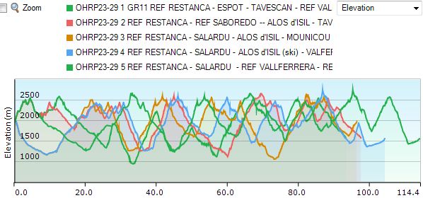
On the Refugi Restanca – Conangles stage, all variants converge, so here too you need to consider your route choice for stages 23 through 29. Let your choice be guided by the chosen period (early or late summer), your own experience and skill, and also by the weather!
The technically easiest option is absolutely the GR11 up to the Rifugio VallFerrera. And in combination with La Porta del Cel, this is also the shortest route with the fewest elevation gains. Especially for those traveling early in the summer season, there is much to be said for this choice. The route generally runs slightly more on the southern Spanish side of the Pyrenees, and the peaks are just a fraction lower. Due to the slightly lower difficulty level, you make slightly better progress and can easily make up a day.
You gain no advantage via the GR11 regarding either the total distance or the elevation gain compared to the shortest variant of the HRP, which contains 2 km of trailless terrain. All other variants are longer and harder. (Details: see next stages!)
Those opting for the GR11 would be better off continuing on to the Refugi Colomers, as you can save a day that way!
Day 22: REFUGI DE CONANGLES – REFUGI RESTANCA/COLOMERS (GR11) |
11,5km | +975 | -575 |
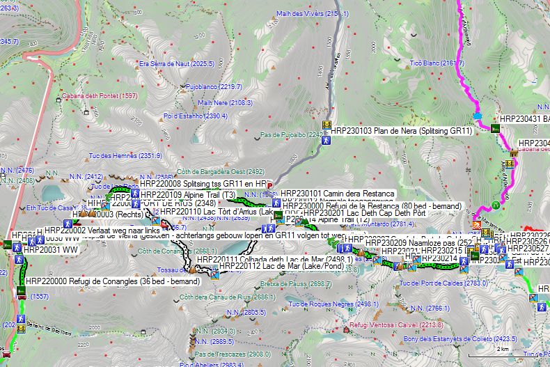
Without rest: 4h30’ with rest: 5h30’ (Restanca)
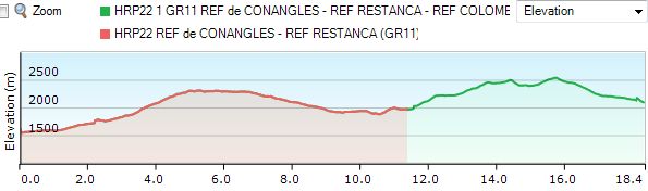
HRP22 REF CONANGLES – REF RESTANCA/COLOMERS (GR11)
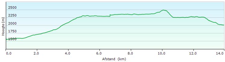
HRP22 REF CONANGLES – REF RESTANCA (Cicerone)
After yesterday’s marathon, some rest seems appropriate. Those who absolutely want to follow George Vernon’s original route can take the detour via the lakes Estany Tort de Rius and Estany de Mar. This extends the day’s stage by 3.5 km and adds about 200 extra meters of elevation gain, both uphill and downhill. A time of 7 hours 15 minutes is given, mainly due to the many boulders on the shore of the Estany de Mar.
You leave the Refugi de Conangles and retrace your steps towards Refugi Hospital de Vielha, specifically up to the signpost at GPS HRP210030 WW. Now turn right here. Follow the white and red markings of the GR11 to the Refugi de la Restanca. They are somewhat sparsely marked and supplemented with cairns, but compared to the previous stage, there are no orientation problems here. The OSM tracklog is very useful. The tracklog for gr-11completo is very rough and differs from the reality on the ground.
Near GPS HRP220001 Gr-11, you emerge onto a gravel road. After just under 400m, you leave the road again to the left (HRP220002). A little further on, you cross the Ribèra de Conangles. A kilometer further, you cross another river, which you follow upstream. 400m further, you cross the river again. 300m further, you reach the junction (HRP220003) with the path to Lake Redon. Here, turn right. From here, you climb to a kind of Faux Col (HRP220004). Subsequently, the path continues at approximately the same altitude to the Port de Rius (HRP220005 – 2348).
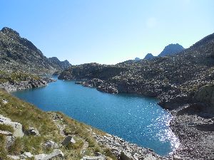 You descend to Lac D’Arrius (HRP220006), which you then circle along the western shore. At the northeastern point of the lake, you will find the split between the GR11 and the HRP. The GR11 continues straight ahead. The HRP continues around the lake for an extra loop of lakes on the way to the REFUGI DE LA RESTANCA (for those who can’t get enough of it). But after yesterday’s marathon stage, that doesn’t seem wise to me. The ideal survival strategy for every HRP hiker should be limiting risk and exertion.
At GPS HRP220009, the Ribèra de Rius disappears under the scree field. At GPS HRP220010, you cross a tributary of the Ribèra de Rius, and at HRP220011, you find a turnoff to the valley (Salardu) without passing the Refugi de la Restanca. Given that the stage via the GR11 to the Refugi de la Restanca is rather short, this is an opportunity to gain a day (or get back) if you have planned a stopover in Salardu (Cicerone variant).
In good weather conditions and with good physical fitness, you could potentially continue to the Refugi Saboredo (HRP240200) (French variant), at the risk of accumulating too many long days. Those wishing to stay on the GR11 are better off continuing to the Refugio Colomers, which, at 18.4 km in length, is not an impossible task.
Those who have planned an overnight stay at the Refugi de la Restanca should turn right here. At the end wall of this valley, the GR11 path is very difficult, winding through bushes and boulders. You then reach a small pass, followed by a very steep climb to a small pass that borders Lake Restanca. You climb under a power line via a technically steep and difficult path. Once at the top, you cross the foundations of the old hut. Just before the dam, you will find a signpost (HRP220013), where you will find the valley variants. You cross the dam and reach the Refugi de la Restanca (80 beds – staffed) (HRP230000).
Refugi de la Restanca (80 bedden – bemand – FEEC) :
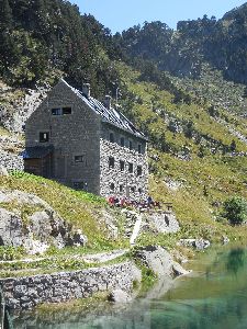
Tel (+34) 902.734.164
Rooms: 5 pm (backpack and shoes in the entrance)
Dinner (7 pm):
Breakfast (7 am): bread, butter, jam, white cheese, chocolate spread, salami, biscuits, cakes, fruit juice, coffee, tea. Buffet style, so take as much as you like.
Half-board: €68 (2026)
Half-board + Picnic: €82 (2026)
Those who choose to continue following the GR11 and also the Carros de Foc (www.carrosdefoc.com) would be better off continuing on to the Refugi de Colomèrs instead of stopping overnight at the Refugio Restanca.
Leave the hut straight ahead and take the upper path until just before the river. Here, climb in a zigzag pattern along the river to the dike of the Lac Deth Cap Deth Pòrt reservoir (HRP230201). You cross the dike and follow the right bank of the lake. Then you continue climbing along the right bank of the tributary towards COLL DE CRESTADA (HRP230205).
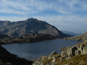 Further on, you will find several turnoffs to the Refugi Ventosa. Do not pay too much attention to the times given here, as they are meaningless. Next, you climb to an unnamed pass (HRP230209). You descend to the outflow (HRP230210) of Lake Estany del Port de Caldes (HRP230211) and then climb to the PORT DE CALDES (HRP230213).
You descend between two lakes at some distance. Next, you continue descending along the left bank of the tributary of Lake Colomèrs to the lake itself (HRP230222). You pass the turnoff (HRP230219) to the Refugi de Colomèrs (HRP230221).
Refugi de Colomèrs (60 bedden – bemand – FEEC):

Owner: Conselh Generau d’Aran
Beds: 60 distributed over 5 rooms. H/P: €67 (2026) (Note: hostels in Catalonia do not accept membership cards from other mountaineering associations.)
Half-board+ Picnic: €82 (2026)
14 – 21 years: discount €4.50
-14 years: discount €15
Tel (+34)902734164 973641681
Breakfast: 7:30 am – 8:00 am
Dinner: 7:00 pm
Mandatory silence at the hut: 10:00 pm
Prices 2023:
Can of soft drink: €3.50
Glass of wine: €3.50
Liter of wine: €10
Bottle of mineral water: €2.80
Shower: €4 (5 long minutes… Passed the shower hose over the partition wall, so we showered with 3 people) for 1 coin of €4.)
Food: high chance of lentils as vegetables! :-(.
Breakfast: weakest of them all: just dry toast, biscuits, jam, cream cheese, and some kind of pre-packaged inedible prepared spread. You won’t make it to lunchtime with this!!! :-(.
One of the most expensive huts of the Carros de Foc! Everything has to be brought in by helicopter.
Route selection stages 23 and 24:
REF RESTANCA – ALOS d’ISIL
In principle, you should have already made the choice between the Spanish (GR11) route before reaching the Refugio de Restanca. However, the choice between the French and Cicerone variants is also quite fundamental!
The Cicerone variant has the advantage of passing through Salardu, a village with a small shop and an ATM. The disadvantage is that the route presents significantly more technical difficulties than the French variant.
You can solve the problem regarding non-financial logistics by purchasing a resupply package in Alos d’Isil.
See the differences in figures down below:
- GR11: REF RESTANCA – ESPOT – TAVESCAN (Green)
- REF RESTANCA – SALARDU – ALOS d’ISIL (Yellow – Custom variant): The shortest and the one with the lowest elevation gain: with a total length of only 31.5 km, 1,875 m of ascent, and 2,600 m of descent. Disadvantage: nearly 2km without a path in a clear area with good visibility! In Salardu there is basically a small shop, but in Alos d’Isil you can also send a pack to the local hostel if you book an overnight stay there!
- REF RESTANCA – REF SABOREDO – ALOS d’ISIL (Red – French variant!): Significantly longer with 600m extra elevation gain: with a total length of 35km and 2500m ascent and 3200m descent. In Alos d’Isil you can send a pack to the local hostel if you book an overnight stay there! The most beautiful and lightest for those daunted by off-road trails! (Off the GR11!)
- REF RESTANCA – SALARDU – ALOS d’ISIL (Blue – Via ski area! 150m off-trail, can also be done via path, but makes it a bit longer again…): Significantly longer with 900m extra elevation gain: with a total length of 36.5km and 2800m ascent and 2600m descent. In principle, there is a small shop in Salardu, but you can also send a pack to the hostel in Alos d’Isil if you book an overnight stay there!
- REF RESTANCA – BANHS DE TREDOS – SALARDU – ALOS d’ISIL (Magenta – The Cicerone variant! 3.5km off-trail! Via ridge and boulder fields!): The longest and the one with the greatest elevation gain: with a total length of 43.5km and 2500m ascent and 3175m descent. In Salardu there is basically a small shop, but in Alos d’Isil you can also send a package to the inn if you book an overnight stay there!
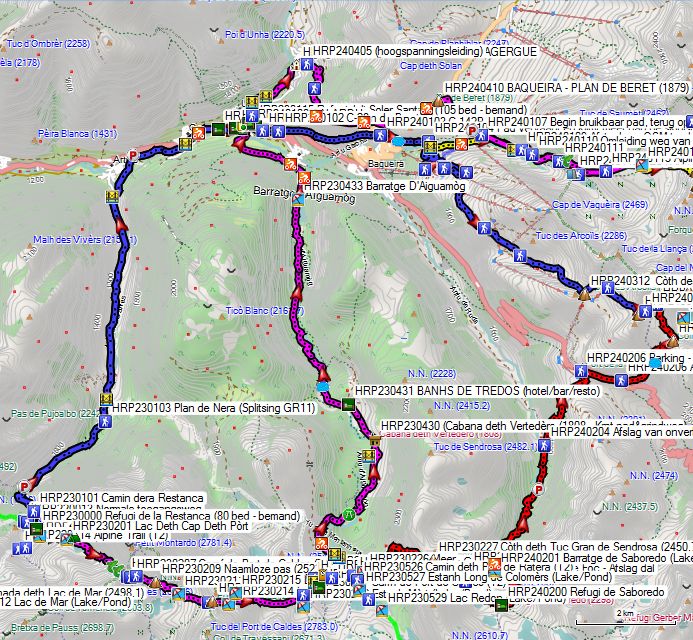
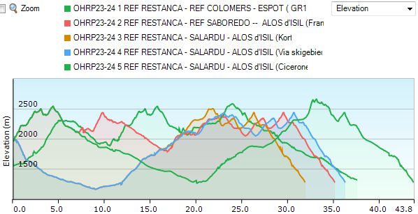 Overview HRP23-24 REF RESTANCA – REF SABOREDO_SALARDU — ALOS d’ISIL
For your information: the color of the contour lines on the graph cannot be selected. The colors on the map were chosen to resemble those in the graph as closely as possible. There are a maximum of 4 different colors per graph, meaning magenta on the map turns back into green on the graph.
Day 23 (1) REFUGI COLOMERS – ESPOT (GR11) |
19,3km | +900 | -1650 |
HRP23 REF COLOMERS – ESPOT (GR11)
HRP23 REF COLOMERS – ESPOT (GR11)
You leave the hut and return to the main path, where you turn right. You descend towards the dam and circle the OLD REFUGI DE COLMERS (HRP230222) clockwise. You pass below the base towards the dam, which you then cross. On the opposite side, you will find a signpost indicating the new path via the right bank (Cicerone variant) and the junction with the GR11 (HRP230223).
You reach the junction with the GR11 (HRP230225) and turn off here in a southerly direction. You reach the Estangh Long de Colomèrs (HRP230527), which you follow along its western bank. You ignore all paths that go into the flank to the right. After the Estangh Long de Colomèrs comes Lac Redon (HRP230529), and even higher up you find Lac deth Ombrèr (HRP230530). The path here takes an irregular course, crossing two tributary rivers and following it at a fork to the southern shore of the lake to begin the real climb back towards Port de Ratera de Colomèrs (2572m – HRP230533). Here you will find the split between the GR-11 and the GR-211.4, which leads to the left towards the Refugi de Saboredo (2299m – HRP240200).
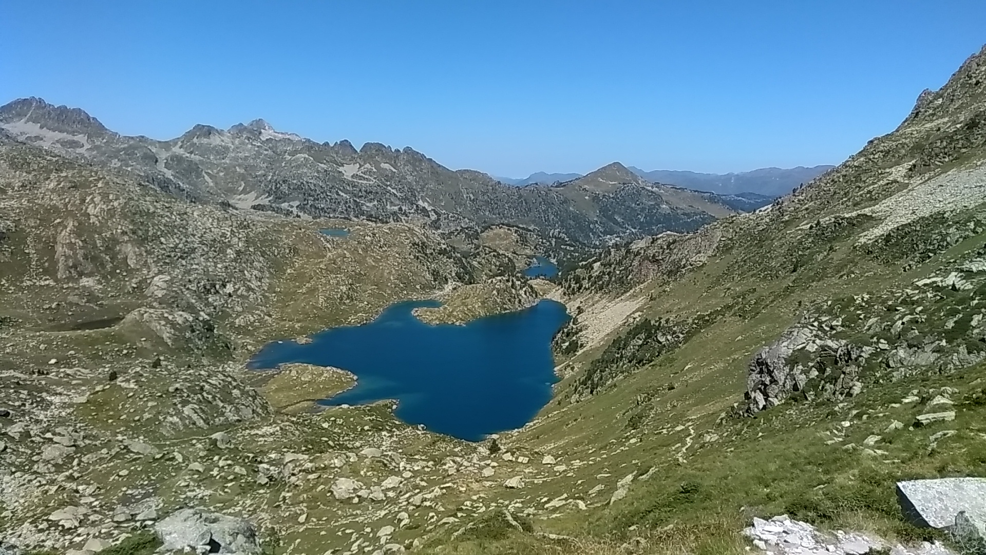 You descend slowly in an easterly direction, staying south of 3 small lakes and north of the Estany del Port de Ratera (HRP230536). Above the northern spur of this lake, you will find a path to the Rifugi D’Amitges (HRP230537), which is mainly used by people who have stayed overnight there or have been taken up by taxi to return to Espot.
Rifugi D’Amitges (2365m – HRP230537)
Proprietor: CEC
Beds: 74
+34 651 55 81 04 (WhatsApp)
+34 973 250 109 ( Not between 22:00 and 8:00u)
info@amitges.com
Refusonline: +34 973 641 681
Web:
From this fork, the descent truly begins on the left bank of the Barranc de Ratera. You cross it for the first time at an altitude of approx. 2270m and 300m further on you cross it again, after which you reach a fork (HRP230539) to the left that leads once again to the Rifugi D’Amitges (HRP230537). However, you continue to follow the river until you reach the Estany de Les Obagues de Ratera (2220m – HRP230540). Past the lake, you follow its outflow until you reach another fork; where, once again, a path leads to the left to the Rifugi D’Amitges (HRP230537). 300m further on, you cross the Barranc de Ratera again via a bridge (HRP230542). 150m further on, you reach a gravel road, which you follow to the left. 400m further on, at the Estanyola de Ratera, you reach the jeep track leading to the Rifugi D’Amitges (HRP230537).
Turn right here and follow the jeep track downhill. You pass south of the Estany de Ratera (HRP230545). 700m after the turn, you cross the Barranc de Ratera again via a bridge (HRP230546). 50m further on, you can choose to follow the path (HRP230547) along the waterfall and the lake instead of continuing down the jeep track.
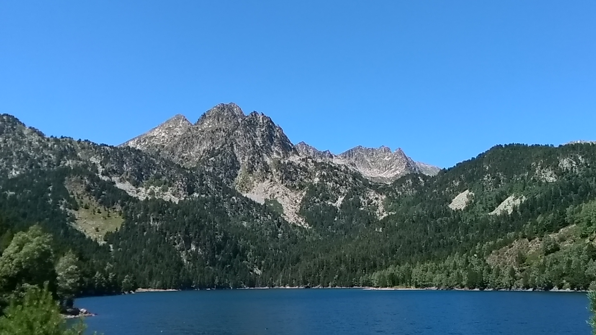 200m further along the path, turn right and begin the descent towards the viewpoint overlooking the waterfall (Cascada de Ratera – HRP230549). After the waterfall, continue descending to the Estany de Sant Maurici (HRP230550), where you follow the riverside path to the left. You leave the forest and reach the taxi parking lot. At a fork past the sanitary building, turn left. 200m further, you reach the turnoff to the Refugi Ernest Mallafré (HRP230554).
Refugi Ernest Mallafrè (1950m – HRP230554)
Proprietor : FEEC
Beds: 34
Tel: +34 722 185 427 (WhatsApp)
Web: www.refusonline.com
Breakfast: 7:00 – 8:30
Dinner: 19:00
Ceiling time: 22:00
2026 Prices:
Half board: €65.00 (Note: hostels in Catalonia do not accept membership cards from other mountaineering associations.)
Full board: €81.50
14 – 21 years: discount €4.50
Under 14 years: discount €15
Can of soft drink: €3.50
Glass of wine: €3.50
Liter of wine: €10
Bottle of mineral water: €2.80
Shower: €2 (unlimited)
400m past the turnoff to the Refugi Ernest Mallafré (HRP230554), you will find the Ermita de Sant Maurici (HRP230555). 200m further on, you will find the path to the valley (HRP230556). The hiking trail is now squeezed between the road and the river. In an open section, you cross the asphalt road. 600m further on, there is a fork leading to the public car park (on the right). Continue straight ahead here in a northeasterly direction. 1km further on, you will find the turnoff to the Refugi de Pla de la Font (2016), located on the Carros de Foc Open Plus. You continue to descend slowly through more open terrain. 650m further on, you can return to the asphalt. However, you continue straight ahead, and 900m further on, you reach a bridge over the Riu Escrita (HRP230562), where you eventually cross the river to return to the asphalt for good 150m further on. 250m further on, you reach the access road to Camping Voraparc. This is the quietest location and has the most shade from trees and its own swimming pool. It is probably also the most expensive. 750m further on, you pass the fire station and cross the river (HRP230564), continuing along the river towards the center of Espot.
Affordable accommodation can be found at Hostal Casa Palmira and Hotel Or Blanc (€65 – 08/2026), both via www.booking.com .
Day 24 (1) ESPOT – REF d’ESTAON (GR11) |
21km | +1850 | -1900 |
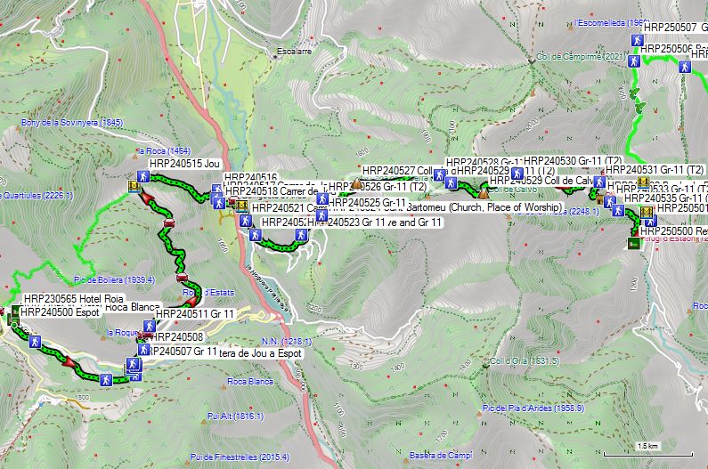
HRP24 ESPOT – REF d’ESTAON (GR11)
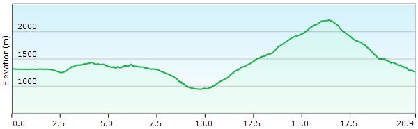
HRP24 ESPOT – REF d’ESTAON (GR11)
From the bridge (HRP240500) in the center of Espot, do not take the main road, but the smaller road on the right bank that turns into a gravel road. After 2 km, turn left at a fork in the road, and after 500 m, turn left again at a T-junction to reach the bridge (HRP240504) over the Riu Escrita. You will reach the asphalt road, where you turn left for 30 m to follow a path to the road between Jou and Espot (HRP240506). Cross this road and follow a path that makes a sharp left turn, then curves again 100 m further on to pass under the high-voltage power lines. Continue in a northerly direction, staying to the left of the road between Jou and Espot. You will reach a gravel road coming from the asphalt and follow it north to the village of Estais.
On the asphalt, turn right, and at the church, turn left. At a bend (HRP240511), leave the asphalt for a gravel road to the right. Continue parallel to the road from Jou to Espot until you return to the road itself at GPS HRP240512 and follow it in a northerly direction. You cross a bridge and a little further on you reach Jou (HRP240515).
At the end of the village, leave the asphalt again for a gravel road that descends in an easterly direction. You reach a number of individual houses and continue descending to the Riu de Jou, where you pass along the river under a double high-voltage power line and then reach the C13. Here, turn right and then right over the Pont de Poldo (HRP240520). 250m further on, at a fork in the road, turn left uphill into the forest. 300m further on, leave the road for a path that cuts across the bends in the asphalt. At an altitude of approx. 1300m, ignore a turn to the right and continue straight ahead upwards.
You reach the asphalt again near the village of Dorve. You cross the village in the direction of the church (HRP240524), which you circle to continue in a northerly direction. At an altitude of 1500m, turn right at a fork, and at the next fork, turn left. You continue climbing towards the Collada de la Serra (1740 – HRP240527). You enter the forest to continue climbing towards the Coll de Calvo (2214 – HRP240529).
From the Coll, you begin the descent. At an altitude of approx. 2000m, you will find a fork (HRP240530), where you turn right. You leave the forest and at an altitude of 1500m, turn right at a fork (HRP240531). You pass the Borda de Palau (hut -HRP240532), after which you join another path twice, continuing in an easterly direction. The path turns south, after which you leave the forest. You walk to the hamlet of Estaon to find the Refugi d’Estaon (HRP250500) of the same name.
Refugi d’Estaon (HRP250500):
C / Únic, 1 – 25572 Estaon (Lleida)
Tel: (+34) 602406378
refugiestaon@gmail.com
Beds: 20€
Half-board: 45€
Day 25 (1) REF d’ESTAON – TAVESCAN (GR11) |
12,4km | +900 | -1050 |
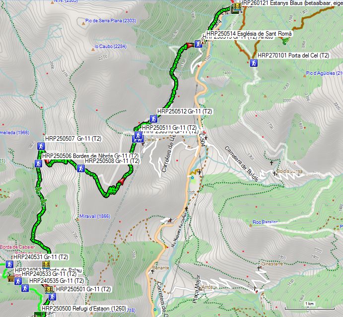
HRP25 REF d’ESTAON – TAVESCAN (GR11)
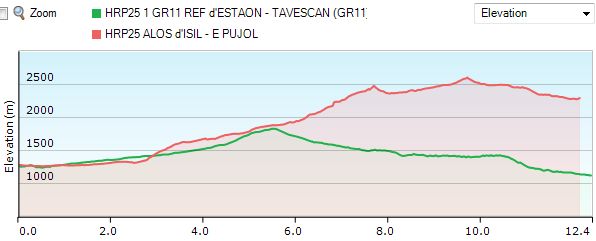
HRP25 REF d’ESTAON – TAVESCAN (GR11)
You leave the inn heading south and walk to the access road to the village. There, turn left towards the church. From the church, walk towards the bridge to cross the river. Just past the bridge, you will find a gravel road to the left, which makes a hairpin bend and heads north. 550m past the first bridge, you will find a second one, where you can choose between staying on the same side and continuing via a path or crossing the river and continuing via the gravel road. 600m further on, you will find a third bridge where you can switch again, with guaranteed dry feet. Another 350m further, both eventually meet, and you are not sure of dry feet if you chose the gravel road. 1.2km further on, you will find another ford, and another 200m further on, yet another one. 600m further on you reach Bordes de Nibros (HRP250506), and another 400m further on, you begin the climb to the right towards an unnamed Coll (approx. 1830m – HRP250508). From this point, you start the descent, first in an easterly, then in a northerly direction. You pass above the hamlet of Lleret. You continue in the northerly direction.
At an altitude of 1400m, you enter the forest. You reach the asphalt road near the hamlet of Aineto (HRP250513). You pass the church and the viewpoint and continue in a northerly direction. You descend to Tavescan (HRP270100).
In Tavescan (HRP270100) you will find several hotels (Book early!).
During the summer season (June to September), there is a small grocery store in Tavescan: Epicerie Marie. Contact the Tourist Office in Tavescan for further information. (+34 973623079). But sending a package to a hotel where you have booked a room seems like a more reliable solution!
HOTEL ESTANYS BLAUS *** (HRP260121):
Single room in August 2026: 77€ (Breakfast+10€) (Hotel website is cheaper than Hotel Search sites!!!!)
Day 23 (3-4) REFUGI RESTANCA – SALARDU (Shortest) |
11,5km | +125 | -875 |
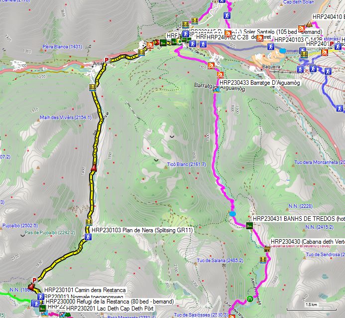
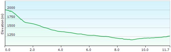
Without rest: 3h00’ (The shortest and fastest route!)
You leave the hut via the normal access road. You cross the dam and then turn right (HRP220013) and descend through the forest via the Camin dera Restanca (HRP230101). You descend along a zigzag path through the forest to a parking lot (HRP230102) at the beginning of a gravel road. You follow this road until you reach another parking lot at the edge of the forest, called Plan de Nera (HRP230103).
Here the GR11 turns right. However, the easiest way is down via the better road, which follows the valley of the Ribèra de Rius downwards. Just past the bridge (HRP230104) over the river, you will find another parking lot. You continue descending via the road on the left bank of the river. Almost in the valley (HRP230105), you cross the river to then follow the Garona upstream towards Salardu. Eventually, you also have to cross the Garona, and the C-28 is unavoidable. Follow this past the roundabout to the center of Salardu (HRP240100).
 In the center of Salardu, opposite the parking lot, you will find a white building with a black roof, which is the Refugi Juli Soler Santalo (105 beds – staffed – FEEC) (HRP230115). Enter via the street-facing terrace.
In the center of Salardu, you will also find a small grocery store (HRP230112 Supermercado) and an ATM (HRP230111).
Details Refugi Juli Soler Santalo: see below!
Day 23 (2) REFUGI RESTANCA – REFUGI SABOREDO (French variant) |
12km | +1200 | -900 |
Without rest: 4h00’
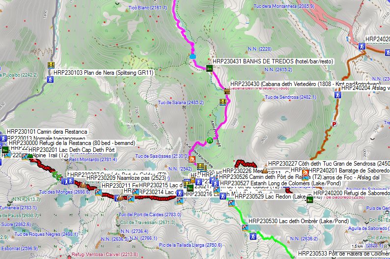
HRP23 REF RESTANCA – SABOREDO (French variant)
HRP23 REF RESTANCA – SABOREDO (French variant)
The French variant follows the Carros de Foc from Refugio Restanca to the Refugi de Colomèrs.
Leaving the hut, head straight ahead and take the upper path until just before the river. Here, you climb in a zigzag pattern along the river to the dam of the Lac Deth Cap Deth Pòrt reservoir (HRP230201). You cross the dam and follow the right bank of the lake. Next, you continue climbing along the right bank of the tributary towards COLL DE CRESTADA (HRP230205).
Further along, you will find several turnoffs to the Refugi Ventosa. Do not pay too much attention to the times given here, as they are meaningless. Next, you climb to an unnamed pass (HRP230209). You descend to the outlet (HRP230210) of Lake Estany del Port de Caldes (HRP230211) and then climb to the PORT DE CALDES (HRP230213).
You descend between two lakes at some distance. Next, you continue descending along the left bank of the tributary of Lake Colomèrs to the lake itself (HRP230222). You pass the turnoff (HRP230219) to the Refugi de Colomèrs (HRP230221).
Refugi de Colomèrs (60 bedden – bemand – FEEC):
Half-board: 60€ (2023)
Half-board + Picnic: 74€ (2023)
Tel (+34)902734164 973641681
You continue your way towards the dam and circle the OLD REFUGI DE COLMERS (HRP230222) clockwise. You pass beneath the base towards the dam, which you then cross. On the opposite side, you will find a signpost indicating the new path via the right bank (E/NL variant) and the junction with the French variant (HRP230223).
The latter continues to follow the Carros de Foc up to the Refugi de Saboredo. You pass the junction with the GR11 (HRP230225) and circle a small lake clockwise (HRP2302236). You climb to the Coth deth Tuc Gran de Sendrosa (HRP230227 – 2451) and descend in a wide arc around a basin to the Refugi de Saboredo (HRP240200).
Refugi de Saboredo: (21 bedden – 2310m – bemand – FEEC):
www.refusonline.com Tel (+34) 661357716
Half-board: 67€ (2026)
Half-board + Picnic: 80€ (2026)
Day 24 (2) REFUGI SABOREDO – ALOS D’ISIL (Franse variant) |
23km | +1250 | -2250 |
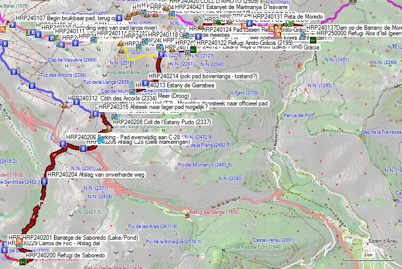
Without rest: 9h30
From the Refugi de Saboredo (HRP240200), you descend via the normal access road along the Arriu de Saboredo. You cross the river via a wooden bridge and continue descending along the Barrage de Saboredo (HRP240201), keeping it to your left. At an altitude of 2080m, the path turns into a gravel road (HRP240202), which you follow downhill through the forest. You stay on the right bank of the Arriu de Saboredo. When you leave the forest, you reach a first parking lot (HRP240203). You continue descending until, at an altitude of approx. 1800m (HRP240204), you find a path to the right that ascends partially through the forest to the Port de la Bonaigua (HRP240205). You emerge onto the C28, a very busy pass road! About 50 meters before the C28, you will find a path (HRP240206) that you follow to the right for a distance of 750m until just before a bend. Here, you cross the road (HRP240206A) to find a path with yellow markings on the opposite side, which you follow in an easterly and later more northerly direction.
You pass the small and usually dry Estany Podo (HRP240207) and climb to the Col de l’ Estany Pudo (HRP240208). You do NOT descend to the Estany Pudo (HRP240209), but round it along the ridge, up to an unnamed Col (HRP240210) at an altitude of 2391m. Those who followed the variant through the ski area join the French one here.
During the descent from this pass, you first round a small, usually dry lake (HRP240212) on the left side. Next, you descend further and pass the Estany de Garrabea (HRP240213) along the southeastern shore. You cross the lake’s outlet and descend further into the basin. At the next fork (HRP240214), the yellow marking leads to the right. Previously, the path to the left was followed, as it maintains a better elevation. The situation remains to be assessed on site! Next, you climb towards the Estany Superior Del Rosari (HRP240220). Along the way, our own variant joins the French one.
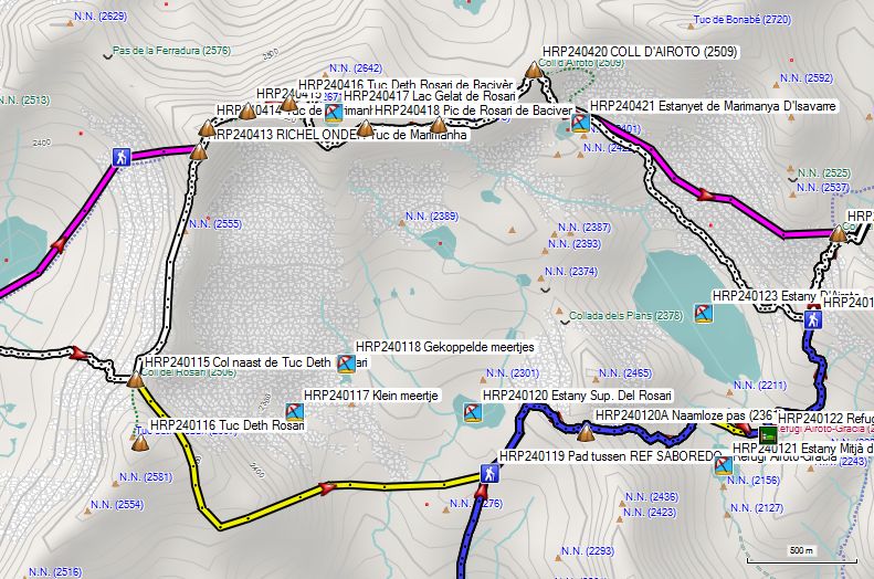
From the lake, you continue climbing to an unnamed Col (HRP240220), after which you descend along the edge of the scree field towards the Refugi Airoto-Gràcia (HRP240222) between the Estany Mitja d’Airoto and the Estatany d’Airoto. From the hut, you climb via a good path to the junction (HRP240224) with the English-Dutch variant to the Col de Clot de Moredo (HRP240225).
From the COLL DE CLOT DE MOREDO, the difficulties for the day are over and you follow a path again. The path deviates slightly from the OSM tracklog. You pass the Estanyola del Clot de Moredo (HRP240226) and a KIND OF PASS (HRP240229). The path ends on a gravel road (HRP240230). Just under 100m past a tubular bridge, you will find a path (HRP240231) that cuts across the bends in the road. Should this be too overgrown, you can of course follow the gravel road itself, along which you continue to descend to the access road to a farm (HRP240232). Here, turn left and follow a less well-maintained road (HRP240232) to the BORDES DE MOREDO (HRP240234).
Follow a rather faint path to the edge of a small wood (HRP240235). Here, turn right and begin the descent to ALOS D’ISIL. You cross the bed of the Barranc de Comabiera (HRP240236), which can sometimes be dry, and continue descending along the Barranc de Moredo in a southeasterly direction to a dam (HRP240237 Dam on the Barranc de Moredo) at the end of a road. From here, you will find a path towards ALOS D’ISIL. At the end, the path becomes a road. The road leads to a small square. On this square, to the right, you will find the Refugi Alos d’Isil (HRP250000).
Dag 24 (3) SALARDU – ALOS D’ISIL (Shortest) |
19,8km | +1750 | -1700 |
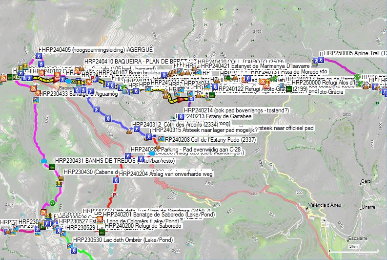
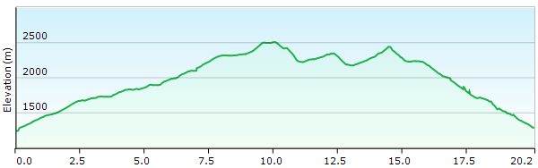 HRP24 SALARDU – ALOS d’ISIL (shortest) (Yellow)
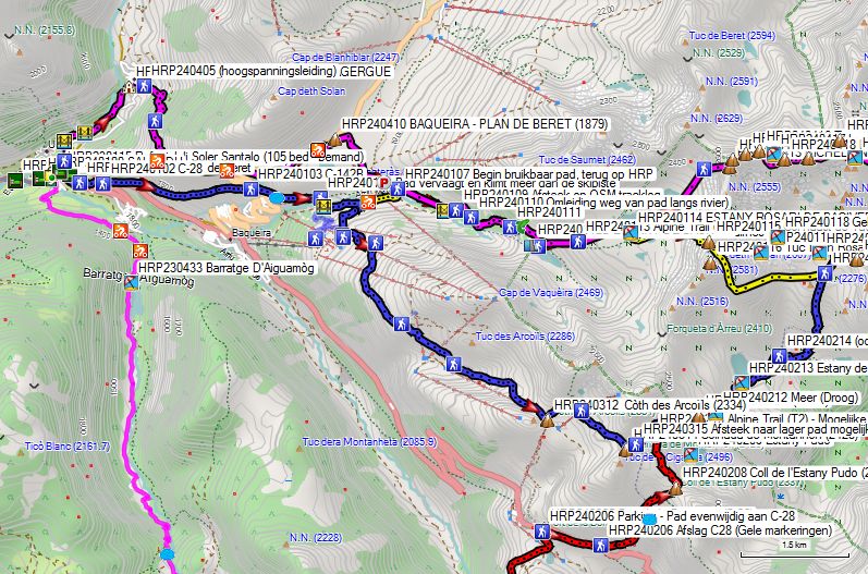
Anyone who has ever looked at a map will be surprised by the route followed here by the HRP (Cicerone). It can actually be a good 2.5 km shorter and involve a potentially negligible 30 m of extra ascent and descent. The only drawback is that the path proposed below is little used and passes through terrain that is clearly not grazed much, meaning the path is slightly overgrown. This is particularly annoying if you leave early in the morning when the grass is still wet.
You leave the Refugi Juli Soler Santalo (HRP230115) via the terrace and descend the stairs to the asphalt, which you follow to the left towards the ski lift monument. You climb the short but steep grassy slope to a bench, located to the left at a height above the asphalt, at the foot of the enclosed houses of the ski resort. Here, you follow the steep path further uphill between the houses. At the end of the street, you will find a signpost (HRP240101) pointing towards BAQUEIRA-BERET (Indication: 5.7 km – 2h10).
Initially, the road is wide, but this changes after you cross the asphalt of the C-28 for the first time (HRP240102).
The road then turns into a narrow and steeply rising path that cuts across a hairpin bend of the C-28. After that, the gradient decreases and the path climbs steadily up the flank. The higher you get on the slope, the more overgrown the path becomes, mainly by grasses and, to a very limited extent, by some thorny bushes.
At GPS HRP240103, you cross the asphalt again, this time of the C-142B. Here you will find another signpost to the “Plan de Beret”, but that won’t tell you much. It is actually located on the approach route followed by Ton Joosten (See above!). You have to climb up along the river here to reach the Parking Orri, referred to by Ton Joosten at the time as Venta Billetes.
However, this is pointless. It is better to cross the asphalt and the Arriu Garona and follow the gravel road in an easterly direction towards the water collector (HRP240103A). You continue along parallel cattle tracks towards the bend in the gravel road (HRP240104).
Here the tracks fade completely and you can choose to cross the water and the ski slope (HRP240105) to then climb up the flank along the ski slope or a path (not on digital map) to a gravel road (HRP240106), which you follow in a descending direction to arrive at GPS point HRP240107 (Beginning of usable path, back at HRP). You are back here on the HRP in 1h45 instead of over 2h20 via the official (Cicerone) route!
 The beginning of the path is fairly easy to follow. At GPS HRP240109, the path takes a shortcut on the OSM tracklog. At GPS HRP240110, you are diverted from the path along the river and take a detour, but an easier route towards the lake and dam of the ESTANY DE BACIVER (HRP240112B). Just before the dam and the lake, at GPS HRP240112A, you encounter a situation that is very unclear. Here you are dealing with a scree field combined with scrub, making cairns difficult to see.
Caution: do not follow the cairns along the lake here, but maintain a more easterly course, away from the lake, along a tributary coming from the ESTANY ROSARI DE BACIVER (HRP240114). From GPS HRP240113, you leave the immediate vicinity of the river.
South of the ESTANY ROSARI DE BACIVER (HRP240114), at a crossroads of paths and mainly OSM tracklogs—as the paths are actually vague—you must decide for yourself which route to choose.
In good weather conditions, you can complete this stage perfectly according to the Cicerone guide, but prior knowledge of the terrain offers a significant advantage.
In bad weather, it is better to try to avoid the long passage over the ridge and through the scree fields. To do this, it is best to climb to the lowest point (HRP240115) on the ridge next to the Tuc Deth Rosari (HRP240116) and, instead of going over the ridge, descend in a wide arc from the ridge towards the northern side of the Estany Sup. Del Rosari lake (HRP240120). Here you will find the path between the REF SABOREDO and the Refugi Airoto-Gràcia (HRP240122). This reduces the distance, the elevation gain, and the difficulty level.
From the Estany Sup. From Del Rosari (HRP240120), you continue climbing to an unnamed Col (HRP240120A), after which you descend along the edge of the scree field towards the Refugi Airoto-Gràcia (HRP240222) between the Estany Mitja d’Airoto and the Estany d’Airoto. From the hut, you climb via a good path to the junction (HRP240224) with the English-Dutch variant to the Col de Clot de Moredo (HRP240225).
From the COLL DE CLOT DE MOREDO, the difficulties for the day are over and you follow a path again. The path deviates slightly from the OSM tracklog. You pass the Estanyola del Clot de Moredo (HRP240226) and a KIND OF PASS (HRP240229). The path ends on a gravel road (HRP240230). Just under 100m past a tubular bridge, you will find a path (HRP240231) that cuts across the bends in the road. Should this be too overgrown, you can of course follow the gravel road itself, along which you continue to descend to the access road to a farm (HRP240232). Here, turn left and follow a less well-maintained road (HRP240232) to the BORDES DE MOREDO (HRP240234).
Follow a rather faint path to the edge of a small wood (HRP240235). Here, turn right and begin the descent to ALOS D’ISIL. You cross the bed of the Barranc de Comabiera (HRP240236), which can sometimes be dry, and continue descending along the Barranc de Moredo in a southeasterly direction to a dam (HRP240237 Dam on the Barranc de Moredo) at the end of a road. From here, you will find a path towards ALOS D’ISIL. At the end, the path becomes a road. The road leads to a small square. On this square, to the right, you will find the Refugi Alos d’Isil (HRP250000).
Day 24 (4) SALARDU – ALOS D’ISIL (via ski arena) |
24,6km | +1950 | -1925 |
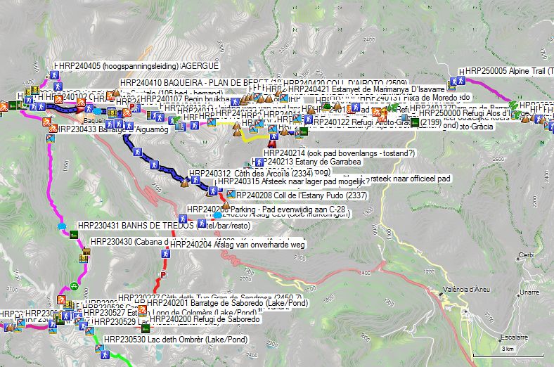
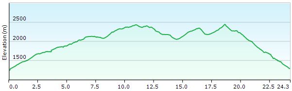 Day 24 SALARDU – ALOS D’ISIL (via ski arena) (Blue)
Anyone who has ever looked at a map will be surprised by the route followed here by the HRP (Cicerone). It can actually be a good 2.5 km shorter and involve a potentially negligible 30 m of extra ascent and descent. The only drawback is that the path proposed below is little used and passes through terrain that is clearly not grazed much, meaning the path is slightly overgrown. This is particularly annoying if you leave early in the morning when the grass is still wet.
You leave the Refugi Juli Soler Santalo (HRP230115) via the terrace and descend the stairs to the asphalt, which you follow to the left towards the ski lift monument. You climb the short but steep grassy slope to a bench, located to the left at a height above the asphalt, at the foot of the enclosed houses of the ski resort. Here, you follow the steep path further uphill between the houses. At the end of the street, you will find a signpost (HRP240101) pointing towards BAQUEIRA-BERET (Indication: 5.7 km – 2h10).
Initially, the road is wide, but this changes after you cross the asphalt of the C-28 for the first time (HRP240102).
The road then turns into a narrow and steeply rising path that cuts across a hairpin bend of the C-28. After that, the gradient decreases and the path climbs steadily up the flank. The higher you get on the slope, the more overgrown the path becomes, mainly by grasses and, to a very limited extent, by some thorny bushes.
At GPS HRP240103, you cross the asphalt again, this time of the C-142B. Here you will find another signpost to the “Plan de Beret”, but that won’t tell you much. It is actually located on the approach route followed by Ton Joosten (See above!). You have to climb up along the river here to reach the Parking Orri, referred to by Ton Joosten at the time as Venta Billetes.
However, this is pointless. It is better to cross the asphalt and the Arriu Garona and follow the gravel road in an easterly direction towards the water collector (HRP240103A). You continue along parallel cattle tracks towards the bend in the gravel road (HRP240104).
Here the tracks fade completely and you can choose to cross the water and the ski slope (HRP240105) to then climb up the flank along the ski slope or a path (not on digital map) to a gravel road (HRP240106), which you follow in a descending direction to arrive at GPS point HRP240107 (Beginning of usable path, back at HRP). You are back here on the HRP in 1h45 instead of over 2h20 via the official (Cicerone) route!
Anyone concerned about the orientation issues around the Estany d’Airoto would be better off choosing the French route. However, if you have neglected to do so, you should follow the gravel road here in a southerly, ascending direction until you reach a crossroads beneath the second and longest cable car (HRP240307), where you follow the road ascending beneath this Mirador cable car to a fork (HRP240309) at an altitude of 2000m. Here, continue south past a third cable car and a power line. Follow these upwards to the next fork (HRP240310). You continue following the cable in a southeasterly direction until a junction (HRP240311) of cable cars at the Cafeteria Argulis (Winter opening only?). Here you leave the main line and follow the Argulis cable car further up in an easterly direction to the upper station of this cable car on the Coth des Arcoilis (HRP240312 – 2334m), a junction of cable cars.
You leave this Col in a northerly and later easterly direction via a double cable car, where you turn right at a junction (HRP240313) just past these cable cars. After 50m, you leave the road via a path in a southeasterly direction. You pass two small lakes and continue climbing to the Colhada de Montahon (HRP240314 – 2428m). Here you start the descent in an easterly direction.
Look for a path here (HRP240315) in an easterly and northeasterly direction about twenty vertical meters below you. Try to cut across here without a path to the highest path below you (HRP240210), and follow this in a northern and later eastern direction.
You are here on the French variant towards the Col (2391m) above the Estany Pudo! Those who do not dare to walk without a path should follow the path from the Colhada de Montahon (2428m) to the path to the Coll de l’Estany Pudo, to reach the French variant here and follow it in a northern direction!
The disadvantage of this route is that it is longer and also involves more elevation gain!
During the descent from this col, you first circle a small, usually dry lake (HRP240212) along the left side. Next, you descend further and pass the Estany de Garrabea (HRP240213) along the southeastern shore. You cross the lake’s outlet and descend further into the basin. At the next fork (HRP240214), the yellow marking leads to the right. Previously, the path to the left was followed, which maintains a better altitude. The situation remains to be assessed on site! Next, you climb towards the Estany Superior Del Rosari (HRP240220). Along the way, our own variant joins the French one.
From the lake, you continue climbing to an unnamed Col (HRP240220), after which you descend along the edge of the scree field towards the Refugi Airoto-Gràcia (HRP240222) between the Estany Mitja d’Airoto and the Estany d’Airoto. From the hut, you climb via a good path to the junction (HRP240224) with the English-Dutch variant to the Col de Clot de Moredo (HRP240225).
 From the COLL DE CLOT DE MOREDO, the difficulties for the day are over and you follow a path again. The path deviates slightly from the OSM tracklog. You pass the Estanyola del Clot de Moredo (HRP240226) and a KIND OF PASS (HRP240229). The path ends on a gravel road (HRP240230). Just under 100m past a tubular bridge, you will find a path (HRP240231) that cuts across the bends in the road. Should this be too overgrown, you can of course follow the gravel road itself, along which you descend further to the access road to a farm (HRP240232). Here you turn left and follow a less well-maintained road (HRP240232) to the BORDES DE MOREDO (HRP240234).
Follow a rather faint path to the edge of a small wood (HRP240235). Here you turn right and begin the descent to ALOS D’ISIL. You cross the bed of the Barranc de Comabiera (HRP240236), which can sometimes be dry, and continue descending along the Barranc de Moredo in a southeasterly direction to a dam (HRP240237 Dam on the Barranc de Moredo) at the end of a road. From here, you will find a path towards ALOS D’ISIL. At the end, the path becomes a road. The road opens onto a small square. On this square, to the right, you will find the Refugi Alos d’Isil (HRP250000).
Refugi d’Alós d’Isil (HRP 0264B): 

https://refugi-dalos-disil.business.site/
+34 644 045 719
+34 624 461 487 (Silvia)
La Placeta, Alós (Alt Àneu)
25586 Catalunya, Spanje
(20 beds in a loft under the roof, 2 showers, 2 toilets, supplies in the form of freezer, canned goods and food with a long shelf life, well-equipped hikers’ kitchen, seating area, dining area) No recent rates online!
Day 23 (5) REFUGI RESTANCA – SALARDU (Cicerone) |
20km | +800 | -1500 |
Without rest: 7h00’, with rest: 8h00’
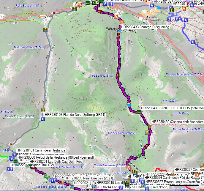
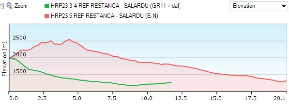 HRP23 REF RESTANCA – SALARDU (Short vs Cicerone)
You leave the hut heading straight ahead and take the upper path until just before the river. Here, you climb in a zigzag pattern along the river to the dam of the Lac Deth Cap Deth Pòrt reservoir (HRP230201). You cross the dam and follow the right bank of the lake. Next, you continue climbing along the right bank of the tributary towards COLL DE CRESTADA (HRP230205).
Further on, you will find several turnoffs to the Refugi Ventosa. Do not pay too much attention to the times given here, as they are meaningless. Next, you climb to an unnamed pass (HRP230209). You descend to the outflow (HRP230210) of Lake Estany del Port de Caldes (HRP230211) and then climb to the PORT DE CALDES (HRP230213).
You descend between two lakes at some distance. Next, you continue descending along the left bank of the tributary of Lake Colomèrs to the lake itself (HRP230222). You pass the turnoff (HRP230219) to the Refugi de Colomèrs (HRP230221).
Refugi de Colomèrs (60 bedden – bemand – FEEC):
Owner: Conselh Generau d’Aran
Beds: 60 distributed over 5 rooms. H/P: €67 (2026) (Note: hostels in Catalonia do not accept membership cards from other mountaineering associations.)
Half-board+ Picnic: €82 (2026)
Tel (+34)902734164 973641681
You continue your way towards the dam and circle the OUDE REFUGI DE COLMERS (HRP230222) clockwise. You pass along the base towards the dam, which you then cross. On the opposite side, you will find a signpost indicating the new path via the right bank and the junction with the French variant (HRP230223).
If you follow the English/Dutch variant, you descend via the wide and worn path on the right bank of the river towards BANHS DE TREDOS (HRP230431). At GPS HRP230424, you return to the left bank via a bridge over the Arriu dera Montanheta, followed by boardwalks over a marshy area. After the end of the boardwalk (HRP230425), you continue along a winding path to the gravel road at the edge of the forest (HRP230426). From the parking lot (GPS HRP230426), the Refugi de Colomers is an easily accessible destination, even for those with limited mobility. From this parking lot, there is a taxi service towards BANHS DE TREDOS (HRP230431). In principle, you are not allowed to drive on this road with your own vehicle.
Those who are smart will follow the gravel road from the highest parking lot (GPS HRP230426). There is also a marked path, but this runs partly through a marshy area. Subsequently, the path cuts away from the road at the hairpin bends to reach a picnic spot in the woods (GPS HRP230427). From here, the path follows a course to the left of a marshy area, while the road does so to the right. The path goes up and down a lot, and you cross many small bridges. It is not very fast, so the gravel road is a good alternative. Just before the Cabana deth Vertedéro (GPS HRP230430), the two rejoin and you can again choose between the road and the path, continuing until the public car park at BANHS DE TREDOS (HRP230431).
BANHS DE TREDOS (GPS HRP230431):
Tel: (+34) 660 175843 (expensive) (No rates online!)
From here, the gravel road turns into asphalt. Lower down in the valley, you pass the D’Aiguamòg reservoir (HRP230433). 450m past the reservoir, you will find a signpost indicating where you can leave the asphalt, but you can also continue following the asphalt until you reach the center of Salardu. Via the valley road, you cross the river RIO GARONA DERUDA and continue your way towards the center of Salardu.
In the center of Salardu, opposite the parking lot, you will find a white building with a black roof, which is the Refugi Juli Soler Santalo (105 beds – staffed – FEEC) (HRP230115). Enter through the terrace on the street side.
In the center of Salardu, you will also find a small grocery store (HRP230112 Supermercado) and an ATM (HRP230111).
Refugi Juli Soler Santalo (105 beds – staffed – CEC):
www.refusonline.com Tel (+34)973645016
Mainly a cheap ski accommodation. Almost empty in the summer. The entire dormitory to ourselves. However, there are families and older people in the rooms.
Dinner (8 pm):
Onion soup
Salad, Tortilla with lamb and fried potatoes
Apple with cinnamon
Breakfast (normally 8 am, unless prepared due to early departure):
Quite little bread, jam, butter, chocolate spread, cheese, ham, fruit juice, biscuits and cakes
Overnight stay in the dormitory: €40 (2024)
Dag 24 (5) SALARDU – ALOS D’ISIL (Cicerone) |
23,1km | +1700 | -1675 |
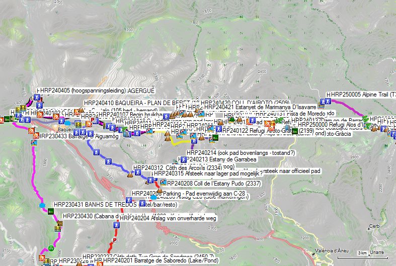
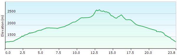 HRP24 SALARDU – ALOS d’ISIL (Cicerone) (Magenta)
Without rest: 9h00 with rest: 12h30 (Difficult, both in terms of orientation and terrain)
From the start in Salardu, the Cicerone guide chooses a strange detour (magenta), where you follow the white and red markings of the GR211 up to the Plan de Beret. You leave Salardu via the road heading north, passing below the district consisting mainly of locked ski lodges. You will find a signpost at GPS HRP240401. 100m further on, you leave the main road towards Unya and cross the river via a bridge over the RIU UNYOLA (HRP240402). At a sharp bend, you leave the road to the right.
300m further on, you cross the Arriu Unhòla again. Between the river and the road, you climb towards BAGERGUE. You pass the Esglèsia de Sant Fèlix (HRP240404) and turn right. You ignore the access road from Salardu and continue straight ahead in a southeasterly direction. The road turns northeast. At the moment he heads north towards a parking lot and has passed a high-voltage power line (HRP240405), leave him and turn right onto a road and then onto the path heading east.
You reach the gravel road again, which circled the basin high above the village (HRP240406); follow it to the right here. At a T-junction, continue in an easterly direction. Follow this gravel road to the asphalt road towards HRP240409 PLAN DE BERET, and cross it (HRP240408) to continue following the gravel road along the asphalt until you reach PLAN DE BERET.
Continue climbing via asphalt or gravel road to the BAQUEIRA-PLAN DE BERET parking lot (HRP240410). Turn right here and follow a nearly flat road towards the parking lot at the ski lift (HRP240411 WW VENTA BILLETES). At the 180° bend, leave the road to the right, towards the start of a usable path (HRP240107). You will be back on the HRP here in 2 hours 20 minutes via the official (Cicerone) route, instead of 1 hour 45 minutes via the shortcut!
The beginning of the path is fairly easy to follow. At GPS HRP240109, the path takes a shortcut on the OSM tracklog. At GPS HRP240110, you are diverted from the path along the river and take a detour, but an easier route towards the lake and dam of the ESTANY DE BACIVER (HRP240112B). Just before the dam and the lake, at GPS HRP240112A, you encounter a situation that is very unclear. Here you are dealing with a scree field combined with scrub, making cairns difficult to see.
Caution: do not follow the cairns along the lake here, but maintain a more easterly course, away from the lake, along a tributary coming from the ESTANY ROSARI DE BACIVER (HRP240114). From GPS HRP240113, you leave the immediate vicinity of the river.
South of the ESTANY ROSARI DE BACIVER (HRP240114), at a crossroads of paths and mainly OSM tracklogs—as the paths are actually vague—you must decide for yourself which route to choose.
In good weather conditions, you can complete this stage perfectly by the book, but prior knowledge of the terrain offers a significant advantage.
In bad weather, it is best to try to avoid the long passage over the ridge and through the scree fields. To do this, it is best to climb to the lowest point (HRP240115) on the ridge next to the Tuc Deth Rosari (HRP240116) and, instead of going over the ridge, descend in a wide arc from the ridge towards the northern side of Lake Estany Sup. Del Rosari (HRP240120). Here you will find the path between the REF SABOREDO and the Refugi Airoto-Gràcia (HRP240122). This reduces the distance, the elevation gain, and the difficulty level.
Only attempt the Cicerone variant in the most optimal weather conditions. As is often the case, the author takes passages through scree fields and climbing over ridges rather lightly. The man lives nearby and can therefore choose the ideal weather conditions to tackle certain passages. Moreover, he has the advantage of knowing the area inside out. The average HRP hiker is here for the first time. The Spanish map material, in particular, is poor, and the markings on the terrain are also poor or non-existent, as Ton Joosten himself admits regarding the climb to the Tuc de Marimanha (HRP240414). You definitely do not want to be on this grade in bad weather conditions. You have to climb Grade II here, and furthermore, you are exposed for a very long time, which is inherent to a grade and therefore by definition unsuitable for bad weather conditions. GPS HRP240412 and the accompanying OSM tracklog, in particular, have to go straight through an enormous scree field, and that is highly unpleasant. Given that you cannot assess certain matters in advance based solely on the map and guide at the time, I took a combination of the Ton Joosten and the short route (Wit) when approaching the Tuc de Marimanha (HRP240414), staying largely to the right of the scree field.
Once on the ridge, you have to find the most suitable route on or off the ridge yourself. After all, there are no indications regarding the route to be found here. This section proceeds entirely based on your own judgment. And if you have someone with you who is facing such conditions for the first time and is wearing footwear that is slightly too light for the circumstances, it slows down your progress. Fortunately, this stage was completed in optimal weather conditions. If you go completely over the ridge, before the RIDGE BELOW Tuc de Marimanha (HRP240413) you need to cross another unnamed peak (2555) that was not visible on the previous generation of the OSM map, nor on the Garmin Basemap. You then descend carefully to the ridge. You climb to the Tuc de Marimanha and descend again to a pass.
From there, you ascend again to the Tuc Deth Rosari de Bacivèr (HRP240416). You descend from this peak and around the Lac Gelat de Rosari (HRP240417), which lies in the valley below. From the Pic de Rosari de Baciver (HRP240418) you are more in hiking terrain.
From HRP240419 you will again find traces of a path and markings, which you then follow in a northeasterly direction to the COLL D’AIROTO (HRP240420). From there, head southeast to the Estany D’Airoto (HRP240123). Those who do not wish to stay overnight at the Refugi Airoto-Gràcia (HRP240122) must actually go back up to the COLL DE CLOT DE MOREDO (HRP240125).
There are 2 options for this:
Day HRP24 SALARDU (detail)
- Follow the description in the Cicerone guide and follow the lake shore through a difficult scree field until you reach a more open area by climbing a bit. There, you will find the path (HRP240124) between Refugi Airoto-Gràcia and COLL DE CLOT DE MOREDO. Depending on whether you want to spend the night at Refugi Airoto-Gràcia or ALOS D’ISIL, you descend or climb to the pass.
- You climb along the edge of the boulder field directly to COLL DE CLOT DE MOREDO (HRP240125) (difficult). On current digital maps, a path is indicated there, but in reality, it is a route through a boulder field that was not visibly marked at the time!
From the COLL DE CLOT DE MOREDO, the difficulties for the day are over and you follow a path again. The path deviates slightly from the OSM tracklog. You pass the Estanyola del Clot de Moredo (HRP240226) and a KIND OF PASS (HRP240229). The path ends on a gravel road (HRP240230). Just under 100m past a tubular bridge, you will find a path (HRP240231) that cuts across the bends in the road. Should this be too overgrown, you can of course follow the gravel road itself, along which you descend further to the access road to a farm (HRP240232). Here you turn left and follow a less well-maintained road (HRP240232) to the BORDES DE MOREDO (HRP240234).
Follow a rather faint path to the edge of a small wood (HRP240235). Here you turn right and begin the descent to ALOS D’ISIL. You cross the bed of the Barranc de Comabiera (HRP240236), which can sometimes be dry, and continue descending along the Barranc de Moredo in a southeasterly direction to a dam (HRP240237 Dam on the Barranc de Moredo) at the end of a road. From here, you will find a path towards ALOS D’ISIL. At the end, the path becomes a road. The road opens onto a small square. On this square, to the right, you will find the Refugi Alos d’Isil (HRP250000).
Refugi d’Alós d’Isil (HRP 0264B):
https://refugi-dalos-disil.business.site/
+34 644 045 719
+34 624 461 487 (Silvia)
La Placeta, Alós (Alt Àneu)
25586 Catalunya, Spanje
(20 beds in a loft under the roof, 2 showers, 2 toilets, supplies in the form of freezer, canned goods and food with a long shelf life, well-equipped hikers’ kitchen, seating area, dining area) No recent rates online!
Day 25 ALOS D’ISIL – REF. ENRIC PUJOL |
13km | +1600 | -600 |
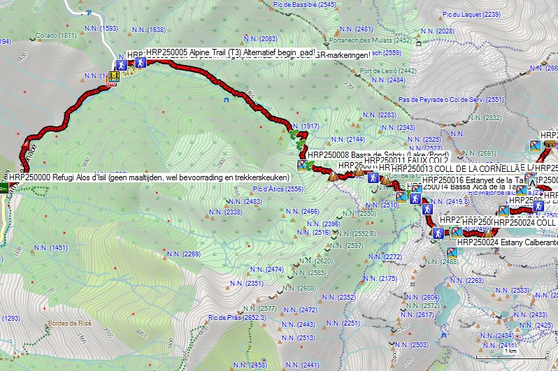

Without rest: 6h30 with rest: 8h45 (Difficult for orientation)
You leave the inn and descend slightly in a northerly direction, between the houses, until you reach the C-147 again. This road climbs slowly over a distance of 2 km. You leave it (HRP250001) via a gravel road, which leads you down to a wooden bridge (HRP250002 Pont de Pina), from where you start the climb along the gravel road. Just past the hairpin bend in the road, you should find the beginning of a path (HRP250003) with GR markings on the left side. However, it is reported that this section is heavily overgrown! Alternatively, continue following the road. You pass a metal cattle gate and gradually enter the territory of the cows. You continue following the road until it dead ends at the bottom of 2 huts, the one on the left noticeably smaller than the one on the right.
You must pay very close attention here! Go between the huts towards the edge of the forest and find a path there (HRP250005), where you turn right. Caution: do not confuse this with another narrow path that runs slightly longer and lower in the meadow and eventually dead ends further on at a bend in the river (Baranc de Commamala).
Once you have found the correct path, it is easy to follow until you reach the lake (HRP250008 Bassa de Sobriu) in the basin below the FAUX COL1 (HRP250010). At a fork, go left (eastward). Just before the FAUX COL2 (HRP250011), you will find another fork and turn right. 200m (HRP250012) further on, the path improves. You climb to the COLL DE LA CORNELLA (HRP250013). You cross the connecting river (HRP250015) between the Estanyet de la Tantera and the Bassa Xica de la Tantera, where you will find white and red paint markings and a flat-lying signpost, which is of little use to you. You should find the intersections of paths HRP250017 & HRP250018 here, as a digital guide. At GPS HRP250019 (scree slope), the path on the terrain and the OSM tracklog rejoin. Heading south, you head towards the COLL DE CURIOS (HRP250020).
You descend from the COLL DE CURIOS and, at the drainage river (HRP250021) of the Bassa de Curiòs (HRP250023), you follow it upstream to the lake. Just before the lake, you cross the drainage river (HRP250022). You pass along the southern shore of the lake and continue climbing along the tributary towards the COLL DE CALBERANTE (HRP250024).
100m past the COLL DE CALBERANTE, you will find a fork in the path, where you descend to the right towards the Estany Major de la Gallina (HRP250025), which you circle clockwise (north shore). After the lake, the course of the path becomes more difficult to follow, especially from GPS HRP250026. The crested path follows a course through the scree field on the left bank of the valley. You can also choose a free descent through the more open right half of the valley.
 The final destination of every chosen route is a multicolored pole (HRP250027), visible from the upper half of the valley. From the multicolored pole, continue in a northerly direction along the eastern shore of the Estany Mitjà de la Gallina (HRP250028). Next, you cross the lake’s outflow river twice, and then proceed in a straight line north to the Estany Inferior de la Gallina (HRP260002) and the Refugi Enric Pujol (HRP260000).
 Just before the Refugi Enric Pujol, you must cross the outflow of the Estany Inferior de la Gallina. This crossing is somewhat uncomfortable. Just before this crossing lies a tiny peninsula that you round clockwise to a kind of small dam made of pebbles that lies just below the waterline. The awkwardness of this crossing lies in the fact that, during the final part of rounding this small peninsula, you must hold on to the peninsula’s wall with your hands. Next, you must step onto these stones lying just below the water surface, let go of the wall, and find support on your walking sticks below the water level to ensure sufficient stability to take the next steps towards the other side. The execution requires a high degree of self-assurance and caution. Mistakes are guaranteed to result in a (partially) wet suit and gear.
On the other side, follow the path upwards towards Refugi Enric Pujol (HRP260000).
Refugi Enric Pujol:
 Unmanned metal hut with 9, maximum 13 beds with mattresses, blankets, and pillows. The top 4 may be considered very uncomfortable given their position directly under the curved roof. There is also a table with benches and stools. There is no toilet, and water must be fetched from the stream.
Route selection stages 26 till 29:
Enric Pujol – El Serrat:
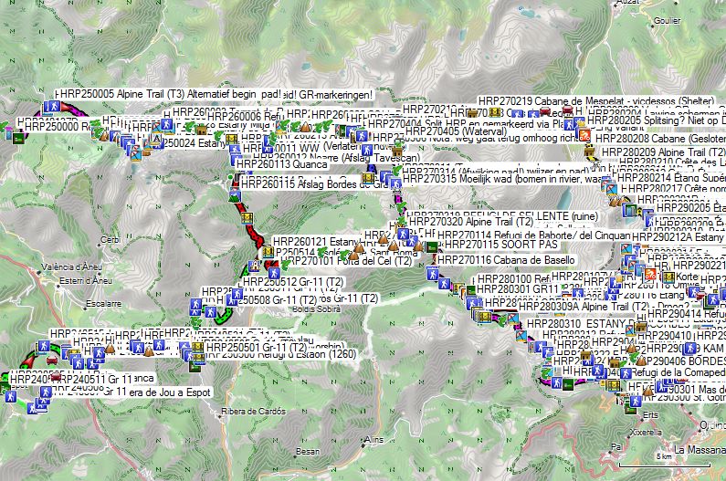
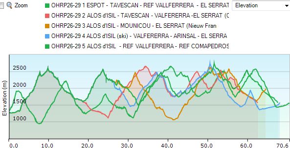 All roads lead to Rome, and in this case to El Serrat, but some are a bit shorter than others! ;-). So it is good to take a quick look at the numbers and make an informed choice regarding which route you actually choose. The French guide by Margaret Millet once again features an interesting route choice, which will be discussed in further detail.
- GR11
- At number one in terms of shortest length and elevation gain is, perhaps surprisingly: Ref. Eric Pujol – Tavescan – Ref. Baboborte – Ref Vallferrera – Port de Rat – El Serrat, with a total length of only 51 km, 3,400 m of ascent, and 4,100 m of descent. There is basically a small shop in Tavescan, but you can also send a package to a hotel in El Serrat if you book an overnight stay there! Anyone who chose the GR11 at the Refugi Colomers (HRP230221) will end up in Tavescan anyway!
- In second place is the new route by Marie Millet: Ref. Eric Pujol – Ref Certascan – Ref. Mounicou – Ref Fourcat – Port d’Albelle – El Serrat, with a total length of 52.5 km, an ascent of 4,200 m, and a descent of 4,500 m. Significantly more elevation gain! In principle, you can ship a pack to both Mounicou and El Serrat! Sending it to Mounicou is, in principle, a bit riskier, given the limited communication facilities at this hut!
In third place is the classic route via Arinsal: Ref. Eric Pujol – Ref Certascan – Ref Vallferrera – Arinsal – El Serrat, with a total length of 56.5 km, an ascent of 4,175 m, and a descent of 4,900 m. Even longer and with even more elevation gain! You can do your shopping in Arinsal! - And in fourth place: the Cicerone version: Ref. Eric Pujol – Ref Certascan – Ref Vallferrera – Ref de l’Angonella – El Serrat with a total length of 57.5 km, 4,450 m of ascent, and 5,150 m of descent. Even longer and even more elevation gain! No possibility to shop in Arinsal!
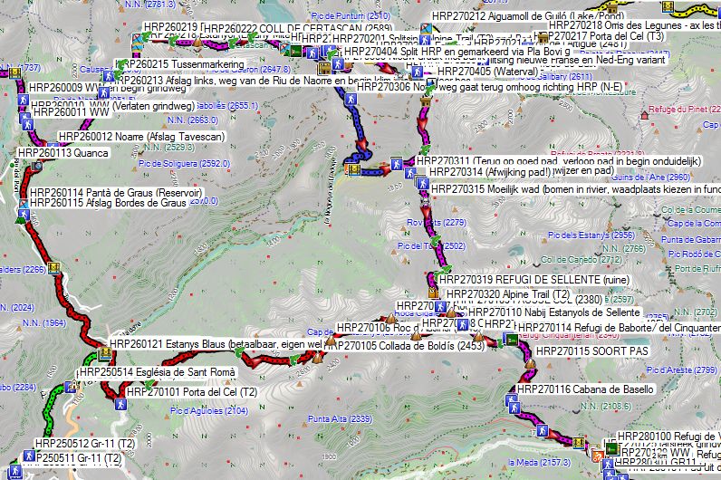
Think before you act! And if you want to send packages with supplies to specific points along the way, you should of course do so from your home!
Day 26 (2) REF. ENRIC PUJOL – TAVASCAN |
12,7km | +125 | -1300 |
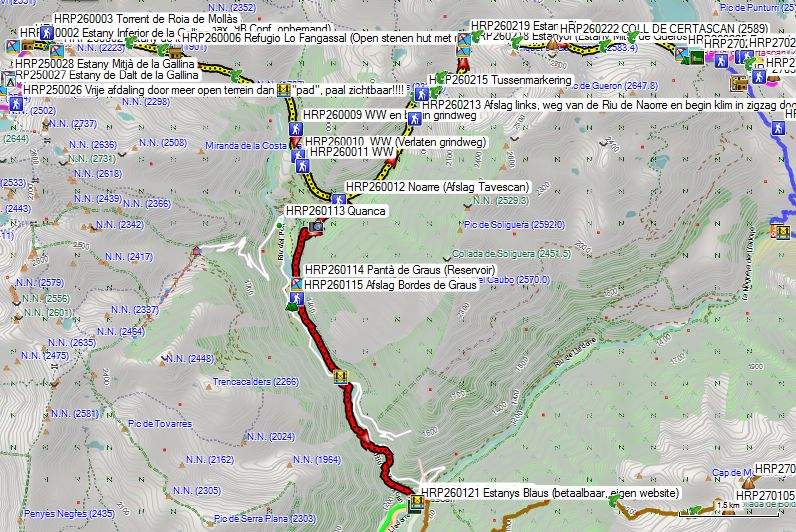
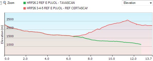
Numbers: they don’t lie! Contrary to what you might have assumed, the proposed descent to Bordes de Graus en Tavescan is interesting in terms of route, provided that you do not simply return along the same path the next morning, but attempt to reach the Refugi Vallferrera via a path called Porta del Cel. That is shorter than the GR11 and, moreover, has less elevation change. You are walking on a ridge route, however, so you must pay attention to the weather!
You leave the hut and walk downhill along the length of the hut. Further on, you will find cairns. The descent here is relatively easy. However, you should be careful here due to a number of large steps combined with wet and slippery rocks. Extending your poles by 30 cm is advisable here on the steepest section. You descend towards the Estany de la Llavera (HRP260002), after which you make an S-bend along the lake’s outlet, which you cross at a crossroads of paths (HRP260003). Next, you descend along the left bank of the Torrent de Roia de Mollàs. At GPS HRP260004, you cross a first small stream. The path moves away from the Torrent de Roia de Mollàs and crosses a larger tributary, the Riu de la Ribereta, at GPS HRP260005. The path then heads towards a freely accessible stone hut called Refugio Lo Fangassal(HRP260006), with 5 mattresses (2015), which can serve as an alternative to the Refugi Enric Pujol.
You continue descending in a southeasterly direction and gradually enter more wooded terrain. At GPS HRP260007, you cross the Riu D’Escobes. Near the RIU DEL PORT (HRP260008), you leave the meadow area and enter the forest. As a result, the path fades.
Do not look too high for the wooden bridge (HRP260008) over the RIU DEL PORT! After crossing the river, it turns south and soon moves away from the river. At GPS HRP260009, the path emerges onto a gravel road at a hairpin bend. Here you will find a truncated signpost, indicating only the direction from which you came.
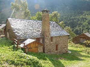 You follow the road south for 450m and then leave it at the next signpost (HRP260010 WW) for a path that runs mostly at the same elevation. 150m further on, you will find another signpost (HRP260011 WW). Here, follow the signs for Bordes de Noarre and Refugi de Certascan. You descend slowly to Noarre (1595m), a hamlet with restored holiday cottages.
 Next to an information panel, you will find two signposts here, one of which points to the Refugi de Certascan (HRP260112). From Noarre, follow a path south to the edge of the forest. There, cross a bridge and continue along the river. You pass the waterfall (HRP260113) on the Noarre and descend further to the Pantà de Graus (HRP260114), a reservoir on the Riu del Port.
Beyond the dam, you leave the forest and find a path (HRP260115) to the right towards the Bordes de Graus campsite (HRP260116). To descend towards Tavescan, you can cross here and descend via the asphalt. You can also follow the path straight ahead, which leads to a gravel road, along which you eventually reach the asphalt. Again, depending on your personal preference, you can descend via the asphalt to the left or cross the bridge (HRP260117) to then descend to the left over the bridge via the path to Tavescan.
In Tavescan (HRP270100) you will find several hotels (Book early!)
During the summer season (June to September) there is a small grocery store in Tavescan: Epicerie Marie. Contact the Tourist Office in Tavescan for further information. (+34 973623079). However, sending a package to a hotel where you have reserved a room seems a more reliable solution!
HOTEL ESTANYS BLAUS *** (HRP260121):
Single Room in August 2026: €77 (Breakfast +€10) (Their own website is cheaper than hotel sites!!!!)
Day 27 (1-2) TAVESCAN – REF VALLFERRERA |
18,3km | +2100 | -1300 |
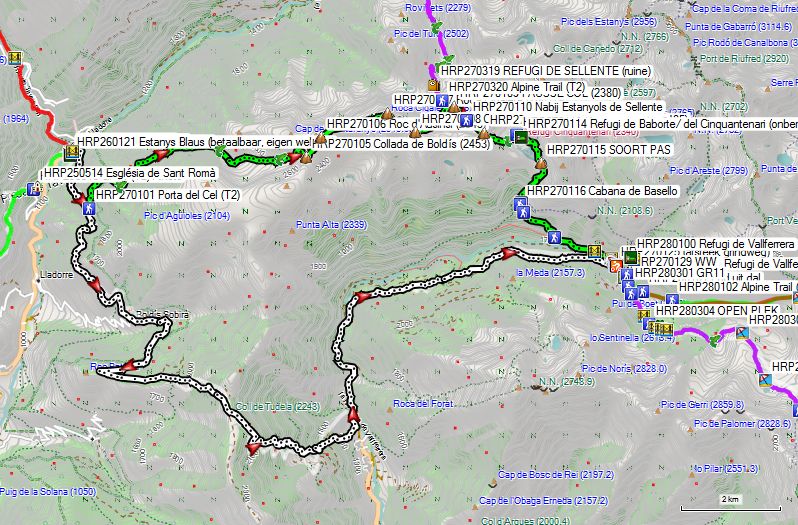
 Descending to 1,120m naturally comes at a price! But after a good bed, a good meal, and fresh supplies in your backpack without any struggle, a lot is possible!
You leave Tavescan (HRP270100) via the GR11 to exit it at an altitude of 1,560m (HRP270101). Compared to the GR11, passing through the Porta del Cel saves you nearly 7km and 350 extra vertical meters!
You follow a path through the forest in a northern and later northeastern direction. After 1km, you reach the Canal de Castellassos (HRP270103). At an altitude of 1,900m, you cross a stream and, a little further on, another one. At the edge of the forest, you reach the bed of the Ribeira de Boldis (HRP270103A). You follow this mountain river upstream. At the confluence with a side arm, cross it and then follow the bed of the main river further uphill until you cross it (HRP270104) just before a small lake. From there, continue climbing to the Collada de Boldis (HRP270105 – 2453). From here, follow the ridge northeast to the Roc d’Ausini (HRP270106 – 2545) and then to the Roca Cigalera (HRP270107 – 2667). From there, descend southeast to the Col de la Llaguna (HRP270108 – 2545) and northeast to the Fausse Col (HRP270109 – 2380). Here you are back on the normal HRP. Further up, you pass near the Estanyols de Sellente (HRP270110) before climbing on to the COLL DE SELLENTE (HRP270111). You descend from the Col in a southeasterly direction, through the scree field. You turn left and leave the scree field for a grassy slope. You descend towards the outlet (HRP270112) of a small lake, which is also a tributary of the Estany de Baborte. From here, you head northeast to GPS HRP270113.
Whether this is a crossroads of paths was not entirely clear on the ground. From here, you head southeast to the Refugi de Baborte/ del Cinquantenari (HRP270114 – unmanned – orange metal approx. 9B). Due to its orange color, the hut is visible from afar.
Refugi de Baborte/ del Cinquantenario:

Unmanned metal hut with 9, maximum 13 beds with mattresses, blankets, and pillows. The top 4 may be considered very uncomfortable given their position right under the curved roof. Furthermore, there is a table with benches and stools. There is no toilet, and water must be fetched from the stream.
The choice of this stage point in the Cicerone guide is incomprehensible, unless you make things more difficult than strictly necessary during the first phase of stage 30 by following the route specified in the English/Dutch guide and subsequently having to drop out at the Refugi de Baborte/del Cinquantenario. Naturally, the choice of an unmanned hut results in the fact that you will once again have to carry extra food and fuel.
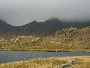 You pass behind the Refugi de Baborte/ del Cinquantenario and descend towards the Estany de Baborte. Next, you follow the eastern shore of the lake. At the end of the lake, turn left towards a KIND OF PASS (HRP270115). You descend from the pass through difficult terrain with a lot of tall bushes and consequently stones that are difficult to see. Continue in this direction towards Cabana de Basello (HRP270116). Stay on the same shore and continue descending to the left, towards the forest. In the forest, you walk at the same elevation for a while before descending further towards GPS HRP270120. This section is surprisingly difficult due to the slippery stones combined with the small elevation changes. At GPS HRP270121, you cross a bridge over a tributary. At GPS HRP270122, you cross the main river via the PUENTE DE MOLINASSA. At GPS HRP270123, you reach the gravel road through the valley. You cut across the various bends in the gravel road and reach the LA MOLINASSA car park (HRP270124). From here, the car-free section of the gravel road begins, leading to the turnoff (HRP270127) to the Refugi de Vallferrera (HRP280100).
Refugi de Vallferrera:
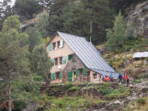
Tel (+34) 973.624.378
Dinner 7 pm:
Soup, salad, chicken, yogurt
Breakfast 7 am:
1 cup of coffee or tea, 2 slices of bread, 5 to 6 cakes, jam, butter, no fruit juice (no self-service, sufficient calories, but lots of sugar and little fiber)
Half-board: €61.50 (Shower included) (2024)
Half-board + Picnic: €75.50 (2024)
1L Wine: €6 (2015)
Shower 5’: €2 😦 (in annex) (2015)
Day 28-29 (1) REF.VALLFERRERA – El SERRAT |
18,2km | +1450 | -1800 |
Without rest: 8h30
By taking this route, you will definitely save a day! And the money you save can be spent on some luxury and a resupply via parcel post in El Serrat!
You leave the Refugio VallFerrera by retracing your steps towards the bridge. 50m before the bridge, you will find a turnoff to the left (HRP270129). You follow this path through the forest for 50m to the river. You leave the forest and encounter a private hut (closed). A little further on, your path joins another path from the valley (HRP280101). At an altitude of 2000m, yet another path joins yours (HRP280102), and you continue climbing steadily along the river until you finally cross it at 2220m. You leave the last remnants of forest behind you and continue climbing steadily towards Port de Boet (HRP280104 – 2511), with the lake of the same name (HRP280103) just below. Here you return to France.
Here, take the yellow-marked path to the right (HRP280105) towards Etang de Médécourbe. You pass below a rocky spur of the Port de Boet, where cable anchors (HRP280106) have been installed. At an altitude of 2480m, you will find a shortcut (HRP280107) that descends directly into the valley, bypassing Lake Médécourbe (HRP280108) itself. The path along the lake descends slightly more gradually but is marked T4. The path along the riverbed is marked T2. It is up to you to choose the most suitable path at the time of your passage. After the two paths meet (HRP280109), you descend on the left bank, and when the river disappears into the forest, you follow the edge of the forest until close to a second mountain stream (HRP280110), where you enter the forest. You now descend in a zigzag pattern through the forest on the right bank of the stream. At an altitude of 2000m, ignore a path (HRP280111) to the left and continue in a southeasterly direction until you cross the Ruisseau de Médécourbe itself. 200m further on, the path emerges at a hairpin bend (HRP280112) of a gravel road. Here, do not go down to the left, but to the right to slowly ascend a little again. At an altitude of 2010m, you cross the Ruisseau de las Bareytes (HRP280113). In open terrain, you cross the Ruisseau de Rat, after which you find a path 40 m further on that cuts across the hairpin bends in the road. You continue climbing along the right bank of the Ruisseau de Rat. At an altitude of 2240m, you leave the forest, and at an altitude of 2320m, you ignore the path (HRP280115) to the right towards the lake. You continue climbing in a zigzag pattern to the Port de Rat (HRP280117 – 2542), where you leave France for Andorra.
From here, you will find white and red GR markings. You descend in a zigzag pattern to a fork (HRP280118), where you turn left and descend along the flank towards a hairpin bend (HRP280119) in the road. You ignore the road, as it would mean too many meters of detouring, and choose the path to the left along the flank of the road and the river. When you reach the road again (HRP280120), depending on the conditions or your preference, take the road to the left or to the right to find a path (HRP280121) downhill just before the river towards the Ordino-Arcalis ski station (HRP280123) and the associated asphalt road. In the summer, a bus should run here between Ordino-Arcalis and El Pradet, but whether it is running at the time you pass by remains a mystery.
On foot, descend via a path across the parking lot, passing under the cable car cables to continue descending along the left bank of the Tristaina. Ignore a path that leads back to the road and continue downhill until you cross a tributary. 100m further on, you will find a path to the right (HRP290215). Here, on the bank of the Riu Tristaina (HRP290215), the old French route via the Rifugio Vallferrera and the new route via Mounicou and the Refuge Fourcat rejoin.
100m further on, you will find a gravel road (HRP290216) that leads you between the two reservoirs. However, ignore the gravel road and continue descending along the left bank of the Tristaina via a path until you reach a gravel road (HRP290218), which you follow further down to the left. Near a bridge (HRP290220) over the Tristaina, return to the asphalt. Before this bridge, you pass the stone Cabana de la Pieta del Castellar (HRP290219). Either continue following the asphalt downhill, or turn right just before the bridge over the Tristaina tributary (HRP290221) and follow the path downhill, which runs closer to the Tristaina riverbed than the road. At an altitude of 1720m, the path rejoins the same road (HRP290223). 200m further on, you can leave the road again to the right (HRP290224).
Those wishing to go to El Serrat (HRP290326) can choose either the path or the road, which involves a small detour. Those going to the Refugi Borda de Sorteny (HRP300111) should definitely choose the asphalt here. At an altitude of 1680m, you will find the turnoff to the road to Sorteny (HRP290225), along which you lose less altitude. This way, you reach the Sorteny car park, which you leave in a southerly direction. via a gravel road until you cross a path (HRP300107) at an altitude of 1800m, which you can follow back up. When the path returns to the gravel road, you also reach the Sorteny Botanical Garden (HRP300108). 450m further on, you reach another car park (HRP300109), from which you follow the path towards the Refugi Borda de Sorteny (HRP300111). 150m past the car park, ignore a path (HRP300110) to the right that crosses the river via a bridge. Refugi de Sorteny (HRP300111):
Refugi de Sorteny (HRP300111): 

Tel : (+376)846446
Rates 2026: Half Board: €70 (2026)
Hut suitable for 40 people, currently operated by the local mountaineering association. In principle, there is a freely accessible section in the basement (8 beds). Reservation required, by phone or via the internet. Power provided by a small generator. Half board and shower available. Credit card payment possible!
About half the prices of Bringué, with half the comfort, but you also lose a resupply point. Sending a package here becomes difficult….
Hotel El Pradet/ Bringué (HRP300100):
Those who are smart book here via the Bringué hotel website (HRP300100), where the 4 hotels owned by the same proprietor can be booked. substantially cheaper than the well-known hotel websites. You get half-board for the price of your room! And that makes it acceptable! 4-star luxury at a reasonable price!
Since the restaurant at El Pradet (HRP290329) is closed in the evening, you will still need to eat at Hotel Bringué. Breakfast is also served here. Dinner (8 pm):
Russian salad
Pork with mustard sauce, pasta, and broccoli
Dessert
Bottle of house wine: €14
50cl Mineral water: €5 (so ask for Aqua Naturale or tap water 😦 )
Room with bed and breakfast for 1 person El Pradet: €147 (August 2026)
Room with bed and breakfast for 1 person Btingué: €135 (August 2026)
Bar El Pradet: 1 cola and 2 glasses of wine: €8
Breakfast (07:45, but not everything is ready yet):
Truly fantastic breakfast buffet: bread, croissants, 4 types of charcuterie, smoked salmon, bacon, eggs, sausages, melon, peeled oranges, yogurt, 4 types of fruit juice, coffee, tea… This will keep you going for well over half a day.
Day 26 (2-3-4) REF. ERIC PUJOL – REF. CERTASCAN |
14km | +1100 | -1100 |

 Without rest: 7h30, with rest: 8h00’
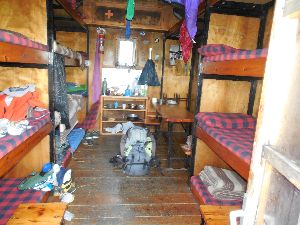 You leave the hut and walk downhill along the length of the hut. Further on, you will find cairns. The descent here is relatively straightforward. However, you should be careful here due to a number of large steps combined with wet and slippery rocks. Extending your poles by 30 cm is advisable here on the steepest section.
You descend towards the Estany de la Llavera (HRP260002), after which you make an S-turn along the lake’s outflow, which you cross at a path intersection (HRP260003). Next, you descend along the left bank of the Torrent de Roia de Mollàs. At GPS HRP260004, you cross a first small stream. The path moves away from the Torrent de Roia de Mollàs and crosses a larger tributary, the Riu de la Ribereta, at GPS HRP260005. Next, the path heads towards a freely accessible stone hut named Refugio Lo Fangassal (HRP260006) with 5 mattresses (2015), which can serve as an alternative to the Refugi Enric Pujol.
You continue descending in a southeasterly direction and gradually enter more wooded terrain. At GPS HRP260007, you cross the Riu D’Escobes. Near the RIU DEL PORT (HRP260008), you leave the meadow area and enter the forest. As a result, the path fades.
Do not look too high for the wooden bridge (HRP260008) over the RIU DEL PORT! After crossing the river, it turns south and soon moves away from the river. At GPS HRP260009, the path emerges onto a gravel road at a hairpin bend. Here you will find a truncated signpost, with indications exclusively in the direction from which you came.
You follow the road south for 450m and then leave it at the next signpost (HRP260010 WW) for a path that runs mostly at the same elevation. 150m further on, you will find another signpost (HRP260011 WW). Here, follow the signs for Bordes de Noarre and Refugi de Certascan. You descend slowly to Noarre (1595m), a hamlet with restored holiday cottages.
Next to an information panel, you will find two signposts here, one of which points to the Refugi de Certascan (HRP260112).
From the second signpost, walk in a northeasterly direction. Past the second building, turn left and then walk to the left of a low wall. The path then slowly approaches the Riu de Noarre, only to suddenly turn left at GPS HRP260213. Here begins a zigzag climb through the forest, which curves back to a ford beneath a small waterfall on the Riu de Flamisella (HRP260214), one of the tributaries of the Riu de Noarre. Climb a little further and turn north. Beyond the vegetation, you will find a distinctive marker that actually indicates a fork in the path. Turn right here in an easterly direction. You are now in a basin with a meandering Riu de Guerosso. You need to be careful here to keep your feet dry. At GPS HRP260216, you will find a post marking the turn to the left. Here you begin a rather technical climb, through a wall with a lot of slabs and loose rock. You will be glad here that you have to climb this rather than descend. Be extra careful in rainy weather. The hardest part is over once you have crossed the outflow of the Estany Inferior de Guerossos (HRP260217). The path continues to climb steeply in an easterly direction and turns north after 250m. Thanks to the white-red and green markings, there is no orientation problem here. You approach the river again near the small Estanyol (Estany Mita) de Guerossos (HRP260218). A little higher up, you reach the larger Estany Blau (HRP260219).
Here the path curves to the right. From GPS HRP260220, there is a discrepancy with the OSM tracklog up to the COLL DE CERTASCAN (HRP260222).
 The descent from the COLL DE CERTASCAN is heavily eroded but well marked with wooden posts. However, these were not fitted with barbed wire, causing them to be used as scratching posts by cattle, which suffer greatly from this. Further down, you cross the Riuet de la Serra Plana for the first time at GPS HRP260223.
Just before the lake, you cross it two more times near GPS HRP260224. You round the Estany de Certascan (HRP260125) along the south side. The Refugi de Certascan (HRP270200) is not located at the lake itself, but in a gully behind a hill.
Refugi de Certascan (FEEC):
www.certascan.com Tel (+34) 973623230

40 beds – 2 showers – 2 toilets – toilet paper in bucket.
Shoes on coat rack – Teva sandals available – backpack in numbered compartment at entrance, same number as bed. Wood fire to heat the hut and dry your laundry if needed.
Note: Huts in Catalonia do not recognize foreign mountaineering cards, so you do not receive a membership discount here (Long live the desire for independence 😦 ).
Dinner: 19:30
Breakfast: 7:00
Bread, butter, jam, cornflakes, coffee, tea and rather watery fruit juice, cookies and cakes (self-service) (no plate, 1 glass (washing-up savings ;-( ).
Half-board: €65 (Shower included) (2026)
Half-board + Picnic: €81.50 (2026)
1L Wine: €8
Day 27 (3) REF. CERTASCAN –GÎTE de MOUNICOU |
16,3km | +825 | -1950 |

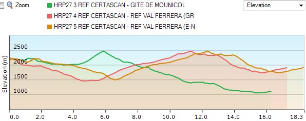
Without rest: 7h30 (Guide)
Statistically speaking, the second best option!
However: the contact details available for the Gîte de Mounicou are limited.
Only 2 phone numbers: +33/(0)5.61.64.87.66 & +33/(0)6.76.80.46.30
No website, no email, no full address, and apart from breakfast, no meals… There is a kitchen, though…
And that makes it a bit difficult to use this gîte as a resupply point….
The new French (Yellow) and Cicerone HRP variants (Magenta) leave the Refugi de Certascan (HRP270200) via the same route to the Estany de Romedo de Baix (HRP270209)
You descend together towards the junction between the path to the parking lot and the path with the white and red markings. 20m further on, there is a second fork (HRP270201) between the path to the SERRA DE LLURI (HRP270202) and the white-red marked path to the Pla de Boavi. From the fork in the paths, you climb upwards in a zigzag pattern to an altitude of 2225m, after which you turn left and descend again to make the passage to the col on the SERRA DE LLURI (HRP270203). Next, you descend to the southern edge of the Estany de Romedo de Dalt lake (HRP270204). You continue along the lake’s edge until you encounter a very difficult passage (HRP270205) on the southwestern flank of the Estany de Romedo de Baix (HRP270207). You continue in the direction of the road that leads back to the car park below the Refugi de Certascan. Next, you cross the dam of the Estany de Romedo de Baix. At the end of the dam, you will find a faint path to the right (east) (HRP270209). Here, the English/Dutch variant turns right, back towards Pla de Boavi. For this route, refer to chapter Day 27 (3-4).
Ignore this path to the right and continue walking straight ahead in a northerly direction along the tributary. You pass a small lake (HRP270210) and then find a path to the left, which you ignore. Continue walking straight ahead to the next lake, named Aiguamoll de Guilo (HRP270212). Near the entrance to this lake, the path turns east and you begin the climb towards the Port de l’Artigue (HRP270214 – 2481). Here, you cross the border into France. 120 vertical meters below the pass, you will find a junction (HRP270215) with a path leading to the adjacent pass. You continue descending and reach the source of the Ruisseau de l’Artigue (HRP270216). You descend along the right bank. At an altitude of 2100m, ignore an ascending path (HRP270217) and continue the descent past a stone hut called Orris des Legunes, with a capacity of up to 3 people. At an altitude of 1780m, you pass a closed private hut (Cabane de Mespelat – HRP270219), which is invisible from the path. You reach the alpine meadows, where both the Ruisseau de l’Artigue and the path curve towards the south. You cross the river via a bridge (HRP270220). On the opposite side, you will find a path coming from the Pic Rouge de Bassiès (2676). On the opposite side, the path does not descend further but becomes a footbridge. You reach a forest. At the end of it, you find a fork in the road (HRP270221), where you keep left to descend as slowly as possible to the beginning of the D66, at a local power plant. You cut across a hairpin bend and reach the lower part of the D66, which you follow in a northeasterly direction. Together with the D66, you cross the Pont de Laouses over the Artigue (HRP270223).
The road continues on the right bank of the Artigue until the intersection with the D8 (HRP270224). Here, you continue south along the D8, ascending slowly, to Mounicou (HRP280200), where you find the hut of the same name along the side of a dead-end gravel road just before the bridge over the Vicdessos (HRP280201).
Gîte de Mounicou (HRP280200):
Beds: 17
Only 2 telephone numbers: +33/(0)5.61.64.87.66 & +33/(0)6.76.80.46.30
No website, no email, no full address and, apart from breakfast, no meals… There is a kitchen, though…
Day 28 (2) GÎTE de MOUNICOU –REF. de FOURCAT |
9,9km | +1775 | -450 |
Without rest: 6h30 (Guide)
Short, technical stage with a lot of bolders and a lot of elevation gain!
You leave the Gîte de Mounicou (HRP280200) and cross the bridge over the river (HRP280201). After 150m, you leave the C8 for a GR marked path (HRP280202). After a short stretch of forest, the path turns into a zigzag in more open terrain. At an altitude of 1360m (1420m guide), you leave the GR markings (HRP280203) for a more ascending path with yellow markings. At an altitude of approximately 1500m, you pass several concrete avalanche screens in a more horizontal section (HRP280204). At the edge of a patch of forest, you turn sharply left and continue back up in a zigzag (HRP280205).
You reach a concrete gully, along which you continue ascending. You reach a grassy track, which you follow briefly before turning right onto a path leading to a hairpin bend in a track (HRP280207)(1680). Here, you go up to the left and climb to the Cabane/Orri de Tignalbu (1790) (HRP280208). The hut is closed. There is a spring.
You continue climbing along a path in a southeasterly direction, following faint yellow markings and cairns. Focus your gaze on a rocky shoulder. The path first runs along the base of this shoulder amidst the vegetation, before climbing it via a rocky and steep path (HRP280209)! After the climb, the path transitions into a path on the flank of (HRP280210) the Crête des Laquels, ascending to a fork (HRP280211) near the Grand Etang du Picot (HRP280212) (2300). From here, you will find White-Red markings up to the Refuge de l’Etang Fourcat. Leave the lake below you to climb between the boulders to the Etang Supérieur du Picot (HRP280214 – 2416). Continue climbing through the boulder field east of the lake to the foot of the Crête Nord du Pic de Malcaras (HRP280216). At an altitude of approx. 2600m, you will find two consecutive cables and brackets (HRP280215) that you can use as handholds and support when climbing over the rocks. With the Crête Nord du Pic de Malcaras (HRP280216 – 2640), you reach a more horizontal section.
You descend in an easterly direction between the boulders on steep terrain. Moreover, you will find few markings here! At the foot of the Crête Nord-est du Pic de Malcaras (HRP280217), you will find a path again and climb to the highest point. From there, you descend through scree and later grass towards a small hill (HRP280218) opposite the hut, where your path joins another. You must once again pass through a boulder field towards a crossroads of paths (HRP280219) above a small lake. From here, you head northeast to the Refuge de l’Etang Fourcat (HRP290200 – 2445).
Refuge de l’Etang Fourcat (HRP290200):
37 beds
Tel:
(+33) 5 61 65 43 15 (summer)
(+ 33) 618200820 (winter)
E-mail: refugedufourcat@gmail.com
https://www.refuge-fourcat.com/
Rates 2026:
Overnight stay: €10.50 (2026)
Breakfast: €9 (2026)
Dinner: €22.50 (2026)
Packed lunch: €13 (2026)
Day 29 (2) REF. de FOURCAT –El SERRAT |
12,5km | +800 | -1250 |
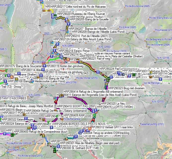
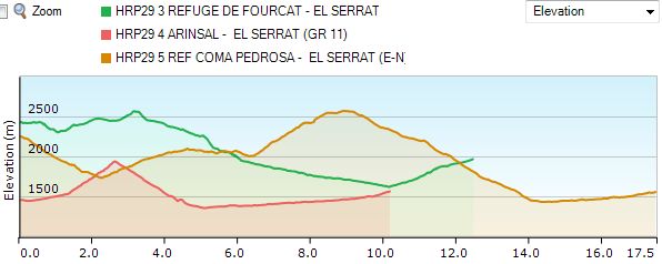
Without rest: 5h30’ (Guide)
You leave the hut (HRP290200) heading south and follow the red and white markings to the lake shore. You cross the dam (HRP290201) and then climb over a rocky spur of a mountain. You descend towards the northeastern spur of the lake. Next, you descend towards a scree hopper with large blocks, advancing along its top in an easterly direction. You reach the turnoff (HRP290202) to a small lake, which you ignore. You now continue in a southerly and later easterly direction to the junction (HRP290203) at the Etang de la Goueille (HRP290205 – 2393).
You follow the shore in a southerly direction to the next junction (HRP290206), where you turn right in a southerly direction. You ascend to one of the Etangs de l’Albeille (HRP290207) and then to the Col of the same name (HRP290210 – 2601), where you enter Andorra.
You descend in a southwesterly direction and pass the small Llacuna Superior (HRP290211). Subsequently, the path splits into two (HRP290212). Choose one based on your personal preference. At the Estany Primer (HRP290214), both rejoin. 400m further on, on the bank of the Riu Tristaina (HRP290215), the old French route via the Rifugio Vallferrera and the new route via Mounicou and the Refuge Fourcat rejoin.
100m further on, you will find a gravel road (HRP290216) that leads you between the two reservoirs. However, you ignore the gravel road and continue descending along the left bank of the Tristaina via a path until you reach a gravel road (HRP290218), which you follow further down to the left. Near a bridge (HRP290220) over the Tristaina, you return to the asphalt. Before this bridge, you pass the stone Cabana de la Pieta del Castellar (HRP290219).
Either you continue down the asphalt, or you turn right just before the bridge over the tributary (HRP290221) of the Tristaina and follow the path downhill, which runs closer to the bed of the Tristaina than the road. At an altitude of 1720m, the path rejoins the same road (HRP290223). 200m further on, you can leave the road again to the right (HRP290224). Those wishing to go to El Serrat (HRP290326) can choose either the path or the road, which involves a slight detour. Those heading to the Refugi Borda de Sorteny (HRP300111) should definitely choose the asphalt road. At an altitude of 1680m, you will find the turnoff to the road to Sorteny (HRP290225), which allows for less elevation loss. You thus reach the Sorteny car park, which you leave heading south via a gravel road until you cross a path (HRP300107) at an altitude of 1800m, which you can follow back up. When the path returns to the gravel road, you also reach the Sorteny Botanical Garden (HRP300108). 450m further on, you reach another car park (HRP300109), from which you follow the path towards the Refugi Borda de Sorteny (HRP300111). 150m past the parking lot, ignore a path (HRP300110) to the right that crosses the river via a bridge.
Refugi de Sorteny (HRP300111):
Tel : (+376)846446
Rates 2026: Half Board: €70 (2026)
Hut suitable for 40 people, currently operated by the local mountaineering association. In principle, there is a freely accessible section in the basement (8 beds). Reservation required, by phone or via the internet. Power provided by a small generator. Half board and shower available. Credit card payment possible!
About half the prices of Bringué, with half the comfort, but you also lose a resupply point. Sending a package here becomes difficult….
Hotel El Pradet/ Bringué (HRP300100):
Those who are smart book here via the Bringué hotel website (HRP300100), where the 4 hotels owned by the same proprietor can be booked. substantially cheaper than the well-known hotel websites. You get half-board for the price of your room! And that makes it acceptable! 4-star luxury at a reasonable price!
Since the restaurant at El Pradet (HRP290329) is closed in the evening, you will still need to eat at Hotel Bringué. Breakfast is also served here. Dinner (8 pm):
Russian salad
Pork with mustard sauce, pasta, and broccoli
Dessert
Bottle of house wine: €14
50cl Mineral water: €5 (so ask for Aqua Naturale or tap water 😦 )
Room with bed and breakfast for 1 person El Pradet: €147 (August 2026)
Room with bed and breakfast for 1 person Btingué: €135 (August 2026)
Bar El Pradet: 1 cola and 2 glasses of wine: €8
Breakfast (07:45, but not everything is ready yet):
Truly fantastic breakfast buffet: bread, croissants, 4 types of charcuterie, smoked salmon, bacon, eggs, sausages, melon, peeled oranges, yogurt, 4 types of fruit juice, coffee, tea… This will keep you going for well over half a day.
Day 27 (4-5) REF. CERTASCAN –REF. VALLFERRERA (GR) |
17,5km | +1350 | -1600 |
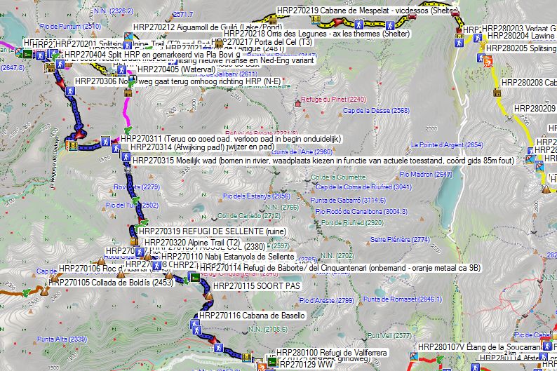
Without rest: 8h15 with rest: 9h00
Route choice:
Up to the bridge on the Pla de Boavi there are three options:
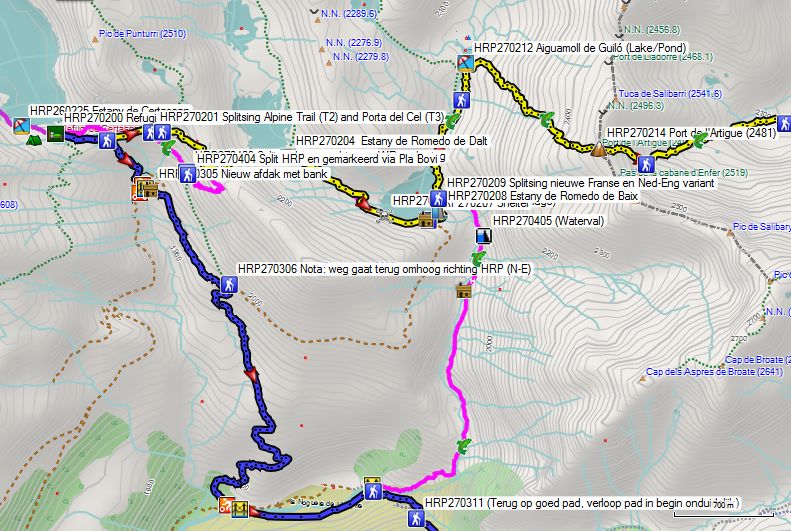
- The Cicerone HRP variant (Magenta): this is 1 km longer and results in 125 m more elevation gain. You descend together towards the fork between the path to the car park and the path with the white and red markings. The new French and the English/Dutch HRP variants (Magenta) leave the Refugi de Certascan (HRP270200) along the same route to the Estany de Romedo de Baix (HRP270209). You descend together towards the fork between the path to the car park and the path with the white and red markings. 20 m further on, there is a second fork (HRP270201) between the path to the SERRA DE LLURI (HRP270202) and the white and red marked path to the Pla de Boavi. From the fork in the paths, you climb upwards in a zigzag pattern to an altitude of 2225m, after which you turn left and descend again to make the passage to the pass on the SERRA DE LLURI (HRP270203). Next, you descend to the southern edge of the Estany de Romedo de Dalt lake (HRP270204). You continue along the lake’s edge until you encounter a very difficult passage (HRP270205) on the southwestern flank of the Estany de Romedo de Baix (HRP270207). You continue in the direction of the road that leads back to the car park below the Refugi de Certascan. Next, you cross the dam of the Estany de Romedo de Baix. At the end of the dam, you will find a faint path to the right (east) (HRP270209). Here, the English/Dutch variant turns right, back towards Pla de Boavi. The path approaches the Riu de Romedo. On the descent, you first see a waterfall (HRP270405). Next, you cross the tributary Barranc de Salibarri (HRP270406). After that, find your own pathless route to an old hut on a small plateau (HRP270407). Keep this hut on your right and you will find traces of a path and a few cairns. Be careful in a rocky section and descend to the place below a waterfall, where you will eventually have to cross the Riu de Romedo (HRP270408). This last part in particular, from crossing the river to Pla de Boavi, is described in the English/Dutch guide as: “Find your own way down into the forest. Here and there are traces of a path and a few cairns. Return to the river and follow it to Pla de Boavi.” Apart from the fact that the description alone makes it clear that this descent is very difficult both technically and in terms of orientation, the added value escapes me. Is this yet another prestige choice with a high macho factor?
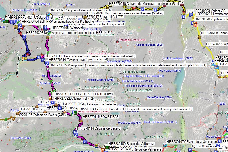

HRP27 REF CERTASCAN – REF VAL FERRERA (Cicerone)
- (Magenta/Blue) Leave the hut heading east and descend (HRP270301) to a small lake. Circle this along the northern side. Follow the path in an easterly and later a southerly direction until you cross the outflow of the Estany de Punturri (HRP270402). Continue descending in a southeasterly direction to the fork between the path to the parking lot (HRP270403) and the path marked with white and red. 20m further on, there is a second fork (HRP270404) between the path to the SERRA DE LLURI (HRP270203) and the white and red marked path to the Pla de Boavi. Follow this path, which climbs slightly, to then descend definitively to the road (HRP270306) to the dam of the Estany de Romedo de Baix. Do not follow this road, as you will return to variant 1 (HRP); instead, cross the road and follow the path further down to Pla de Boavi. Caution: the rocks on the path below the tree line can be very slippery. Once you reach the road at Pla de Boavi, follow it to the left. The road is initially flat and fades into a grassy plain. Continue along a path to the bridge over La Noguera de Lladorre.
- (Blue) It can be even shorter by starting the descent at point GPS HRP270301 via the path leading down there. You cross the stream and descend along its right bank to the next reservoir. Below the lake, the path emerges onto a gravel road (HRP270302), which you follow to the right. 50m further on, you reach another gravel road (HRP270303), which you follow to the left, towards a bridge (HRP270304). 30m further on, you pass a bench with a shelter (HRP270305). You descend to point GPS HRP270306. Do not follow the gravel road, as this would return you to variant 1 (HRP); instead, cross the road and follow the path further down to the Pla de Boavi. Caution: the rocks on the path below the tree line can be very slippery. Once you reach the road (HRP270307) in the Pla de Boavi, follow it to the left. 80m further on, you can already cross La Noguera de Lladorre (HRP270308) to follow a path on the other side in an easterly direction to the second bridge. You can also continue following the road, which is initially flat but fades into a grassy plain. Continue along a path to the second bridge over La Noguera de Lladorre (HRP270309). You will be down in 2h30, which is more than 30 minutes shorter than the time of 3h05 given in the guide.

HRP27 REF CERTASCAN – REF VAL FERRERA (GR)
On the opposite side of the bridge (HRP270310), you need to keep a close eye on the path. Both the tracks on the terrain and the OSM tracklog follow a path that runs dangerously close to the Riu de Broate. Only at GPS HRP270311 are you back on a good path. You follow this to the bridge over the RIU DE SELLENTE (HRP270312), a tributary of the Riu de Broate. After the bridge, you follow the river 50m upstream, then leave the main path (HRP270313) at a makeshift signpost. You climb up via a cow path to rejoin the original path (HRP270314) 50m further on. The reason for this detour was unclear. Higher up, you return to the river. At GPS HRP270315, you will find a difficult ford. There are trees lying in the river. You must choose a ford depending on the current conditions.
1 km after the ford, you cross the RIU DE SELLENTE again at the ford (HRP270316) in a rocky zone. 650 m further on, you cross one of the tributaries of the RIU DE SELLENTE, namely the Ribera de Canedo (HRP270317).
You cross all tributaries diagonally towards GPS HRP270318 to continue climbing in a zigzag towards the ruins of the REFUGI DE SELLENTE (HRP270319).
You follow the river for another 250 m and then head towards a FAUSSE COL (HRP270109). Here, the Porta de Cel coming from Tavescan joins your path. Further up, you pass near the Estanyols de Sellente (HRP270110) before climbing on to the COLL DE SELLENTE (HRP270111). You descend from the Col in a southeasterly direction, through the scree field. You turn left and leave the scree field for a grassy slope. You descend towards the outlet (HRP270112) of a small lake, which is also a tributary of the Estany de Baborte. From here, you head northeast to GPS HRP270113.
Whether this is a crossroads of paths was not entirely clear on the ground. From here, you head southeast to the Refugi de Baborte/ del Cinquantenari (HRP270114 – unmanned – orange metal approx. 9B). Due to its orange color, the hut is visible from afar.
Refugi de Baborte/ del Cinquantenario:
Unmanned metal hut with 9, maximum 13 beds with mattresses, blankets, and pillows. The top 4 may be considered very uncomfortable given their position right under the curved roof. Furthermore, there is a table with benches and stools. There is no toilet, and water must be fetched from the stream.
The choice of this stage point in the Cicerone guide is incomprehensible, unless you make things more difficult than strictly necessary during the first phase of stage 30 by following the route specified in the English/Dutch guide and subsequently having to drop out at the Refugi de Baborte/del Cinquantenario. Naturally, the choice of an unmanned hut results in the fact that you will once again have to carry extra food and fuel.
You pass behind the Refugi de Baborte/ del Cinquantenario and descend towards the Estany de Baborte. Next, you follow the eastern shore of the lake. At the end of the lake, turn left towards a KIND OF PASS (HRP270115). You descend from the pass through difficult terrain with a lot of tall bushes and consequently stones that are difficult to see. Continue in this direction towards Cabana de Basello (HRP270116). Stay on the same shore and continue descending to the left, towards the forest. In the forest, you walk at the same elevation for a while before descending further towards GPS HRP270120. This section is surprisingly difficult due to the slippery stones combined with the small elevation changes. At GPS HRP270121, you cross a bridge over a tributary. At GPS HRP270122, you cross the main river via the PUENTE DE MOLINASSA. At GPS HRP270123, you reach the gravel road through the valley. You cut across the various bends in the gravel road and reach the LA MOLINASSA car park (HRP270124). From here, the car-free section of the gravel road begins, leading to the turnoff (HRP270127) to the Refugi de Vallferrera (HRP280100).
Refugi de Vallferrera:
Tel (+34) 973.624.378
Dinner 7 pm:
Soup, salad, chicken, yogurt
Breakfast 7 am:
1 cup of coffee or tea, 2 slices of bread, 5 to 6 cakes, jam, butter, no fruit juice (no self-service, sufficient calories, but lots of sugar and little fiber)
Half-board: €61.50 (Shower included) (2024)
Half-board + Picnic: €75.50 (2024)
1L Wine: €6 (2015)
Shower 5’: €2 😦 (in annex) (2015)
Day 28 (3-4) REF. VALLFERRERA – COMAPEDROSA –ARINSAL |
10,5km 15km
|
+1000 +1000 |
-700 -1450 |
Zonder rust: 7u00’ met rust: 8u00’
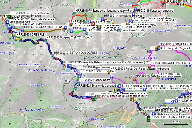
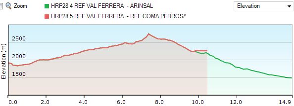 Dag 28 REF VALFERRERA – COMAPEDROSA/ARINSAL
You leave the hut (HRP280100) and retrace your steps towards the gravel road (HRP270128). You turn left, and after only 200m you pass the signpost (HRP280301) GR11) to the Port de Boet (HRP280104 – 2511m). You continue straight ahead here, and another 200m further on, you leave the gravel road straight ahead at the first hairpin bend (HRP280302).
At GPS HRP280303, you cross the first bridge over a tributary and continue straight ahead via a difficult-to-follow path along the riverbank. 200m further on, you reach an OPEN PLACE (HRP280304). Here you cross several small streams via 3 small bridges, which are sometimes a bit redundant. Do not cross the third bridge in the clearing at GPS HRP280308, as that path returns to the path to the Port de Boet (HRP280104 – 2511m).
Via a small valley, you climb to a plateau, where you cross a stream (HRP280309). You round a ridge, along which you continue climbing upwards. The path is sometimes difficult to follow here. Look out carefully for cairns and paint markings. The frequency could be a bit higher here. You cross the outlets of the ESTANY D’ASCORBES (HRP280310). You continue climbing and approach the outlet of the Estany de Baiau, which you cross at GPS HRP280312. 50m before that, turn left at a fork (HRP280311). You can see the Refugi de Baiau – Josep Maria Montfort (HRP280313 – 9B unmanned) from afar, because it is situated on a small hill, and of course because of its color.
Refugi de Baiau – Josep Maria Montfort : 

Unmanned metal hut with 9, maximum 13 beds with mattresses, blankets, and pillows. The top 4 may be considered very uncomfortable given their position directly under the curved roof. Furthermore, there is a table with benches and stools. There is no toilet, and water must be fetched from the stream.
You descend from the small hill and pass along the north side of the lake. At GPS HRP280314, you must climb the hill and pass along the top of the vertical rock face, as this is not possible along the lake at the bottom.
At GPS HRP280315, there is a fork in the path that is not marked as such. You will see a path going up to the left. Do not follow this. You continue along the grassy shore of the lake towards the boulder field on the bank further along. You follow the cairns through this boulder field. Further on, the rocks become larger, revealing some grass and soil between them again. The path slaloms between these rocks. Higher up, the rocks narrow again. Once again, the cairns are too small and too far apart, making the “path” difficult to follow. At GPS HRP280316, a clearer path begins.
The final section to the PORT DE BAIAU (HRP280317) is so steep that for every two steps you take, you slide one backward. You have to search for footing in the fine, loose gravel. You are glad to be up here, because this final section in particular is very uncomfortable. Despite this being the GR11, you should not underestimate the technical level of this climb. The fact that it is only weakly marked does not exactly make matters easier.
Once on the Andorran side, the character of the path changes completely. Here you will find both white and red signs as well as yellow dots as markers. On weekends and in good weather, you will find many people here wanting to climb the nearby Pic de Comapedrosa. At GPS HRP280318 & HRP280319, you will find paths that descend from the summit.
 You descend towards Estany Negre (HRP280322), which you circle along the left (eastern) side. 100m further on, you will find the fork (HRP280323) between the path to the PORT DE BAIAU and the “normal path” to the Pic de Comapedrosa. You descend in the direction of the Estanys de Comapedrosa (HRP280324) and cross its outcrop (HRP280325).
Initially, you descend in a southerly direction. Around 2500m, you change direction across the valley floor to the southeast and later east. There you will find an unmarked fork (HRP280326). Those wishing to reach the Refugi de la Comapedrosa (HRP290400 – expensive) should take the ascending path to the right.
Refugi de la Comapedrosa (HRP290400):
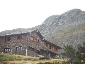
60 Beds, Tel: (+376)327955,
Unless you want to follow the Cicerone variant, staying overnight here is pointless.
A sensible person simply goes straight ahead at the unmarked fork (HRP280326) below the Refugi de la Comapedrosa and leaves the hut for what it is. 500m further on, you walk in the direction of the Collet de Comapedrosa, where you will find a signpost (HRP280327) to the hut. The descent takes you through steep and eroded terrain. At GPS HRP280328, you cross a river. Shortly after the river, you enter the forest.
The rest of the path is fairly straightforward. At GPS HRP280329, you will find a first bridge over the Riu de Comapedrosa. At GPS HRP280330, you will find a second bridge over the Riu Pollos. You continue descending to a fork in the gravel road (PLA DE L’ESTANY (HRP280331 – 1745m)). The English/Dutch variant ascends here via the gravel road.
Those who are sensible will continue descending via the gravel road to the asphalt (HRP280333). You descend further towards a small car park (HRP280334) and then go through the tunnel (HRP280335) towards Arinsal. Here, you take the descending direction and cross the Riu d’Arinsal (HRP280336). You follow the asphalt for just under a kilometer to the center of Arinsal. 500m past the turnoff for the next stage you will find:
Hotel Sant Gothard by Nexta**** (HRP290300):
Hotel website: 1p/€80 and 1p + Half Board: €114 (August 2026) (€6 cheaper than via Booking!)
Hotel Comapedrosa (HRP280338):
Hotel Comapedrosa (HRP280338) currently only accepts bookings of at least 2 nights, which is obviously not very appealing….
Room 101: 1st floor, street side, 2 balconies, roller shutters and double glazing. Little traffic at night. Fully private bathroom, shower and hairdryer, which overheats quickly.
Room 102: river noise (probably applies to all rooms at the rear).
Single Room H/P: €60 (Own website) (2024).
Dinner (7 pm to…) : Platos Combinados: normally this expression makes me very nervous, but here you really get value for money: 3 slices of pork, salad and fries €8 (more than enough). Bottle of good wine at the bar (divided into three glasses): €6. The same bottle served with the meal, but suddenly costs €8 on the hotel bill with the food. Not theft yet, but certainly odd…
Breakfast (8am):
Bread, croissants, pastries, sweetened cereals, butter, jam, ham, cheese, chorizo, 3 types of fruit juice, water, milk, all served buffet style. Be careful with the coffee machine, especially if you want tea or hot water. Water with coffee residue sometimes comes out of the spout. So test it first before putting your tea bag in your cup…
Dag 29 (4) ARINSAL –El SERRAT |
10km | +750 | -650 |
Without rest: 3h30’ with rest: 4u00’
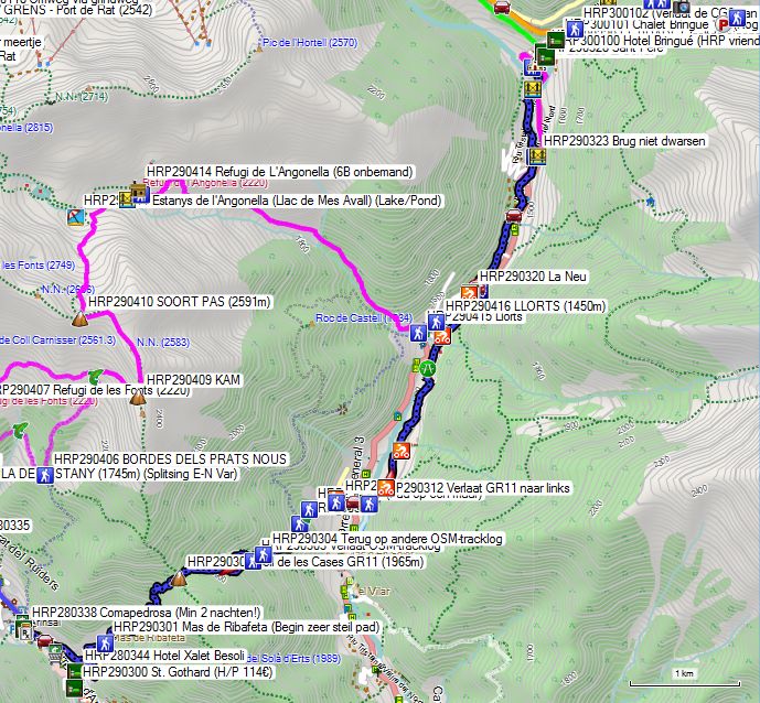
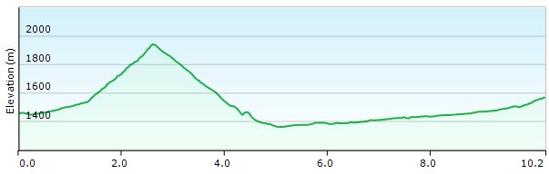
A sort of rest day. Time for shopping and just some rest for your body. Apart from luxury hotels, you won’t find anything in El Serrat. Those who find El Serrat too expensive can seek accommodation at the Refugi de Sorteny, at half the price, but also with half the comfort. If you were already staying in a hotel in Arsinal, that matters less. Refugi de Sorteny is no longer freely accessible, but is now actively operated by the local mountaineering association. In principle, there is a freely accessible section in the basement (status unknown!).
You leave your hotel and head to the intersection of the main street with the Cs-412 or Carretera Mas de Ribafeta. You climb along this road through this neighborhood with apartments for skiers until almost the end of the street. At the last bend, you will find a signpost (HRP290301) at the edge of the forest that leads you away from the asphalt. The climb is very steep. You work up a sweat, but the path is good. The Coll de les Cases GR11 (HRP290302-956m) itself is small and treeless. You will find a signpost there: to the left, you go towards the Pic de Percanela (2495m).
Arans is marked straight ahead. However, the digital map shows two paths straight ahead… You initially follow the right-hand path, but you leave it at GPS HRP290303 (Leave OSM tracklog) to rejoin another OSM tracklog at GPS HRP290304, along which you reach Arans. You pass another fork (HRP290305), where you continue descending to the right towards the stream (HRP290306). After the stream, it is somewhat difficult to find the path (HRP290307). It runs along a wall. You descend further and reach the asphalt (HRP290308) in Arans. You descend (HRP290309) towards the main road (HRP290310) and cross it as well. At a bridge (HRP290311), you will find a signpost (HRP290312) where you leave the GR11 to the left. From here, El Serrat is signposted.
Follow the gravel road to the left, ignoring all steeply climbing turnoffs to the right. At GPS HRP290319, you can either turn left, immediately cross the river, and follow the main road to the right. However, you can also stay a little further along the left bank to cross the river past the iron mine and return about 100m to the left to take a road behind the Hotel La Neu (HRP290320). Here you will find a signpost to El Serrat (HRP290321).
Note: The description in the Cicerone guide directs you onto the road to El Serrat from here. Not very HRP-friendly! You follow the gravel road on the right bank of the river. At GPS HRP290322, you return to asphalt. Follow this to the roundabout. Here too, stay on the right bank and continue straight ahead via a country road (HRP290324), which fades somewhat. At GPS HRP290325, you reach another bridge. There is another one 150m further on. Use either of these bridges to reach the left bank and briefly take the CG-3. You soon leave it on the opposite side for a shortcut (HRP290326) at a hairpin bend in the road. You pass the chapel of El Serrat and reach the asphalt again. The “village” of El Serrat actually consists exclusively of hotels and a ski shop for the higher-lying Arcalis ski area.
Hotel El Pradet/ Bringué (HRP300100):
Those who are smart book here via the Bringué hotel website (HRP300100), where the 4 hotels owned by the same proprietor can be booked. substantially cheaper than the well-known hotel websites. You get half-board for the price of your room! And that makes it acceptable! 4-star luxury at a reasonable price!
Since the restaurant at El Pradet (HRP290329) is closed in the evening, you will still need to eat at Hotel Bringué. Breakfast is also served here. Dinner (8 pm):
Russian salad
Pork with mustard sauce, pasta, and broccoli
Dessert
Bottle of house wine: €14
50cl Mineral water: €5 (so ask for Aqua Naturale or tap water 😦 )
Room with bed and breakfast for 1 person El Pradet: €147 (August 2026)
Room with bed and breakfast for 1 person Btingué: €135 (August 2026)
Bar El Pradet: 1 cola and 2 glasses of wine: €8
Breakfast (07:45, but not everything is ready yet):
Truly fantastic breakfast buffet: bread, croissants, 4 types of charcuterie, smoked salmon, bacon, eggs, sausages, melon, peeled oranges, yogurt, 4 types of fruit juice, coffee, tea… This will keep you going for well over half a day.
Refugi de Sorteny (HRP300111):
Tel : (+376)846446
Rates 2026: Half Board: €70 (2026)
Hut suitable for 40 people, currently operated by the local mountaineering association. In principle, there is a freely accessible section in the basement (8 beds). Reservation required, by phone or via the internet. Power provided by a small generator. Half board and shower available. Credit card payment possible!
About half the prices of Bringué, with half the comfort, but you also lose a resupply point. Sending a package here becomes difficult….
Day 29 (5) REF. COMAPEDROSA –El SERRAT |
17km
|
+1125 | -1825 |
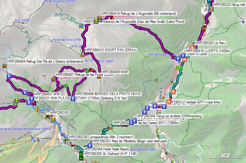
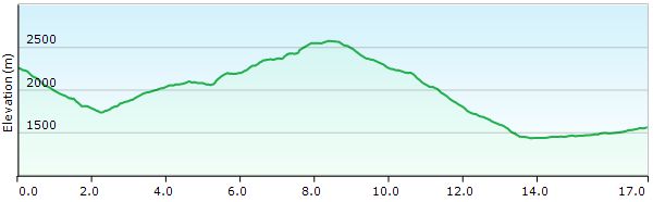
Tracklogs for this variant can currently be found on the digital map up to EL SERRAT. Nevertheless, it remains a route for purists who believe that the HRP in its simplest form is not yet challenging enough. Moreover, several variants are possible, leaving even more room for free interpretation…
You leave the Refugio Comapedrosa and walk towards the Collet de Comapedrosa, where you will find a signpost (HRP280327) back to the hut. Here, turn right. The descent proceeds through steep and eroded terrain. At GPS HRP280328, you cross a river. Shortly after the river, you enter the forest.
The remainder of the path is fairly straightforward. At GPS HRP280329, you will find a first bridge over the Riu de Comapedrosa. At GPS HRP280330, you will find a second bridge over the Riu Pollos. You continue descending to a fork in the gravel road (PLA DE L’ESTANY (HRP280331 – 1745m)). The Cicerone variant ascends here via the gravel road.
You follow the road through 3 hairpin bends until you reach an open area in the forest, where a private hut is located. At the end of this section, you will find a fork in the paths (HRP290401). The path to the right climbs the most evenly. In yet another open area, you will find 2 huts and a fork with a path to the right (HRP290402), near the stream bed. From here, you will find a path to the Refugi de Les Fonts (HRP290407 – 2220), an unmanned hut owned by the municipality. In the Cicerone guide at the time, the choice was made to continue climbing towards the Refugi Del Pla de l’Estany (HRP290404 – 2030), another unmanned hut. At the Pla, you turn right and follow a Sentier en Balcon there. At a fork, instead of climbing towards the Refugi de Les Fonts (HRP290407 – 2220), you turn right, cross the Torrente Ribal (HRP290405), and continue walking to the BORDES DELS PRATS NOUS (HRP290406).
From here, the path goes straight up, first through forest, later through more open terrain until the Refugi de Les Fonts (HRP290407 – 2220), which joins the path (HRP290408). Here, you turn right, towards an unnamed pass (HRP290409) on the ridge. You follow this in a northerly and later westerly direction to another Nameless Species Pass (HRP290410 – 2591). From this pass, you descend in a northerly direction to right next to the Estany de l’Angonella (HRP290411). You descend along the Riu de l’Angonella to the bridge (HRP290412) over this river. On the opposite side, you will find the Refugi de L’Angonella (HRP290413 – 6B unmanned).
From the Refugi de L’Angonella, you descend on the left bank of the river of the same name. You enter the forest and descend further into Llorts (HRP290415).
In Llorts, turn left and reach the asphalt. You follow the main road in a northeasterly direction to the Hotel La Neu, belonging to the same group as the one in El Serrat, but more expensive. Here you will find a signpost to El Serrat (HRP290321).
Note: The description in the Cicerone guide directs you here to the road to El Serrat. Not very HRP-friendly!
Follow the gravel road on the right bank of the river. At GPS HRP290322, you return to asphalt. Follow this to the roundabout. Here too, stay on the right bank and continue straight ahead via a country road (HRP290324), which fades somewhat. At GPS HRP290325, you arrive at another bridge. There is another one 150m further on. Use either of the two bridges to reach the left bank and briefly take the CG-3. You leave it soon on the opposite side for a shortcut (HRP290326) at a hairpin bend in the road. You pass the chapel of El Serrat and reach the asphalt again. The “village” of El Serrat actually consists exclusively of hotels and a ski shop for the higher-altitude Arcalis ski area.
Beyond the church, you will find the Hotel El Pradet/ Bringué.
According to the guide, the route is marked, and in Andorra, the markings are usually of better quality than elsewhere. However, my essential criticism of this variant in the Cicerone guide is that it is far-fetched and artificially difficult, meaning it contributes neither to the safety nor the comfort of the HRP hiker.
Hotel El Pradet/ Bringué (HRP300100):
Those who are smart book here via the Bringué hotel website (HRP300100), where the 4 hotels owned by the same proprietor can be booked. substantially cheaper than the well-known hotel websites. You get half-board for the price of your room! And that makes it acceptable! 4-star luxury at a reasonable price!
Since the restaurant at El Pradet (HRP290329) is closed in the evening, you will still need to eat at Hotel Bringué. Breakfast is also served here. Dinner (8 pm):
Russian salad
Pork with mustard sauce, pasta, and broccoli
Dessert
Bottle of house wine: €14
50cl Mineral water: €5 (so ask for Aqua Naturale or tap water 😦 )
Room with bed and breakfast for 1 person El Pradet: €147 (August 2026)
Room with bed and breakfast for 1 person Btingué: €135 (August 2026)
Bar El Pradet: 1 cola and 2 glasses of wine: €8
Breakfast (07:45, but not everything is ready yet):
Truly fantastic breakfast buffet: bread, croissants, 4 types of charcuterie, smoked salmon, bacon, eggs, sausages, melon, peeled oranges, yogurt, 4 types of fruit juice, coffee, tea… This will keep you going for well over half a day.
Refugi de Sorteny (HRP300111):
Tel : (+376)846446
Rates 2026: Half Board: €70 (2026)
Hut suitable for 40 people, currently operated by the local mountaineering association. In principle, there is a freely accessible section in the basement (8 beds). Reservation required, by phone or via the internet. Power provided by a small generator. Half board and shower available. Credit card payment possible!
About half the prices of Bringué, with half the comfort, but you also lose a resupply point. Sending a package here becomes difficult….
Day 30 El SERRAT –REF JUCLAR |
20km | +2250 | -1525 |
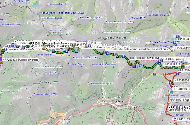
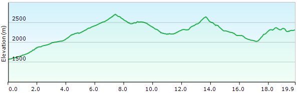
Without rest: 8 hours
Technically a fairly simple stage, which is currently well marked as a regional GR with yellow and red paint markings. Ignore the description in the Cicerone guide.
Leave your hotel and climb up via the CG-3. You pass the even more upscale Chalet Bringue **** (HRP300101). Leave the road straight ahead at the next hairpin bend (HRP300102) via a path to the left of a driveway leading to a country house.
Follow the path uphill for 400m to cross the Riu de Rialb (HRP300103) via a bridge. 300m further on, you cross another bridge (HRP300105) and there you will find a fork (HRP300106), where you keep to the right. Continue uphill southeast to the gravel road (HRP300107). You can either follow the gravel road to the right or use one of the shortcuts, but these are very steep. Once at the top, you pass a small botanical garden (HRP300108 Botanical Garden). The gravel road climbs even further to a car park (HRP300109). The road is closed to the general public here by a gate. Further on, the road fades for a while, but it continues to the Cabane Borda Sorteny (HRP300111).
Refugi de Sorteny (HRP300111):
Tel : (+376)846446
Rates 2026: Half Board: €70 (2026)
Hut suitable for 40 people, currently operated by the local mountaineering association. In principle, there is a freely accessible section in the basement (8 beds). Reservation required, by phone or via the internet. Power provided by a small generator. Half board and shower available. Credit card payment possible!
About half the prices of Bringué, with half the comfort, but you also lose a resupply point. Sending a package here becomes difficult….
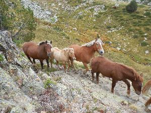 You pass the Cabane Borda Sorteny on the left side. Here you will find a path leading uphill in an easterly direction. It does not coincide with the OSM tracklog, but remains to the left of it. You approach the river and cross the Riu de la Cebollera via a bridge (HRP300113). The route has been diverted away from the channel of the Riu de la Serrera. You reach the side valley itself again after passing through a cattle gate. In sight of the Cabane Pleta Serrera, you turn into the side valley itself and continue climbing upwards. You cross the river at GPS HRP300115. You reach a fork in the paths (HRP300116) and continue on the left bank in a southeasterly direction. At an altitude of 2500m, you cross one of the tributaries. You continue climbing to the COLLADA DELS MENERS (HRP300118). Just past the Col, you will find a hut (HRP300119). You descend through a side gully to the right of the Col, first heading south, then east and north, making a sort of semicircle. Above the Estany de Ransol (HRP300121), you will find a crossroads of paths.
The English/Dutch guide directs you downhill here towards the parking lot and then back uphill towards Cabana Coms de Jan. Once again, a choice whose purpose completely escapes me. The yellow-red marked route stays at a higher altitude better and is therefore physically less demanding. You make a large clockwise turn. At GPS HRP300123, you cross a small pass, after which the descent on the flank begins. 300m further on, you will find another fork, where you continue descending to the left towards CABANA COMS DE JAN (HRP300125). In the final section before the hut, you pass below a steep slope.
CABANA COMS DE JAN (8 beds – unstaffed):
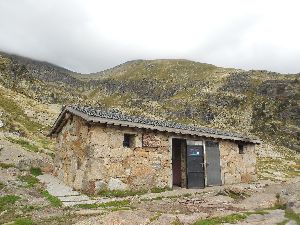
The hut is divided into two sections. In the left section, you will find a wood fire (without wood), and two bunk beds for four people, the two bottom ones having a “6mm mattress” made of closed-cell foam. Better than nothing, but it isn’t much. There is also a table with two benches. The right half has only two bunk beds for four people, without any form of mattress, blanket, or pillow. Each section has a single-pane window and a metal entrance door.
Furthermore, near the hut, there is a black plastic hose carrying a large amount of water coming from the top of the slope. Nothing is known about the quality. Filtering is therefore essential. There are no sanitary facilities. Quite spartan, then…
During the night, wind speeds exceeded 100 km/h under a clear sky, causing it to cool down significantly. In bad conditions, a hut sleeping bag is insufficient here. Dragging along a Thermarest mattress that you will only use for one night is a decision that everyone needs to weigh up for themselves. However, nowadays you can choose the Refuge de Juclar and no longer have to cross the border back to the Refuge du Rulhe, making this stage feasible without the inconvenience of an overnight stay at the CABANA COMS DE JAN.
You pass the hut and continue at the same altitude in an easterly direction towards the riverbed, which you can see from the hut. The first cairn (HRP300126) is difficult to see from the hut, as it is quite far away. Further along, the course of the path is quite clear. At GPS HRP300127, you will find another fork. Here, you follow the ascending path in an easterly direction.
You slowly climb the flank of the mountain. At GPS HRP300129, you cross a first river gully. At GPS HRP300130, a second. At GPS HRP300131 you reach the scree field, and from this point the path can be followed without difficulty to the SERRA DE CABANA SORDA (HRP300132).
 From the pass, you descend steeply to a fork at GPS HRP300133. Here, turn left and stay at more or less the same altitude for 150m, after which the path continues to descend to the small dam of the reservoir. Cross this dam and return towards Refugi de Cabana Sorda (HRP300134).
Refugi de Cabana Sorda:
Unmanned, 12 beds, no mattresses, blankets, or pillows, 2 tables, fire, and BBQ
From the hut, your path, which is quite indistinct, heads south. Lower down (HRP300135), the path becomes clearer.
The path descends in a wide arc towards the valley floor. You will find a signpost at GPS HRP HRP300136.
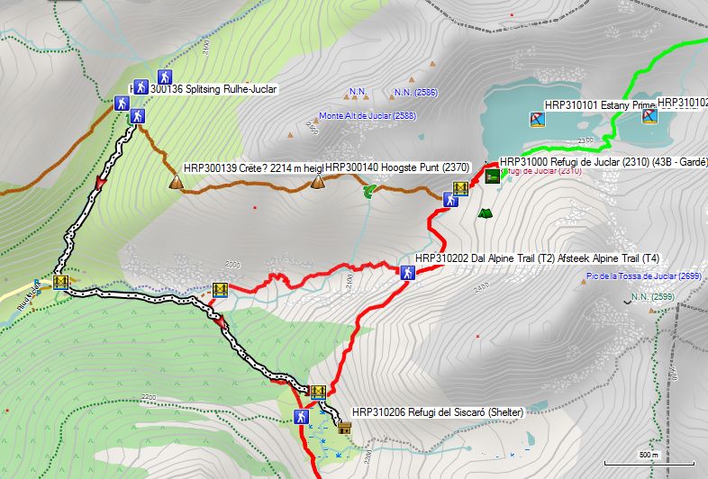
Here the paths towards the Refuge de Juclar and the Refuge du Rulhe split! Unless you wish to leave the HRP, there is no longer any reason to go to the Refuge du Rulhe at this moment. And from the Refuge de Juclar, you can reach l’HOSPITALET. pres d’ANDORRA in half a day.
So, turn right here and cross the Riu Manegor (HRP300137). On the opposite side, you will find the path to the PORT DE FONTARGENTE/PORT d’INCLES (HRP30033). Follow this to the left for a distance of 40m, then leave it for a path (HRP300138) to the Refuge de Juclar.The path is marked with yellow dots. You climb in a southeasterly and later easterly direction. This point of change of direction is referred to as Crête (HRP300139 – 2214m) by the French guide. From there, however, you continue climbing to the highest point (HRP300140), which, according to the digital map, is closer to 2370m.
From there, you descend to the outflow (HRP300141) of a small, unnamed lake. You descend into a narrow valley. Just before the Riu de Juclar, you turn left (HRP300142). 80m further on, you cross two arms of the Riu de Juclar (HRP300143) via a bridge, and continue upstream to the dam and the lake, and via a detour to the Refuge de Juclar (HRP310000).
Refuge de Juclar (HRP310000 – 2310):
Beds: 43
Tel: +376 678145
Half-board: €51 (2026)
Packed lunch: €14
Solar-powered shower, dry toilets.
Alternative via the Refuge Du Rulhe:
The easiest way is to follow the ascending path to the PORT DE FONTARGENTE/PORT d’INCLèS (HRP300339) from the junction (HRP300136) near the Riu Manegor. You will reach the pass without any difficulty.
 The descent to the Etangs de Fontargenta (HRP300341) is difficult due to the extensive bouldering. You can see the hut from afar, but the path to it is challenging. At the end of the lake (HRP300342), where the path curves around the lake, walking becomes slightly easier again. You follow the shore to a gully (HRP300343), leaving the bank behind. At the end of the gully, you do not descend into the green valley but remain on the flank of the slope and within the bouldering field at a more or less constant elevation. In the basin of the Ruisseau de L’Estagnol, the path is relatively leveled, with the stones laid more or less flat. Nevertheless, the path remains difficult until the path intersection leading to the COLLADA DE JUCLAR (HRP300344). Here, you turn left and climb slowly towards Refuge Du Rulhe (HRP310300).
Refuge Du Rulhe: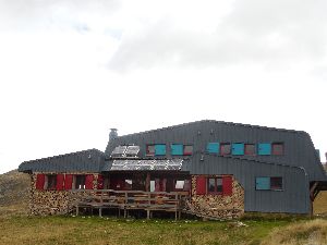

Tel (+33) 561.65.65.01
Showers only from 5 pm: 😦 .
Dinner at 7:30 pm, eventually becomes 8 pm:
Soup
Spaghetti with beef stew
Cheese & cake
Breakfast 7 am:
Bread, muesli, cornflakes, milk, coffee, tea, butter, jam
H/P: €48.00 (2026)
1/2L Wine: €4.80
Four-person room for 2 🙂 (no snoring!!!)
Retrace your steps from yesterday to the junction (HRP300344) between the paths to the COLLADA DE JUCLAR and the PORT DE FONTARGENTE/PORT d’INCLèS. Do not cross the river and continue straight ahead on the right bank of the Laquet (HRP310301). Further on at GPS HRP310302, you cross the outflow of the Etang de L’Estagnole (HRP310303) and continue along the western shore of the lake. You head towards an impressive scree slope, which is largely avoided by the path. The path is well laid out with mule use in mind.
 At the top, you reach a kind of pass and then the Etang de Joclar (HRP310304). You circle this lake clockwise. There are a few technical sections in this zone. The pass you are heading towards is not immediately visible from the lake. The climb itself to the COLLADA DE JUCLAR (HRP310103) is quite manageable. Here you find the connection to the route coming from the Refuge de Juclar.
Route selection stages 31-32:
Juclar – Bouillouses:
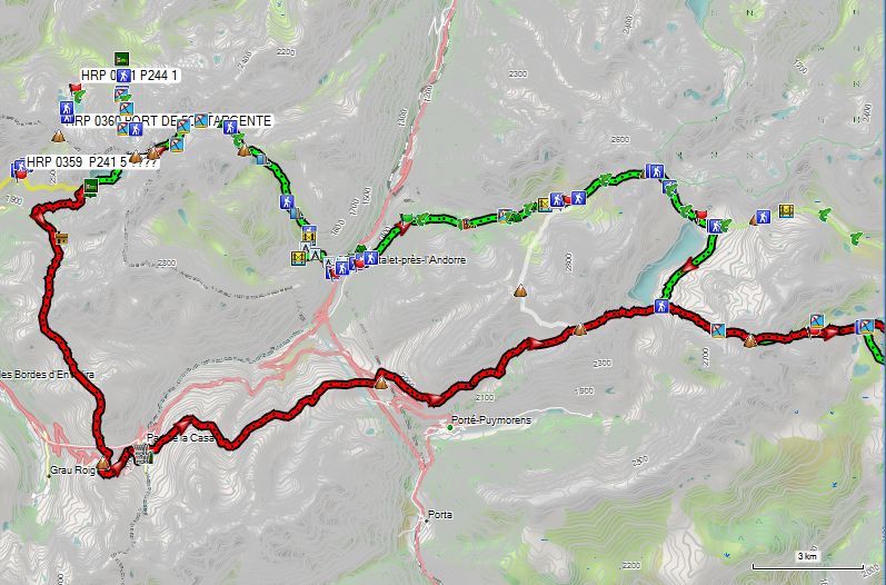
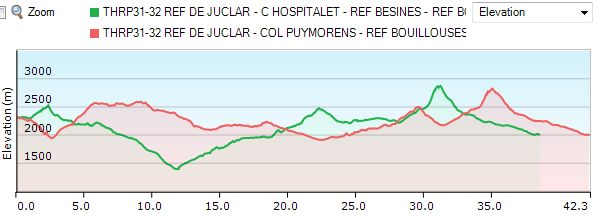
As mentioned before: “All roads lead to Rome, and in this case to Bouillouses, but some are a bit shorter than others!” ;-). And so it is good to take a quick look at the numbers and make an informed choice regarding which route you actually choose. In the French guide by Marrie Millet, there is once again a route choice that, in my opinion, is not very interesting, which I will discuss in more detail later.
- At number one in terms of shortest length and elevation gain is, perhaps surprisingly: Refuge de Juclar – l’Hospitalet – Refuge de Bésines – Bouillouses – excluding the Pic Carlit, with a total length of only 36 km, 1925 m of ascent, and 2225 m of descent. There is a small shop in l’Hospitalet.
- In second place in terms of shortest length and elevation gain is, perhaps surprisingly: Refuge de Juclar – l’Hospitalet – Refuge de Bésines – Bouillouses – with the Pic Carlit, with a total length of 38.5 km and 2,425 m of ascent and 2,725 m of descent. There is a small shop in l’Hospitalet. So you climb an extra 500 m, and on sunny days without the Mistral, you find yourself in the crowds of day-trippers along the side of Les Bouillouses.
- In third place is Marie Millet’s new route: Refuge de Juclar – Pas de la Case – Col Puymorens – Bouillouses – with the Pic Carlit, with a total length of 42.5 km and 2,650 m of ascent and 2,950 m of descent. There are shops in Pas de la Case. The French might be doing some tax shopping there. The question remains which ones are open. Half of the hotels are only open in winter! After all, this is a ski village! An additional disadvantage is that accommodation on the Col Puymorens is only open from mid-June to mid-August, which means you have actually started the HRP too early! So you add 4 km and climb an extra 250 m, and on sunny days without the Mistral, you find yourself in the crowds of day-trippers on the side of Les Bouillouses. Anyone wishing to complete this route outside the mentioned period must look for accommodation at the Porte Puymorens, which adds another 1 km and 150 m of extra climbing to the previous figures.
- At number four is the new route by Marie Millet: Refuge de Juclar – Pas de la Case – Col Puymorens – Bouillouses – without the Pic Carlit, with a total length of 46.0 km, 2,375 m of ascent, and 2,675 m of descent. Compared to option one, that means climbing an extra 10km and 550m. Moreover, the same remarks regarding overnight stay apply as under option three!!!
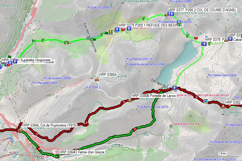
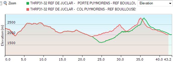
HRP31-32 REF DE JUCLAR – REF BOUILLOUSES (mt Carlit – detour if accommodation on the Col Puymorens is closed!)
Note: Given the obvious disadvantages of the route over the Col Puymorens, it will not be discussed further in this report. Anyone who does not find the HRP in its simplest form sufficiently challenging can do the extras at their own discretion!
Day 31 REF JUCLAR – HOSP. pres d’ANDORRA – REF BESINES |
14km | +600 | -1400 |
Without rest: 8 hours; with rest: 9 hours 30 minutes
You leave the Refuge de Juclar (HRP310000) and walk east along the southern bank of the Estany Primer de Juclar (HRP310101). At the end of this, the path turns north and passes between the Estany Primer and Segon de Juclar (HRP310102). You cross the connecting river and climb north and later northeast to the Collada de Juclar (HRP310103). You do not cross this pass, as that would take you to the Refuge du Ruhle (HRP310300), but return to the upper reaches of the Riu de Juclar. At the second of 3 small lakes, you climb to the PORT DE L’ALBE (HRP310104) on the ridge between the Pic de Ruf and Pic de Noè.
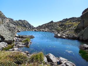 The descent from the Port de L’Albe is very difficult due to the many boulders. You descend via the left side of the lakes in succession: Etang Haut de L’Albe (HRP310105), Etang Bas de L’Albe (HRP3100106), and Etang de Couart (HRP310108). At the end of this lake, you will find nice camping spots (HRP310110). Just before the end of the flat part of the valley, you must go up the wall to the right. There is no signpost, only a white and red painted St. Andrew’s cross (HRP310111), a few meters past the turn.
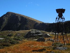 Once above the edge of the plateau, you see an old, rusty rain gauge. You pass the base of this gauge, after which the path becomes somewhat difficult to follow again. The pass itself is clearly visible, and once above the Couillade de Pédourés (HRP310113), the path becomes clearer once more. You descend along the flank of the ridge and then make a wide turn around the lake, before descending towards the floor slab of a demolished building. Here you pass a small waterfall, marred by a concrete channel.
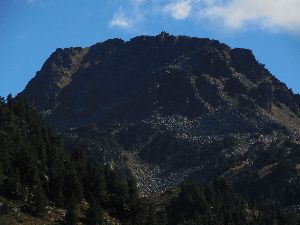 The GR trail follows the left bank of the river. Please note: there is also another path (HRP310116) to the right, which crosses the river and continues towards the start of a gravel road leading down to the valley.
You head towards the left side of a small dammed lake (HRP310118). You will need to ascend slightly to pass the dam.
You continue descending along the river to a historic stone bridge (HRP310120). You pass under a pipeline (HRP310121) carrying water for a hydroelectric power plant in the valley. You descend further towards a side valley of the RUISSEAU DE SICA, where you also cross the river via another stone bridge (HRP310122 (Signpost)), to follow it downstream on the other bank. You pass under the pipeline (HRP310123) twice more and descend further to a signpost (HRP310124), which indicates a renovated path towards Hospitalet. This path leads to the N20 (HRP310127).
In the village street you will find: Gite L’Hospitalite (HRP310132).
Gite L’Hospitalite:
Tel (+33) 674.87.05.05
Dinner (7:30 pm):
Quiche
Lasagna
Cheese and dessert
Wine included at the table (cheap French, always less good than Spanish)
Lots of calories, but practically no vegetables… and that for a gite in the valley!
Breakfast (8 am):
Bread, rolls, butter, jam, coffee, tea, cocoa, milk (be sure to ask for extra bread).
Half-board: Prices not listed on the website (no propietor website found). (in a shared room, which you will probably have to yourself during the low season
in a single room.)
After shopping or picking up a parcel at l’Hospitalet station (HRP310129), cross the tracks and turn right onto the main street in front of Hotel Puymorens (HRP310131). You pass Gîte l’Hospitalité (HRP310132) and then turn left. Continue to the signpost (HRP310133) at the foot of the stairs, which marks the beginning of the path to the Refuge de Besines. The first part of the climb is quite rough, but further along it ascends very gradually.
At GPS HRP310134 you cross the N22. On the opposite side, the path runs parallel to the N22 for about 50 meters before separating from the road and climbing further up. At GPS HRP310135, you have a view over the valley and take a hairpin bend to the right.
Higher up, you reach a road (HRP310136), where you turn left. 400m further on, you will find the junction (HRP310137) between the path to the Refuge de Besines (HRP320100) and the Col du Puymorens (HRP320200), where you turn left.

At GPS HRP310138, the path turns into the side valley. You cross two streams and then reach the first of a series of cattle gates (HRP310141). A kilometer further on, you reach the dam of the Etang Des Besines (HRP310142). You follow the lake along the southern shore. This spot invites you to camp (HRP310144), provided you can share it with the cows. Be careful with low footwear for muddy sections caused by tributaries.
At GPS HRP310145, you cross a larger tributary of the Etang Des Besines, namely the Ruisseau de Coume D’Or. 450m further on, you cross the Ruisseau de Coume D’Agnel via a bridge (HRP310147). Here you begin the final climb to the Refuge de Besines. Just below the hut, you will find a signpost (HRP310148) indicating the fork between the GR10 and the GR107C from Hospitalet. Just behind the hut itself, you will find the signpost to Merens-Les-Vals (HRP310149 – GR10).
Refuge de Bésines (CAF – HRP320100 – 2104m):
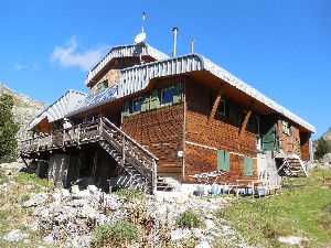
56 beds
Tel (+33) 9 88 77 35 28
(+33) 6 85 77 64 47
Rates 2026:
Overnight stay: €10.50 (2026)
Breakfast: €11.50 (2026)
Dinner: €22.50 (2026)
Packed lunch: €14
Note: Reservations are highly recommended, especially on weekends. Given that the hut is easily accessible, it is also popular with groups of schoolchildren. At the time of our visit to the hut, the entire upper floor was occupied by schoolchildren with their supervisors, and we were directed to the winter room. However, the downstairs sanitary facilities remained closed, meaning we had to use the upstairs facilities for the morning rush.
Dinner (7:30 PM):
Soup
Stew with mashed potatoes
Cheese and dessert
Breakfast (8:00 AM – together with the group):
Bread, cornflakes, toast, jam, butter, coffee, tea, cocoa (a bit low-fat, end of season in combination with the amount needed for a group of schoolchildren?)
Day 32 REFUGE DE BESINES – REFUGE BOUILLOUSES (GR) |
15,5km | +800 | -850 |
Without rest: 6h15’ with rest: 6h30’
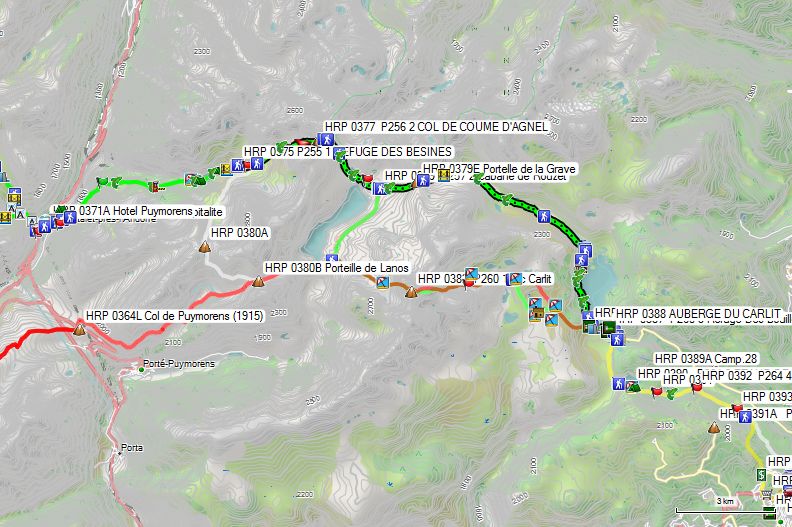

Alternatives:
- (Green – red) Refuge de Besines – Refuge Bouillouses via the Cabane de Rouzet and the Pic Carlit: 18.8km – +1250m -1300m. Strange, unpleasant, and steep climb with a risk of rockfall. Whether it makes sense to undertake this with a multi-day backpack remains a philosophical question. In good weather conditions, you will encounter day-trippers on the descent who attempt the ascent from Les Bouillouses with daypacks and often unsuitable equipment. In any case, it does not make sense to undertake this under any conditions other than the most optimal. Be especially careful with wind (Mistral) and/or rain.

- (White – red) Refuge de Besines – Refuge Bouillouses via the Porteille de Lanos (HRP 0380A) and the Pic Carlit: 18.1km – +1250m -1300m. 700m shorter with the same elevation difference. Regarding the Pic Carlit, the same remarks apply as under 1.


 From the hut (HRP320100), descend to the signpost below the hut (HRP310148), where you turn left. The first part is fairly flat and pleasant, until the junction between the GR and variant 2) via the Porteille de Lanos (HRP320101) and the Pic Carlit. After that, the terrain gradually ascends, and from GPS HRP320103 the terrain becomes very rocky up to the COL DE COUME D’AGNEL (HRP320104).
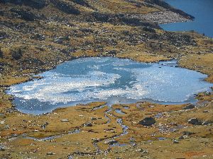 On the DE COUME D’AGNEL, do not be misled by the paint markings on the wall of the ridge. Focus on the clearly visible path in the flat section. The path remains flat until GPS HRP320105. At GPS HRP320106, you will find another fork, where you turn right. Subsequently, it descends quite steeply to the Estany de Lanoset (HRP320109), which stands out due to the lush vegetation just below the surface.
From the edge of Estany de Lanoset (HRP320109), the path continues through rocky terrain towards the edge of the Estany de Rouzet (HRP320110). From there, it ascends slightly towards the Cabane de Rouzet (HRP320111).
Cabane de Rouzet (HRP320111):

Empty stone building with a steel door. The area is heavily polluted by users, mainly fishermen.
Those wishing to take the variant towards Pic Carlit circle Lac Lanoux here in the direction of GPS HRP320210.
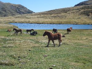 The GR ascends to the wide pass named Portelle de la Grave (HRP320115). The path is clearly visible on the slope below the col due to erosion. Consequently, the climb is quite steep and straight.
200m past the col, the path makes a noticeable bend to the right (HRP320116) and then to the left, before descending further towards Lake L’Estagnol (HRP320118). The landscape here is very attractive. Wild horses are often found around the lake. The terrain is flat. Shortly after the lake, you cross the outflow of L’Estagnol (HRP320117).
 Next, you descend into the main valley (HRP320119) of La Grave, which is also scenically very attractive. After the confluence with the Llosa, the river’s name changes to La Tet. You follow this valley to the Lac des Bouillouses (HRP320134). La Grave meanders. You will find a path close to the riverbank and sometimes a path that stays slightly higher up the slope.
From GPS HRP320123, you will encounter many day-trippers on sunny days. You follow the lake shore to the dam. Here you will find the Hotel Les Bones Horses (HRP320131). Next, you cross the dam or follow the road just below the dam.
You will find a huge parking lot here. Close to the lake, you will find the AUBERGE DU CARLIT (HRP3201315) and, slightly lower down, the CAF Refuge Des Bouillouses (HRP330000).
Refuge Des Bouillouses (HRP330000):
The hut is no longer owned by the CAF, but by the municipality. Very difficult to find correct information. It was supposedly closed for renovation until June 2023.
45 beds – refugedesbouillouses@gmail.com or contact@pyrenees-catalanes.com
Tel (+33) (0)4 68 04 49 86
Often fully booked on weekends and sunny days.
Alternatief:
HOTEL LES BONES HORES (HRP320131):
LAC DES BOUILLOUSES
66210 MONT LOUIS
Tél: +34 607159518
Rates: Half board from €69 single room, €63/ppn for two in a room. (2025)
Dag 33 REFUGE BOUILLOUSES – EYNE (winkel) |
17km | +350 | -700 |
Without rest: 3h45’ with rest: 4h00’
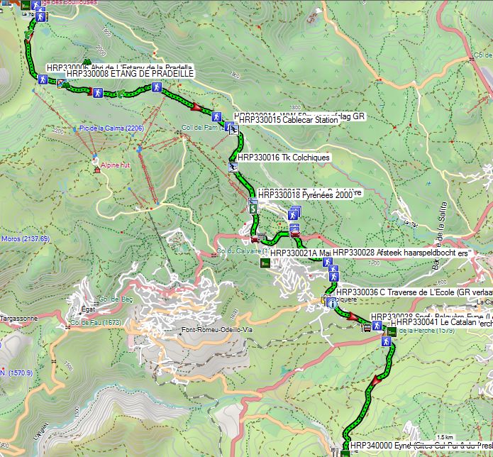
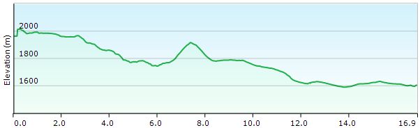

You leave the inn (HRP33000) and walk behind the building. Here you will find the GR trail, which you follow through the forest until it crosses the road. Next, you also cross the river (HRP330003). You follow a faint path (HRP330004) along the edge of a flat meadow area, crisscrossed by small streams, resulting in a sometimes muddy path.
At the Abri de L’Estany de la Pradella (HRP330006), which is in practice used as a cowshed, you turn right to continue your way (HRP330007) on a path to the left of a fence.
At the end of the lake (HRP330008), you enter the forest and the descent begins. In the sections where the path drops steeply, it is also heavily eroded, resulting in many loose stones. This makes for very unpleasant walking. In those sections, therefore, you have to search for a bit of soil between the stones or a path at the edge of the forest.
From the intersection of gravel roads at GPS HRP330013, this is over. From here, you follow a road that remains at more or less the same elevation on the flank and is easy to walk on.
At GPS HRP330014, you will find a signpost, and a little less than 50m further on, the GR leaves the gravel road for a descending path that winds its way along the back of the gardens of the ski accommodation in the ski village of Super-Bolquère.
In doing so, however, you miss an ATM and a good opportunity to do some shopping. It is therefore better to stay on the gravel road at the GR turn-off near a ski lift upper station (HRP330015) and descend a ski slope in a southeasterly and later southerly direction to the next ski lift (HRP330016), which you then follow again in a southeasterly direction to the valley station of Pyrénées 2000 (HRP330018). Walk to the car park, where you should find an ATM (HRP330020). Continue descending via the Avenue du Serrat de l’Ours, which you follow downhill to the roundabout (HRP330021) with the D618. Follow this to the left via the lateral road, which leads you to the Intermarché (HRP330022). After shopping, follow the D618 again in an easterly direction to the next intersection (HRP330027), where you rejoin the GR. Here, follow the smaller D10C downhill to the right for 1 km.
Shortly after a nearly right-angled bend to the right, leave it to the right via a path (HRP330028) that cuts across a hairpin bend in the road. At the end, the path is muddy. At GPS HRP330029, cross the D10C and continue straight ahead to GPS HRP330030.
From here, follow the D10C again to the entrance of Bolquère. At the fork, turn left and take the lowest road (Rue Du Stade) and then the Rue Du Ruisseau. At the end of this, you rejoin the D10C (HRP330035), which you follow to the left until Traverse de L’Ecole (HRP330036). Here, the GR leaves the D10C to return to the D10C (HRP330039) via a 900m detour at the Yellow Train station (HRP330038 Sncf: Bolquère-Eyne). By doing so, you also miss the information panel about the GR10 at GPS HRP330037. It is therefore easier to simply continue following the D10C to the Col de La Perche (HRP330040).
Here you leave the GR10, which goes to the left. 100m to the left on the N116, you will find Hotel Le Catalan (HRP330041).
Hotel Le Catalan:
- Col de la Perche
- 66210 La Cabanasse
- 04 68 04 21 83
- contact@hotel-lecatalan.com
Double room: €79 to €99 (2024)
Continue straight ahead and follow the D33 for 3 km into the village of Eyne. You can reach the Gite du Presbytère (HRP340000) by taking the road uphill to the left at a fork in the road at the entrance to the village and walking up to the base of the bell tower.
Gite du Presbytère – Gites Cal-Pai :
Carrer del Ventador,
66800 Eyne
bonjour@gite-calpai.com Tel (+33) 608.82.00.99
H/P: €85 p/n individual – €70 p/n (couple) (2024)
Contrary to what is stated in the guide and on the website, no meals are provided here outside the ski season. It is abundantly clear that these refuges make their money during the winter season and that those few stray HRP hikers are tolerated there, but no extra effort will be made for them.
Those arriving here between Friday and Sunday afternoon can still find something to eat at the bar/restaurant (HRP 0400A) at the parking lot at the end of the village. At lunchtime, you can get a daily special here on the days mentioned; in the evening, only tapas. Those passing through during the week will have to bring their own food from the FOOD STORE OPPOSITE THE POST in Bolquère (or the Intermarché for a wider selection) and prepare it in the hikers’ kitchen, or go to the Hotel Le Catalan mentioned above. This does extend the next day’s stage by 3 km.
I sent 2 emails to the mailbox of www.gite-calpai.com, but never received a reply. Overnight stay at Presbytère: €23 (money left on the nightstand, no one home in the Calpai gite in the evening (also the owners’ residence, accessible via the metal stairs outside going up past the Presbytère))
Restaurant L’Indret (HRP330043):
Now with different owners and possibly longer opening hours!
Daily special: Belgian (yes, really) stew with fries: €10.90 (2015)
Glass of wine: €1.80 (2015)
Various (Belgian) beers available.
Shop in bar (2015):
Bread: €1.80
Jam: €2
Can of Ravioli: €2.10
Info point next to the bar:
Bottle of organic wine: €8.10 or €9.90
Day 34 EYNE – REFUGE ULL DE TER |
19,5km | +1700 | -1050 |
Without rest: 6h30’ with rest: 7h30’
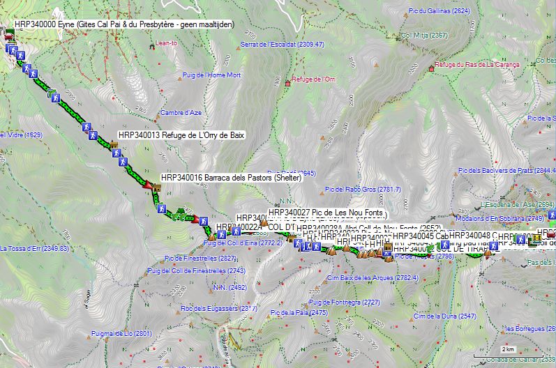
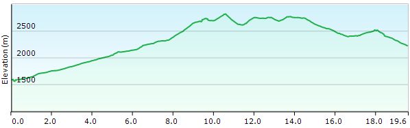
You leave the inn (HRP340000) to the left and go uphill for a few meters before descending towards the D33. You follow the D33 200m to the left and cross the river there (HRP340002). 50m further on, you leave the road to the left via a gravel road (HRP340003). 150m further on, you leave the gravel road to the right (HRP340004). The route is marked by wooden posts with signs bearing green arrows. 250m further on, you turn right again (HRP340005). 500m further on, you reach a gravel road (HRP340006), which you follow to the left. 250m further on, you reach a cattle gathering point (HRP340007). You circle around the pen and do not descend to the Coma D’Eina, but remain at the same level via a path. 750m further on, you cross the Mas Rondole (HRP340009). You leave the forest and continue through grassland. An information sign urges you to exercise caution towards the cattle. At an altitude of 2050m, you spot the Refuge de L’Orry de Baix (HRP340013) on the opposite side of the river. 300m further on, at GPS HRP340014 and a small waterfall, the path turns right around a small hill by the river. You can also continue following the river and then return to the main path a little further up, climbing steeper uphill at GPS HRP340015.
 At GPS HRP340017, you cross a major tributary of the Coma D’Eina and continue uphill between the two riverbeds to GPS HRP340018, where you find a clear path again. At GPS HRP340019 and HRP340020, you cross two smaller tributaries. At GPS HRP340022, the path makes a noticeable bend to the right and left before climbing further via a heavily eroded path to the COL D’EYNE (HRP340022A).
 Apart from a few posts marking the boundary of the Reserve Naturelle de la Vallee D’Eyne, you will find few signs here. You proceed by sight to the Pic D’Eyne (HRP340024); initially it is pathless, but higher up you will find a trail. From GPS HRP340023, you can also stay on the southern flank.
At the Pic D’Eyne, turn right and descend slightly to a saddle between the Pic D’Eyne and the Pic de Les Nou Fonts (HRP340025), to then climb to the Pic de Les Nou Fonts (HRP340027) itself. At GPS HRP340026, you will find a sheet metal post (CEF) with a container holding the summit book. The actual summit cable (HRP340027) is a little further on. Just before this cable, you will find a path that leaves the ridge to the right. The first part is somewhat steep and technical, but further down the path becomes easier. You descend further to the Coll de Nou Fonts (HRP340028), where the GR11 from Nuria joins the border ridge. A little above the pass, you will find the Abri Coll de Nou Fonts (HRP340028A). The white and red markings cause some confusion here.
 You will find a path along both the French side (easier) and the Spanish side (somewhat more difficult). The Spanish path goes over a small peak at GPS HRP340030 (2798.4), whereas the French path goes around this peak. Both paths rejoin at GPS HRP340031. Next, you go below (HRP340032) the Pic de Noucreus (HRP340033) towards COL DE NOU CREUS (Col des Neufs Croix) (HRP340035), recognizable by the nine crosses. From the Col, it goes downhill towards Coll de Carangà (HRP340037), recognizable by the signpost to the Refugi Coma de Vaca (ca. 2000m – 1u22′).
 After the pass, the route ascends again towards the highest point (HRP340038) on the western flank of the Pic Inferior de la Vaca (HRP340039). You round the Pic along the south side and then leave the border at the Col de la Vaca (HRP340040) in a southerly direction to round the COL DE TIRAPITZ (HRP340042) there. On the other side, you descend towards the junction (HRP340043) to Cabana de Tirapits (HRP340045) and the path below (HRP340044) the Cabana de Tirapits (HRP 0409B).
From here, the path descends in a southeasterly, easterly, and later northeasterly direction. You cross a stream twice. At the second one (HRP340047 El Freser), you will also find painted markings (HRP340048) to the Refugi Coma de Vaca (approx. 2000m). From here, follow the path uphill along the flank to the COLL DE LA MARRANA (HRP340049). The descent is particularly remarkable. The white and red markings follow a route through a scree field just below the pass. However, there is also a path that makes a 180° counterclockwise turn right up against the flank of the mountain face and then down into the basin. In the basin, the path markings are rather vague until the Refugi Ull de Ter (HRP350000), due to the presence of a ski slope.
Refugi Ull de Ter (HRP350000):
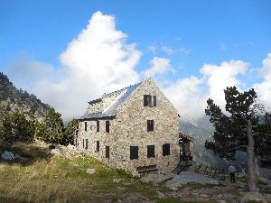
52 beds
Tel (+34) 972.192.004
(+34) 619 514 159
Half-board: 59€ppn (2026)
(open from mid-June to mid-September, after that only on weekends or with a minimum of 8 people).
If not open, you can go to the open hut: Refugi LLiure, Ull de Ter winter room (HRP 0411A – free – mattresses, blankets, table and a few chairs, water point at the bottom of the main hut, food to be provided by yourself of course)

It was really annoying that the hut manager was present to work on the hut, but apparently lacked the commercial sense to welcome us to the main hut.
Day 35 REFUGE ULL DE TER – REFUGE MARIAILLES |
22km | +600 | -1100 |
Without rest: 6h30’ with rest: 7h00’
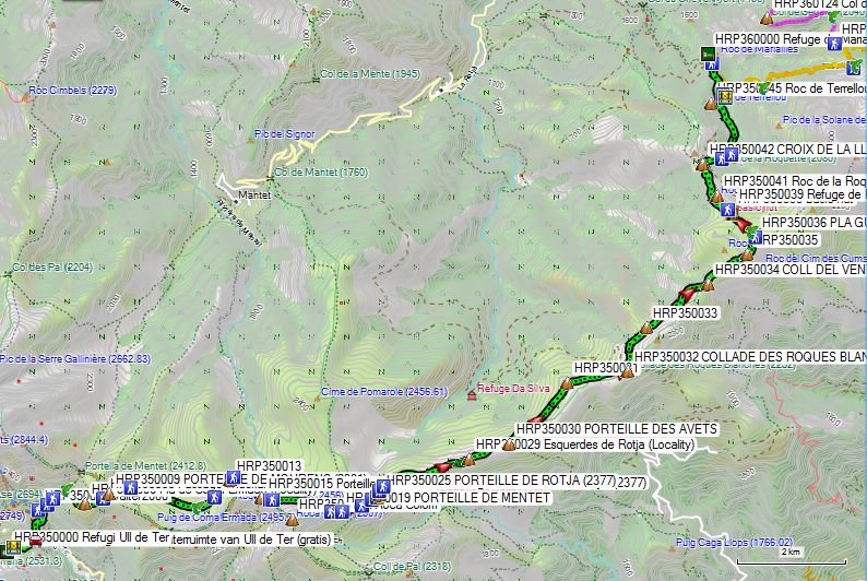
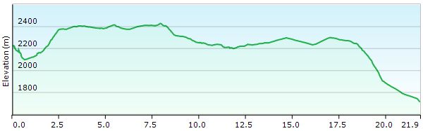
You leave the hut and pass underneath the building, past the drinking trough with a water point. You descend via the path and cross the Riu Ter via a bridge (HRP350001A). The path ends on the asphalt at a hairpin bend (HRP350001B) on the road to the Vallter 2000 ski resort. On the asphalt, turn left. At the very next bend in the road, near a stream, you already have the option to take a shortcut via a steep path to the higher hairpin bend. You can also do this at the next hairpin bend, or simply follow the asphalt.
Once at the top, at the parking lot with the ski resort buildings, you need to go behind the buildings to find a faint jeep track (HRP350002) in the grass that goes uphill. The track ends and turns into a path. You will find the first white and red markers at GPS HRP350003. You climb upwards via a path that is initially heavily eroded. After wading through the Torrent de la Portella (HRP350005), the path improves substantially. At GPS HRP350006, you have reached the top. Here, the color of the markings changes from the Spanish white-red of a variant of the GR11 to the yellow-red of the French Ronde du Canigo (RC) or Tour de Réserves (TR).
At GPS HRP 0412C, you will see a path diagonally to the right that ascends slightly into the mountain flank and forms an unmarked shortcut off the official path. The marked route continues straight ahead for a short distance to the PORTEILLE DE MOURENS (HRP350009), where you will find a signpost to the right. At GPS HRP350010, the shortcut rejoins the main path. Subsequently, the path turns in a southeasterly direction. After a dry riverbed (GPS HRP350011), the path continues in a northeasterly direction. You head towards the highest point (GPS HRP350013) and then turn right (GPS HRP350014). At the Porteille des Caillau (GPS HRP350015), you will find a post marking the boundary of the Mantet Nature Reserve. Here, you do not ascend steeply towards Roca Colom (GPS HRP350017A), but take the highest path (GPS HRP350016) along the flank towards the open pass Porteille de Mentet (GPS HRP350019).
 At GPS HRP350018 you will find the last marker on the terrain around the PORTEILLE DE MENTET, and at GPS HRP350020 the first. From the PORTEILLE DE MENTET, the path becomes somewhat indistinct. You switch from the French side to the Spanish side to return to the French side at the PORTEILLE DE ROTJA (GPS HRP350025). The OSM tracklog is inaccurate here. You do indeed pass through the small gate at the PORTEILLE DE MENTET towards France. On the French side, you will see a signpost standing in the scree slope (GPS HRP350026). You descend towards it and continue at the foot of the slope to return to the border ridge. You reach the PORTEILLE DES AVETS (GPS HRP350030). You leave the ridge again and pass a partially wooded and rocky spur inland into France (GPS HRP350031), where progress is quite difficult. At the COLLADE DES ROQUES BLANCHES (GPS HRP350032), you return to the border ridge. Here you follow the gently rising gravel road, which is not very pleasant to walk on, given the abundance of loose stones on the surface. At GPS HRP350033, you reach the highest point, after which the path descends again towards COLL DEL VENT (GPS HRP350034).
From the pass, a heavily eroded track leads uphill again to GPS HRP350035, after which the terrain levels out and the road disappears into the landscape. A faint trail leads you to a signpost (GPS HRP350036 PLA GUILHEM) at a crossroads on an otherwise barren plain. At the signpost, turn left and the marking changes from yellow-red to the white-red of the GR10. You cross a dry riverbed (GPS HRP350037) and continue in a northwesterly direction. Strangely enough, the cairns are located on the terrain at some distance from the trail. You pass the Refuge de Pla Guillem at some distance (unmanned stone hut, 20B, no water, no blankets! – GPS HRP350039). Via a ridge, you descend towards CROIX DE LA LLIPODERE (GPS HRP350042), where you reach a gravel road. You cut across the hairpin bends in the road via a heavily eroded path until you reach the road again at GPS HRP350044 and follow it to the left towards a crossroads of gravel roads (HRP350046). Here you descend further towards the Refuge de Mariailles (HRP360000).
Refuge de Mariailles:

55 beds
refuge.mariailles@gmail.com mjordronneau@wanadoo.fr
Tel (+33) 468.05.57.99
Tel (+33) 468.96.22.90
Dinner (7:00 PM):
Pea soup
Sausage with mashed potatoes
Cheese, dessert
Breakfast: (6:30 AM):
Bread, pastries, butter, jam, coffee, tea, cocoa
Half-board: €51.00 (2026)
5’ Shower: €3.00 (2026)
1/2L Red wine: €6
Reservation: €15 (deposit)
Route selection stages 36-37:
MARIALLES – CORTALETS/BATERE:

Important notice:
The Refuge de Cortalets is closed for renovation work from the summer of 2026 until at least 2028!!!!
As a result, this option is no longer available; you must choose an overnight stay at the Gîte de Batère, after which you can still choose to descend to Amélie-Les-Bains.
Considerations regarding route choice and stage division:
As mentioned earlier, I am not a fan of including peaks in the planning of a long and inherently difficult trek, as this only increases the difficulty level.
Anyone wishing to attempt the summit of the Canigou can only do so safely in good weather conditions and preferably with a backpack that is not too heavy. It is recommended to split this stage into two parts with an overnight stay at the Refuge des Cortalets. This way, you also have two days during which you can attempt the summit depending on the weather conditions.
(However, since this hut is closed until summer 2028, this option is no longer available!)
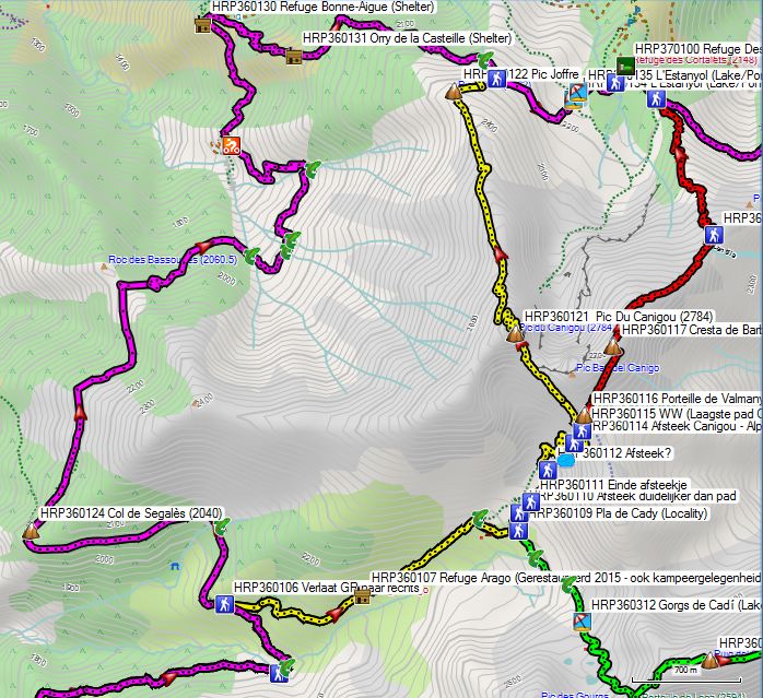
Four options:
- Day 36: REFUGE MARIAILLES – GITE BATERE (Red) (without Pic de Canigou, but via the ridge): 26km +1450m -1700m: Clearly the shortest distance with the smallest elevation difference. If the Mistral does not blow you off the ridge, this is the only option that is still easy to complete in 1 day. Note that the highest point of the ridge is only 70m lower than the Pic. Anyone passing here when the Mistral is blowing may encounter wind speeds of over 120km/h and wind chill temperatures well below freezing. Anyone passing here in such conditions, with or without summer gloves, will already experience the first symptoms of frostbite on a descent of barely 250m performed at a light jog. In such circumstances, you really don’t want to be on the Canigou itself, where the technical conditions, especially on the climb from the Gite de Mariailles, are more difficult, resulting in a slower terrain speed and thus a greater risk of more severe frostbite.

- Day 36 REFUGE MARIAILLES – GITE BATERE (Yellow) (with Pic de Canigou): 27.5km +1450m -1600m: 1.5km longer than the ridge route, with a negligible elevation difference. The technical difficulty is higher, particularly on the climb (T3 – II+), meaning you are exposed to the elements for longer. Only under the most ideal conditions and preferably with an overnight stay at the Refuge des Cortalets (Closed until summer 2028!).
- Day 36 REFUGE MARIAILLES – GITE BATERE (Green) (without Pic de Canigou, without Refuge des Cortalets!): Only 17.5km! +1325m -1550m: Clearly the shortest variant, with the smallest elevation gain. Ridge route, making it only safe in very good weather conditions. Only cairns and very isolated! Self-reliance necessary! Most difficult part T3 and II+ such as the Pic du Canigou!

- Day 36 REFUGE MARIAILLES – GITE BATERE (Magenta) (without Pic de Canigou, but via the GR10): 31km +1750m -2000m: Clearly the longest variant, with the highest elevation gain. However, it remains below 2267m, making it safe in bad weather conditions. GR10 markings. The Refuge des Cortalets is closed until summer 2028! Note: This option is not described further.

Day 36 (1) REFUGE MARIAILLES – REF CORTALETS (zdr Canigou) |
11,5km | +1100 | -650 |
Without rest: 5h00’
You leave the Refuge de Mariailles (HRP360000) and climb back to the signpost at the car park (HRP350046). There, take the descending path towards Canigou. You descend to the river Llipodere, which you cross via a bridge (HRP360102). Next, you begin the slow climb towards Canigou. At GPS HRP360103, you cross a first periodic stream. Further on, you cross the main river in this side valley via a ford on the river Cady (HRP360105). The route here is rather unclear. On the other side of the river, you will see a wall. Follow the path up this wall to the left. 600m further on, you reach the junction (HRP360106) between the GR10 and the path to Canigou. Refer to point 3 above regarding this.
 Leave the GR10 to the right and continue your climb towards Canigou. After 1 km, you reach the Refuge Arago (HRP360107). It was restored in 2015. Camping facilities are also available here. In the next section, the path is somewhat difficult to follow due to the undergrowth. Just under a kilometer past the hut, you cross a tributary of the Cady River (HRP360108). The main path continues here in an easterly direction towards the Pla de Cady (HRP360109). Here, continue in a northerly direction. At GPS HRP360110, you reach a shortcut that is clearer than the original path. At GPS HRP360111, you are back on the original path.
At GPS HRP360112, you reach the foot of the wall. Higher up (HRP360113), you will find another spring. The path is in good condition.
At GPS HRP360115, you reach a fork in the path, which is marked only by painted markings on relatively small stones. The lowest path leads you to the Pic de Canigou (HRP360121).
The highest path leads towards Porteille de Valmanya (HRP360116) and then the ridge. In this regard, please refer to the remarks formulated under points 1 and 2.
Via the highest path, you reach the Porteille de Valmanya without difficulty, and from there you can see the path along the flank of the ridge to the highest point on the ridge, the Cresta de Barbet (HRP360117).
In the event of a mistral wind, this section can be dangerous, given that the path descends over a distance of 250 vertical meters right up against the edge of the ridge. You leave the edge of the ridge at GPS HRP360118 and descend in a northerly direction. Once you reach the forest zone, the path becomes somewhat less defined due to shortcuts. At GPS HRP360120, you rejoin the GR10. You reach the Refuge des Cortalets by going 300m to the left.
Refuge des Cortalets (HRP370100 – CAF):
The Refuge de Cortalets is closed for renovation work from the summer of 2026 until at least 2028!!!!
112 Beds (open from late May to mid-October) Reservation recommended.
Tel (+33) 468.96.36.19 (hut)
Overnight stay in a bunkbed: €12.22
Half-board: 38 + €12.22 (bunkbed) (members)
Day 36 (2) REF. MARIAILLES – GITE BATERE (without Canigou) |
26km | +1450 | -1675 |
Without rest: 9:00 with rest: 9:30.
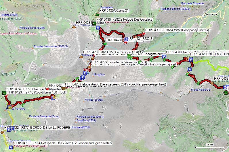
Reflections regarding route selection and stage division:
As mentioned earlier, I am not a fan of including peaks in the planning of a long and inherently difficult trek, as this only increases the difficulty level.
Anyone wishing to attempt the summit of the Canigou can only do so safely in good weather conditions and preferably with a backpack that is not too heavy. It is recommended to split this stage into two, including an overnight stay at the Refuge des Cortalets. This way, you have two days during which you can attempt the summit depending on the weather conditions.
The Refuge des Cortalets is closed for renovation work from the summer of 2026 until at least 2028!!!! An overnight stay at the renovated Gîte de Batère is essential. As a result, a passage over the Pic du Canigou is even less advisable! Day 36 REFUGE MARIAILLES – GITE BATERE (without Pic de Canigou, but via the ridge): 26km +1450m -1700m: Clearly the shortest distance with the smallest elevation difference. If the Mistral doesn’t blow you off the ridge, this is the only option that is still easy to complete in one day. Note that the highest point of the ridge is only 70m lower than the Pic. Anyone passing here when the Mistral is blowing may encounter wind speeds of over 120 km/h and wind chill temperatures well below freezing. Anyone passing here in such conditions, with or without summer gloves, will already experience the first symptoms of frostbite on a descent of barely 250m performed at a light jog. In such circumstances, you really don’t want to be on the Canigou itself, where the technical conditions, especially on the climb from the Gite de Marialles, are more difficult, resulting in a slower terrain speed and thus a greater risk of more severe frostbite.
Without rest: 5h00’
You leave the Refuge de Mariailles (HRP360000) and climb back to the signpost at the car park (HRP350046). There, take the descending path towards Canigou. You descend to the river Llipodere, which you cross via a bridge (HRP360102). Next, you begin the slow climb towards Canigou. At GPS HRP360103, you cross a first periodic stream. Further on, you cross the main river in this side valley via a ford on the river Cady (HRP360105). The route here is rather unclear. On the other side of the river, you will see a wall. Follow the path up this wall to the left. 600m further on, you reach the junction (HRP360106) between the GR10 and the path to Canigou. Refer to point 3 above regarding this.
Leave the GR10 to the right and continue your climb towards Canigou. After 1 km, you reach the Refuge Arago (HRP360107). It was restored in 2015. Camping facilities are also available here. In the next section, the path is somewhat difficult to follow due to the undergrowth. Just under a kilometer past the hut, you cross a tributary of the Cady River (HRP360108). The main path continues here in an easterly direction towards the Pla de Cady (HRP360109). Here, continue in a northerly direction. At GPS HRP360110, you reach a shortcut that is clearer than the original path. At GPS HRP360111, you are back on the original path.
At GPS HRP360112, you reach the foot of the wall. Higher up (HRP360113), you will find another spring. The path is in good condition.
At GPS HRP360115, you reach a fork in the path, which is marked only by painted markings on relatively small stones. The lowest path leads you to the Pic de Canigou (HRP360121).
The highest path leads towards Porteille de Valmanya (HRP360116) and then the ridge. In this regard, we refer to the reservations already expressed regarding a passage over the Pic du Canigou.
Via the highest path, you reach the Porteille de Valmanya without difficulty, and from there you can see the path along the flank of the ridge to the highest point on the ridge, the Cresta de Barbet (HRP360117).
In the event of a mistral wind, this section can be dangerous, given that the path descends over a distance of 250 vertical meters right up against the edge of the ridge. You leave the edge of the ridge at GPS HRP360118 and descend in a northerly direction. Once you reach the forest zone, the path becomes somewhat less defined due to shortcuts. At GPS HRP360120, you rejoin the GR10. You reach the Refuge des Cortalets by going 300m to the left.
Refuge des Cortalets (HRP370100 – CAF):
The Refuge de Cortalets is closed for renovation work from the summer of 2026 until at least 2028!!!!
112 Beds (open from late May to mid-October) Reservation recommended.
Tel (+33) 468.96.36.19 (hut)
Overnight stay in dormitory: €12.22
Half-board: 38 +€12.22 (in dormitory) (members)
Those continuing directly to the Gite Batère should turn right at the intersection with the GR10.
The path initially runs at the same level along the flank. After a bend to the right, the descent begins. Then follows a flat section through a rocky slope. Further on, the path descends again and turns in a southerly direction. You pass through a small gate (HRP370102) in a fence and continue in the same direction until GPS HRP370103. Here the path makes a hairpin bend to return in a northerly direction. You reach the fence (HRP370103A) again and follow it in a descending direction. At GPS HRP370104, you go through another small gate and continue descending along the other side of the same fence. At an altitude of approx. 1700m, you reach the gravel road to the Refuge des Cortalets.
You leave this road immediately to the right through a small gate in a fence (HRP370105). You follow a path at the same elevation in a southwesterly direction until, at the end of the valley, you cross La Lentilla (HRP370106) and a tributary (HRP370107) in succession. 150m further on, you cross a third one (HRP370108). You remain at the same elevation for about 3 km, crossing several periodic streams. After 2.3 km, you pass the Refuge Pinatell (HRP370112).
Refuge Pinatell:

In 2015, a warning about bedbugs in the hut was stapled to the door here.
After the periodic stream (HRP370114), you begin the descent to the MAISON FORESTIERE DE L’ESTANYOL (HRP370116).
 Maison Forestiere de l’Estanyol:

Large stone hut, part of which is accessible to the public. From the hut, you walk another 500m uphill with a slight ascent. Along the way, you pass two signposts: the first is a single signpost (HRP370117) to Valmaya, the second is a multi-armed signpost (HRP370118), where you take the direction towards Batère.
Near the mountain stream, you switch to a zigzag path, along which you gain just under 200 vertical meters until you cross it at GPS HRP360222. Subsequently, the path levels out again and you walk at almost the same altitude towards COL DE LA CIRERE (HRP360223 – Signpost). From the pass, you descend, first via a path (HRP360225), then via a gravel road (HRP3602226), which turns into an asphalt road (HRP360227), for the final stretch to the GITE D’ETAPE DE BATERE (HRP370200).
GITE D’ETAPE DE BATERE:
Reopened on 12/04/2026!
38 Beds
Lieu-dit les Mines de Batère – 66150 CORSAVY
contact.refugebatere@gmail.com
Tel +33 7 63 33 59 84
Dinner (7:30 PM):
- Rillettes with lettuce
- Tartiflettes
- French toast
- Coffee or tea included
Breakfast (6:45 AM):
Sweet bread, bread, jam, butter, fruit juice, coffee, tea (generous portion)
Half-board dormitory: €46 (2023), (shower & use of wood-fired hot tub (outdoor) included)
New management! No rates on the current website.
1/2L red wine: €6 (2015)
Day 36 (3) REF. MARIAILLES – GITE BATERE (without Canigou & Ref. Cortalets) |
17,5km | +1325 | -1550 |
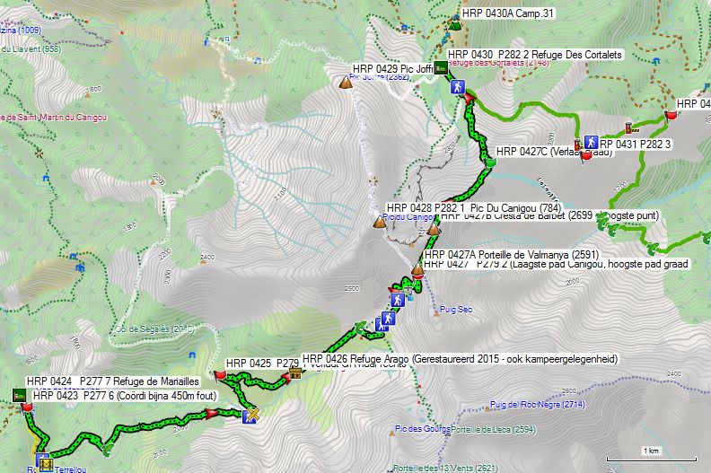
Day 36 REFUGE MARIAILLES – GITE BATERE (without Pic de Canigou, without Refuge des Cortalets!): Only 17.5km! +1325m -1550m: Clearly the shortest variant, with the smallest elevation gain. Ridge route, making it only safe in very good weather conditions. Only cairns and very isolated! Self-reliance necessary! Most difficult part T3 and II+ like Pic du Canigou!
You leave the Refuge de Mariailles (HRP360000) and climb back to the signpost at the car park (HRP350046). There, take the descending path towards Canigou. You descend to the river Llipodere, which you cross via a bridge (HRP360102). Next, you begin the slow climb towards Canigou. At GPS HRP360103, you cross a first periodic stream. Further on, you cross the main river in this side valley via a ford on the river Cady (HRP360105). The route here is rather unclear. On the other side of the river, you will see a wall. Follow the path up this wall to the left. 600m further on, you reach the junction (HRP360106) between the GR10 and the path to Canigou. Refer to point 3 above regarding this.
Leave the GR10 to the right and continue your climb towards Canigou. After 1 km, you reach the Refuge Arago (HRP360107). It was restored in 2015. Camping facilities are also available here. In the next section, the path is somewhat difficult to follow due to the undergrowth. Just under a kilometer past the hut, you cross a tributary of the Cady River (HRP360108). The main path continues here in an easterly direction towards the Pla de Cady (HRP360109).
Here you continue in a southeasterly direction. 200m further on, you cross a tributary of the Gourgs du Cady (HRP360310) near a small lake. Next, you pass a second, slightly larger lake to the northeast. You continue in a southeasterly direction and cross Le Cady (HRP360311). You continue along the left bank to the source lake (HRP360312) of Le Cady. The path winds its way between the lakes. The route is also winding in the final face.
As early as 50m before the Portelle de Leca (HRP360313 – 2594), it is best to start looking out for cairns on the flank just below the ridge towards the Puig del Roc Negre (HRP360314 – 2714). Certainly the first part of the trail runs along the northern flank and requires “alpine insight” and the use of hands and feet in combination with a multi-day backpack to climb here safely. Those who started in Hendaye will have no trouble with this.
Once past the summit of the Puig del Roc Negre (HRP360314 – 2714), the technical difficulty drops sharply to T2. It remains a little-trodden path marked by cairnes. South of a first “Summit” (HRP360315) and, during the descent from the first, a second, smaller “bump” (HRP360315), you pass along the north side. You continue descending near the ridge and pass a third “bump” (HRP360317), again along the south side. After that, the path ascends slightly again to pass south of the Pic Gallinasse (HRP360318 – 2461.4). You pass the turnoff to this summit at GPS HRP360318.
From here, the path becomes clearer again. You continue descending along the ridge towards the Pic de Cincreus (HRP360319 – 2266). Just before the Pic de Pel de Ca (HRP360320), you return to the south flank. You descend further to the COL DE LA CIRERE (HRP360223 – Signpost). From the col, you descend, first via a path (HRP360225), then via a gravel road (HRP360226), which turns into an asphalt road (HRP360227), for the final stretch to the GITE D’ETAPE DE BATERE (HRP370200).
GITE D’ETAPE DE BATERE:
Reopened on 12/04/2026!
38 Beds
Lieu-dit les Mines de Batère – 66150 CORSAVY
contact.refugebatere@gmail.com
Tel +33 7 63 33 59 84
Dinner (7:30 PM):
- Rillettes with lettuce
- Tartiflettes
- French toast
- Coffee or tea included
Breakfast (6:45 AM):
Sweet bread, bread, jam, butter, fruit juice, coffee, tea (generous portion)
Half-board dormitory: €46 (2023), (shower & use of wood-fired hot tub (outdoor) included)
New management! No rates on the current website.
1/2L red wine: €6 (2015)
Route selection stages 37-38:
CORTALETS/BATERE – LAS ILLAS:
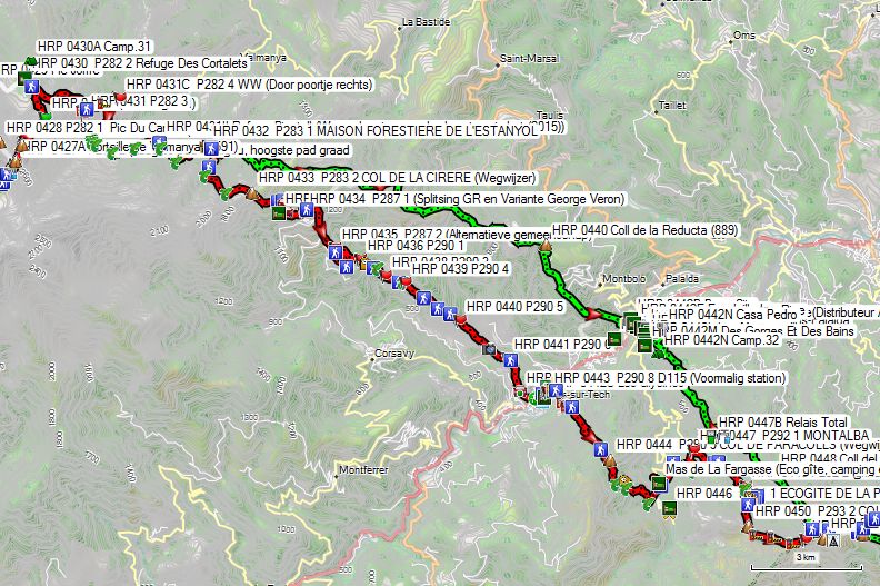
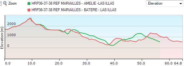
Once again: “All roads lead to Rome, and in this case Las Illas, but some are a bit shorter than others!” ;-). And so it is good to take a quick look at the numbers and make an informed choice regarding which route you actually choose. The Cicerone guide features a route choice that, in my opinion, is currently not very interesting, which I will discuss in more detail later.
- In second place in terms of shortest length and elevation gain is, perhaps surprisingly: REF MARIAILLES – CORTALETS – AMELIE-LES-BAINS – LAS ILLAS without the Pic Canigou, with a total length of only 56.5 km, 3,050 m of ascent, and 4,200 m of descent. The climb of the Canigou adds 1.5 km and 50 meters of elevation gain to that. Given that an overnight stay at the Refuge des Cortalets was chosen here, making it a relatively short stage, a climb of the Canigou could be considered, weather permitting. (And after the reopening of the Refuge de Cortalets after the summer of 2028!) Until that date, an overnight stay at the Gite de Batère must be chosen. This extends the total by 1.5 km. There is a Proxi supermarket in Amélie.
- In third place, and at a very large distance in terms of the shortest length and elevation gain, is the English/Dutch variant: MARIAILLES – BATERE – LA FARGASSE – LAS ILLAS without the Pic Canigou, with a total length of almost 65 km, 3,475 m of ascent, and 4,600 m of descent, or just a whopping 8.5 km in horizontal distance and 450 extra vertical meters. Due to the distance to the Gîte de Batère, climbing the Canigou is definitely not recommended. You will find a Spar supermarket in Arles Sur Tech.
- Ranked number one in terms of shortest length and elevation gain is: REF MARIAILLES – BATERE – AMELIE-LES-BAINS – LAS ILLAS (without Pic de Canigou, without Refuge des Cortalets!): Only 49.5km! +2900m -4050m: Clearly the shortest variant, with the smallest elevation gain. A ridge route, meaning the first part is only safe in very good weather conditions. Only cairns and very isolated! Self-reliance is necessary! Most difficult part: T3 and II+ like the Pic du Canigou! If in doubt regarding the weather, choose option 1!
Day 37 (1) REF CORTALETS – AMELIE-LES-BAINS |
27,5km | +650 | -2550 |
The Refuge de Cortalets is closed for renovation work from the summer of 2026 until at least 2028!!!! An overnight stay in the renovated Gîte de Batère is highly recommended.
Without rest: 8:00
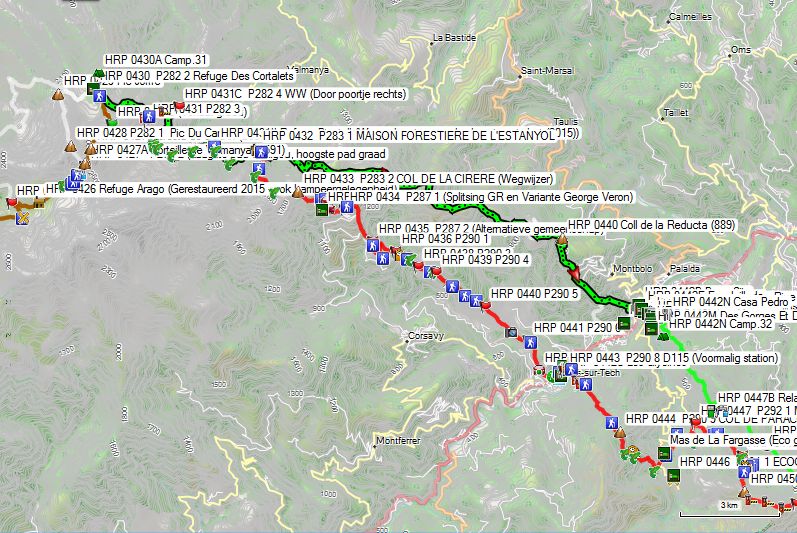
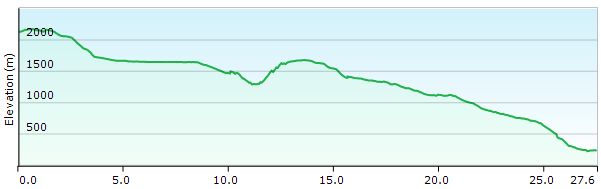
You leave the Refuge de Cortalets and follow the GR10 in an easterly direction. Initially, the path runs at the same level along the flank. After a bend to the right, the descent begins. Then follows a flat section through a rocky slope. Further on, the path descends again and turns south.
You pass through a small gate (HRP370102) in a fence and continue in the same direction until GPS HRP370103. Here, the path makes a hairpin bend to return in a northerly direction. You reach the fence again (HRP370103A) and follow it in a descending direction. At GPS HRP370104, you pass through another small gate and continue descending along the other side of the same fence. At an altitude of approx. 1700m, you reach the gravel road to the Refuge des Cortalets.
You leave this road immediately to the right through a small gate in a fence (HRP370105). You follow a level path in a southwesterly direction until you cross La Lentilla (HRP370106) and a tributary (HRP370107) in succession at the end of the valley. 150m further on, you cross a third one (HRP370108). You remain level for about 3km, crossing several periodic streams. After 2.3km, you pass the Refuge Pinatell (HRP370112).
Refuge Pinatell:
In 2015, a warning about bedbugs in the hut was stapled to the door here.
After the periodic stream (HRP370114), you begin the descent to the MAISON FORESTIERE DE L’ESTANYOL (HRP370116).
Maison Forestiere de l’Estanyol:
Large stone hut, part of which is accessible to the public. From the hut, you walk another 500m uphill with a slight ascent. Along the way, you pass two signposts: the first is a single signpost (HRP370117) to Valmaya, the second is a multi-armed signpost (HRP370118), where you take the direction towards Batère.
You descend through the forest until you reach a forest road (HRP370119) at an altitude of 1280m, which you follow to the right. Later, this turns into a path along which you climb to La Pinouse (HRP370120). You walk in a southerly direction past or between the largest buildings and re-enter the forest in a southeasterly direction. You continue climbing until you reach an open area in the forest at an altitude of approx. 1480m. You stay at the edge of the forest until, at 1620m, you follow an open area between two sections of forest in an easterly and later almost northerly direction.
You climb a spur of the Puig de l’Estelle (HRP370121 – 1778), passing along its southern side. There, you find another path (HRP370122), which you follow in an easterly direction over the eastern ridge until the descent begins. You reach the Tour de Batère (HRP370124 – 1448).
Those who follow the road along the edge of the forest in a westerly direction here reach the Gîte de Batère (HRP370200) of the same name via the Col de la Descarga (HRP370201 – 1393).
Towards Amélie, however, you continue in an easterly direction (HRP370125), passing below the Sarrat de Font Frede (HRP370126 – 1430). After a hairpin bend, you reach a lower gravel road (HRP370127), which you follow again in an easterly and later a southerly direction. At an altitude of 1300m, this road enters the forest and remains so until a crossroads on the Coll de Formentera (HRP370129 – 1133). You continue in a southeasterly direction and pass under a power line. Further on, you reach a crossroads at the Old Mining Station of Formentera (HRP370130). You descend between the buildings via a stony path to the Coll de la Reducta (HRP370133 – 889).
Here, follow the asphalt road to Puig Rémy (HRP370134). 500m further on, leave the asphalt at a hairpin bend via a path (HRP370135) through the forest in a southeasterly direction (yellow markings). At a signpost for “Amélie”, continue straight ahead. You reach Amélie-Les-Bains via a housing development. Cross the bridge (HRP370143) and reach the actual center. On Avenue du Vallespir, you will find an ATM (HRP370148) and a shop (HRP370154), as well as several hotels.
Day 38 (1) AMELIE-LES-BAINS –LAS ILLAS |
17,5km | +0 | -0 |
Without rest: 6h30′.
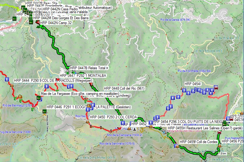
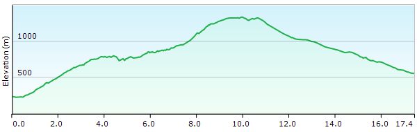
You leave Amélie-Les-Bain via the Avenue du Général de Gaulle (HRP380101) and the Chemin de Can Pastou. 75m along this road, you will already find a path (HRP380102) to the right that zigzags through the forest towards a crossroads of paths (HRP3801014) at an altitude of 440m. Take the steepest path to the left and climb (yellow markings). At the next forks (HRP380106/7/8), keep to the right. You reach the asphalt road (HRP3801019), which you follow to the left until you reach the Mas de Can Félix (HRP380110).
You circle this estate along the lower edge, following an orange marking to a stone building at an altitude of 903m (HRP380113). Turn left here and pass over the top of the building. You reach the Coll del Ric (HRP380114 – 961). You continue climbing along a ridge in a southeasterly direction until you reach a crossroads of paths (HRP380116). Here, turn left and follow a path along the base of the border ridge until you reach the border at the Col Du Puits de la Neige (HRP380120).
At the Col du Puits de la Neige (HRP380120), there are again two options:
- Follow the GR10. This follows the contours of the mountain flank to reach D13F. Follow this to the right until Las Illas. This variant is 3 km longer than the route along the Spanish side
 .
.
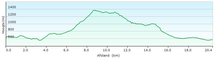
- At the COL DU PUITS DE LA NEIGE, you can switch sides via a gate with a cattle grid. On the Spanish side, you will find a signpost to Les Salines and Coll de Lli. You descend slightly via a path in a southeasterly direction. After 700m, you reach a hut (HRP380122) with room for 12 people, which is always open and usable when the Refugi de Les Salines (HRP380123 – open Thu to Sun) is closed. There is also a spring (HRP380121 – Font de la Cova).

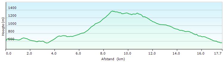
Turn right for the parking lot. 50m further on, turn left, and after 150m, cross the Riera de Les Salines (HRP380124). 700m further on, you reach a gravel road (HRP380126), where you turn left. A little further on, you are at the Coll de Cordes (HRP380127).
You descend from the pass in an easterly to southeasterly direction. Near the Coll de la Biga (HRP380129 – 832) and the ruins of the Castell de Cabrera, the road follows the contours of the landscape, first in a northerly and later in an easterly direction. You continue descending towards COL DE LLY (HRP380130).
At the Col, you cross the border again and descend in a northerly direction. At GPS HRP380131, you reach a gravel road, along which you continue descending to the right towards Las Illas. Just past the parking lot, you will find Hostal Dels Trabucayres (HRP390000).
The gite d’etape (HRP390001) appears to be open again.
Gîte municipal – Las Illas:
3 Cami Manuel Azaña 66480 MAUREILLAS LAS ILLAS
Tel: (+33) 7 76 09 65 81 (Leave a message. You will be contacted between 12 and 2 pm.)
Beds: 15 beds, 14 of which are in bunk beds.
The price for an overnight stay is €20.
Hostal Dels Trabucayres:

Placeta de la Llibertat, Las Illas, Maureillas, France
Tel (+33) 468.83.07.56 (Open at 4:30 PM)
(+33) 4 68 66 55 38
Rooms with shared bathroom facilities in the hallway. The rooms at the rear have a terrace.
Rates:
Rooms: No recent rates online for the rooms, meals only.
Day 37 (2) GITE BATERE – LA FARGASSA
|
18km | +850 | -1600 |
Without rest: 6h15’ with rest: 6h45’
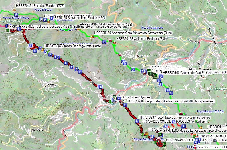
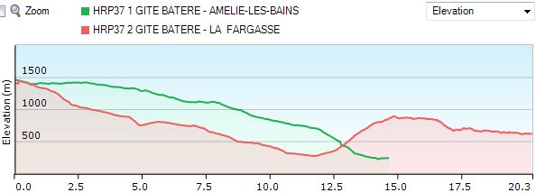
Note: It is also possible to choose the route to Amélie-Les-Bains from the Gîte de Batère (HRP370200) and stay overnight there instead of the more alternative accommodation option at Mas de la Fargassa. To do this, leave the gîte to the left as well, but continue following the asphalt until the Col de la Descarga (HRP370201 – 1393). Here, take the gravel road uphill to the left until you reach the Tour de Batère (HRP370124 – 1448). From here, you are on the route description to Amélie-Les-Bains under chapter: Day 37 (1) REF CORTALETS – AMELIE-LES-BAINS
The stage via Arles-sur-Tech and the Mas de la Fargassa is fully marked GR10.
You leave the gite (HRP370200) to the left and descend slightly via the asphalt until the first hairpin bend, which is the Col de Descarga (HRP370201). Here, you leave the asphalt straight ahead via a path that initially descends near a small stream (HRP370202 – Descarga). After 500m, you leave this stream and continue descending along the edge of a wooded area towards a gravel road (HRP370203). Here you encounter a kind of alternative community, with a collection of vehicles, tents, structures, and small gardens.
The GR markings are faint here. You are walking in a southerly direction and not a westerly one (to the right). You only find a marker again at GPS HRP370204.
You follow the gravel road through the forest for a length of 1.5km. You leave it at the third hairpin bend (HRP370206) for a path. 200m further on, you pass the ruins of the Refuge Des Vigourats (HRP370207). You descend about 100 vertical meters and cross the Descarga or Freixe stream at GPS HRP370210.
 You climb out of the brook’s gully and reach a gravel road (HRP370211), which you follow to the right. 500m further on, you cross a periodic stream, after which you return to a T-junction (HRP370213). Here you turn right again. 700m further on, you leave the road for a path (HRP370214). You descend to a gravel road (HRP370217). Turn right and reach the ruins of a kind of intermediate station on the cable car between the Mine de Batère and Arles-sur-Tech. You descend 250 vertical meters over a ridge of rough rock. At the entrance to the forest, you pass a signpost to a lime kiln (HRP370218).
 600m further on, you reach a gravel road (HRP370219). Leave this again at GPS HRP370220 and descend through the forest towards Arles-sur-Tech (HRP370221 (Start of asphalt – signpost)). Turn left and turn left again at the next intersection (HRP370222). You go along the Rue Des Écoles and find a bench under the trees at the end of it (HRP370223). Next, you go through a back street (Traverse Albert Rouge), parallel to the D115. At the end of it (HRP370226), continue following the D115 to the left for a distance of 80m to the Passage de la Coquinière, which you turn right onto and follow along its entire length to the old station (HRP370228). Continue in the same direction and follow the Rue Du 14 Juillet to the bridge (HRP370231) over the river.

Hotel Les Glycines:
7 rue du Jeu de Paume, Arles-sur-Tech, France
Tel: +33 4 68 39 10 09
Room: From €80 (2024)
Cheaper alternative via Booking.com:
Maev’Arles (€41 – 2024)
Across the road, you will find a signpost (HRP370232). Turn right and enter a small wood. Do not follow the central axis, but go up the right wall and then through a small gate (HRP370233). There you will find a better path, which you follow to the left until you reach a concrete road. Follow this to the right and leave it after 100m to the left through a small gate (HRP370235). After 100m you reach another small gate (HRP370236) and then begin a climb via a kind of natural staircase of nearly 400 vertical meters. You reach a sort of faux col (HRP370237), after which the path climbs in a more natural way to the COL DE PARACOLLS (HRP370238 – Signpost). The path goes up and down a bit until you reach the ruins of a house (HRP370240), after which the descent begins to the ford at the Terme (HRP370244). Next, turn left to the first building, which is the ECOGITE DE LA PALETTE (HRP370245). The second building is a kind of commune, connected to the Ecogite.
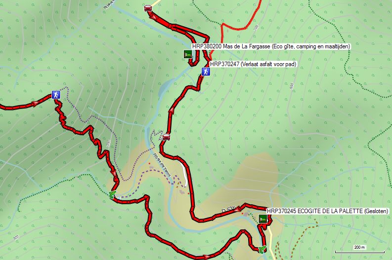
ECOGITE DE LA PALETTE:
Closed!!! Only old information to be found (2019!!!!)
According to the neighbors of Mas de la Fargassa, it is supposed to be open again, but no recent info to be found!
Alternative 1:
Mas de la Fargassa:
(Ecological vegetarian holiday spot for families, but also gite HRP/GR11 after the closure of La Palette. Located over 1 km further along the next day’s route. Whether any shortcuts are accessible to the public is currently unknown.)
lafargassa@gmail.com
Tel: 0033(0)468390115
Satellite tel : 0033 (0) 972515541
Overnight stay in a dormitory p.p. € 22, –
Bivouac p.p € 12, –
For the second night, an additional daily rate of €10
Dinner p.p. € 20.00
Breakfast p.p. € 12.00
Picnic p.p. € 14.00
Alternative 2:
Reroute via Amélie-les-Bains (GR – see above)
Dag 38 (2) LA FARGASSA – LAS ILLAS |
18km | +1100 | -1200 |
Without rest: 6h30’ with rest: 7h00’
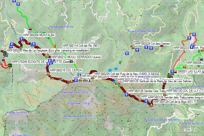
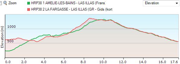
Those who prefer to stay close to the original route leave the gite and return to the asphalt, which you follow to the right. Approximately level with the gite on the asphalt, leave the road (HRP370247) for a path that ascends the mountainside to the left. This is a typical path that follows the contours of the landscape, with only slight ups and downs. At GPS HRP380203, you cross a periodic stream. At GPS HRP380204, you look down on MONTALBA.
The path then climbs about 200 vertical meters before remaining at the same level again until you reach a gravel road (HRP380207). Follow this to the right and cross two periodic streams. Next, resume the climb via a more overgrown and ascending gravel road. At the second hairpin bend, you will find the ruins of the MOULI SERRADOU (HRP380212). The road becomes more of a path and continues climbing up to the COL CERDA (HRP380215).
You can also continue following the asphalt until it turns into a gravel road. Here you will find a forest road that ascends gradually until just before a bridge over a tributary. Here you leave the forest road for a path that stays on the same bank and continues climbing to the COL CERDA (HRP380215). Here you turn right.
You descend from the pass and pass several gates. At GPS HRP380220, the GR leaves the border ridge for a technically easier path via the French side.
 The Cicerone guide directs you further along the ridge here via a yellow-marked route. You will need to improvise a lot to reach the Roc de Frausa (HRP380221). From the summit, you descend towards a transmission mast (HRP380224), and then via the French side to the COL DU PUITS DE LA NEIGE (HRP380120).
The GR10 descends from the ridge towards a crossroads of paths (HRP380116). From the valley, the French variant from AMELIE-LES-BAINS rejoins the border ridge here. The GR10 makes a hairpin turn here and climbs back up by about 25 vertical meters, to then continue running below the ridge with the Roc de Frausa (HRP380221) and thus reach the COL DU PUITS DE LA NEIGE (HRP380120). Below the pass, the path becomes a bit indistinct, but technically the terrain presents no difficulties. You walk towards the pass on sight.
- Follow the GR10. This follows the contours of the mountain flank to reach D13F. Follow this to the right until Las Illas. This variant is 3 km longer than the route along the Spanish side.
- At the COL DU PUITS DE LA NEIGE, you can switch sides via a gate with a cattle grid. On the Spanish side, you will find a signpost to Les Salines and Coll de Lli. You descend slightly via a path in a southeasterly direction. After 700m, you reach a hut (HRP380122) with room for 12 people, which is always open and usable when the Refugi de Les Salines (HRP380123 – open Thu to Sun) is closed. There is also a spring (HRP380121 – Font de la Cova).
Turn right for the parking lot. 50m further on, turn left, and after 150m, cross the Riera de Les Salines (HRP380124). 700m further on, you reach a gravel road (HRP380126), where you turn left. A little further on, you are at the Coll de Cordes (HRP380127).
You descend from the pass in an easterly to southeasterly direction. Near the Coll de la Biga (HRP380129 – 832) and the ruins of the Castell de Cabrera, the road follows the contours of the landscape, first in a northerly and later in an easterly direction. You continue descending towards COL DE LLY (HRP380130).
At the Col, you cross the border again and descend in a northerly direction. At GPS HRP380131, you reach a gravel road, along which you continue descending to the right towards Las Illas. Just past the parking lot, you will find Hostal Dels Trabucayres (HRP390000).
The gite d’etape (HRP390001) appears to be open again.
Gîte municipal – Las Illas:
3 Cami Manuel Azaña 66480 MAUREILLAS LAS ILLAS
Tel: (+33) 7 76 09 65 81 (Leave a message. You will be contacted between 12 and 2 pm.)
Beds: 15 beds, 14 of which are in bunk beds.
The price for an overnight stay is €20.
Hostal Dels Trabucayres:
Placeta de la Llibertat, Las Illas, Maureillas, France
Tel (+33) 468.83.07.56 (Open at 4:30 PM)
(+33) 4 68 66 55 38
Rooms with shared bathroom facilities in the hallway. The rooms at the rear have a terrace.
Rates:
Rooms: No recent rates online for the rooms, meals only.
Day 39 LAS ILLAS – COL DE L’OUILLAT |
23km | +1050 | -650 |
Without rest: 6h00 with rest: 6h15.
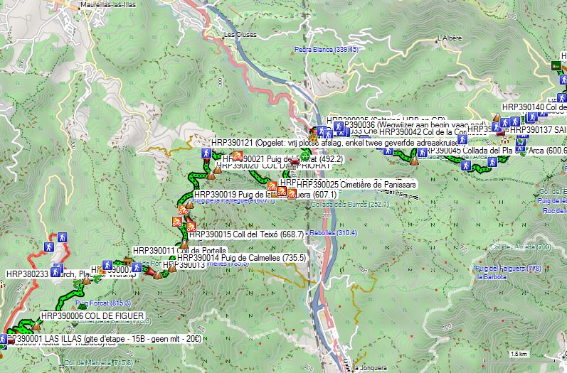

You leave the inn and walk north along the main street. At the end of the built-up area, you will find signs for the GR10, which continues along the D13 in a northerly direction.
The GR follows the D13 for a length of nearly 3 km and then leaves it via a gravel road (HRP390106) that leads to the border ridge. This is 1.5 km longer than the route along the border ridge described below (HRP390007).
In Las Illas, you can also turn right at the end of the village (HRP390002) and climb upwards in a zigzag pattern via the Route de Manrell (HRP390005) towards COL DE FIGUER (HRP390006). From here, you have overcome the greatest elevation difference. You continue following the gravel road right up against the border ridge. At GPS HRP390007, you rejoin the GR10, which you follow to the COL DE L’OUILLAT (HRP400000).
250m further on, you cross a stream (HRP390008). Another 250m further, you pass a farm (HRP390009). 600m further on, you reach a fork at a wooden hut on the Coll de Portells (HRP390011), where you turn right. At GPS HRP390013, you reach a highest point. From here, you descend mainly to the turnoff (HRP390018) to the D13 and Maureillas-Las-Illas. However, you continue to follow the border ridge to the COL DEL PRIORAT (HRP390020). The road turns north here, and 500m further on you leave this gravel road quite suddenly via a path (HRP390021) that leads into the forest to the right. Only 2 painted white and red address crosses mark this turn. The path ends on a paved green cycle path (HRP390022), which you follow to the right. You pass the Site de Panissars (HRP390023), where the paving has been replaced by gravel for a short distance. At the Cimetière de Panissars (HRP390025), the road curves to the right (HRP390026) to then climb towards Le Perthus (HRP390034). Along the way, you pass the turnoff to FORT DE BELLEGARDE (HRP390027).
The town of Le Perthus is completely dominated by the presence of the A9 motorway viaduct. The GR10 reaches the old main road N-II or D900 (HRP390034) and follows it to the left until the large car park. Here, you leave it to the right and pass under the viaduct.
The English/Dutch guide directs you onto the D71 just past the viaduct (HRP390035) for a distance of over 4 km, before leaving it via a path at GPS HRP 0465 P301 1, indicated there by a signpost. You climb towards SAINT MARTIN DE L’ALBERE (HRP 0466 P301 2), where you return to the D71. At GPS HRP 0467 P301 3, you leave it again to cut across a hairpin bend in the road. Once back on the road, leave it again to the left to cut across another hairpin bend. At the Col El Rat (HRP 0467B), you definitively join the GR10 up to the COL DE L’OUILLAT (HRP 0469 P302 2). The added value of this route choice completely escapes me, given that it is neither shorter nor easier and ultimately returns to the GR10 anyway.
The GR10 itself leaves the D71 to the right via a gravel road (HRP390035), just past the A9 viaduct. The gravel road ends at the border. At GPS HRP390036, you will find a signpost at the beginning of a faint path. You follow this uphill until it emerges onto another sort of road, which you now follow more smoothly until GPS HRP390037. From here, you will find a path towards the border pass (HRP390038). Once across the border, the path becomes wider and flatter. At GPS HRP390039, you emerge onto a proper gravel road, which you follow as close as possible to the border ridge. At GPS HRP390047, you gradually turn away from the border in the direction of the Ruisseau de L’Albere (HRP390052).
You climb up alongside the river via a narrow and steep path to a hairpin bend on the D71 (HRP390055). From here, the GR follows a narrow path parallel to the same D71 until the Col El Rat (HRP390058). From the col, you follow a path that is initially heavily eroded through an area of grass and low scrub. At GPS HRP390061, you will find a large cairn. You continue in the same direction until GPS HRP390063, where you leave the wide eroded track through the open area towards the edge of the forest. Once in the forest, the path becomes flatter and clearer. After 800m you reach the COL DE L’OUILLAT with the Chalet de L’Albère (HRP400000) located there.
Chalet de L’Albère:
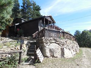
Tel (+33) 468.83.62.20
Half-board: 46€ (2024)
1/2L Red or rosé wine: €6 (2015)
Upon arrival, we were informed that a performance would take place on Saturday evening, with the potential for noise disturbance. We were accommodated in the room furthest from the restaurant to minimize the disturbance. Furthermore, the overnight rate was reduced to Half-board: €30. (They also forgot to charge for the half-liter of red wine from lunchtime). So be sure to book on the weekend and do not let yourself be directed to the Refuge de la Tagnarede. That is, after all, a pretty filthy dump (HRP400013).
On a normal weekend, weather permitting, there are many guests who come to enjoy the view and the food.
Dinner (7:30 PM):
- Salad
- Pork cheek with pasta
Breakfast (7 AM):
Toasted bread (had to ask for a lot of extras), jam, butter, coffee or tea, fruit juice.
Day 40 COL DE L’OUILLAT – BANYULS-SUR-MER |
23km | +850 | -1700 |
Without rest: 6h00 with rest: 7h00.
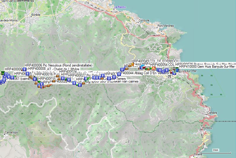

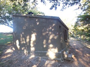 You leave the gite and walk towards the road. Outside the fence, you return in almost the same direction and climb the fairly steep slope to the border ridge of COL DES TROIS TERMES (HRP400003). The GR markings lead you to the pass itself, but you can just as easily follow the path just below the border ridge until you reach the transmission tower Pic Neoulous (HRP400006).
The GR returns to the asphalt. You pass the transmission station and then descend (HRP400007), first through the forest and then through an open area to a saddle (HRP400008).
Do not descend all the way to the gravel road, but find an initially faint path towards Refuge de la Tagnarede (4B – unmanned – quite dirty – HRP400013).
From the refuge, you start walking a little closer to the ridge again. You pass boundary stone 585 (HRP400021). You turn in a northeasterly direction and head towards a kind of Col (HRP400022). The trail is faint here due to the absence of cairns.
At GPS HRP400023, you leave the ridge and round the Puig de Pradets (HRP400025) via the French side. Just before returning to the pass (HRP400026), the path becomes faint through the forest. Once on the border ridge, you immediately leave it again to round the Pic Dels Quatre Termes (HRP400028).
After the Pic Dels Quatre Termes, you briefly return to the border ridge (HRP400030). The OSM tracklog then leaves the ridge again, but you can also simply continue walking on it for a distance of approximately 500m. You continue walking in the treeless zone around the border ridge. In doing so, you round any obstacles. At GPS HRP400039, you leave the border ridge again to round the Pic de Sailfort (HRP400041). On a sunny Sunday, you will find many day-trippers picnicking at the Col.
From the Col (HRP400042), you begin the descent. At GPS HRP400044 (Turnoff Coll D’En Verderol), stay on the ridge and ignore the path leading downhill. At GPS HRP400046, ignore the turnoff to Rimbau. At the COL DE BAILLAURY (HRP400048), you will find the vehicles of those who are too lazy to go up the mountain on foot.
 Next, you tackle the final climb of the HRP, namely the one to the COL DE FORMIGOU (HRP400049). From here, you walk at the same altitude to the COL DES GASCONS (HRP400051). Here you will find a signpost indicating a shortcut around a hairpin bend. The path is quite steep and eroded. Caution is advised. At GPS HRP400053, you are back on the asphalt. Follow this downhill towards the COL DES LLAGASTE RA (HRP400054). Here you leave the asphalt for a gravel road, which you follow in an easterly direction. The road alternates with sections of path that cut across corners (HRP400057). At a fork in the road at GPS HRP400059, turn left. It appears as if signs were deliberately removed here. Descend to the road (HRP400060) and cross it towards the side street. At the next intersection (HRP400061), turn right. Continue descending towards the railway. At GPS HRP400063, you reach the asphalt and pass through a tunnel under the railway. At a T-junction (HRP400064), turn left. At the next T-junction at a small square, turn left (HRP400066) and then continue in the original direction. At the square on the coastal road, turn right towards the Town Hall (HRP410000).
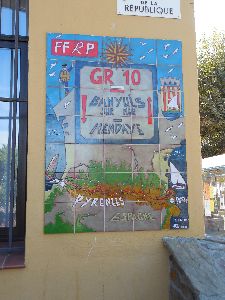
Here you will find a section of tiled wall marking the end or beginning of the GR10. Depending on the weather, you can wash your feet in the sea or go for a full dive. At the public beach, you need to go quite far into the water to swim, as the bottom slopes only gradually. Wading sandals are recommended. You can use the beach showers and the free public toilets (HRP400073) to change. You can find a snack at Snackbar La Ganotte (HRP400075) (Closed: 31/12 – 01/02).
Around 8:00 PM, the night train to Paris passes through Banyuls-Sur-Mer station (HRP400078). You can reach the station via Avenue de la Gare.
Return trip from halfway:
Walking time Hotel L’Aquitaine – station: 20’
For the return journey, I have three different tickets for the various legs of the route: Luchon – Toulouse, Toulouse – Lyon, Lyon – Brussels. For some reason, I did not manage to book a ticket for the Brussels – Ghent leg this time. On future trips, I will certainly look into the connection via Lille as well.
The Luchon – Toulouse ticket is one of the type without reserved seats. The train is not the night train located on track two, but is a TER train of the type without a separate locomotive. Do not forget to validate your ticket at the yellow machines. Fortunately, these stand out better than their Italian counterparts.
The Toulouse – Lyon ticket does include reserved seats. However, in France, trains are announced quite late with their exact platform of departure. So be alert and on time. The train is also very long. Up to Lyon, the TGV travels only as fast as a normal train, but with slightly fewer stops. At one point, the train even came to a standstill without any communication about it, and consequently arrived in Lyon half an hour late.
In the meantime, the Lyon-Brussels train had already departed. Normally, a TGV Lyon – Lille departs one hour later, on which I was allowed, but on which I naturally did not have a reserved seat. There are still a number of seats in the restaurant car where you can normally sit, which are apparently not sold as reserved seats. The train conductors also have their reserved seats there in a separate area, and that is good to know in such a case. Ultimately, this train also departed more than an hour late, causing most French passengers who had a connection to their final destination to miss their connection as well. Buses or taxis were reserved for the French passengers in each case to take them to their final destination, given that these were usually the last trains. For the few passengers with Brussels as their final destination, for whom there was no longer a connection to Brussels either, a hotel was reserved in Lille and my ticket was adjusted for the Lille – Brussels leg the following morning. This turned out not to be a TGV, but a regular Belgian Intercity train, so in principle I could have taken a later train. Naturally, I got off in Ghent.
Initially, there appeared to be 5 passengers in this case, but I think I was the only one who actually got his hotel room. In such a situation, it is important to be a bit assertive and ensure that you are properly directed to the right person. At the end of the platform, there was also SNCF staff handing out vouchers for compensation for the delay. You should definitely accept those as well. For the price of a single international stamp, I managed to secure a 75% discount on the price of the Toulouse – Lyon and Lyon – Brussels routes in the form of discount vouchers for a future trip within the year, totaling a final amount of €63.50.
The hotel in Lille turned out to be a Budget hotel belonging to the Ibis Group. Usually, the more luxurious version and the budget version are located in the same building, but in Lille, they are situated in different locations, with the luxury version located right near the station and the budget version a little further away. Consequently, I was initially directed to the luxury version by the SNCF staff, but that turned out to be incorrect information. The night attendant directed me to the Budget version, where they were aware of my arrival. Fortunately, I had a GPS, which meant getting around Lille went relatively smoothly. Since the first train from Lille was listed on my ticket, it turned out to be a relatively short night, meaning I was the first at the breakfast buffet again. In terms of compensation policy, the NMBS still has a thing or two to learn from the SNCF.
End conclusion:
After two 3-week periods, my intended final destination has been reached, and I must return home. My fitness is optimal. I experienced virtually no discomfort. I had to improvise a great deal, and thanks to the wife of my Australian travel companion, this went very smoothly.
In 42 days, I conquered about 50,000 vertical meters (up and down) and had to endure almost no rain or thunderstorms during the hikes themselves, because we left the HRP twice due to forecast bad weather. The third time was due to the technical difficulty level because of the amount of snow still present in early summer.
Personally, I would not make such an early start again in the Pyrenees for routes above 2300m. This is due, on the one hand, to the poor condition of the markings on the terrain and, on the other hand, to the infrequent use of the HRP, meaning that there is often no usable trail to be found in the snow. For that reason, carrying and knowing how to use an ice axe and crampons is more necessary in early summer than on comparable routes in the Alps.
I recommend the use of a GPS to everyone in the Pyrenees, because you have to assume the poor quality of the markings and signposts on the terrain. In the Basque Country, this has to do with the multitude of paths, the use of Basque on signposts, the condition of the signs on the terrain, and even errors in the GPS points provided by Ton Joosten. Outside the Basque Country, this has to do with the poor condition of the markings on the terrain, the lack of tracks in the snow, and the aforementioned errors in the GPS points provided by Ton Joosten. It is therefore not absolutely necessary, but it does save time, energy, and frustration. My Australian travel companion experienced this firsthand. I am old enough to still manage without it, but technology exists, so I don’t see why you wouldn’t use it. Normally, I don’t constantly look at my GPS, but in the Pyrenees, this was more necessary than on the GTA, for example. During those three weeks, I only had to consult my guide once on the terrain itself, and that was because no path was marked on the OSM map in the section in question, and I could only rely on the rough original tracklog for that part.
I consider creating a tracklog an essential part of your preparation for the HRP. That is why I do not make my tracklog publicly available. You can find instructions on how to create one yourself under the heading: Oriëntatie – GPS (see above).
Regarding resupply along the way, using Post Restante in France is a good idea. However, be aware that there are issues with the security of the contents. Therefore, do not send essential items. Consider a private courier.
Also, build a reserve into your planning for unforeseen circumstances. Alternative routes are more limited in the Pyrenees than in the Alps. Extreme weather phenomena occur more frequently than in the Alps, due to the shape of the mountain range and the proximity of the Atlantic Ocean.
In addition to self-knowledge, you must possess a multitude of skills for this trek. This involves orientation and walking technique on all types of terrain, including slabs, loose gravel, and especially snow in early summer. A basic understanding of climbing technique wouldn’t hurt either.
Furthermore, you must have basic knowledge of meteorology and be flexible in your plans.
Adjust your travel plans based on the weather, your physical condition, and your skill level. Overconfidence leads to accidents. Go into the mountains, but above all, come back (alive!). Nowhere have I seen as many rescue flights as in the Pyrenees!!!
Coördinatenlijst: